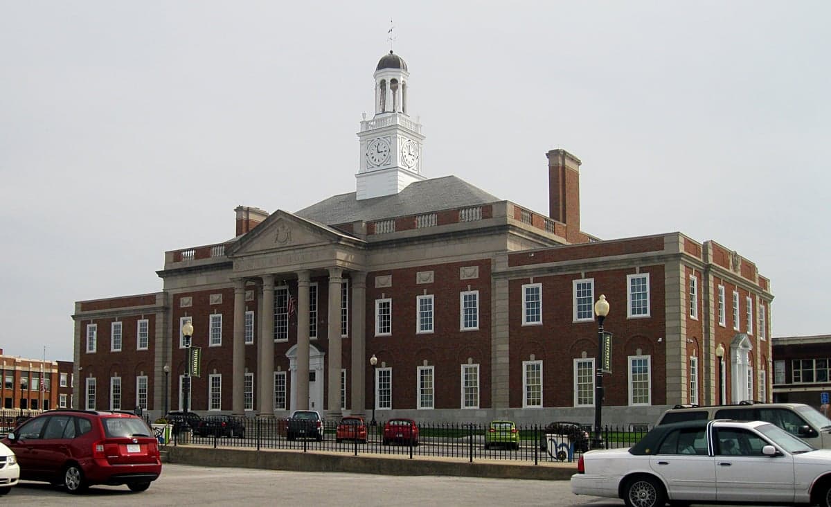
Photo: Wikipedia
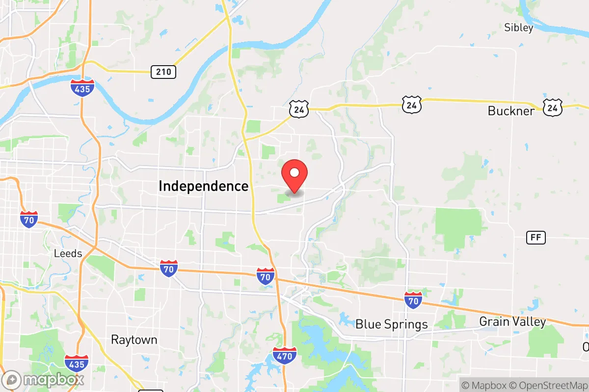
Strategic Assessment of Independence, MO
Multiple tactical vulnerabilities. Population density, target proximity, or disaster risk are likely compounding. A retreat property and exit planning is required.
What does the Strategic Assessment tell us?
Our Strategic Assessment grades tactical survivability of an area. Major population centers, military targets, fallout zones, natural disasters, and border exposure all drive risk — lower exposure means a more defensible position in a crisis.
This is heavily inspired by Joel Skousen's Strategic Relocation book. Highly recommended you checkout the book ($)What does this tell us?
Our Strategic Assessment grades tactical survivability of an area. Major population centers, military targets, fallout zones, natural disasters, and border exposure all drive risk — lower exposure means a more defensible position in a crisis.
This is heavily inspired by Joel Skousen's Strategic Relocation book. Highly recommended you checkout the book ($)Strategic Pillars

Key Distances
Regional Safe Places
Below is our recommended "safe zones" in Missouri and the surrounding area based on our strategic heuristics. For most people, it's unrealistic to live in a “safe zone” full-time due to work, family or other personal reasons. They tend to be more rural. However, many of these areas are perfect for second homes and retreat properties that double as a vacation home or even a short-term rental.


Important Note: For informational purposes only. This does not mean nothing bad ever happens in the green zones. Please use common sense. This is based on public data and modeled with AI. We tried to take a conservative approach but mistakes happen. We update this regularly as new information becomes available.
Solar Generator Recommendations
Backup power matters more here than in safer locations. We've picked three solar generators across budgets and capacity tiers — start with the budget unit if you only need a few essentials, or step up if you want to run a fridge and HVAC for days at a time.

Jackery Portable Power Station Explorer 300
Budget OptionPower on the Go: Weighing only 11 lbs, it's convenient to set up and store with book-sized foldable solar panels

BLUETTI Portable Power Station AC180
Designed for both indoor and outdoor scenarios, AC180 is highly capable as it has a robost capacity and continuous output power.

EF ECOFLOW DELTA Pro Ultra Power Station
Upgraded PickEcoFlow DELTA Pro Ultra is a whole-home energy system designed to grow with your family. Integrated with the Smart Home Panel 2, it scales to meet your evolving energy needs — keeping your home powered, intelligent, and secure through every stage of life.
We earn a commission, at no additional cost to you.
Strategic Assessment Analysis
Independence, Missouri, sits in a precarious but potentially advantageous position for those serious about strategic relocation. Its location on the western edge of the Kansas City metro offers a mix of proximity to regional resources and a buffer from the densest urban chaos, but the trade-offs are sharp. For a prepper or survivalist with a conservative mindset, this area demands a clear-eyed assessment of its resilience against civic unrest, infrastructure collapse, and fallout risks—because the same highways that bring supplies can also bring trouble.
Geographic position and natural advantages for long-term stability
Independence occupies a spot on the Missouri River bluffs, giving it decent elevation and access to one of the continent's major waterways. The surrounding landscape is a mix of rolling hills, limestone bluffs, and agricultural bottomland, which supports local food production and offers multiple escape routes. The city sits at the crossroads of Interstates 70 and 435, plus U.S. Highway 24 and 40, meaning you can move north toward rural Iowa, west toward the Great Plains, or south into the Ozarks within a couple of hours. For a relocator, this is a double-edged sword: the same roads that let you bug out also let threats roll in from Kansas City, St. Louis, and points beyond. The region's climate is continental, with hot summers and cold winters, but it avoids the worst of tornado alley's bullseye—though severe weather is still a real concern. The Missouri River provides a reliable water source, but it's also a flood risk in low-lying areas, so any property purchase should be above the 100-year floodplain. The soil in nearby rural areas is fertile, supporting corn, soybeans, and livestock, which matters if you're planning to grow your own food or trade with local farmers. The area's natural defenses are moderate: the river and bluffs create some chokepoints, but there's no mountain range or vast forest to hide in. You're in the heart of the Midwest, which means you're visible and accessible—good for logistics, bad for staying off the grid.
Risks, exposures, and proximity to fallout-relevant landmarks
The biggest strategic liability for Independence is its proximity to Kansas City, just 10 miles east. Kansas City is a major transportation hub with a FedEx hub, rail yards, and a population of nearly 500,000 in the city proper, plus over 2 million in the metro. In a collapse scenario—whether from economic crisis, civil unrest, or a mass casualty event—that density becomes a liability. The city has seen its share of riots and protests in recent years, and the police force has been under political pressure, which doesn't inspire confidence for those who value order. Independence itself has a population around 120,000, which is manageable but still carries urban risks like gang activity and property crime. The area is also within 50 miles of Whiteman Air Force Base, home to the B-2 Spirit stealth bomber. That's a high-value target in any conflict involving strategic bombing, and while the base is south of the city, fallout patterns from a strike or accident could drift over Independence depending on wind direction. The nearby Truman Reservoir and Lake Jacomo are water assets, but they're also potential targets for sabotage or contamination. On the plus side, the region lacks major nuclear power plants—the closest is Callaway Plant in Missouri, about 150 miles east—so you're not in the immediate blast zone of a reactor failure. But the rail lines running through Independence carry hazardous materials daily, and a derailment or attack could contaminate local water supplies. For a prepper, the key takeaway is that Independence is close enough to big-city problems to feel the shockwaves, but far enough that you might have time to react—if you're paying attention.
Practical resilience for a relocator: food, water, energy, and defensibility
For a single individual or family looking to set up a resilient homestead, Independence offers a mixed bag. The city has a municipal water system drawing from the Missouri River, which is vulnerable to contamination and disruption. A well on your property is a must for any serious prepper, and the limestone bedrock in the area can make drilling expensive but doable—expect costs of $5,000 to $15,000 for a deep well. The soil in the surrounding countryside is good for gardening, with a growing season from April to October, but you'll need to amend it with compost and deal with clay in some spots. Local farmers' markets and co-ops exist, but they're not robust enough to rely on in a crisis; you'll want to establish relationships with nearby producers in Jackson County or just east in Lafayette County. Energy-wise, the grid is typical for the Midwest—aging infrastructure, prone to outages during storms, and increasingly tied to renewable mandates that can create instability. Solar panels are a solid investment here, with about 200 sunny days per year, but you'll need battery storage to handle winter cloud cover. Natural gas is available in most of Independence, which is good for heating and cooking, but a backup propane tank or wood stove is wise. Defensibility is the weak point: Independence is flat to gently rolling, with no natural barriers. Your best bet is a property on the outskirts with a long driveway, good sightlines, and a perimeter fence. The local gun culture is strong, and Missouri is a shall-issue state for concealed carry, so you can legally arm yourself. But the city itself has a mixed reputation for law enforcement response times—rural areas can see 20-minute waits, while urban zones are quicker but more chaotic. For a family, the school system is a concern: Independence Public Schools have struggled with funding and performance, so private or homeschool options are worth considering if you're planning for long-term stability.
The overall strategic picture for Independence is one of calculated risk. It's not a fortress, and it's not a remote bunker—it's a middle-ground location that gives you access to resources while forcing you to stay vigilant. If you're willing to invest in a well, solar, and a defensible property on the city's edge, you can carve out a decent position. But if you're looking for true isolation or a bug-out location far from population centers, keep driving west into the Flint Hills or south into the Ozarks. Independence works best as a base of operations for someone who needs to stay connected to a job or family in the Kansas City area but wants a fighting chance when things go sideways. The conservative values of the region—self-reliance, gun rights, and a general distrust of federal overreach—align well with a prepper mindsetched. Just don't mistake its suburban comfort for real security. The risks are real, and the margin for error is thin. Plan accordingly.
* Values derived from national, state, county, city and local statistics and may differ in a specific area. Last updated: 2026-04-29T21:11:02.000Z
Narrative content on this page is AI-generated and may contain mistakes. Verify any details that matter before acting on them.
ReloMaps may earn a commission from affiliate links at no extra cost to you.