Photo: Wikipedia
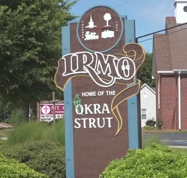
Strategic Assessment of Irmo, SC
Meaningful friction. Expect exposure to either population pressure, blast zones, or natural disaster risk. Consider buying a retreat property.
What does the Strategic Assessment tell us?
Our Strategic Assessment grades tactical survivability of an area. Major population centers, military targets, fallout zones, natural disasters, and border exposure all drive risk — lower exposure means a more defensible position in a crisis.
This is heavily inspired by Joel Skousen's Strategic Relocation book. Highly recommended you checkout the book ($)What does this tell us?
Our Strategic Assessment grades tactical survivability of an area. Major population centers, military targets, fallout zones, natural disasters, and border exposure all drive risk — lower exposure means a more defensible position in a crisis.
This is heavily inspired by Joel Skousen's Strategic Relocation book. Highly recommended you checkout the book ($)Strategic Pillars

Key Distances
Regional Safe Places
Below is our recommended "safe zones" in South Carolina and the surrounding area based on our strategic heuristics. For most people, it's unrealistic to live in a “safe zone” full-time due to work, family or other personal reasons. They tend to be more rural. However, many of these areas are perfect for second homes and retreat properties that double as a vacation home or even a short-term rental.


Important Note: For informational purposes only. This does not mean nothing bad ever happens in the green zones. Please use common sense. This is based on public data and modeled with AI. We tried to take a conservative approach but mistakes happen. We update this regularly as new information becomes available.
Solar Generator Recommendations
Backup power matters more here than in safer locations. We've picked three solar generators across budgets and capacity tiers — start with the budget unit if you only need a few essentials, or step up if you want to run a fridge and HVAC for days at a time.

Jackery Portable Power Station Explorer 300
Budget OptionPower on the Go: Weighing only 11 lbs, it's convenient to set up and store with book-sized foldable solar panels

BLUETTI Portable Power Station AC180
Designed for both indoor and outdoor scenarios, AC180 is highly capable as it has a robost capacity and continuous output power.

EF ECOFLOW DELTA Pro Ultra Power Station
Upgraded PickEcoFlow DELTA Pro Ultra is a whole-home energy system designed to grow with your family. Integrated with the Smart Home Panel 2, it scales to meet your evolving energy needs — keeping your home powered, intelligent, and secure through every stage of life.
We earn a commission, at no additional cost to you.
Strategic Assessment Analysis
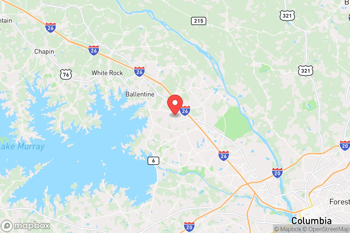
Irmo, South Carolina, sits in a deceptive sweet spot: close enough to Columbia for employment and infrastructure, yet far enough to avoid the worst of a major city’s collapse dynamics. Its location along the I-26 corridor gives residents a viable escape route toward the Upstate or the coast, while the surrounding Lake Murray region provides a natural buffer against unchecked urban sprawl. For a relocator thinking in terms of strategic depth, Irmo offers a blend of suburban convenience and rural-adjacent resilience that is increasingly rare in the Southeast.
Geographic position and natural advantages for long-term security
Irmo’s primary strategic asset is its position on the fall line between the Piedmont and the Coastal Plain, which historically meant fewer flood risks than areas closer to the coast. The town sits on a ridge of relatively high ground, with elevations around 200–300 feet, reducing vulnerability to storm surge or catastrophic river flooding. Lake Murray, a 50,000-acre reservoir created by the Saluda Dam, dominates the western edge of the area. This body of water provides a reliable freshwater source and a natural barrier against approach from the west. The dam itself, operated by Dominion Energy, is a critical piece of infrastructure—if compromised, it would inundate much of the lower Saluda River valley, but the dam is regularly inspected and hardened against seismic events. The surrounding hardwood forests and rolling hills offer decent cover and limited lines of sight from major roads, which is a minor but real tactical advantage for those concerned with civil unrest. The climate is humid subtropical, with hot summers and mild winters, meaning year-round gardening is feasible with season extension techniques, and heating fuel demands are modest compared to northern states.
Risks, exposures, and proximity to fallout-relevant landmarks
The most significant risk for Irmo is its proximity to Columbia, 12 miles east, and the concentration of government and military infrastructure there. Fort Jackson, a major Army training base, lies southeast of Columbia. In a mass casualty event or civil unrest scenario, this base could become a focal point for federal response—or a target. The Columbia Metropolitan Airport is also a potential chokepoint for evacuation or supply chains. Irmo is within the 50-mile fallout zone of the VC Summer Nuclear Station in Jenkinsville, about 30 miles northwest. While the plant is a pressurized water reactor with containment, any major incident would place Irmo in the plume exposure pathway. Emergency planning zones extend 10 miles for ingestion, but the 50-mile ingestion pathway zone covers the entire area. On the plus side, prevailing winds in the region are from the southwest, which would push any airborne contamination away from Irmo in most weather patterns. The Saluda Dam itself is a high-risk target for sabotage or natural failure; a breach would send a wall of water down the Saluda River, but Irmo sits on the north side of the lake and is largely above the inundation zone. The town is also in Seismic Zone 2, meaning moderate earthquake risk—not a primary concern, but worth noting for infrastructure hardening.
Practical resilience for a relocator: food, water, energy, and defensibility
For a relocator serious about self-sufficiency, Irmo offers a mixed bag. Water is the strongest asset: Lake Murray is a massive, year-round reservoir with public access points and private docks. A household with a simple filtration system (Berkey, Sawyer, or a well) can secure drinking water indefinitely. The lake is stocked with striped bass, catfish, and crappie, providing a protein source that doesn’t require refrigeration. Food production is viable but requires land. Most residential lots in Irmo proper are 0.25–0.5 acres, which is enough for a substantial garden and a few chickens, but not for livestock. For larger-scale food security, look at properties in the Chapin or Little Mountain areas west of Irmo, where acreage is more available. The growing season runs from April to October, with a frost-free period of about 220 days. Energy resilience is a weak point. The grid here is served by Dominion Energy and is vulnerable to ice storms and hurricanes. Backup solar with battery storage is advisable, but the tree canopy can limit solar gain. Natural gas is available in most subdivisions, which is useful for cooking and heating during outages. Defensibility is moderate. Irmo is a suburban grid of cul-de-sacs and main arteries, not a natural fortress. The best defensive posture is to live on a dead-end road near the lake, with limited access points and good sight lines. The local law enforcement presence is adequate for routine crime, but in a SHTF scenario, the population density (about 12,000 in Irmo proper, 70,000 in the greater area) means you cannot rely on police for perimeter security. Community cohesion is a wild card. Irmo has a strong church presence and a relatively stable population, which can translate into mutual aid networks—but only if you invest in relationships before the crisis.
Overall, Irmo presents a viable but not ideal strategic relocation option for the conservative prepper. Its strengths are water access, moderate climate, and a location that avoids the worst of coastal hurricane risks and inland tornado alleys. Its weaknesses are proximity to Columbia, the nuclear plant, and the dam, plus a suburban layout that limits defensibility and large-scale food production. For a single individual or a small family willing to invest in off-grid water, solar, and a deep pantry, Irmo can work as a base of operations. But for those seeking true rural isolation and minimal exposure to infrastructure targets, the areas further west—toward Saluda or Edgefield counties—offer more strategic depth. Irmo is a compromise: it gives you the lake and the corridor, but it asks you to accept the risks of being within striking distance of a state capital and a nuclear facility. If you can manage those risks with good intel and preparation, it’s a solid choice. If not, keep looking west.
* Values derived from national, state, county, city and local statistics and may differ in a specific area. Last updated: 2026-04-29T22:54:06.000Z
Narrative content on this page is AI-generated and may contain mistakes. Verify any details that matter before acting on them.
ReloMaps may earn a commission from affiliate links at no extra cost to you.