
Photo: Wikipedia
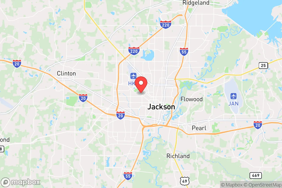
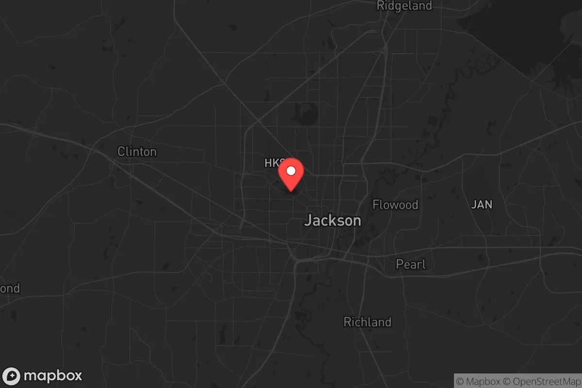
Strategic Assessment of Jackson, MS
Workable tactical position. Some exposure to population density or targets, but generally defensible in a crisis.
What does the Strategic Assessment tell us?
Our Strategic Assessment grades tactical survivability of an area. Major population centers, military targets, fallout zones, natural disasters, and border exposure all drive risk — lower exposure means a more defensible position in a crisis.
This is heavily inspired by Joel Skousen's Strategic Relocation book. Highly recommended you checkout the book ($)What does this tell us?
Our Strategic Assessment grades tactical survivability of an area. Major population centers, military targets, fallout zones, natural disasters, and border exposure all drive risk — lower exposure means a more defensible position in a crisis.
This is heavily inspired by Joel Skousen's Strategic Relocation book. Highly recommended you checkout the book ($)Strategic Pillars

Key Distances
Regional Safe Places
Below is our recommended "safe zones" in Mississippi and the surrounding area based on our strategic heuristics. For most people, it's unrealistic to live in a “safe zone” full-time due to work, family or other personal reasons. They tend to be more rural. However, many of these areas are perfect for second homes and retreat properties that double as a vacation home or even a short-term rental.
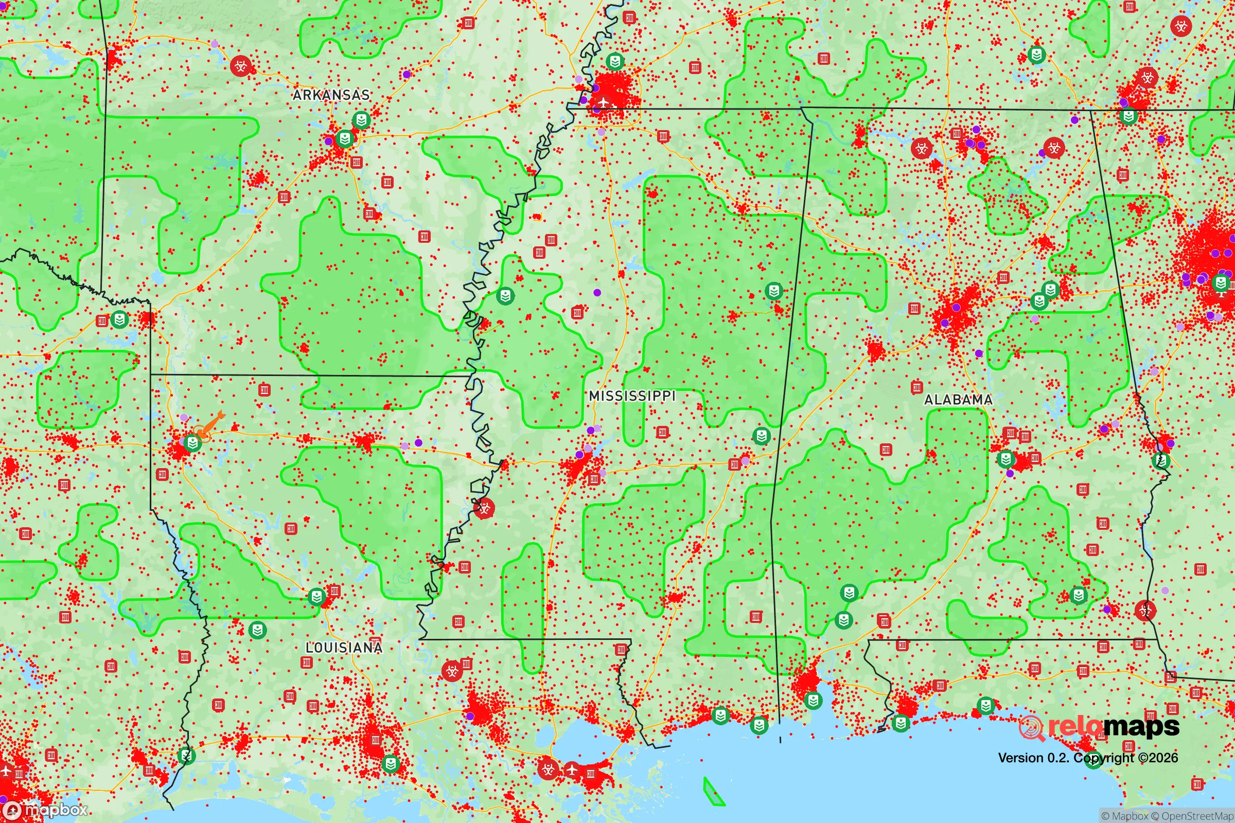
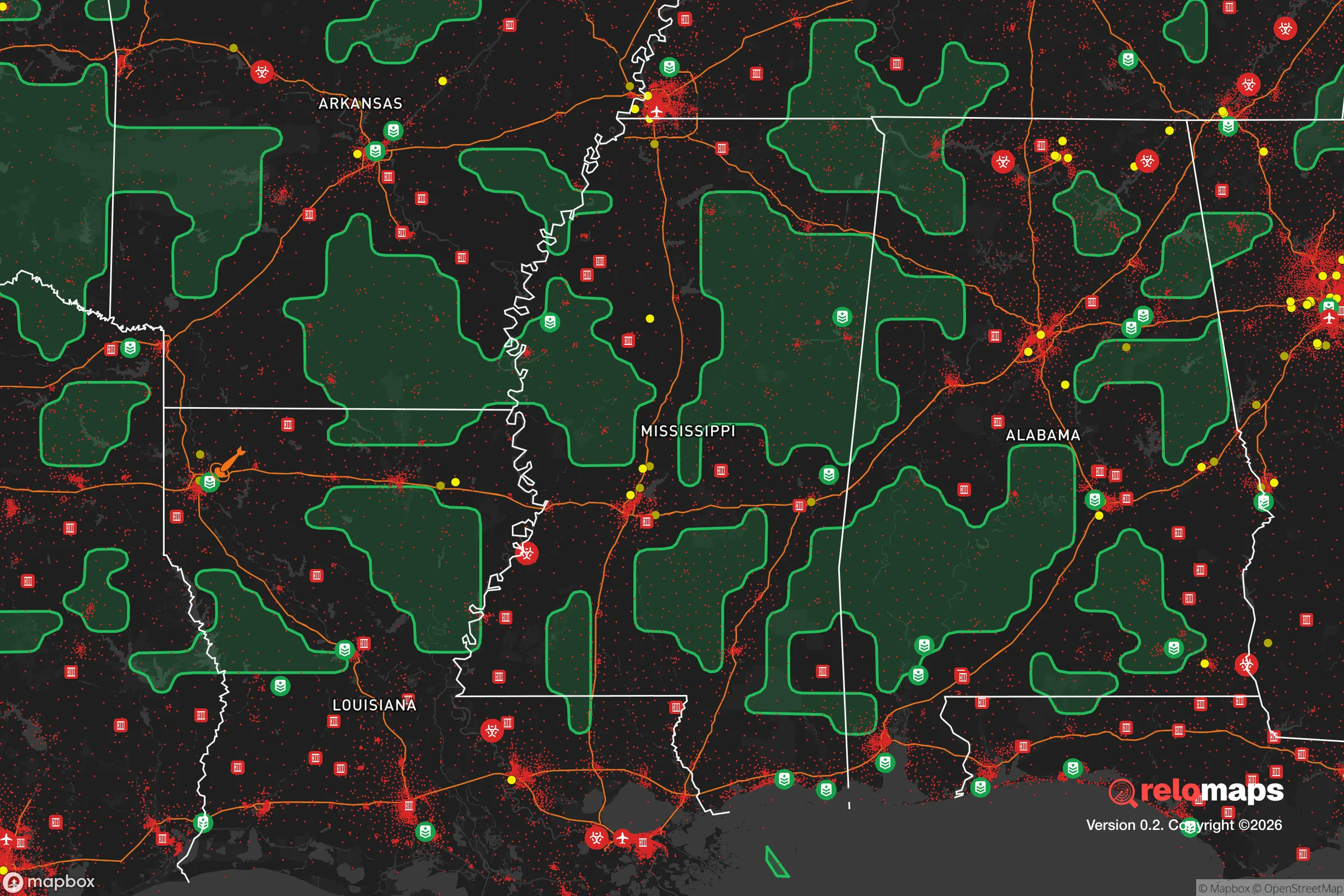
Important Note: For informational purposes only. This does not mean nothing bad ever happens in the green zones. Please use common sense. This is based on public data and modeled with AI. We tried to take a conservative approach but mistakes happen. We update this regularly as new information becomes available.
Solar Generator Recommendations
Backup power matters more here than in safer locations. We've picked three solar generators across budgets and capacity tiers — start with the budget unit if you only need a few essentials, or step up if you want to run a fridge and HVAC for days at a time.

Jackery Portable Power Station Explorer 300
Budget OptionPower on the Go: Weighing only 11 lbs, it's convenient to set up and store with book-sized foldable solar panels

BLUETTI Portable Power Station AC180
Designed for both indoor and outdoor scenarios, AC180 is highly capable as it has a robost capacity and continuous output power.

EF ECOFLOW DELTA Pro Ultra Power Station
Upgraded PickEcoFlow DELTA Pro Ultra is a whole-home energy system designed to grow with your family. Integrated with the Smart Home Panel 2, it scales to meet your evolving energy needs — keeping your home powered, intelligent, and secure through every stage of life.
We earn a commission, at no additional cost to you.
Strategic Assessment Analysis
Jackson, Mississippi, sits in a precarious strategic position: it offers genuine geographic resilience through its location away from coastal storm surge zones and major seismic fault lines, yet it also carries significant liabilities for anyone serious about long-term preparedness. The city itself has experienced decades of population decline—down from a peak of nearly 200,000 in the 1980s to roughly 145,000 today—which means infrastructure has been shrinking rather than growing. For a relocator with a survivalist or prepper mindset, Jackson’s core value lies not in the city proper but in the surrounding rural areas of Hinds, Rankin, and Madison counties, where land is still affordable and water resources are abundant. The real question is whether the risks of being near a state capital with a struggling municipal government outweigh the advantages of low population density and access to the Pearl River watershed.
Geographic position and natural advantages for long-term survival
Jackson’s location in central Mississippi places it roughly 150 miles from the Gulf Coast, far enough inland to avoid the worst of hurricane storm surges but close enough to be affected by heavy rainfall and inland flooding. The city sits on the Pearl River, which provides a reliable freshwater source—critical for any long-term self-sufficiency plan. The surrounding terrain is mostly rolling hills and hardwood forests, offering natural cover and defensible positions if you choose property with elevation. The climate is humid subtropical, with a growing season of about 230 days, meaning you can produce food year-round with proper planning. The Mississippi River is about 40 miles west, giving access to a major waterway for trade or evacuation if needed. For a prepper, the key advantage here is that Jackson is not a primary target for any large-scale conflict or nuclear strike—it lacks the strategic military installations, major ports, or dense population centers that would make it a priority. The nearest major fallout danger would be from a strike on the Memphis area (about 200 miles north) or the Gulf Coast naval facilities, but prevailing winds in this region typically blow from the south and southwest, which would push fallout away from Jackson in most scenarios.
Risks, exposures, and proximity to fallout-relevant landmarks
The most immediate risk for a relocator in the Jackson area is not external attack but internal collapse. Jackson’s municipal water system has been in crisis for years—boil-water notices are routine, and in 2022 the system nearly failed entirely, leaving residents without running water for weeks. This is a red flag for anyone planning to rely on municipal infrastructure during a crisis. The city’s population is concentrated in a relatively small footprint (about 110 square miles), and the urban core has high crime rates—Jackson’s violent crime rate is consistently among the highest in the nation, with a murder rate around 60 per 100,000 residents in recent years. For a prepper, this means the city itself is a liability: during a grid-down scenario or civil unrest, the urban areas would likely become dangerous quickly. The proximity to major highways (I-55 and I-20) is a double-edged sword—they provide evacuation routes but also funnel potential threats from larger cities like Memphis, New Orleans, and Birmingham. The nearest nuclear power plant is the Grand Gulf Nuclear Station in Port Gibson, about 45 miles southwest, which is a consideration for fallout exposure if an accident or attack occurs. The plant is a boiling water reactor, and while it has a good safety record, any nuclear facility within 50 miles is worth noting on a risk map.
Practical resilience for a relocator: food, water, energy, and defensibility
For someone serious about self-sufficiency, the Jackson area offers several practical advantages. Water is abundant—the Pearl River and its tributaries provide surface water, and the Mississippi Embayment aquifer lies beneath much of the region, meaning well water is accessible at reasonable depths (typically 100-300 feet). Food production is viable with the long growing season, and there are established farming communities in Madison and Rankin counties where you can buy land with existing agricultural infrastructure. The state has relatively lax regulations on rainwater collection, livestock, and off-grid living compared to more restrictive states. Energy resilience is mixed: the grid is prone to outages during storms, but solar potential is decent (about 4.5 peak sun hours per day), and natural gas is available in many rural areas. For defensibility, the ideal property would be in the hillier terrain east of Jackson in Rankin County or south toward Copiah County, where you get elevation, tree cover, and distance from major roads. The biggest practical challenge is supply chain vulnerability—Jackson is not a major logistics hub, so during a national emergency, resupply of ammunition, medical supplies, and specialized gear would be slower than in regions closer to distribution centers. You would need to stockpile accordingly, with a minimum of six months of supplies recommended for any serious prepper setup here.
The overall strategic picture for Jackson is one of trade-offs. It offers genuine resilience through low population density in the surrounding counties, abundant water, and a climate that supports year-round food production. But it also carries significant risks from municipal instability, high urban crime, and proximity to a nuclear facility. For a conservative-leaning relocator who values self-reliance and is willing to invest in off-grid infrastructure—well water, solar, septic, and a substantial food stockpile—the areas outside Jackson proper can be a solid choice. The key is to avoid the city limits entirely and focus on the rural periphery, where land is still cheap (around $3,000-$5,000 per acre) and neighbors are likely to share your values. If you’re looking for a place that is off the radar of major threats but still within a day’s drive of essential resources, Jackson’s hinterlands deserve a serious look—just don’t plan on relying on the city itself for anything in a crisis.
* Values derived from national, state, county, city and local statistics and may differ in a specific area. Last updated: 2026-04-24T06:30:35.000Z
Narrative content on this page is AI-generated and may contain mistakes. Verify any details that matter before acting on them.
ReloMaps may earn a commission from affiliate links at no extra cost to you.