
Photo: Wikipedia
Strategic Assessment of Lyon County
Strong survivability profile. Good buffer from population centers, with manageable environmental and tactical risks.
What does the Strategic Assessment tell us?
Our Strategic Assessment grades tactical survivability of an area. Major population centers, military targets, fallout zones, natural disasters, and border exposure all drive risk — lower exposure means a more defensible position in a crisis.
This is heavily inspired by Joel Skousen's Strategic Relocation book. Highly recommended you checkout the book ($)What does this tell us?
Our Strategic Assessment grades tactical survivability of an area. Major population centers, military targets, fallout zones, natural disasters, and border exposure all drive risk — lower exposure means a more defensible position in a crisis.
This is heavily inspired by Joel Skousen's Strategic Relocation book. Highly recommended you checkout the book ($)Strategic Pillars

Key Distances
Strategic Assessment Analysis
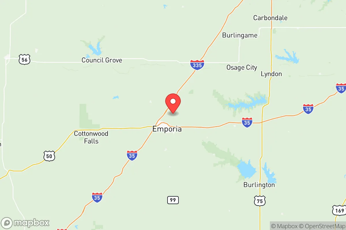
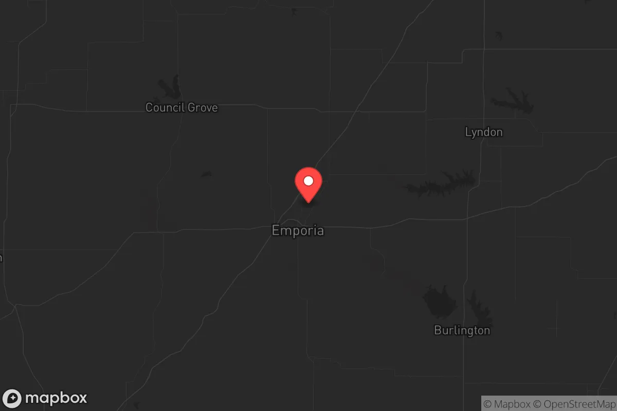
Lyon County, Kansas, anchored by the city of Emporia, offers a compelling blend of geographic isolation and practical self-sufficiency that appeals to those prioritizing resilience over convenience. Its position in the Flint Hills—roughly 90 miles southwest of Kansas City and 50 miles northeast of Wichita—places it outside the immediate blast and fallout zones of major population centers while still providing access to regional supply chains. The county’s agricultural base, low population density (roughly 33,000 residents across 850 square miles), and distance from high-value strategic targets make it a viable option for relocators seeking a defensible, low-profile base of operations in an increasingly unstable national landscape.
Geographic position and natural advantages for long-term survival
Lyon County sits in the heart of the Flint Hills, one of the last remaining tallgrass prairie ecosystems in North America. This terrain offers several natural advantages for a prepper or survivalist household. The rocky, hilly landscape is difficult to traverse with heavy equipment, providing a natural barrier against large-scale movement—whether that’s a military convoy or a desperate urban exodus. The region’s shallow, rocky soils discouraged intensive farming historically, which means the area avoided the dense settlement patterns seen in the Corn Belt. Today, that same geology supports robust cattle grazing, and the county is dotted with small ranches and farmsteads that can be acquired for relatively low cost—think $150,000 to $300,000 for a 20- to 40-acre parcel with a well and septic. The Flint Hills also host the largest remaining concentration of intact prairie in the U.S., which means ample forage for livestock and wildlife for hunting. The county’s water resources are decent: the Cottonwood River and Neosho River converge near Emporia, and the John Redmond Reservoir lies just east in Coffey County, providing a regional water backup. However, groundwater in the Flint Hills is often shallow and hard, so well depth and yield should be verified before purchase. The climate is continental—hot summers, cold winters, with average annual precipitation around 35 inches—which supports dryland farming of hay, sorghum, and winter wheat without heavy irrigation dependency.
Risks, exposures, and proximity to fallout-relevant landmarks
No location is risk-free, and Lyon County has its own set of exposures that a strategic relocator must weigh. The most obvious concern is the county’s proximity to the Kansas City metropolitan area, roughly 90 miles northeast. While that distance provides a buffer against the initial blast effects of a nuclear detonation over a major city, it does not eliminate fallout risk. Prevailing winds in the region are from the south and southwest, meaning fallout from a strike on Kansas City would likely drift east-northeast, away from Lyon County. However, a ground burst on the city could still deposit lighter particulate across eastern Kansas depending on weather patterns. More concerning is the presence of the Wolf Creek Nuclear Generating Station in neighboring Coffey County, about 25 miles east of Emporia. This single-unit pressurized water reactor is a potential target for sabotage or accident. A catastrophic failure at Wolf Creek—whether from a cyberattack, physical assault, or natural disaster—could render large swaths of Lyon County uninhabitable for weeks or months, depending on wind direction. The county also lies within 150 miles of McConnell Air Force Base in Wichita and Whiteman Air Force Base in Missouri, both of which are high-priority targets in a conflict scenario. On the plus side, Lyon County has no major refineries, chemical plants, or military installations within its borders, reducing the likelihood of a direct strike. The largest industrial facility is the Tyson Foods pork processing plant in Emporia, which employs about 2,500 people—a potential target for civil unrest but not a strategic military asset.
Practical resilience for a relocator: food, water, energy, and defensibility
For a relocator serious about self-sufficiency, Lyon County offers a workable baseline but requires deliberate investment. Food security is the strongest asset: the county is part of a regional agricultural network that produces beef, pork, corn, soybeans, and hay. Emporia has a well-established farmers’ market and multiple feed stores, and the surrounding rural areas have a culture of hunting deer, turkey, and small game. A family with a few acres can raise chickens, goats, or a milk cow with relative ease. Water security is more variable. Municipal water in Emporia comes from the Neosho River and is treated at the city’s water plant, which is vulnerable to power outages or contamination. Rural properties typically rely on private wells, but the Flint Hills’ limestone and shale geology means wells can be deep (200-400 feet) and prone to hard water and sulfur odors. A backup hand pump or solar-powered pump is advisable. Energy resilience is a mixed bag. The county is served by Evergy, which has a moderately reliable grid, but rural areas experience outages during ice storms and summer thunderstorms. Solar potential is decent—the region averages about 200 sunny days per year—but winter cloud cover can reduce output significantly. Wood heating is a practical option given the abundance of oak, hickory, and cedar in the area. Defensibility is where Lyon County shines. The dispersed population, limited road network, and open sightlines across the prairie make it difficult for a large group to approach unnoticed. A well-chosen property with a long driveway, a creek or pond for water, and a view of the surrounding terrain can be made quite secure with modest improvements. The county’s sheriff’s office is professional but small—about 20 deputies for the entire county—so law enforcement response times in rural areas can exceed 30 minutes. That means self-reliance is not optional; it’s the default.
The overall strategic picture for Lyon County is one of moderate risk with high potential reward for those willing to put in the work. It avoids the worst fallout corridors of the coasts and major inland cities while retaining access to agricultural resources and regional trade routes. The presence of a nuclear plant 25 miles away is a genuine concern, but it’s a known variable that can be planned for—unlike the unpredictable chaos of a major metropolitan collapse. For a conservative-leaning relocator who values community, land, and the ability to weather a crisis without relying on government handouts, Lyon County deserves a serious look. It’s not a bug-out paradise in the Rockies, but it’s a solid, workable piece of the American heartland that can support a family through the hard years ahead.
* Values derived from national, state, county, city and local statistics and may differ in a specific area. Last updated: 2026-05-23T10:40:30.000Z
Narrative content on this page is AI-generated and may contain mistakes. Verify any details that matter before acting on them.
ReloMaps may earn a commission from affiliate links at no extra cost to you.