Photo: Wikipedia
Demographics of Montgomery County
Affluence Level in Montgomery County
A middle-class area roughly in line with national averages across income, home values, education, and employment.
People of Montgomery County
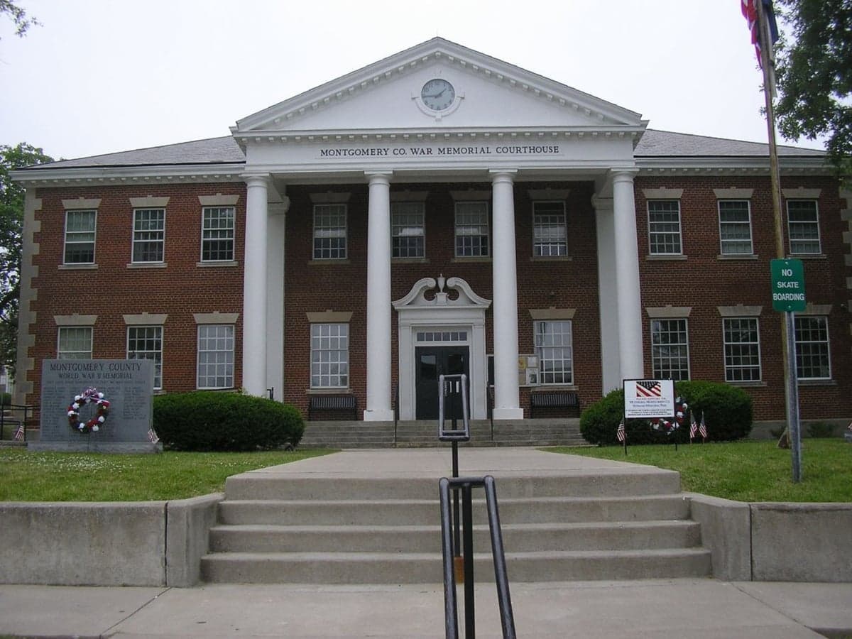
Montgomery County, Kentucky, is a predominantly white, rural community of 28,271 residents where a deeply rooted Scots-Irish and English heritage shapes the local character. With a foreign-born population of just 1.0% and a 92.1% white demographic, the county remains one of the least ethnically diverse in the state, though a small but growing Hispanic community (3.3%) and a modest Black population (2.6%) add subtle layers to its cultural fabric. The county seat of Mount Sterling serves as the economic and social hub, while smaller communities like Camargo, Jeffersonville, and Means anchor the surrounding farmland. This is a place where family ties run deep, church attendance is high, and the pace of life remains decidedly slow — a profile that appeals strongly to conservative-leaning families seeking stability and traditional values.
Settlement & growth (pre-1960)
Long before European settlers arrived, the region that is now Montgomery County was part of the vast hunting grounds of the Shawnee and Cherokee nations. These Native groups used the area primarily for seasonal hunting, with the Licking River and its tributaries providing travel corridors. No permanent Native villages existed within the county's boundaries, as the land was contested territory between tribes. The first European incursion came in the 1770s, when long hunters from Virginia and Pennsylvania crossed the Cumberland Gap into what was then Fincastle County, Virginia.
The county's permanent settlement began in earnest after the American Revolution, when the Virginia legislature granted land bounties to veterans. The first wave of settlers — overwhelmingly Scots-Irish and English from Virginia, North Carolina, and Pennsylvania — arrived in the 1780s and 1790s. They were drawn by cheap, fertile land in the Bluegrass region and the promise of self-sufficiency. These pioneers established homesteads along the Licking River and its creeks, with the settlement that would become Mount Sterling emerging as a natural crossroads. The town was formally laid out in 1792, the same year Kentucky became a state, and was named after a Scottish town — a nod to the settlers' heritage. Montgomery County itself was formed from Clark County in 1796.
Throughout the 19th century, the population remained overwhelmingly of British Isles descent. Tobacco farming became the economic backbone, with the county's dark-fired tobacco gaining a national reputation. This cash crop required significant labor, and by 1860, enslaved Black people made up roughly 25% of the county's population — a higher proportion than in many other Kentucky counties. After the Civil War and Emancipation, many freed Black families remained in the area, forming small communities like Bathgate and the Bunker Hill neighborhood in Mount Sterling. However, the post-Reconstruction era saw a steady outmigration of Black residents to northern industrial cities, a trend that accelerated through the Great Migration of 1910-1970.
The late 19th and early 20th centuries brought a small but notable wave of German and Irish immigrants, who arrived to work on the railroad lines being built through the county. The Louisville and Nashville Railroad reached Mount Sterling in the 1870s, connecting the county to broader markets. These immigrants largely assimilated into the existing white population, and few distinct ethnic enclaves formed. The town of Camargo, originally settled by a French Huguenot family, remained a tiny farming hamlet. Meanwhile, Jeffersonville and Means developed as railroad stops and trading centers for the surrounding agricultural countryside.
The 20th century saw little demographic change. The county's population peaked at around 15,000 in 1900 and then stagnated for decades, as young people left for factory jobs in Lexington, Cincinnati, and Detroit. The Great Depression hit tobacco farmers hard, but the New Deal's rural electrification program and the establishment of the Mount Sterling National Bank helped stabilize the local economy. World War II brought a brief economic boost, but the post-war era saw continued outmigration. By 1960, the county's population had barely reached 13,000, and its racial composition was over 95% white.
Modern era (post-1965)
The 1965 Hart-Cellar Act, which dramatically reshaped American immigration, had almost no effect on Montgomery County. Unlike urban centers or Sun Belt boomtowns, this rural Kentucky county received virtually no new immigrant populations from Asia, Latin America, or the Middle East. The foreign-born share remains at just 1.0% in 2025, a figure that has barely budged in sixty years. The county's demographic story since 1965 is not one of immigration but of domestic migration patterns and natural population growth.
The most significant shift has been the gradual return of some residents from urban areas. Beginning in the 1990s, a modest but steady stream of retirees and remote workers from Lexington (45 miles west) and Cincinnati (120 miles north) began moving to Montgomery County, drawn by lower housing costs and a slower pace of life. This trend accelerated after 2020, as the COVID-19 pandemic made remote work permanent for many professionals. New subdivisions have sprouted on the outskirts of Mount Sterling, particularly along the KY-11 corridor and near the Mount Sterling-Montgomery County Airport.
The Hispanic population has grown from negligible levels in 1990 to 3.3% today, driven primarily by Mexican and Central American immigrants who arrived to work in tobacco farming, horse breeding, and the county's growing manufacturing sector. Major employers like Mount Sterling Manufacturing (automotive parts) and Pilot Travel Centers have attracted a small but visible Hispanic workforce. These families tend to settle in Mount Sterling itself, particularly in the West Mount Sterling area, where a handful of Spanish-language churches and tiendas have opened. The Black population, meanwhile, has declined to 2.6%, as younger Black residents continue to leave for larger cities with more economic opportunities.
The East/Southeast Asian population (0.1%) and Indian-subcontinent population (0.4%) are tiny and largely consist of professionals — doctors at St. Joseph Mount Sterling Hospital, engineers at local manufacturing plants, and a few university faculty commuting to Morehead State University. No distinct Asian or Indian enclaves exist; these families are dispersed throughout the county. The college-educated share of the population stands at 20.8%, below the national average of 33%, reflecting the county's working-class, agricultural character.
The future
Montgomery County is projected to experience slow but steady growth over the next 10-20 years, driven primarily by domestic in-migration from more expensive parts of Kentucky and the Midwest. The county's population could reach 30,000 by 2040, with most new residents settling in and around Mount Sterling. The Hispanic share is likely to rise to 5-6% as agricultural and manufacturing jobs continue to attract immigrant labor, but the county will remain overwhelmingly white and native-born. The Black population is expected to remain stable or decline slightly, while Asian and Indian populations will likely remain below 1% each.
The cultural identity of the county is evolving in subtle ways. The influx of remote workers and retirees from Lexington is bringing a slightly more diverse set of political and social views, but the county's conservative, churchgoing character remains deeply entrenched. The Republican Party dominates local elections, and social issues like gun rights, school choice, and opposition to abortion remain defining concerns. The county's schools — particularly Montgomery County High School and McNabb Middle School — are seeing modest increases in Hispanic enrollment, which is slowly diversifying the student body.
New housing developments are concentrated in the Indian Mound and Spencer Road areas east of Mount Sterling, as well as along the US-460 corridor toward Camargo. These are predominantly single-family homes aimed at families and retirees. The county's agricultural base — tobacco, cattle, and hay — is shrinking as farmland is converted to residential use, but farming remains a core part of the local identity. The biggest wildcard is the potential for larger-scale manufacturing or logistics development, which could accelerate growth and attract more diverse populations.
For someone moving in now, Montgomery County offers a stable, predictable, and deeply traditional community. It is not a place of rapid change or demographic transformation. The population is aging slightly, but families with children remain common. The county's appeal lies in its low crime rate, affordable housing (median home value around $150,000), and strong sense of neighborly connection. New residents will find a place where the past is still present — where family names from the 1790s still appear on mailboxes, and where the rhythms of rural life continue to shape daily existence.

* Values derived from national, state, county, city and local statistics and may differ in a specific area. Last updated: 2026-09-20T02:44:48.000Z
Narrative content on this page is AI-generated and may contain mistakes. Verify any details that matter before acting on them.
ReloMaps may earn a commission from affiliate links at no extra cost to you.

