
Photo: Wikipedia
Strategic Assessment of Montgomery County
Workable tactical position. Some exposure to population density or targets, but generally defensible in a crisis.
What does the Strategic Assessment tell us?
Our Strategic Assessment grades tactical survivability of an area. Major population centers, military targets, fallout zones, natural disasters, and border exposure all drive risk — lower exposure means a more defensible position in a crisis.
This is heavily inspired by Joel Skousen's Strategic Relocation book. Highly recommended you checkout the book ($)What does this tell us?
Our Strategic Assessment grades tactical survivability of an area. Major population centers, military targets, fallout zones, natural disasters, and border exposure all drive risk — lower exposure means a more defensible position in a crisis.
This is heavily inspired by Joel Skousen's Strategic Relocation book. Highly recommended you checkout the book ($)Strategic Pillars

Key Distances
Strategic Assessment Analysis
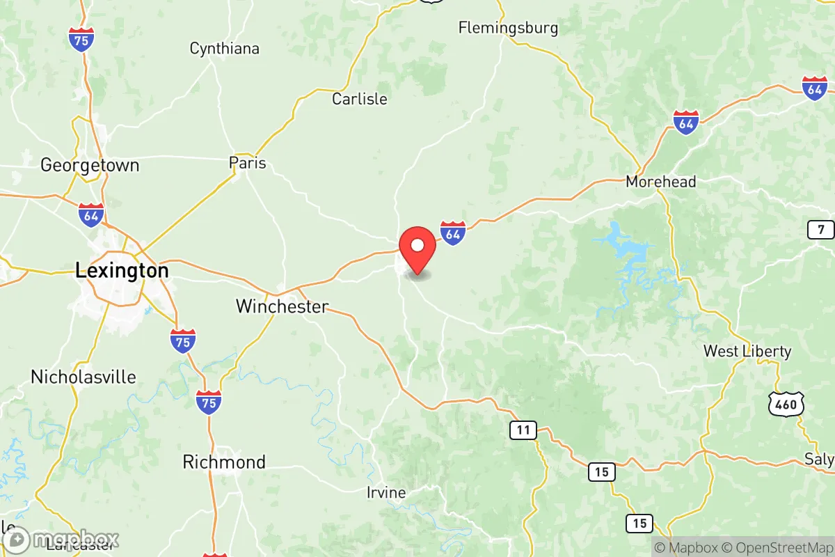
Montgomery County, Kentucky, anchored by the county seat of Mount Sterling, presents a compelling case for relocation-minded individuals and families who prioritize resilience and self-sufficiency without complete isolation. Its strategic position along the I-64 corridor places it roughly 40 miles east of Lexington and 90 miles southeast of Louisville, offering a buffer from major metropolitan vulnerabilities while maintaining access to essential supply chains and medical infrastructure. The county’s rolling hills, mixed hardwood forests, and proximity to the Daniel Boone National Forest provide natural advantages for those serious about disaster preparedness, though its location near regional infrastructure and transportation hubs introduces specific risk considerations that warrant careful evaluation.
Geographic position and natural advantages for self-sufficiency
Montgomery County sits in the heart of the Bluegrass region’s eastern transition zone, where the fertile inner Bluegrass gives way to the more rugged Appalachian foothills. This geography offers a blend of productive agricultural land and defensible terrain. The county’s elevation averages around 950 feet, with local ridges reaching over 1,100 feet, providing natural drainage and reducing flood risk compared to low-lying areas along the Kentucky River. The Licking River, which forms part of the county’s western boundary, and its tributaries like Slate Creek offer surface water sources for those with proper filtration systems. The area’s limestone bedrock supports reliable groundwater wells, a critical advantage for long-term water security. The surrounding forestland, particularly the 700,000-acre Daniel Boone National Forest about 20 miles southeast, provides a substantial buffer zone and potential foraging, hunting, and timber resources. Mount Sterling itself sits at the intersection of I-64 and the Mountain Parkway, a dual-highway advantage that facilitates evacuation or supply movement in multiple directions—east toward Ashland and West Virginia, west to Lexington, and south into the Appalachian corridor.
Risks, exposures, and proximity to fallout-relevant landmarks
While Montgomery County avoids the direct blast and fallout risks of major metropolitan targets, its location near several significant infrastructure nodes introduces moderate man-made risk. The most proximate high-value target is the Blue Grass Army Depot in Richmond, Kentucky, about 45 miles southwest, which stores chemical weapons and conventional munitions—a primary concern for fallout patterns depending on prevailing winds. The LG&E and KU power plant in Clark County (near Winchester), roughly 25 miles west, and the East Kentucky Power Cooperative’s Spurlock Station in Maysville, about 40 miles north, represent conventional power generation targets. The I-64 corridor itself, a major east-west logistics artery, could be a secondary target or chokepoint during a crisis. Natural disaster risks are comparatively low: the region experiences occasional tornadoes (typically EF-1 or EF-2), infrequent ice storms that can knock out power for days, and minor flooding along the Licking River floodplain. The county sits in a moderate seismic zone, with the New Madrid fault zone roughly 250 miles west—distant enough that a major quake there would cause shaking but not catastrophic damage. For a relocator, the primary man-made risk is fallout from a strike on the Blue Grass Depot or, less likely, from a major event at the Louisville International Airport or Fort Knox (about 90 miles west). Prevailing winds in the region are generally from the southwest, meaning fallout from the depot would likely track northeast, away from Mount Sterling proper.
Practical resilience for a relocator: food, water, energy, and defensibility
Montgomery County offers above-average practical resilience for a relocator willing to invest in preparation. The county’s agricultural base is substantial: over 1,200 farms cover roughly 60% of the land area, producing tobacco, corn, soybeans, hay, and livestock. The Mount Sterling Farmers Market and local CSAs provide immediate access to fresh produce, while the surrounding Amish and Mennonite communities in neighboring Bath and Fleming counties offer a decentralized food production network that would likely persist through disruptions. Water security is strong: the county’s groundwater is generally high-quality and accessible via shallow wells (50-150 feet deep) in most areas, and the Licking River provides a surface water backup for those with proper treatment. The Mount Sterling Water Works draws from the Licking River and maintains a 1.5-million-gallon storage tank, but a relocator should plan for private well or rainwater catchment as a primary source. Energy resilience is moderate: the local electric cooperative, Blue Grass Energy, serves the area with overhead lines vulnerable to ice storms and wind, but the county’s tree cover and rural layout make solar panel installation viable for off-grid capability. Propane and wood heating are common in rural homes, with ample firewood available from local forests. Defensibility is a mixed picture: the county’s rolling terrain and scattered woodlots provide natural cover and chokepoints, but the I-64 corridor and Mountain Parkway create easy access for outsiders. The most defensible properties are those on dead-end roads off the main highways, particularly in the southern part of the county near the Bath County line or in the eastern hills toward the Menifee County border. The Mount Sterling Police Department and Montgomery County Sheriff’s Office maintain a visible presence, but rural response times can exceed 20 minutes, making personal security planning essential.
Overall, Montgomery County represents a balanced strategic choice for the resilience-minded relocator. It avoids the extreme risks of major metropolitan areas and the Blue Grass Depot’s immediate blast zone while retaining access to Lexington’s medical and supply infrastructure (University of Kentucky Medical Center is 45 minutes away). The county’s agricultural capacity, water resources, and moderate population density (about 28,000 residents) create a sustainable baseline for long-term self-sufficiency. The primary trade-offs are the moderate fallout risk from the depot and the vulnerability of the I-64 corridor as a crisis chokepoint. For a family or individual willing to invest in well water, solar backup, and a defensible rural property in the county’s southern or eastern reaches, Montgomery County offers a credible foundation for disaster preparedness without the extreme isolation of deeper Appalachian locations. The key is to avoid the immediate I-64 corridor and Mount Sterling’s downtown core, focusing instead on the agricultural areas around Jeffersonville or Camargo, where natural buffers and community networks are strongest.

* Values derived from national, state, county, city and local statistics and may differ in a specific area. Last updated: 2026-09-20T02:44:48.000Z
Narrative content on this page is AI-generated and may contain mistakes. Verify any details that matter before acting on them.
ReloMaps may earn a commission from affiliate links at no extra cost to you.

