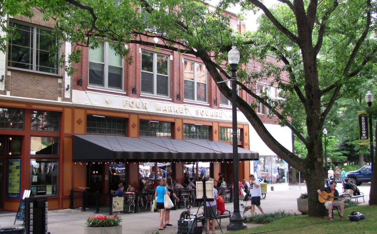
Photo: Wikipedia
Strategic Assessment of Knoxville, TN
Meaningful friction. Expect exposure to either population pressure, blast zones, or natural disaster risk. Consider buying a retreat property.
What does the Strategic Assessment tell us?
Our Strategic Assessment grades tactical survivability of an area. Major population centers, military targets, fallout zones, natural disasters, and border exposure all drive risk — lower exposure means a more defensible position in a crisis.
This is heavily inspired by Joel Skousen's Strategic Relocation book. Highly recommended you checkout the book ($)What does this tell us?
Our Strategic Assessment grades tactical survivability of an area. Major population centers, military targets, fallout zones, natural disasters, and border exposure all drive risk — lower exposure means a more defensible position in a crisis.
This is heavily inspired by Joel Skousen's Strategic Relocation book. Highly recommended you checkout the book ($)Strategic Pillars

Key Distances
Regional Safe Places
Below is our recommended "safe zones" in Tennessee and the surrounding area based on our strategic heuristics. For most people, it's unrealistic to live in a “safe zone” full-time due to work, family or other personal reasons. They tend to be more rural. However, many of these areas are perfect for second homes and retreat properties that double as a vacation home or even a short-term rental.
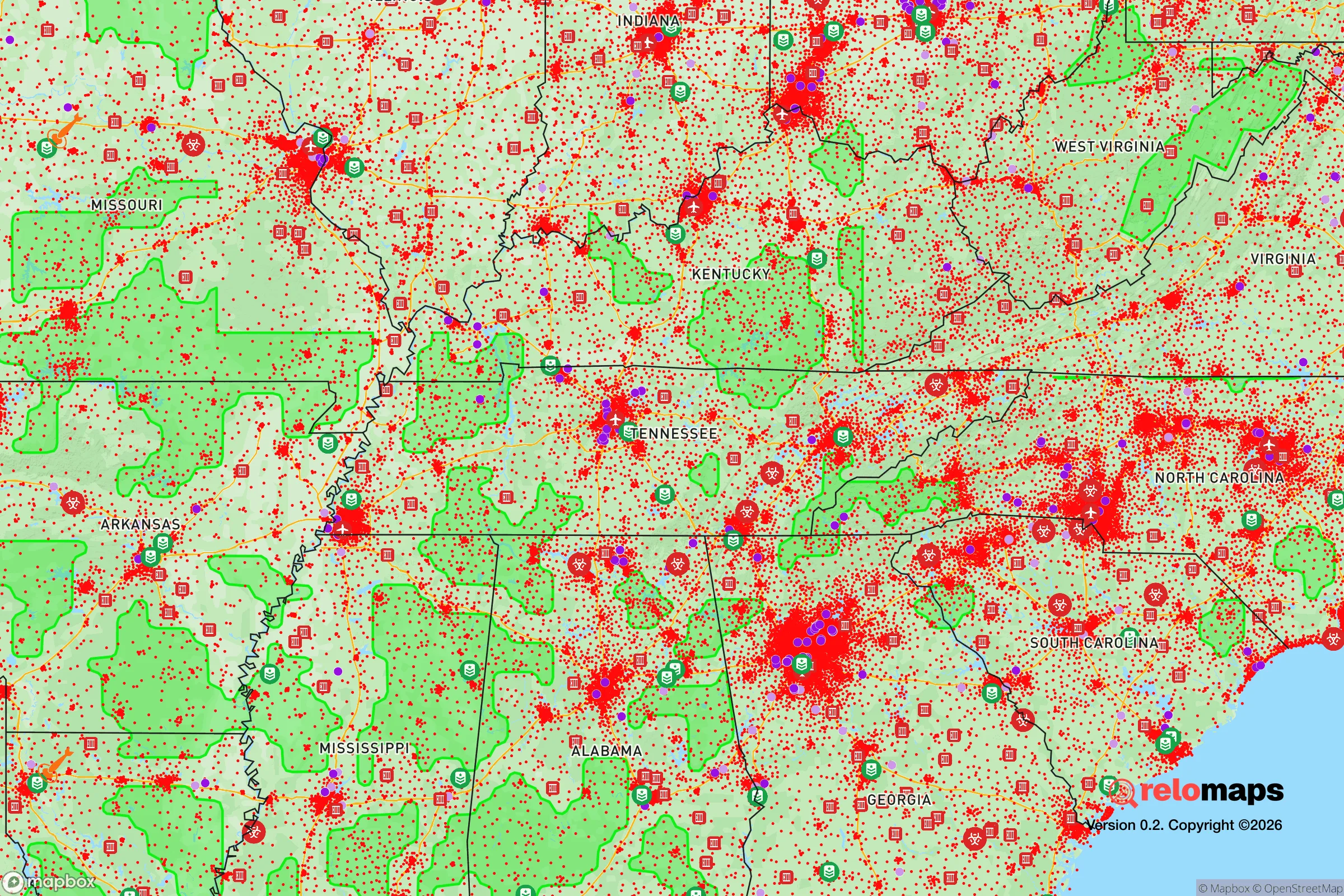
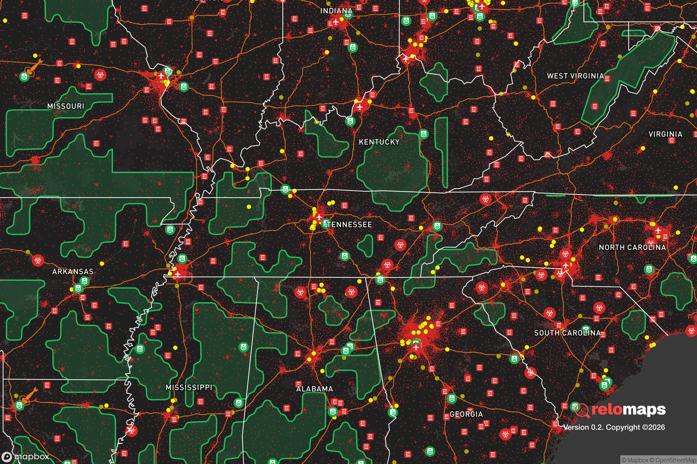
Important Note: For informational purposes only. This does not mean nothing bad ever happens in the green zones. Please use common sense. This is based on public data and modeled with AI. We tried to take a conservative approach but mistakes happen. We update this regularly as new information becomes available.
Solar Generator Recommendations
Backup power matters more here than in safer locations. We've picked three solar generators across budgets and capacity tiers — start with the budget unit if you only need a few essentials, or step up if you want to run a fridge and HVAC for days at a time.

Jackery Portable Power Station Explorer 300
Budget OptionPower on the Go: Weighing only 11 lbs, it's convenient to set up and store with book-sized foldable solar panels

BLUETTI Portable Power Station AC180
Designed for both indoor and outdoor scenarios, AC180 is highly capable as it has a robost capacity and continuous output power.

EF ECOFLOW DELTA Pro Ultra Power Station
Upgraded PickEcoFlow DELTA Pro Ultra is a whole-home energy system designed to grow with your family. Integrated with the Smart Home Panel 2, it scales to meet your evolving energy needs — keeping your home powered, intelligent, and secure through every stage of life.
We earn a commission, at no additional cost to you.
Strategic Assessment Analysis
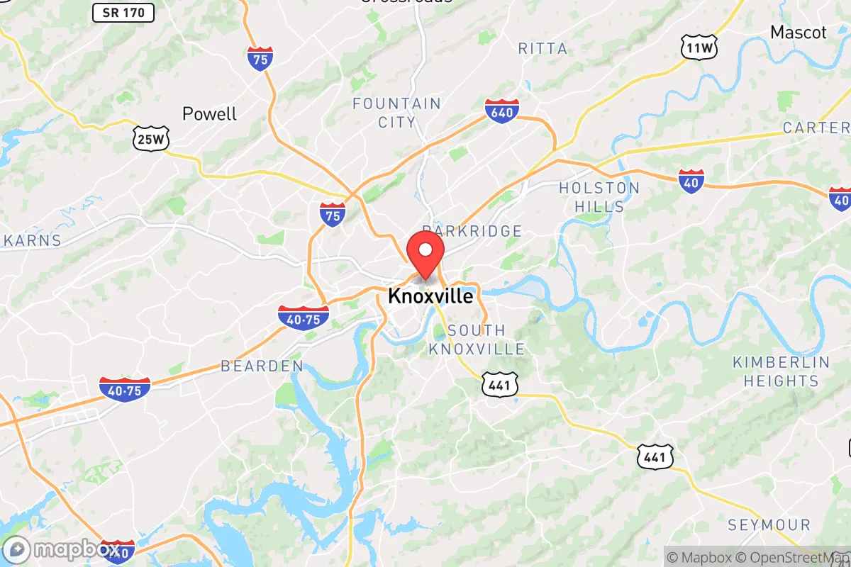
Knoxville sits in a geographic sweet spot that makes it one of the more strategically resilient mid-sized cities in the eastern United States for those thinking long-term about stability and self-sufficiency. Tucked into the Tennessee Valley and shielded by the Appalachian foothills, the area offers a rare combination of natural barriers, water abundance, and distance from the most obvious national-level targets — all while maintaining access to essential infrastructure. For a relocator with a prepper mindset, Knoxville checks boxes that few other cities of its size can match, though it is not without its own exposures that demand honest assessment.
Geographic position and natural advantages for long-term stability
Knoxville’s location at the junction of Interstates 40, 75, and 81 places it at a logistical crossroads, but its real value lies in what surrounds it. The Great Smoky Mountains to the southeast and the Cumberland Plateau to the northwest create a natural bowl that buffers the city from the worst of extreme weather patterns while providing ample escape routes into sparsely populated terrain. The Tennessee River runs directly through the city, and the nearby Tennessee Valley Authority (TVA) system of dams and reservoirs — including Norris Lake, Cherokee Lake, and Watts Bar — gives the region one of the most reliable freshwater supplies in the country. For anyone concerned with water security in a crisis, this is a major advantage. The surrounding valleys and ridges also offer defensible terrain for those willing to move 30 to 60 minutes outside the urban core, with thousands of acres of national forest land providing both resources and buffer. The climate is moderate — hot summers, mild winters — which means fewer freeze-related failures and a longer growing season for anyone serious about food production. Knoxville sits far enough inland to be safe from hurricane storm surge and far enough from major fault lines to avoid significant earthquake risk, though minor tremors are possible.
Risks, exposures, and proximity to fallout-relevant landmarks
No location is immune, and Knoxville has its share of vulnerabilities that a strategic relocator must weigh. The most obvious concern is the Oak Ridge National Laboratory and the Y-12 National Security Complex, located just 20 miles west of downtown. Y-12 is a primary storage and processing site for highly enriched uranium and a key node in the U.S. nuclear weapons complex. In a worst-case scenario involving a major conflict or terrorist action, this facility is a high-value target. The prevailing wind patterns generally carry fallout eastward toward the mountains, but a ground burst or sabotage event could still pose a contamination risk to Knoxville itself, depending on the specifics. Additionally, the TVA’s Watts Bar Nuclear Plant, about 50 miles southwest, and the Sequoyah Nuclear Plant near Chattanooga, 90 miles south, add to the regional risk profile. Knoxville is also within a few hours’ drive of major population centers like Nashville, Atlanta, and Charlotte, which means that in a mass evacuation event, the interstates could become clogged with refugees heading east or north. The city’s own population of roughly 190,000 swells to over 850,000 in the metro area, and the narrow mountain passes and river crossings could become choke points during a rapid exodus. Flooding along the Tennessee River and its tributaries is a periodic concern, though TVA’s dam system mitigates the worst of it. For the prepper, the key takeaway is that Knoxville’s strategic value comes with a target liability — proximity to Oak Ridge is the single biggest factor to plan around.
Practical resilience for a relocator: food, water, energy, and defensibility
For someone serious about self-reliance, Knoxville offers strong fundamentals. Water is abundant and accessible — the Tennessee River alone carries more than 30,000 cubic feet per second past the city, and the TVA reservoir system provides backup storage that makes municipal water supplies more resilient than in most regions. Well water is viable in the surrounding counties, with typical depths of 100 to 300 feet in the valley areas. The growing season runs roughly from April to October, and the fertile river valleys support a wide range of crops, from corn and soybeans to vegetables and fruit trees. Local agriculture is robust, with numerous farmers’ markets, co-ops, and a strong network of small farms within an hour’s drive. For those looking to buy land, property in Loudon, Blount, and Anderson counties remains relatively affordable compared to national averages, with acreage parcels available under $10,000 per acre in many areas. Energy is a bright spot: the TVA grid is one of the most stable in the country, powered by a mix of nuclear, hydro, coal, and natural gas. Solar potential is moderate — the region gets about 200 sunny days per year — but the tree cover in the foothills can limit panel efficiency. Defensibility is good but not perfect. The terrain offers natural chokepoints along the river crossings and mountain passes, but the valley floor itself is open and would be hard to secure against a determined group. The best strategy for a relocator is to establish a primary residence within 30 to 45 minutes of Knoxville for access to supplies and medical care, while maintaining a more remote retreat deeper into the mountains — the Cherokee National Forest and the areas around Tellico Plains and the Citico Creek Wilderness offer some of the best options for a bug-out location within two hours of the city.
The overall strategic picture for Knoxville is one of calculated trade-offs. It offers a rare combination of water security, moderate climate, defensible terrain, and logistical access that makes it a strong candidate for anyone looking to relocate with resilience in mind. The proximity to Oak Ridge is a genuine concern that cannot be ignored, but it is a manageable risk if you plan your specific location carefully — staying east or south of the city reduces exposure to potential fallout patterns. The region’s political culture leans conservative, with a strong tradition of gun ownership, hunting, and local self-governance that aligns well with a prepper mindset. Knoxville is not a bunker, and it is not immune to the broader instability that may come, but for the strategic relocator who wants a base with real options — water, food, energy, and room to maneuver — it is one of the more sensible bets in the eastern half of the country. The key is to treat it as a hub, not a fortress, and to build your plan around the terrain and resources that lie just beyond the city limits.
* Values derived from national, state, county, city and local statistics and may differ in a specific area. Last updated: 2026-04-15T23:51:31.000Z
Narrative content on this page is AI-generated and may contain mistakes. Verify any details that matter before acting on them.
ReloMaps may earn a commission from affiliate links at no extra cost to you.