Photo: Wikipedia
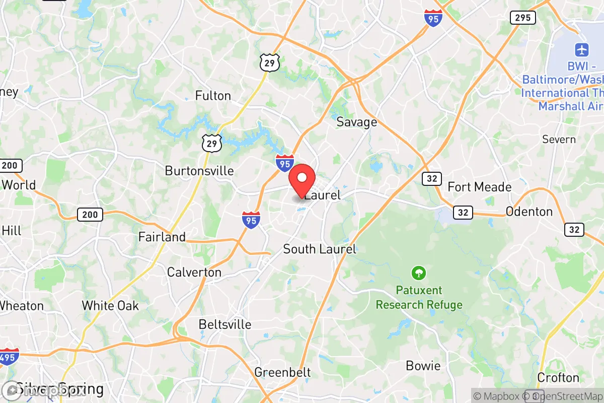
Strategic Assessment of Laurel, MD
Multiple tactical vulnerabilities. Population density, target proximity, or disaster risk are likely compounding. A retreat property and exit planning is required.
What does the Strategic Assessment tell us?
Our Strategic Assessment grades tactical survivability of an area. Major population centers, military targets, fallout zones, natural disasters, and border exposure all drive risk — lower exposure means a more defensible position in a crisis.
This is heavily inspired by Joel Skousen's Strategic Relocation book. Highly recommended you checkout the book ($)What does this tell us?
Our Strategic Assessment grades tactical survivability of an area. Major population centers, military targets, fallout zones, natural disasters, and border exposure all drive risk — lower exposure means a more defensible position in a crisis.
This is heavily inspired by Joel Skousen's Strategic Relocation book. Highly recommended you checkout the book ($)Strategic Pillars

Key Distances
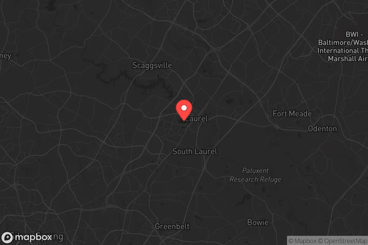
Regional Safe Places
Below is our recommended "safe zones" in Maryland and the surrounding area based on our strategic heuristics. For most people, it's unrealistic to live in a “safe zone” full-time due to work, family or other personal reasons. They tend to be more rural. However, many of these areas are perfect for second homes and retreat properties that double as a vacation home or even a short-term rental.


Important Note: For informational purposes only. This does not mean nothing bad ever happens in the green zones. Please use common sense. This is based on public data and modeled with AI. We tried to take a conservative approach but mistakes happen. We update this regularly as new information becomes available.
Solar Generator Recommendations
Backup power matters more here than in safer locations. We've picked three solar generators across budgets and capacity tiers — start with the budget unit if you only need a few essentials, or step up if you want to run a fridge and HVAC for days at a time.

Jackery Portable Power Station Explorer 300
Budget OptionPower on the Go: Weighing only 11 lbs, it's convenient to set up and store with book-sized foldable solar panels

BLUETTI Portable Power Station AC180
Designed for both indoor and outdoor scenarios, AC180 is highly capable as it has a robost capacity and continuous output power.

EF ECOFLOW DELTA Pro Ultra Power Station
Upgraded PickEcoFlow DELTA Pro Ultra is a whole-home energy system designed to grow with your family. Integrated with the Smart Home Panel 2, it scales to meet your evolving energy needs — keeping your home powered, intelligent, and secure through every stage of life.
We earn a commission, at no additional cost to you.
Strategic Assessment Analysis
Laurel, Maryland, sits in a precarious strategic position that demands careful consideration for anyone prioritizing long-term resilience and preparedness. While its location along the I-95 corridor offers immediate economic advantages, this same connectivity makes it a potential chokepoint and target during periods of civil unrest or large-scale disruption. For the conservative-minded relocator focused on self-reliance and security, Laurel presents a mixed picture: proximity to the federal government and critical infrastructure offers some stability, but the area's density and dependence on fragile supply chains introduce significant vulnerabilities that must be weighed against any perceived benefits.
Geographic position and natural advantages for long-term stability
Laurel's geography is defined by its position within the Washington-Baltimore metropolitan area, roughly midway between the two cities. This places it within the Baltimore-Washington Parkway and I-95 corridor, a major north-south artery that is both a lifeline and a liability. The area sits on the fall line, where the Piedmont plateau meets the Atlantic Coastal Plain, providing slightly more varied terrain than the flat coastal areas to the east. The Patuxent River runs nearby, offering a potential water source, though it is heavily managed and not pristine. The region's natural advantages are modest: moderate climate with four distinct seasons reduces the risk of extreme weather events like hurricanes or blizzards, though severe thunderstorms and occasional tornadoes are possible. The soil is generally poor for large-scale agriculture, meaning food production would require significant effort and amendment. For a prepper, the key takeaway is that Laurel's natural defenses are minimal—no mountains, no deep forests, no natural barriers to slow movement or provide cover. The area's primary natural advantage is its access to the Patuxent and its position within a broader watershed, but this is offset by the sheer density of population and infrastructure that would make independent survival challenging.
Risks, exposures, and proximity to fallout-relevant landmarks
The most significant risk for Laurel residents is its proximity to high-value targets in the event of a national security crisis. Laurel lies within 20 miles of the National Security Agency (NSA) headquarters at Fort Meade, a primary target for any adversary. The nearby Baltimore-Washington International Airport (BWI) and the rail lines running through the city are also critical infrastructure points. In a scenario involving electromagnetic pulse (EMP) or cyberattack, Laurel's dependence on the electrical grid and digital infrastructure would be a severe liability. The area's population density—over 25,000 people within the city limits and hundreds of thousands in the surrounding suburbs—means that any disruption to food, water, or fuel supplies would lead to rapid civil unrest. The I-95 corridor is a known evacuation route, but in a crisis, it would become a parking lot, trapping residents. Additionally, the proximity to Washington, D.C., means that any political or social upheaval would ripple outward quickly, with Laurel serving as a staging ground or bottleneck. For the survivalist, the concentration of government and military assets within a 30-mile radius makes this area a high-risk zone for secondary effects of a major event, including fallout from a conventional or nuclear strike on the capital or military installations.
Practical resilience for a relocator: food, water, energy, and defensibility
When assessing Laurel's practical resilience, the picture is sobering. Food security is a major concern: the area has few working farms, and most grocery stores rely on just-in-time delivery systems that would fail within days of a supply chain disruption. Community gardens exist but are insufficient for the population. Water access is theoretically possible from the Patuxent River, but it is heavily polluted with agricultural runoff and urban contaminants, requiring advanced filtration. The municipal water supply is vulnerable to both cyberattack and physical sabotage. Energy resilience is equally weak: the grid is aging and prone to outages during storms, and solar adoption is moderate but not widespread. Natural gas lines are common but could be disrupted. For defensibility, Laurel's suburban layout—with cul-de-sacs, strip malls, and interconnected neighborhoods—offers some natural chokepoints but also many avenues of approach. Single-family homes with basements provide some shelter from fallout, but apartment dwellers are at a severe disadvantage. The local police and fire departments are professional but would be overwhelmed in a large-scale event. The best practical advice for a relocator is to invest in a well-stocked bug-out location west or north of the city, in more rural areas like Howard County or Carroll County, where terrain and lower population density offer better options for long-term survival. Within Laurel, focus on hardening a single-family home with a basement, installing a rainwater catchment system, and building a community network of like-minded neighbors.
The overall strategic picture for Laurel, Maryland, is one of calculated risk. It is not a location for those seeking true independence or a low-profile existence. The area's economic opportunities and access to federal jobs are real, but they come with the price of being a potential flashpoint in any national crisis. For the conservative prepper, Laurel might serve as a temporary base for building resources and connections, but it should not be considered a long-term retreat. The combination of high population density, critical infrastructure targets, and limited natural defenses makes it a location where preparation must be aggressive and proactive. If you choose to live here, you must accept that your survival plan hinges on mobility and community, not on the land itself. The smartest move is to treat Laurel as a stepping stone—a place to earn, learn, and network before relocating to a more defensible position in the Appalachian foothills or the rural Midwest. In the meantime, invest in a robust emergency kit, a reliable vehicle, and a network of trusted contacts who share your commitment to readiness. The area's resilience is not inherent; it must be built, one household at a time.
* Values derived from national, state, county, city and local statistics and may differ in a specific area. Last updated: 2026-04-22T02:20:32.000Z
Narrative content on this page is AI-generated and may contain mistakes. Verify any details that matter before acting on them.
ReloMaps may earn a commission from affiliate links at no extra cost to you.