Photo: Wikipedia
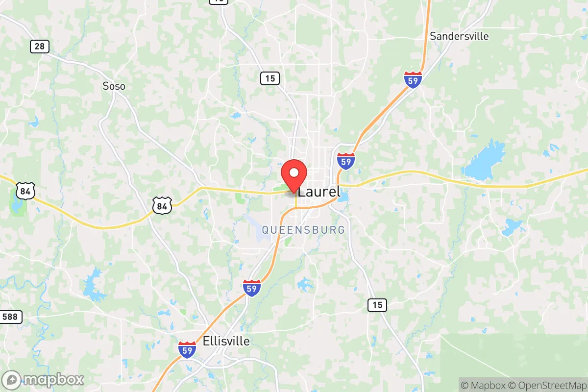
Strategic Assessment of Laurel, MS
Workable tactical position. Some exposure to population density or targets, but generally defensible in a crisis.
What does the Strategic Assessment tell us?
Our Strategic Assessment grades tactical survivability of an area. Major population centers, military targets, fallout zones, natural disasters, and border exposure all drive risk — lower exposure means a more defensible position in a crisis.
This is heavily inspired by Joel Skousen's Strategic Relocation book. Highly recommended you checkout the book ($)What does this tell us?
Our Strategic Assessment grades tactical survivability of an area. Major population centers, military targets, fallout zones, natural disasters, and border exposure all drive risk — lower exposure means a more defensible position in a crisis.
This is heavily inspired by Joel Skousen's Strategic Relocation book. Highly recommended you checkout the book ($)Strategic Pillars

Key Distances
Regional Safe Places
Below is our recommended "safe zones" in Mississippi and the surrounding area based on our strategic heuristics. For most people, it's unrealistic to live in a “safe zone” full-time due to work, family or other personal reasons. They tend to be more rural. However, many of these areas are perfect for second homes and retreat properties that double as a vacation home or even a short-term rental.
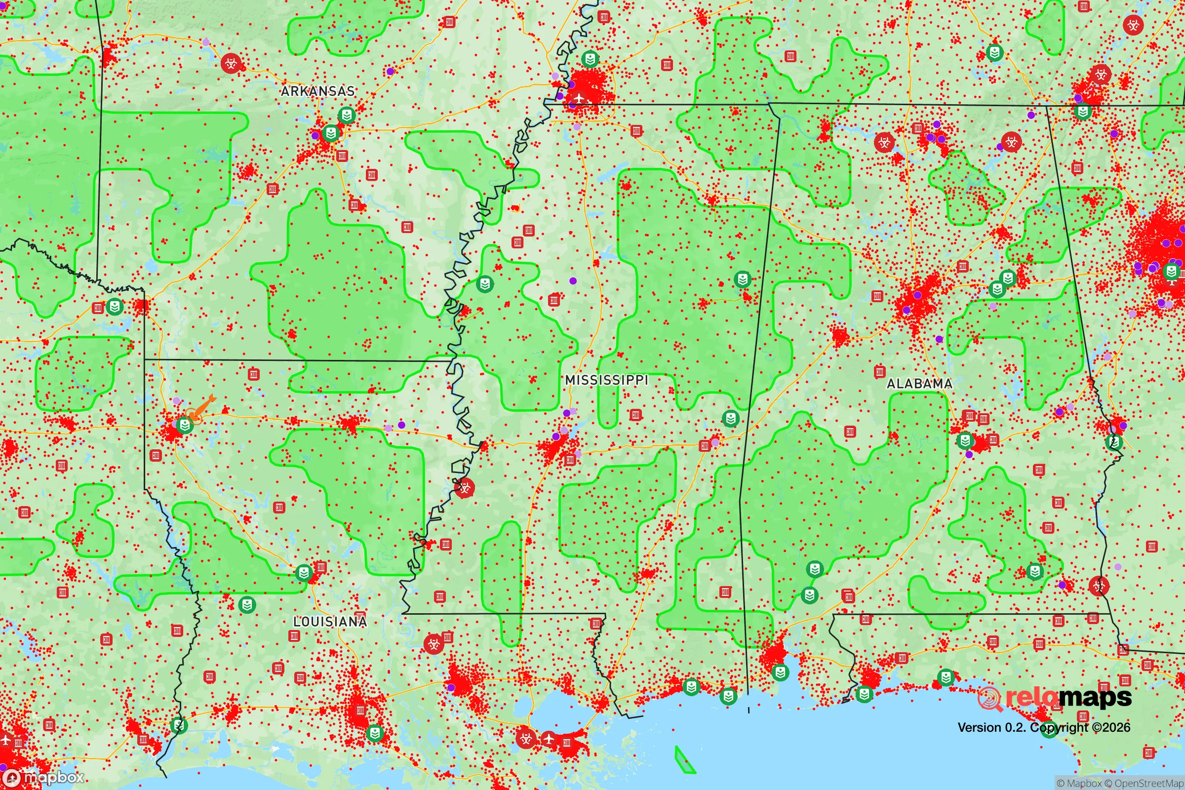
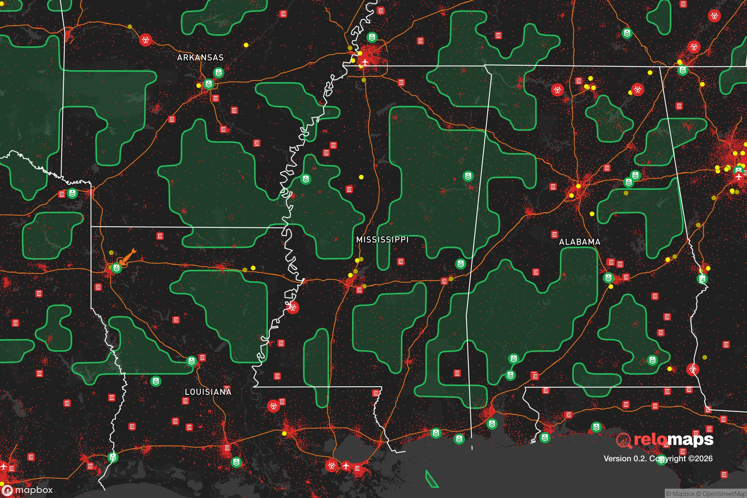
Important Note: For informational purposes only. This does not mean nothing bad ever happens in the green zones. Please use common sense. This is based on public data and modeled with AI. We tried to take a conservative approach but mistakes happen. We update this regularly as new information becomes available.
Solar Generator Recommendations
Backup power matters more here than in safer locations. We've picked three solar generators across budgets and capacity tiers — start with the budget unit if you only need a few essentials, or step up if you want to run a fridge and HVAC for days at a time.

Jackery Portable Power Station Explorer 300
Budget OptionPower on the Go: Weighing only 11 lbs, it's convenient to set up and store with book-sized foldable solar panels

BLUETTI Portable Power Station AC180
Designed for both indoor and outdoor scenarios, AC180 is highly capable as it has a robost capacity and continuous output power.

EF ECOFLOW DELTA Pro Ultra Power Station
Upgraded PickEcoFlow DELTA Pro Ultra is a whole-home energy system designed to grow with your family. Integrated with the Smart Home Panel 2, it scales to meet your evolving energy needs — keeping your home powered, intelligent, and secure through every stage of life.
We earn a commission, at no additional cost to you.
Strategic Assessment Analysis
Laurel, Mississippi, sits in a sweet spot for those serious about strategic relocation: far enough from the Gulf Coast to dodge the worst of hurricane storm surge, yet close enough to the Pine Belt’s timber and water resources to sustain a household through extended disruptions. The city’s population hovers around 18,000, with Jones County adding roughly 67,000 residents—small enough to avoid the chaos of a major metro, but large enough to maintain a hospital, a regional airport, and a solid base of trades and services. For a conservative-leaning prepper or survivalist, Laurel offers a quiet, land-rich environment that’s within striking distance of the Gulf’s energy infrastructure without being directly in the blast zone of a hurricane or a major population center’s collapse.
Geographic position and natural advantages for long-term security
Laurel’s location in southeastern Mississippi places it on the edge of the Piney Woods, a region of dense pine forests, rolling hills, and abundant freshwater. The city sits near the headwaters of the Leaf River, which feeds into the Pascagoula River system—one of the last free-flowing river systems in the lower 48. That means reliable surface water for filtration, irrigation, and livestock, even if municipal supplies are disrupted. The area’s clay-loam soils are workable for small-scale farming, and the long growing season (roughly 230 frost-free days) allows for year-round food production with proper planning. Timber is the dominant natural resource; Jones County is one of Mississippi’s top lumber producers, so firewood, building materials, and biomass fuel are locally abundant. The terrain is gently rolling, not mountainous, which makes road travel and off-grid construction easier than in Appalachia or the Ozarks. Elevation averages around 250 feet, so flooding is limited to low-lying creek bottoms—most of Laurel’s residential areas sit on well-drained ridges. For a relocator focused on self-sufficiency, the combination of water, wood, and arable land is hard to beat in the Deep South.
Risks, exposures, and proximity to fallout-relevant landmarks
No location is immune to risk, and Laurel has its share of vulnerabilities that a strategic relocator must weigh. The most obvious is hurricane threat: while Laurel is about 80 miles inland from the Gulf of Mexico, a major storm like Katrina (2005) can still dump heavy rain and spawn tornadoes well inland. Power outages lasting a week or more are realistic in a direct hit, and tree damage from high winds is common. That said, Laurel is far enough from the coast to avoid storm surge and the worst of the wind field—a Category 5 making landfall at Biloxi would likely bring sustained winds of 60-80 mph to Laurel, not the 150+ mph seen on the beach. More concerning for the prepper mindset is the proximity to critical infrastructure that could become a target or a liability. The Mississippi Gulf Coast is home to the Chevron Pascagoula Refinery (one of the largest in the U.S.), the Port of Gulfport, and Naval Air Station Meridian (about 40 miles north of Laurel). A major disruption at any of these—whether from a natural disaster, a cyberattack, or civil unrest—could ripple into Laurel through fuel shortages, supply chain breaks, or displaced populations. The city is also within 100 miles of Hattiesburg (population 50,000) and Mobile, Alabama (population 190,000), both of which could become sources of refugee flow in a crisis. On the positive side, Laurel has no nuclear power plants within 50 miles (the closest is Grand Gulf, about 120 miles northwest), and no major military bases or chemical plants inside the city limits. The Jones County Jail and the South Mississippi Correctional Institution are nearby, but they’re low-risk compared to the petrochemical complexes along the coast.
Practical resilience for a relocator: food, water, energy, and defensibility
For a single individual or a family looking to hunker down, Laurel offers a mix of advantages and gaps that need filling. Water is the strongest asset: the Leaf River and its tributaries provide year-round flow, and the shallow aquifer (the Citronelle Formation) yields good-quality groundwater at depths of 50-150 feet. A well with a hand pump or a solar-powered submersible is a realistic DIY project here. Food production is viable but requires work: the soil is acidic and sandy in places, so raised beds or amendments (lime, compost) are necessary for vegetables. Deer, turkey, and small game are plentiful in the surrounding national forests (De Soto National Forest is about 30 miles south), and fishing in the Leaf River yields catfish, bass, and bream. Local farmers’ markets and feed stores (like Laurel’s Tractor Supply and local co-ops) mean seeds, tools, and livestock supplies are accessible without a long drive. Energy resilience is moderate: the region gets about 215 sunny days per year, enough for a modest solar array, but summer cloud cover from Gulf storms can reduce output for days at a time. A backup generator running on propane or diesel is a wise investment. Wood heat is practical given the timber abundance, but most homes in Laurel are built with central HVAC and lack wood stoves—retrofitting is straightforward but adds cost. Defensibility is a mixed bag: Laurel’s layout is typical of a small Southern city, with a grid of streets and a downtown core. Rural properties on the outskirts (within 10-15 miles of town) offer better standoff distance, natural tree cover, and multiple egress routes via state highways 15, 28, and 84. The city itself has a police force of about 40 officers and a county sheriff’s department, but in a prolonged crisis, rural self-reliance is the safer bet. The local hospital, South Central Regional Medical Center, is a 150-bed facility with a Level III trauma center—adequate for routine emergencies but not for mass casualty events. Stockpiling medical supplies and training in basic trauma care is strongly advised.
The overall strategic picture for Laurel is one of moderate security with strong natural foundations. It’s not a hardened bunker location like the Idaho panhandle or the West Texas desert, but it offers a realistic balance of access to resources, distance from major threats, and a community that leans conservative and self-reliant. The biggest risks are hurricane-related disruptions and the potential for coastal refugee flows, both of which can be mitigated with a well-stocked pantry, a reliable water source, and a defensible rural property. For a relocator who values land, water, and a low-key lifestyle over absolute isolation, Laurel deserves a serious look—just don’t expect it to be a secret for long as more people wake up to the vulnerabilities of the coasts and the big cities.
* Values derived from national, state, county, city and local statistics and may differ in a specific area. Last updated: 2026-05-01T01:04:07.000Z
Narrative content on this page is AI-generated and may contain mistakes. Verify any details that matter before acting on them.
ReloMaps may earn a commission from affiliate links at no extra cost to you.