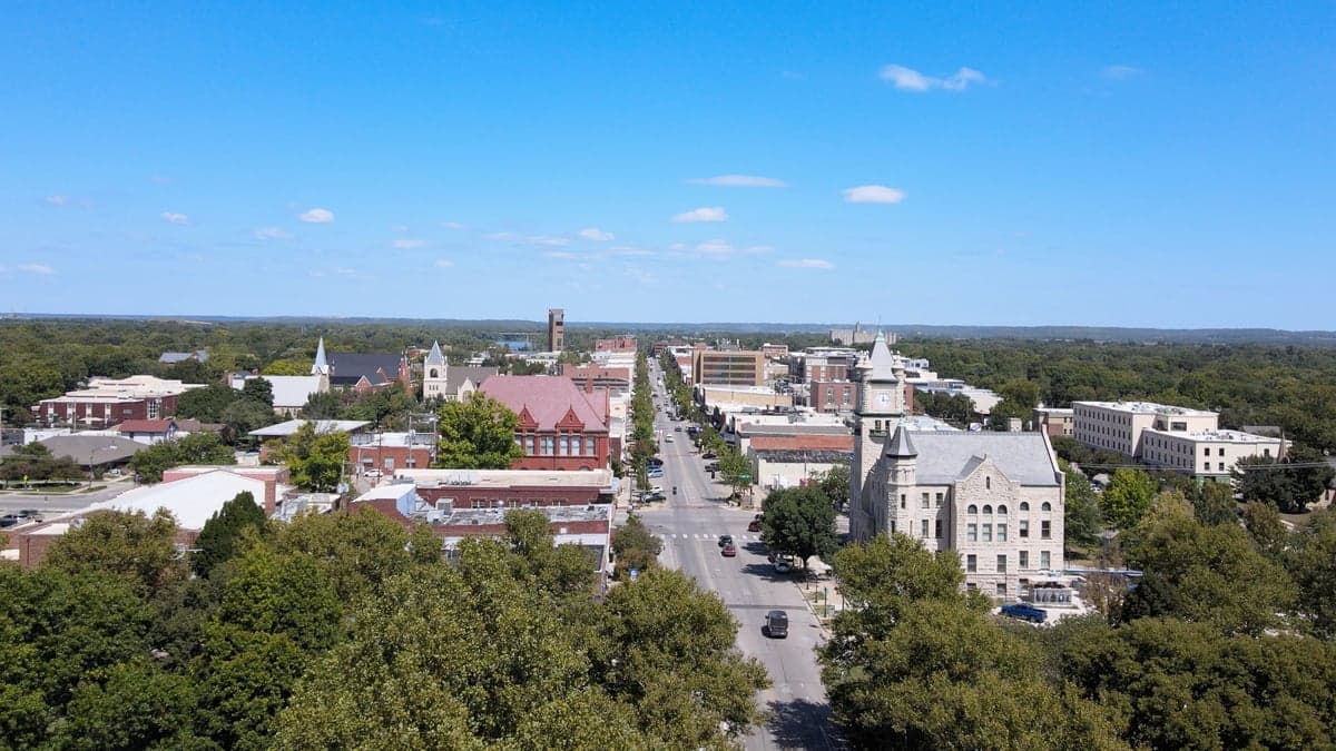
Photo: Wikipedia
Strategic Assessment of Lawrence, KS
Meaningful friction. Expect exposure to either population pressure, blast zones, or natural disaster risk. Consider buying a retreat property.
What does the Strategic Assessment tell us?
Our Strategic Assessment grades tactical survivability of an area. Major population centers, military targets, fallout zones, natural disasters, and border exposure all drive risk — lower exposure means a more defensible position in a crisis.
This is heavily inspired by Joel Skousen's Strategic Relocation book. Highly recommended you checkout the book ($)What does this tell us?
Our Strategic Assessment grades tactical survivability of an area. Major population centers, military targets, fallout zones, natural disasters, and border exposure all drive risk — lower exposure means a more defensible position in a crisis.
This is heavily inspired by Joel Skousen's Strategic Relocation book. Highly recommended you checkout the book ($)Strategic Pillars

Key Distances
Regional Safe Places
Below is our recommended "safe zones" in Kansas and the surrounding area based on our strategic heuristics. For most people, it's unrealistic to live in a “safe zone” full-time due to work, family or other personal reasons. They tend to be more rural. However, many of these areas are perfect for second homes and retreat properties that double as a vacation home or even a short-term rental.
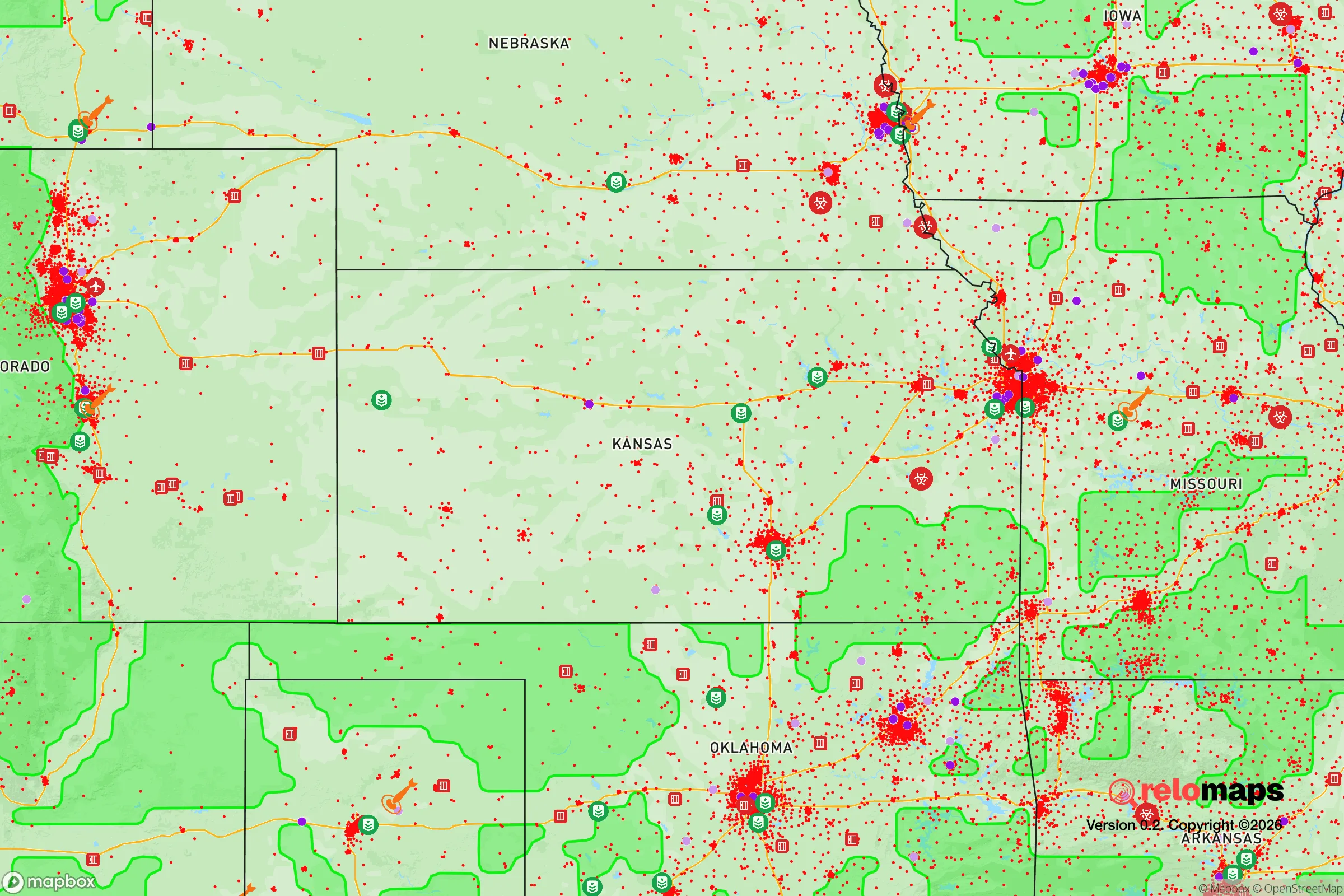
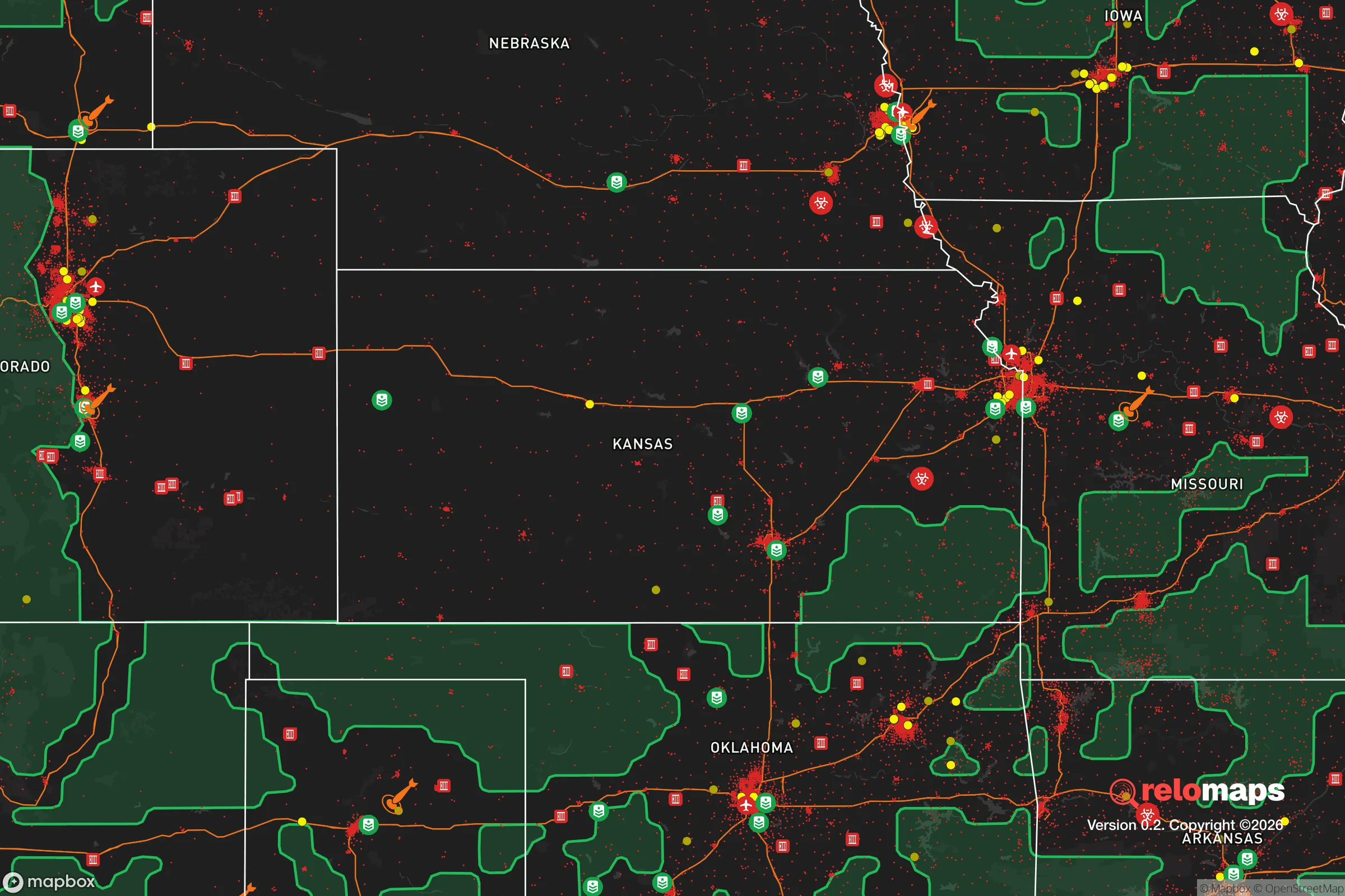
Important Note: For informational purposes only. This does not mean nothing bad ever happens in the green zones. Please use common sense. This is based on public data and modeled with AI. We tried to take a conservative approach but mistakes happen. We update this regularly as new information becomes available.
Solar Generator Recommendations
Backup power matters more here than in safer locations. We've picked three solar generators across budgets and capacity tiers — start with the budget unit if you only need a few essentials, or step up if you want to run a fridge and HVAC for days at a time.

Jackery Portable Power Station Explorer 300
Budget OptionPower on the Go: Weighing only 11 lbs, it's convenient to set up and store with book-sized foldable solar panels

BLUETTI Portable Power Station AC180
Designed for both indoor and outdoor scenarios, AC180 is highly capable as it has a robost capacity and continuous output power.

EF ECOFLOW DELTA Pro Ultra Power Station
Upgraded PickEcoFlow DELTA Pro Ultra is a whole-home energy system designed to grow with your family. Integrated with the Smart Home Panel 2, it scales to meet your evolving energy needs — keeping your home powered, intelligent, and secure through every stage of life.
We earn a commission, at no additional cost to you.
Strategic Assessment Analysis
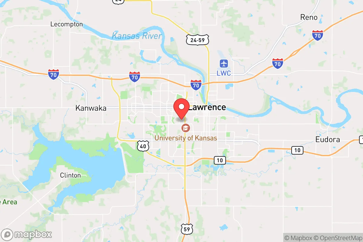
Lawrence, Kansas, sits in a precarious but potentially advantageous position for those prioritizing long-term resilience and strategic relocation. Its location roughly 40 miles west of the Kansas City metro area and 25 miles east of Topeka places it within a corridor that could become a buffer zone during widespread unrest, but also within the shadow of major population centers that pose significant risks. The city's reliance on the University of Kansas as its primary economic engine provides a degree of institutional stability, but that same institution also introduces vulnerabilities tied to national political and social currents. For a conservative-leaning individual or family thinking in terms of decades, not years, Lawrence offers a mixed bag: decent agricultural access, a relatively low population density compared to the coasts, but a political and cultural climate that may feel increasingly hostile to traditional values and self-reliance.
Geographic position and natural advantages for long-term survival
Lawrence's geography is defined by the Kansas River, which cuts through the northern edge of the city, and the Wakarusa River to the south, providing dual water sources that are a genuine asset for a prolonged grid-down scenario. The surrounding terrain is predominantly flat to gently rolling agricultural land, with the Flint Hills region beginning just south of the city—offering rocky, less arable ground that could serve as a natural barrier or retreat zone. The area sits in USDA hardiness zone 6a, with a growing season of roughly 180 days, meaning a determined household can produce a significant portion of its own food with proper planning. The lack of major mountain ranges or dense forests means line-of-sight visibility is high, which is a double-edged sword: it aids in situational awareness but offers little natural cover for movement or concealment. The city's position along Interstate 70 and the Kansas Turnpike (I-35) is a critical vulnerability, as these highways would become chokepoints for mass evacuation from Kansas City and Topeka during a crisis, potentially funneling desperate populations directly through Lawrence.
Risks, exposures, and proximity to fallout-relevant landmarks
The single greatest strategic liability for Lawrence is its proximity to the Kansas City metropolitan area, home to over 2.1 million people, which would become a zone of extreme danger during any large-scale civil unrest, economic collapse, or mass casualty event. In a scenario involving nuclear detonation—whether from a state actor or a terrorist device—Lawrence lies roughly 50 miles from the Kansas City urban core, placing it within the moderate fallout zone for a ground burst of a 10-kiloton weapon. Prevailing westerly winds would carry fallout eastward, meaning Lawrence could be spared the heaviest contamination depending on wind direction, but the city is still close enough to experience significant secondary effects like refugee influx, supply chain collapse, and martial law enforcement. Additionally, the Sunflower Army Ammunition Plant, located just 15 miles southeast in De Soto, is a former government explosives manufacturing site that, while largely decommissioned, still contains residual contamination and could become a target for looting or sabotage during unrest. The presence of the University of Kansas, with its large student population and progressive political leanings, means Lawrence would likely be a focal point for ideological conflict if the nation fractures along cultural lines—making it less defensible for those who value traditional conservative principles.
Practical resilience for a relocator: food, water, energy, and defensibility
For a relocator serious about self-sufficiency, Lawrence offers a mixed reality. The city's water supply comes from the Kansas River via the city's treatment plant, which is vulnerable to both contamination and power loss; a well-drilled private property outside city limits is a far more reliable option, with groundwater depths averaging 50-100 feet in the area. The local food scene is dominated by chain grocery stores and a handful of farmers' markets, but the surrounding agricultural county (Douglas) produces corn, soybeans, and wheat, meaning a prepper with land can establish a garden and small livestock operation—chickens and goats are practical here. Energy infrastructure relies on the regional grid, which is prone to ice storms and tornado damage; solar panels with battery storage are a wise investment, as the area averages 210 sunny days per year, slightly below the national average but workable. Defensibility is a challenge: Lawrence is a sprawling, low-density city with no natural defensive terrain, and its many entry points along highways and county roads make it hard to secure. A better strategy is to locate on a rural property within 15-20 miles of Lawrence, where you can access the city's resources (hardware stores, medical facilities) while maintaining a buffer. The local gun culture is moderate—Kansas is a shall-issue state for concealed carry, and open carry is legal without a permit—but the university's liberal influence means you'll encounter more anti-gun sentiment than in rural parts of the state. Stockpiling ammunition and medical supplies is straightforward, as there are no state-level bans on bulk purchasing.
In the overall strategic picture, Lawrence represents a compromise: it offers the agricultural and water resources of the Great Plains, but it's tethered to a politically volatile university town and a major metro area that could become a liability in a crisis. For a conservative relocator, the city's cultural environment may feel increasingly alienating, with local governance leaning left on issues like zoning, taxation, and public health mandates. The smart play is not to move into Lawrence proper, but to secure land in the surrounding unincorporated areas of Douglas or adjacent Leavenworth County, where you can leverage the city's infrastructure while maintaining independence. If you're willing to put in the work—digging a well, building a root cellar, establishing a garden, and networking with like-minded locals—this area can serve as a viable base of operations for weathering the coming storms. Just don't expect the neighbors to share your worldview, and plan for the day when the highways from Kansas City run one way: west.
* Values derived from national, state, county, city and local statistics and may differ in a specific area. Last updated: 2026-04-30T04:46:20.000Z
Narrative content on this page is AI-generated and may contain mistakes. Verify any details that matter before acting on them.
ReloMaps may earn a commission from affiliate links at no extra cost to you.