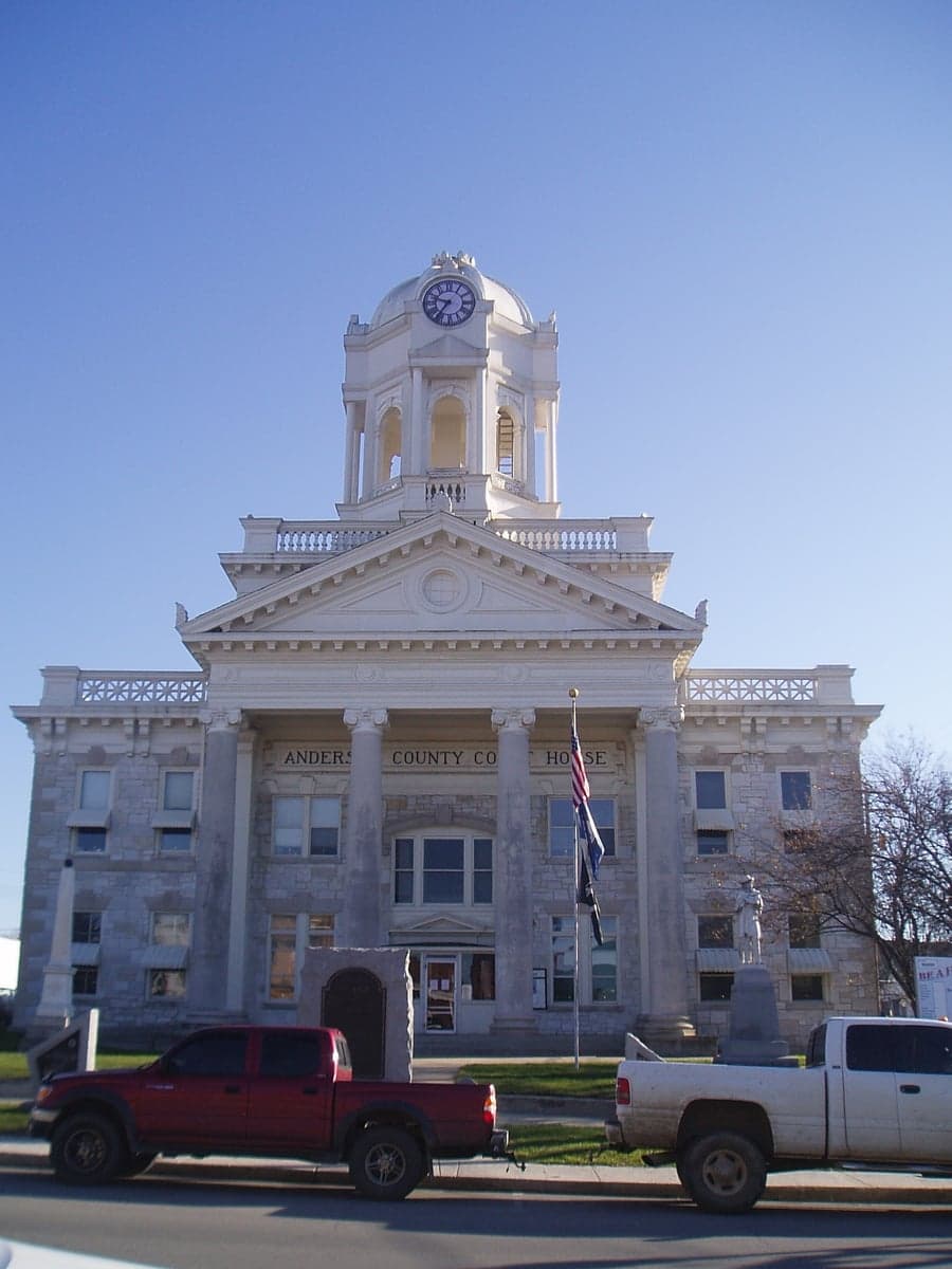
Photo: Wikipedia
Strategic Assessment of Lawrenceburg, KY
Workable tactical position. Some exposure to population density or targets, but generally defensible in a crisis.
What does the Strategic Assessment tell us?
Our Strategic Assessment grades tactical survivability of an area. Major population centers, military targets, fallout zones, natural disasters, and border exposure all drive risk — lower exposure means a more defensible position in a crisis.
This is heavily inspired by Joel Skousen's Strategic Relocation book. Highly recommended you checkout the book ($)What does this tell us?
Our Strategic Assessment grades tactical survivability of an area. Major population centers, military targets, fallout zones, natural disasters, and border exposure all drive risk — lower exposure means a more defensible position in a crisis.
This is heavily inspired by Joel Skousen's Strategic Relocation book. Highly recommended you checkout the book ($)Strategic Pillars

Key Distances
Regional Safe Places
Below is our recommended "safe zones" in Kentucky and the surrounding area based on our strategic heuristics. For most people, it's unrealistic to live in a “safe zone” full-time due to work, family or other personal reasons. They tend to be more rural. However, many of these areas are perfect for second homes and retreat properties that double as a vacation home or even a short-term rental.


Important Note: For informational purposes only. This does not mean nothing bad ever happens in the green zones. Please use common sense. This is based on public data and modeled with AI. We tried to take a conservative approach but mistakes happen. We update this regularly as new information becomes available.
Solar Generator Recommendations
Backup power matters more here than in safer locations. We've picked three solar generators across budgets and capacity tiers — start with the budget unit if you only need a few essentials, or step up if you want to run a fridge and HVAC for days at a time.

Jackery Portable Power Station Explorer 300
Budget OptionPower on the Go: Weighing only 11 lbs, it's convenient to set up and store with book-sized foldable solar panels

BLUETTI Portable Power Station AC180
Designed for both indoor and outdoor scenarios, AC180 is highly capable as it has a robost capacity and continuous output power.

EF ECOFLOW DELTA Pro Ultra Power Station
Upgraded PickEcoFlow DELTA Pro Ultra is a whole-home energy system designed to grow with your family. Integrated with the Smart Home Panel 2, it scales to meet your evolving energy needs — keeping your home powered, intelligent, and secure through every stage of life.
We earn a commission, at no additional cost to you.
Strategic Assessment Analysis
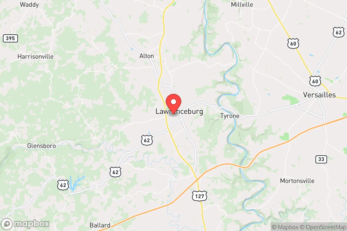
Lawrenceburg, Kentucky, presents a mixed strategic picture for the conservative prepper or survivalist. Its primary resilience advantage is its position in the Bluegrass region, roughly 30 miles west of Lexington and 50 miles southeast of Louisville, placing it in a "donut hole" of relative isolation from the immediate fallout zones of those major population centers. However, this proximity is a double-edged sword, and the area's specific infrastructure and geography demand a hard-nosed assessment of its viability as a long-term retreat or relocation destination for those prioritizing self-sufficiency and security.
Geographic position and natural advantages for a strategic retreat
Lawrenceburg sits in Anderson County, a landscape of rolling hills, limestone karst, and the Kentucky River palisades. The Kentucky River itself is a significant natural feature, providing a potential water source and a natural barrier to the south and east. The terrain is not mountainous, but it is dissected by steep ravines and wooded hollows, offering numerous pockets of concealment and defensible positions for a prepared individual. The area is part of the Outer Bluegrass region, which means the soil is generally fertile, supporting small-scale agriculture and livestock. The climate is temperate, with four distinct seasons, avoiding the extreme heat of the deep south or the brutal winters of the upper Midwest, which is a practical advantage for year-round food production and outdoor work. The local water table is generally good, and many rural properties have access to private wells, a critical factor for off-grid living. The region's karst topography, however, means groundwater is vulnerable to surface contamination, so well placement and septic system management require careful attention.
Risks, exposures, and proximity to fallout-relevant landmarks
The most significant strategic liability is Lawrenceburg's location within the broader Kentucky "Golden Triangle" of Louisville, Lexington, and Northern Kentucky/Cincinnati. While the town itself is small (population ~12,000), it sits within a 50-mile radius of two major metropolitan areas that are prime targets for civil unrest, economic collapse, or, in a worst-case scenario, a nuclear event. A detonation at the Louisville International Airport or the UPS Worldport hub would send fallout plumes that could easily drift over Anderson County depending on wind patterns. Similarly, Lexington's population density and status as a regional economic hub make it a secondary target. The closest high-value target is the Blue Grass Army Depot in Richmond, KY (about 45 miles east), which stores chemical weapons and conventional munitions—a catastrophic accident or attack there would render large swaths of central Kentucky uninhabitable. Lawrenceburg is also within the fallout shadow of the Fort Knox gold depository (about 50 miles west), a symbolic and strategic target. The area is not immune to natural hazards; the Kentucky River is prone to flooding in low-lying areas, and the karst geology can lead to sinkholes and groundwater contamination. The primary risk, however, is the human factor: a mass evacuation from Louisville or Lexington would likely funnel along US-127 and I-64, turning Lawrenceburg into a chokepoint and a target for desperate refugees.
Practical resilience for a relocator: food, water, energy, and defensibility
For a relocator with a prepper mindset, Lawrenceburg offers a mixed bag of practical resilience. Food security is achievable but not automatic. The surrounding farmland supports corn, soybeans, and tobacco, but the local agricultural economy is not geared toward small-scale, diversified subsistence farming. A relocator would need to establish their own gardens, orchards, and livestock operations, and the local extension office and farming community are generally helpful but not set up for a sudden influx of new homesteaders. The local farmers' market and a few small grocery stores provide some supply chain redundancy, but the town is heavily dependent on trucking routes from Louisville and Lexington. Water security is a strong point for those on private wells, but municipal water users are vulnerable to system failures or contamination. A backup well or a rainwater catchment system is a must. Energy resilience is a weak point. The local grid is served by Kentucky Utilities, which relies on coal and natural gas. Power outages are common during storms, and the grid is not hardened against EMP or cyberattack. Solar potential is moderate, but the region's frequent cloud cover and tree canopy reduce efficiency. A generator with a substantial fuel store is a practical necessity. Defensibility is terrain-dependent. The best properties are those with a single access road, a good view of the surrounding area, and a water source on-site. The town itself is not defensible; it's a typical small Kentucky town with a courthouse square and a few main roads. A relocator should aim for a rural property at least 10-15 miles outside of town, preferably on a dead-end road with natural barriers. The local law enforcement is the Anderson County Sheriff's Office, which is small and would be overwhelmed in a major crisis. The local population is generally conservative and self-reliant, which is a positive for community cohesion, but it also means that newcomers will be scrutinized and must prove their value to the community.
The overall strategic picture for Lawrenceburg is one of calculated risk. It is not a remote, off-grid paradise, nor is it a high-risk urban kill zone. It is a buffer zone. For a relocator who is prepared, self-sufficient, and willing to invest in hardening their property, it offers a viable middle ground: close enough to access resources and medical care in a stable period, but far enough from the primary blast zones and population centers to offer a fighting chance during a collapse. The key is to treat Lawrenceburg not as a final destination, but as a base of operations. The smart play is to secure a rural property with a well, a garden, and a defensible perimeter, and to establish relationships with local farmers and tradesmen before a crisis hits. The area's greatest weakness is its position on the evacuation routes from Louisville and Lexington; a relocator must have a plan for that scenario, whether it's a secondary retreat further into the Appalachian foothills or a hardened position that can be held against transient threats. For the conservative prepper who understands that no location is perfect, Lawrenceburg offers a realistic, if unglamorous, option for strategic relocation in the Bluegrass.
* Values derived from national, state, county, city and local statistics and may differ in a specific area. Last updated: 2026-05-01T14:52:16.000Z
Narrative content on this page is AI-generated and may contain mistakes. Verify any details that matter before acting on them.
ReloMaps may earn a commission from affiliate links at no extra cost to you.