Photo: Wikipedia
Strategic Assessment of Le Mars, IA
Workable tactical position. Some exposure to population density or targets, but generally defensible in a crisis.
What does the Strategic Assessment tell us?
Our Strategic Assessment grades tactical survivability of an area. Major population centers, military targets, fallout zones, natural disasters, and border exposure all drive risk — lower exposure means a more defensible position in a crisis.
This is heavily inspired by Joel Skousen's Strategic Relocation book. Highly recommended you checkout the book ($)What does this tell us?
Our Strategic Assessment grades tactical survivability of an area. Major population centers, military targets, fallout zones, natural disasters, and border exposure all drive risk — lower exposure means a more defensible position in a crisis.
This is heavily inspired by Joel Skousen's Strategic Relocation book. Highly recommended you checkout the book ($)Strategic Pillars

Key Distances
Regional Safe Places
Below is our recommended "safe zones" in Iowa and the surrounding area based on our strategic heuristics. For most people, it's unrealistic to live in a “safe zone” full-time due to work, family or other personal reasons. They tend to be more rural. However, many of these areas are perfect for second homes and retreat properties that double as a vacation home or even a short-term rental.


Important Note: For informational purposes only. This does not mean nothing bad ever happens in the green zones. Please use common sense. This is based on public data and modeled with AI. We tried to take a conservative approach but mistakes happen. We update this regularly as new information becomes available.
Solar Generator Recommendations
Backup power matters more here than in safer locations. We've picked three solar generators across budgets and capacity tiers — start with the budget unit if you only need a few essentials, or step up if you want to run a fridge and HVAC for days at a time.

Jackery Portable Power Station Explorer 300
Budget OptionPower on the Go: Weighing only 11 lbs, it's convenient to set up and store with book-sized foldable solar panels

BLUETTI Portable Power Station AC180
Designed for both indoor and outdoor scenarios, AC180 is highly capable as it has a robost capacity and continuous output power.

EF ECOFLOW DELTA Pro Ultra Power Station
Upgraded PickEcoFlow DELTA Pro Ultra is a whole-home energy system designed to grow with your family. Integrated with the Smart Home Panel 2, it scales to meet your evolving energy needs — keeping your home powered, intelligent, and secure through every stage of life.
We earn a commission, at no additional cost to you.
Strategic Assessment Analysis
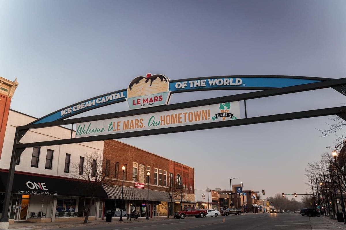
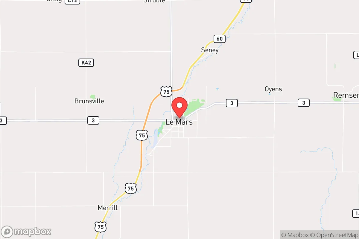
Le Mars, Iowa, sits in a position that resilience-minded relocators should study closely: it is the county seat of Plymouth County, roughly 25 miles northeast of Sioux City and about 100 miles north of Omaha, Nebraska. With a population hovering around 10,000, the town is large enough to support a hospital, a solid grocery base, and a regional workforce, yet small enough that it avoids the congestion and target profile of a major metro. The local economy is anchored by the Wells Enterprises ice cream plant (the world's largest ice cream factory) and a mix of agribusiness, manufacturing, and healthcare, giving it a stable employment base that doesn't rely on government or tech-sector volatility. For someone assessing long-term strategic viability, Le Mars offers a rare combination: a functioning small city with its own infrastructure, surrounded by productive farmland, and positioned far enough from major population centers to reduce exposure to cascading urban collapse scenarios.
Geographic position and natural advantages for long-term security
Le Mars sits in the Loess Hills region of northwest Iowa, a landscape of rolling hills and deep, fertile topsoil that is among the most productive agricultural land in the United States. The area is drained by the Floyd River, which runs through town and feeds into the Missouri River system about 20 miles to the west. This means surface water is accessible, though not abundant, and the water table is generally high enough for private wells in rural areas outside the city limits. The terrain is not mountainous, but the hills provide some natural screening and defensible positions for those who know how to use them. The climate is continental, with cold winters and hot summers, but the growing season (roughly 150 days) is sufficient for staple crops like corn, soybeans, and garden vegetables. For a prepper or survivalist, the key advantage here is the sheer agricultural output of the surrounding region — Plymouth County alone produces millions of bushels of corn and soybeans annually, and the local food supply chain is robust enough that even a partial disruption would leave significant local stockpiles. Additionally, the town is situated along U.S. Highway 75 and is a short drive from Interstate 29, providing two viable evacuation routes north toward Sioux Falls or south toward Omaha, while avoiding the chokepoints of larger interstates.
Risks, exposures, and proximity to fallout-relevant landmarks
No location is without risk, and Le Mars has several that a strategic relocator must weigh. The most obvious is proximity to the Missouri River and the potential for catastrophic flooding. The Floyd River has a history of flash flooding, and while the town itself is not in a designated floodplain, the surrounding low-lying farmland can become impassable during heavy rain events. The 2019 Missouri River floods, which inundated parts of western Iowa and Nebraska, did not directly threaten Le Mars but did disrupt rail and road links to the south. More concerning from a survivalist perspective is the town's location relative to potential fallout targets. The nearest major city is Sioux City (population ~85,000), which is not a primary nuclear target but does host a major rail yard, a port on the Missouri River, and several industrial facilities. Omaha, 100 miles south, is a more significant target due to Offutt Air Force Base (home of U.S. Strategic Command) and the city's role as a regional transportation hub. Le Mars is outside the immediate blast and thermal zones for any likely strike on Omaha or Sioux City, but prevailing winds from the west could carry fallout from a strike on Offutt or the Minuteman III missile fields in western Nebraska and the Dakotas. The town is also roughly 150 miles from the nearest active nuclear power plant (Fort Calhoun in Nebraska, now decommissioned, and Cooper Nuclear Station in Brownville, Nebraska, still operational). A major release from Cooper, while unlikely, would put Le Mars in a downwind risk zone depending on weather patterns. For the prepper, this means a robust fallout shelter plan and a stockpile of potassium iodide are non-negotiable if you choose to settle here.
Practical resilience for a relocator: food, water, energy, and defensibility
Le Mars scores well on the practical metrics that matter most for long-term self-sufficiency. Food security is the town's strongest card. The surrounding countryside is a patchwork of family farms, grain elevators, and livestock operations. Within a 20-mile radius, you have access to corn, soybeans, cattle, hogs, poultry, and dairy. The local Hy-Vee grocery store is well-stocked under normal conditions, and there are several smaller markets and a farmers' market in season. For those willing to garden, the soil is rich and the growing season is reliable. Water is more of a concern. The municipal water supply comes from groundwater wells, and the system is generally reliable, but a prolonged power outage would knock out pumping. Private wells are the gold standard here, and many rural properties within 10 miles of town have them. If you buy land outside the city limits, a well and a backup generator (or solar with battery storage) should be your first infrastructure investment. Energy resilience is moderate. The local grid is served by MidAmerican Energy, which has a mix of coal, natural gas, and wind generation. Northwest Iowa is one of the windiest regions in the country, and wind turbines dot the landscape. A savvy relocator could install a small wind turbine or solar array and be largely off-grid for electricity. Heating is primarily natural gas or propane, with wood as a backup option — the Loess Hills have decent timber for firewood, but it's not a dense forest. Defensibility is where Le Mars presents a mixed picture. The town itself is laid out on a grid, with open farmland on all sides, meaning there are no natural barriers to approach. However, the surrounding hills and river valleys offer numerous defensible homestead sites for those willing to live 5-15 miles out. The local law enforcement presence is modest (Plymouth County Sheriff's Office and a small city police department), which is fine for normal times but would be stretched thin in a crisis. The community is tight-knit and largely self-reliant, with a strong agricultural culture that values neighborly assistance — a social asset that cannot be overstated in a collapse scenario.
The overall strategic picture for Le Mars is that of a solid B+ location for the conservative prepper or survivalist. It is not a remote mountain redoubt, nor is it a fortified compound in the desert. It is a working Midwestern town with real economic and agricultural foundations, situated far enough from major targets to survive a first-strike scenario, but close enough to regional infrastructure to maintain a decent quality of life during normal times. The risks — flooding, fallout from distant strikes, and a relatively flat terrain — are manageable with proper planning. The strengths — abundant local food, a functional local economy, a community of self-sufficient farmers, and multiple evacuation routes — make it a viable base for those who want to be prepared without living like hermits. If you are looking for a place where you can raise a family, keep a garden, store supplies, and still drive to a decent hardware store or clinic, Le Mars deserves a serious look. Just make sure you have a basement shelter, a well, and a good relationship with your neighbors — because in a real crisis, those are the things that will matter most.
* Values derived from national, state, county, city and local statistics and may differ in a specific area. Last updated: 2026-04-19T08:27:43.000Z
Narrative content on this page is AI-generated and may contain mistakes. Verify any details that matter before acting on them.
ReloMaps may earn a commission from affiliate links at no extra cost to you.