
Photo: Wikipedia
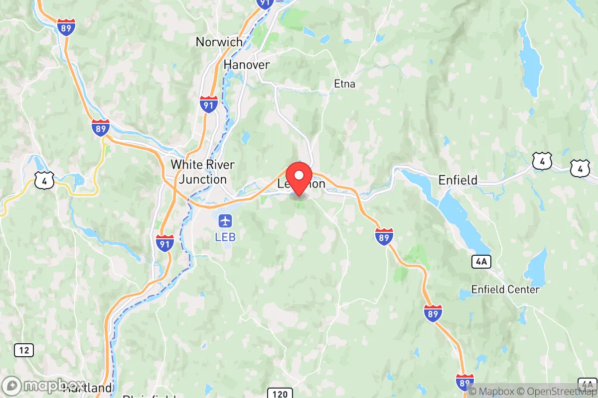
Strategic Assessment of Lebanon, NH
Meaningful friction. Expect exposure to either population pressure, blast zones, or natural disaster risk. Consider buying a retreat property.
What does the Strategic Assessment tell us?
Our Strategic Assessment grades tactical survivability of an area. Major population centers, military targets, fallout zones, natural disasters, and border exposure all drive risk — lower exposure means a more defensible position in a crisis.
This is heavily inspired by Joel Skousen's Strategic Relocation book. Highly recommended you checkout the book ($)What does this tell us?
Our Strategic Assessment grades tactical survivability of an area. Major population centers, military targets, fallout zones, natural disasters, and border exposure all drive risk — lower exposure means a more defensible position in a crisis.
This is heavily inspired by Joel Skousen's Strategic Relocation book. Highly recommended you checkout the book ($)Strategic Pillars

Key Distances
Regional Safe Places
Below is our recommended "safe zones" in New Hampshire and the surrounding area based on our strategic heuristics. For most people, it's unrealistic to live in a “safe zone” full-time due to work, family or other personal reasons. They tend to be more rural. However, many of these areas are perfect for second homes and retreat properties that double as a vacation home or even a short-term rental.


Important Note: For informational purposes only. This does not mean nothing bad ever happens in the green zones. Please use common sense. This is based on public data and modeled with AI. We tried to take a conservative approach but mistakes happen. We update this regularly as new information becomes available.
Solar Generator Recommendations
Backup power matters more here than in safer locations. We've picked three solar generators across budgets and capacity tiers — start with the budget unit if you only need a few essentials, or step up if you want to run a fridge and HVAC for days at a time.

Jackery Portable Power Station Explorer 300
Budget OptionPower on the Go: Weighing only 11 lbs, it's convenient to set up and store with book-sized foldable solar panels

BLUETTI Portable Power Station AC180
Designed for both indoor and outdoor scenarios, AC180 is highly capable as it has a robost capacity and continuous output power.

EF ECOFLOW DELTA Pro Ultra Power Station
Upgraded PickEcoFlow DELTA Pro Ultra is a whole-home energy system designed to grow with your family. Integrated with the Smart Home Panel 2, it scales to meet your evolving energy needs — keeping your home powered, intelligent, and secure through every stage of life.
We earn a commission, at no additional cost to you.
Strategic Assessment Analysis
Lebanon, New Hampshire, offers a strategic relocation option for those prioritizing resilience and preparedness, combining a robust local economy with a geographic position that provides meaningful separation from major metropolitan vulnerabilities. Situated in the Upper Valley along the Connecticut River, Lebanon sits roughly 70 miles from the New Hampshire seacoast and about 130 miles from Boston—close enough for occasional access to urban resources, but far enough to avoid the immediate fallout zones and civil unrest patterns that plague larger cities. The area’s low population density, strong community networks, and access to natural resources make it a defensible base for individuals and families focused on long-term sustainability and self-reliance.
Geographic position and natural advantages for long-term security
Lebanon’s location in Grafton County places it within the broader White Mountain region, offering a natural buffer against the cascading effects of urban collapse. The Connecticut River provides a reliable water source, while the surrounding hills and forests create natural chokepoints and defensible terrain. The area is far enough from the I-95 corridor—a primary evacuation route and potential target during mass casualty events—to reduce the risk of being overrun by fleeing populations. The local topography, with its steep ridges and limited road networks, naturally slows movement and makes the region harder to navigate for those unfamiliar with it. This is a significant advantage for a relocator: the same geography that makes daily life slightly inconvenient in winter becomes a strategic asset during unrest. The region also sits outside the primary wind patterns that would carry fallout from a major coastal event, though it is not immune to secondary effects. The presence of Dartmouth-Hitchcock Medical Center in nearby Hanover is a double-edged sword—it provides world-class medical care but also makes the area a potential target for those seeking resources during a crisis. However, the hospital’s location on a hill with limited access points offers some natural defensibility.
Risks, exposures, and proximity to fallout-relevant landmarks
No location is without risk, and Lebanon has specific exposures that a prepper must account for. The most significant is the proximity to the Vermont Yankee nuclear power plant site in Vernon, Vermont, roughly 30 miles south. While the plant is decommissioned, spent fuel remains on-site in dry cask storage, creating a long-term contamination risk in the event of a deliberate attack or catastrophic failure. The prevailing winds from the southwest could carry fallout directly into the Upper Valley. Additionally, the area is within 200 miles of the Portsmouth Naval Shipyard and the Boston metropolitan area—both high-value targets in a conflict scenario. The I-89 corridor, which runs through Lebanon, is a major north-south route that could become a funnel for displaced populations from southern New England. The city itself has a population of around 14,000, but the broader Lebanon-Hanover-White River Junction area swells with commuters and students from Dartmouth College, creating a transient population that could become a liability during a breakdown of civil order. The college itself, with its liberal leanings and high-profile events, could attract protest activity or become a focal point for unrest. The local economy’s reliance on healthcare and education means that a prolonged crisis would hit the job market hard, though the presence of manufacturing and logistics firms like Hypertherm and L.L.Bean’s distribution center provides some diversification.
Practical resilience for a relocator: food, water, energy, and defensibility
For a relocator focused on practical preparedness, Lebanon offers several concrete advantages. The Connecticut River is a year-round water source, but access points are limited and require filtration—plan for a high-quality gravity filter or UV system. The region’s agricultural base is modest but real: the Upper Valley has a network of small farms, farmers’ markets, and CSAs that can supplement food stores, though winter growing requires greenhouse infrastructure. The local soil is rocky and acidic, so raised beds and soil amendments are necessary for serious gardening. Energy resilience is a mixed bag. The area is prone to winter storms that knock out power for days at a time, so a backup generator or solar array with battery storage is essential. Wood heat is common and practical, with abundant firewood available from state forests and private woodlots. The local building codes are strict, but older homes often have basements and root cellars that can be reinforced for storage or shelter. Defensibility is decent but not ideal: the city center is compact and walkable, but the surrounding residential areas are spread out along winding roads with limited sightlines. A rural property on a dead-end road with a good well and septic system is the gold standard here. The local gun culture is strong but not aggressive—New Hampshire has no state income tax or sales tax, and gun laws are among the most permissive in New England, with no permit required for open or concealed carry. The Grafton County Sheriff’s Office is professional and responsive, but response times in rural areas can exceed 20 minutes. The community itself is a mix of long-time locals, Dartmouth academics, and remote workers—politically, the area leans left in the city proper but becomes more conservative as you move into the surrounding towns. This creates a social dynamic that requires careful navigation: keep your preparedness activities low-key and focus on building relationships with neighbors who share your values.
Overall, Lebanon presents a solid but not exceptional strategic option for the conservative prepper. Its strengths lie in natural resources, defensible terrain, and separation from major urban centers, while its weaknesses include proximity to a nuclear waste site and a politically mixed population that could become a liability during unrest. The area is best suited for a relocator who values a strong local economy and medical access but is willing to invest in off-grid infrastructure and maintain a low profile. For those willing to push further north into the more remote parts of Grafton or Coos County, the resilience profile improves, but Lebanon itself remains a viable base camp for the early stages of a collapse scenario. The key is to secure a property with independent water and heat, stockpile supplies for at least six months, and establish a network of trusted contacts before any crisis hits. The Upper Valley is not a fortress, but it is a place where a prepared individual can ride out the storm with a reasonable chance of success.
* Values derived from national, state, county, city and local statistics and may differ in a specific area. Last updated: 2026-05-02T02:47:55.000Z
Narrative content on this page is AI-generated and may contain mistakes. Verify any details that matter before acting on them.
ReloMaps may earn a commission from affiliate links at no extra cost to you.