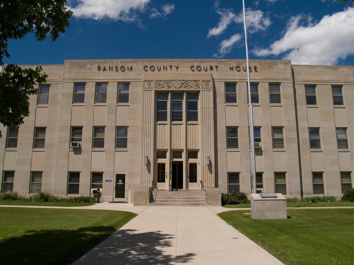
Photo: Wikipedia
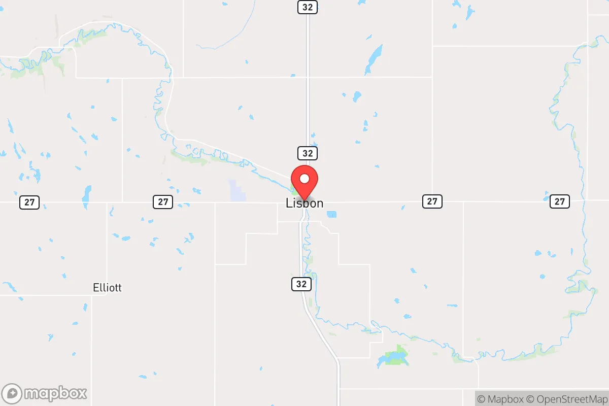
Strategic Assessment of Lisbon, ND
Strong survivability profile. Good buffer from population centers, with manageable environmental and tactical risks.
What does the Strategic Assessment tell us?
Our Strategic Assessment grades tactical survivability of an area. Major population centers, military targets, fallout zones, natural disasters, and border exposure all drive risk — lower exposure means a more defensible position in a crisis.
This is heavily inspired by Joel Skousen's Strategic Relocation book. Highly recommended you checkout the book ($)What does this tell us?
Our Strategic Assessment grades tactical survivability of an area. Major population centers, military targets, fallout zones, natural disasters, and border exposure all drive risk — lower exposure means a more defensible position in a crisis.
This is heavily inspired by Joel Skousen's Strategic Relocation book. Highly recommended you checkout the book ($)Strategic Pillars

Key Distances
Regional Safe Places
Below is our recommended "safe zones" in North Dakota and the surrounding area based on our strategic heuristics. For most people, it's unrealistic to live in a “safe zone” full-time due to work, family or other personal reasons. They tend to be more rural. However, many of these areas are perfect for second homes and retreat properties that double as a vacation home or even a short-term rental.
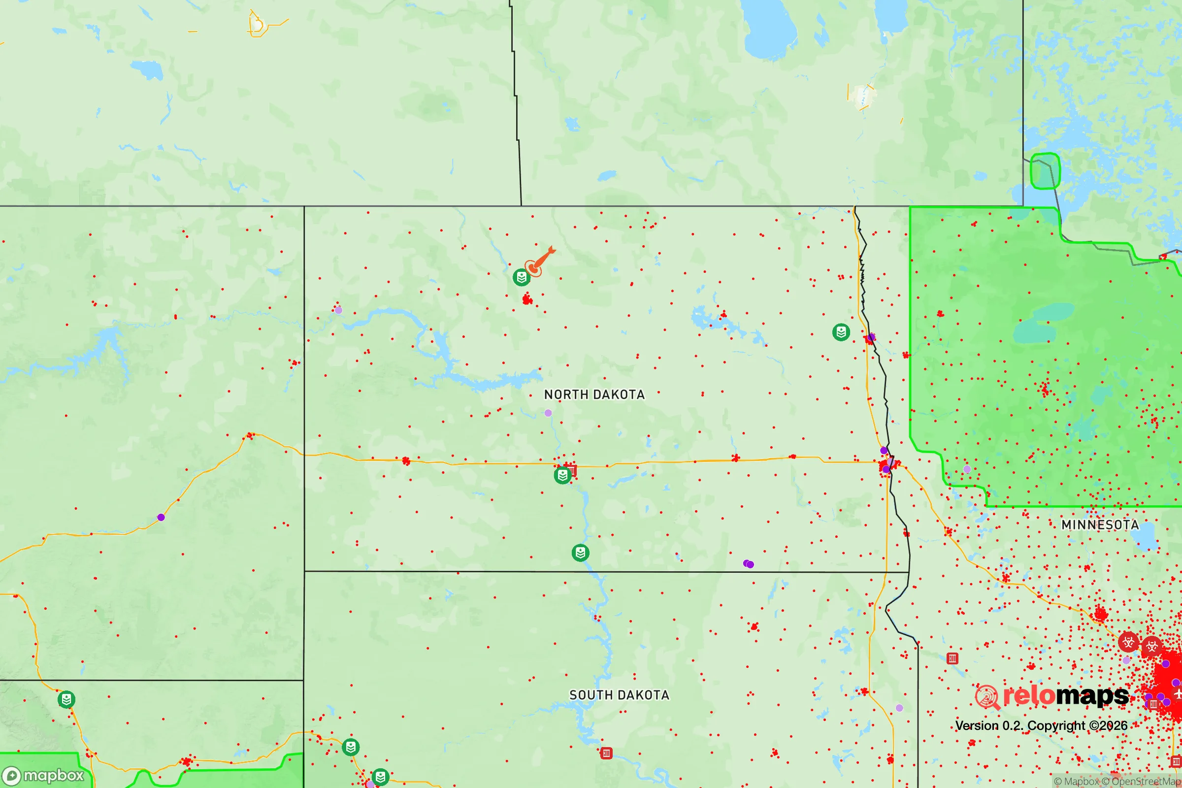
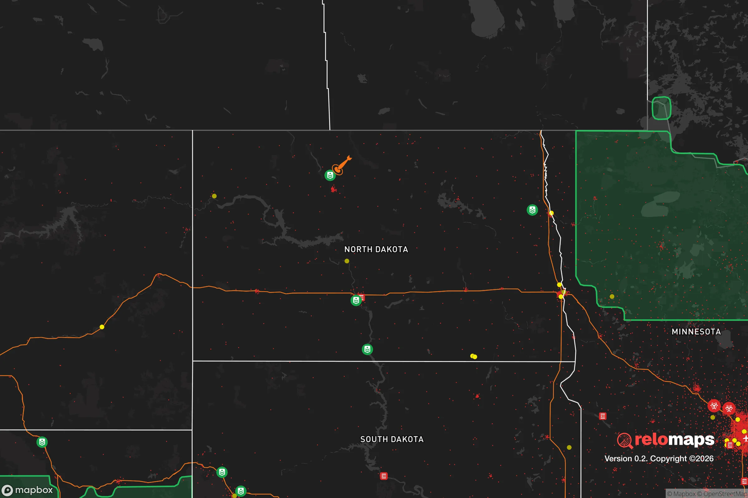
Important Note: For informational purposes only. This does not mean nothing bad ever happens in the green zones. Please use common sense. This is based on public data and modeled with AI. We tried to take a conservative approach but mistakes happen. We update this regularly as new information becomes available.
Solar Generator Recommendations
Backup power matters more here than in safer locations. We've picked three solar generators across budgets and capacity tiers — start with the budget unit if you only need a few essentials, or step up if you want to run a fridge and HVAC for days at a time.

Jackery Portable Power Station Explorer 300
Budget OptionPower on the Go: Weighing only 11 lbs, it's convenient to set up and store with book-sized foldable solar panels

BLUETTI Portable Power Station AC180
Designed for both indoor and outdoor scenarios, AC180 is highly capable as it has a robost capacity and continuous output power.

EF ECOFLOW DELTA Pro Ultra Power Station
Upgraded PickEcoFlow DELTA Pro Ultra is a whole-home energy system designed to grow with your family. Integrated with the Smart Home Panel 2, it scales to meet your evolving energy needs — keeping your home powered, intelligent, and secure through every stage of life.
We earn a commission, at no additional cost to you.
Strategic Assessment Analysis
Lisbon, North Dakota, offers a compelling blend of agricultural self-sufficiency and geographic isolation that makes it a serious candidate for those prioritizing long-term resilience over convenience. Located in Ransom County, roughly 50 miles southwest of Fargo and 90 miles northwest of the Minnesota border, this town of roughly 2,200 people sits in a region that is both far enough from major population centers to avoid the worst of civil unrest and close enough to essential supply routes to remain viable. The area’s flat, fertile plains and low population density create a natural buffer against the cascading failures that plague urban corridors, while its position in the Red River Valley provides access to some of the most productive farmland in the United States. For a relocator thinking in terms of decades, not months, Lisbon represents a low-profile, high-stability option that doesn’t require abandoning modern infrastructure entirely.
Geographic position and natural advantages for long-term security
Lisbon’s location is its primary strategic asset. The town sits at the intersection of North Dakota Highways 32 and 27, providing two viable egress routes in any direction—critical if one road becomes compromised by weather, accident, or civil disruption. The surrounding landscape is predominantly agricultural, with vast stretches of wheat, corn, and soybean fields interspersed with small family farms. This means that in a prolonged disruption of supply chains, the local area can produce food at a scale that most of the country cannot. The Sheyenne River runs through the town, offering a reliable surface water source, though it is not a major river and would require treatment for potable use. The region’s groundwater is generally good, with many rural properties drawing from private wells. Lisbon is also within a two-hour drive of the Missouri River and Lake Oahe, which could serve as a secondary water reserve in extreme scenarios. The flat terrain, while offering little in the way of natural defensive cover, provides excellent visibility for miles in all directions—a double-edged sword that favors those who are prepared to monitor their surroundings.
Risks, exposures, and proximity to fallout-relevant landmarks
No location is without vulnerabilities, and Lisbon’s are worth understanding. The most significant risk is its proximity to Fargo, the state’s largest city, which sits roughly 50 miles to the northeast. While 50 miles is a meaningful buffer, it is not insurmountable for a determined population fleeing a major disaster. Fargo’s population of roughly 130,000, combined with its status as a regional economic and transportation hub, means that any large-scale event—whether natural, economic, or civil—could trigger a wave of out-migration that would strain small towns like Lisbon. The town is also within 100 miles of the Grand Forks Air Force Base, a potential target in a conflict scenario, though the base’s primary mission is unmanned aerial systems rather than nuclear-capable bombers, which reduces its strategic value to an adversary. More concerning is the proximity to the Spiritwood Energy Park, about 30 miles west, which includes a coal-fired power plant and a proposed carbon capture facility. While not a direct fallout risk, such industrial sites could become secondary targets or sources of contamination in a broader conflict. The region’s flat terrain also means that any airborne contamination—whether from a nuclear event or a chemical spill—would spread rapidly with the prevailing winds, which typically blow from the northwest. This makes Lisbon’s position downwind of the Bakken oil fields (roughly 150 miles west) a consideration for those concerned with long-term environmental fallout.
Practical resilience for a relocator: food, water, energy, and defensibility
For a relocator focused on practical self-sufficiency, Lisbon offers a mixed but workable picture. The town itself has a small grocery store, a hardware store, and a farm supply co-op, but the bulk of food production happens on the surrounding farms. Building relationships with local farmers before a crisis is essential—those who arrive without a network will find themselves at a disadvantage. The local climate is harsh, with winter temperatures frequently dropping below -20°F and snow cover lasting from November through March. This limits the growing season to roughly 120 days, making cold-hardy crops like potatoes, carrots, and certain grains the most reliable options. Greenhouses or high tunnels would be necessary for year-round vegetable production. Water is generally accessible via private wells, but the region’s high mineral content means that filtration or treatment is advisable for long-term consumption. Energy is a bright spot: North Dakota is a net exporter of electricity, and Lisbon is served by the Sheyenne Valley Electric Cooperative, which has a strong track record of grid reliability. However, a grid-down scenario would require backup generation, and the flat, open landscape offers little natural cover for solar panels or wind turbines, which would be visible from a distance. Defensibility is a challenge. The town’s layout is typical of a small Plains community—a central grid of streets with residential areas radiating outward. There are no natural chokepoints, no hills to fortify, and no dense forests to provide concealment. A determined group could approach from any direction. The best defensive strategy is not physical fortification but obscurity: Lisbon is small enough that it is unlikely to be a target of organized looting or military action, and its residents are generally armed and self-reliant. The local sheriff’s office has four deputies, and the nearest state police post is in Valley City, 40 miles away. In a crisis, the community would largely be on its own.
The overall strategic picture for Lisbon is one of moderate resilience with clear trade-offs. It offers genuine advantages in food production potential, water access, and distance from major population centers, but it is not a fortress. The town’s flat, exposed terrain and harsh winters demand a higher level of preparation than a more temperate or defensible location might require. For a single individual or a family willing to invest in cold-weather gear, backup power, and a strong local network, Lisbon provides a viable base for weathering the kinds of disruptions that are becoming more common. It is not a place for those seeking immediate comfort or convenience, but for those who understand that resilience often comes at the cost of convenience. The key is to arrive early, build relationships, and treat the town not as a final destination but as a foundation—one that can be strengthened over time through preparation and community integration. In a world where the reliability of supply chains, civil order, and national infrastructure is increasingly uncertain, Lisbon offers a quiet, low-profile option that deserves serious consideration from anyone thinking strategically about the next decade.
* Values derived from national, state, county, city and local statistics and may differ in a specific area. Last updated: 2026-04-19T08:56:51.000Z
Narrative content on this page is AI-generated and may contain mistakes. Verify any details that matter before acting on them.
ReloMaps may earn a commission from affiliate links at no extra cost to you.