Photo: Wikipedia
Strategic Assessment of Lyndon, KY
Multiple tactical vulnerabilities. Population density, target proximity, or disaster risk are likely compounding. A retreat property and exit planning is required.
What does the Strategic Assessment tell us?
Our Strategic Assessment grades tactical survivability of an area. Major population centers, military targets, fallout zones, natural disasters, and border exposure all drive risk — lower exposure means a more defensible position in a crisis.
This is heavily inspired by Joel Skousen's Strategic Relocation book. Highly recommended you checkout the book ($)What does this tell us?
Our Strategic Assessment grades tactical survivability of an area. Major population centers, military targets, fallout zones, natural disasters, and border exposure all drive risk — lower exposure means a more defensible position in a crisis.
This is heavily inspired by Joel Skousen's Strategic Relocation book. Highly recommended you checkout the book ($)Strategic Pillars

Key Distances
Regional Safe Places
Below is our recommended "safe zones" in Kentucky and the surrounding area based on our strategic heuristics. For most people, it's unrealistic to live in a “safe zone” full-time due to work, family or other personal reasons. They tend to be more rural. However, many of these areas are perfect for second homes and retreat properties that double as a vacation home or even a short-term rental.


Important Note: For informational purposes only. This does not mean nothing bad ever happens in the green zones. Please use common sense. This is based on public data and modeled with AI. We tried to take a conservative approach but mistakes happen. We update this regularly as new information becomes available.
Solar Generator Recommendations
Backup power matters more here than in safer locations. We've picked three solar generators across budgets and capacity tiers — start with the budget unit if you only need a few essentials, or step up if you want to run a fridge and HVAC for days at a time.

Jackery Portable Power Station Explorer 300
Budget OptionPower on the Go: Weighing only 11 lbs, it's convenient to set up and store with book-sized foldable solar panels

BLUETTI Portable Power Station AC180
Designed for both indoor and outdoor scenarios, AC180 is highly capable as it has a robost capacity and continuous output power.

EF ECOFLOW DELTA Pro Ultra Power Station
Upgraded PickEcoFlow DELTA Pro Ultra is a whole-home energy system designed to grow with your family. Integrated with the Smart Home Panel 2, it scales to meet your evolving energy needs — keeping your home powered, intelligent, and secure through every stage of life.
We earn a commission, at no additional cost to you.
Strategic Assessment Analysis
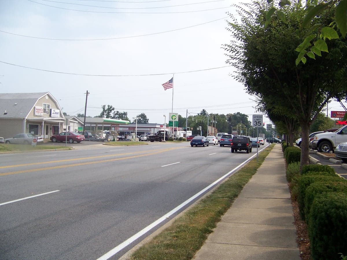
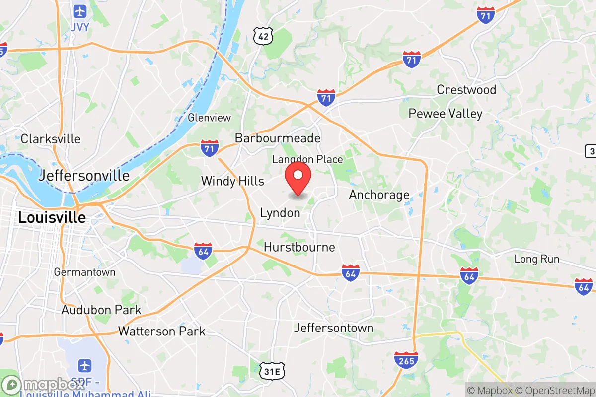
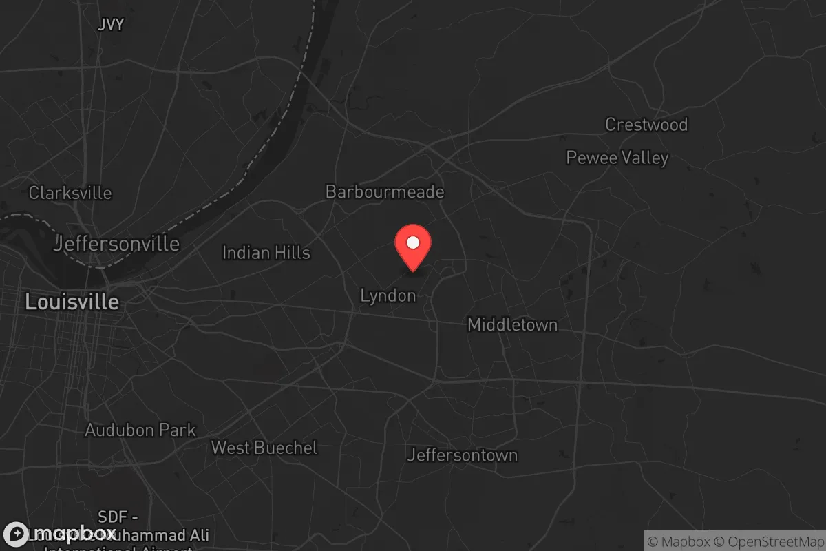
Lyndon, Kentucky, sits in a precarious but potentially strategic pocket of the Bluegrass State, offering a mix of suburban convenience and genuine resilience advantages for those thinking ahead. Located just east of Louisville in Jefferson County, this community of roughly 11,000 people benefits from being close enough to a major metro for supply runs and medical access, yet far enough from the urban core to avoid the worst of a city’s collapse during unrest or disaster. For a relocator with a prepper mindset, Lyndon’s real value lies in its position along the I-64 and I-265 corridors, providing multiple egress routes out of the Louisville basin and into the more rural, defensible terrain of eastern Kentucky and the Appalachian foothills.
Geographic position and natural advantages for long-term stability
Lyndon’s geography is a mixed bag, but the positives are worth noting. The area sits on the eastern edge of the Louisville metro, meaning you’re not boxed in by the Ohio River to the north or the sprawling industrial zones to the south. The terrain is gently rolling, with decent tree cover in residential pockets, offering some natural concealment and a slight elevation advantage over the flood-prone Ohio River valley. The soil is workable for small-scale gardening, and the local water table is generally reliable, with many homes on municipal water sourced from the Ohio River and groundwater wells. For a prepper, the key advantage is the proximity to the Knobs region—a band of steep, forested hills just east of Lyndon that provide natural choke points and defensible positions if you need to bug out. The area’s temperate climate means four distinct seasons, with no extreme wildfire risk and only occasional tornado threats, which are manageable with a proper storm shelter. The real strategic value is the ability to move east into the more sparsely populated counties of Shelby, Henry, and Oldham, where land is cheaper and community ties are stronger.
Risks, exposures, and proximity to fallout-relevant landmarks
Lyndon’s biggest vulnerability is its proximity to Louisville, a city of over 600,000 people that sits on a major interstate and rail hub. In a scenario of civil unrest, mass casualty events, or a major disaster, Louisville would become a chokepoint for refugees, looters, and government overreach. Lyndon is only about 10 miles from downtown Louisville, meaning you’re within the blast radius of any major industrial accident at the Rubbertown chemical plants or the Ohio River’s barge traffic, which carries everything from ammonia to crude oil. The Louisville International Airport and the UPS Worldport hub are also within 15 miles, making the area a potential target for any coordinated attack or supply chain disruption. Additionally, the Fort Knox military base is about 35 miles southwest, which could be a double-edged sword—it’s a source of security but also a potential target for adversaries. The Ohio River itself is a major vulnerability: if a dam failure or flood event occurs, Lyndon’s elevation (roughly 600 feet) keeps it safe from direct flooding, but the evacuation chaos from lower-lying areas would overwhelm local roads. The I-64 and I-265 interchanges near Lyndon would become gridlocked within hours of any major event, so having a secondary bug-out route via US-60 or local backroads is non-negotiable.
Practical resilience for a relocator: food, water, energy, and defensibility
For a relocator serious about self-sufficiency, Lyndon offers a workable baseline but requires significant upgrades. The municipal water supply is treated and generally safe, but in a prolonged grid-down scenario, you’ll need a backup well or rainwater catchment system—many older homes in the area have basements that can be retrofitted for water storage. The local soil is clay-heavy but amendable, and community gardens are rare, so you’ll need to establish your own raised beds or find a plot in the nearby rural areas. Grocery access is excellent in normal times, with multiple Kroger, Walmart, and Aldi locations within a 10-minute drive, but these will be stripped within hours of a crisis. For energy, the grid is reliable but aging, and solar is viable with average sun exposure of 4.5 peak hours per day. Natural gas is widely available for heating and cooking, which is a plus for long-term resilience if the grid fails. Defensibility is moderate: Lyndon is a typical suburban grid of cul-de-sacs and main roads, making it hard to secure a perimeter. However, the neighborhood layout means you can fortify a single street or block with neighbors you trust. The local police presence is decent, but in a SHTF scenario, you’re on your own. The best strategy is to use Lyndon as a staging point—a place to stockpile supplies, build a network, and then bug out to a more defensible rural property within a 30-minute drive east. The area’s strong conservative lean (Jefferson County is purple, but the eastern suburbs lean red) means you’ll find like-minded neighbors who value preparedness, though you’ll need to vet them carefully.
The overall strategic picture for Lyndon is one of cautious opportunity. It’s not a bug-out location in itself, but it’s a solid base of operations for someone who wants to stay close to Louisville’s resources while maintaining a quick escape route. The risks are real—proximity to a major city, industrial hazards, and potential gridlock—but the advantages of multiple egress routes, decent soil, and a like-minded community make it a viable option for the prepared relocator. If you’re willing to invest in a well, solar panels, and a solid bug-out vehicle, Lyndon can serve as a launchpad for long-term survival. Just don’t plan to stay put when the lights go out—have a plan to move east into the hills, and you’ll be ahead of 90% of the population.
* Values derived from national, state, county, city and local statistics and may differ in a specific area. Last updated: 2026-04-21T09:09:29.000Z
Narrative content on this page is AI-generated and may contain mistakes. Verify any details that matter before acting on them.
ReloMaps may earn a commission from affiliate links at no extra cost to you.