Photo: Wikipedia
Strategic Assessment of Howard County
Meaningful friction. Expect exposure to either population pressure, blast zones, or natural disaster risk. Consider buying a retreat property.
What does the Strategic Assessment tell us?
Our Strategic Assessment grades tactical survivability of an area. Major population centers, military targets, fallout zones, natural disasters, and border exposure all drive risk — lower exposure means a more defensible position in a crisis.
This is heavily inspired by Joel Skousen's Strategic Relocation book. Highly recommended you checkout the book ($)What does this tell us?
Our Strategic Assessment grades tactical survivability of an area. Major population centers, military targets, fallout zones, natural disasters, and border exposure all drive risk — lower exposure means a more defensible position in a crisis.
This is heavily inspired by Joel Skousen's Strategic Relocation book. Highly recommended you checkout the book ($)Strategic Pillars

Key Distances
Strategic Assessment Analysis
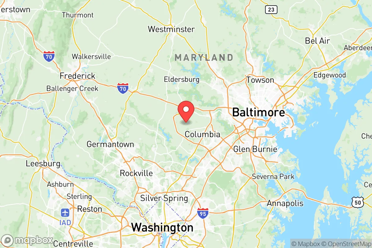
Howard County, Maryland, occupies a strategic position in the Mid-Atlantic that balances proximity to the nation’s capital with a degree of geographic insulation, making it a nuanced option for relocation-minded individuals and families who prioritize resilience. Located roughly midway between Washington, D.C., and Baltimore, the county offers access to major employment centers while maintaining a suburban-to-rural character that supports self-sufficiency planning. Its location along the Interstate 95 corridor provides logistical advantages, but the same corridor introduces exposure to risks that a serious preparedness-minded reader must weigh carefully.
Geographic position and natural advantages for long-term stability
Howard County’s geography is defined by the rolling Piedmont plateau, which offers well-drained soils, moderate elevation, and a climate that supports four-season agriculture. The county sits well inland from the Chesapeake Bay and the Atlantic coast, reducing exposure to hurricane storm surge and sea-level rise that threaten coastal communities like Annapolis or Ocean City. The Patapsco River forms much of the county’s eastern boundary, and the Patuxent River runs through its western portion, providing reliable freshwater sources. The area’s average elevation of 400–600 feet above sea level places it above floodplains that affect lower-lying parts of the Baltimore-Washington corridor. The county’s forest cover—roughly 35% of its land area—offers natural windbreaks, wildlife habitat, and potential for timber and foraging resources. For a relocator assessing long-term habitability, Howard County’s inland position and moderate topography represent genuine advantages over coastal or low-lying alternatives.
Risk exposure: proximity to critical infrastructure and fallout-relevant landmarks
Howard County’s location within the densely populated Northeast Corridor introduces significant man-made risks that a resilience-focused analysis cannot ignore. The county lies approximately 25 miles southwest of Baltimore’s industrial waterfront, which includes the Port of Baltimore, major chemical storage facilities, and the Sparrows Point steel complex—a former industrial giant now redeveloped but still hosting energy and logistics infrastructure. To the south, the county is roughly 30 miles from Washington, D.C., a primary target for any strategic adversary. The I-95 corridor, which bisects Howard County, is a high-value transportation artery that could become a chokepoint or target during a crisis. Within the county itself, the National Security Agency (NSA) headquarters at Fort Meade sits on the county’s eastern border, making the area a potential secondary target in a conflict scenario. The county also hosts several data centers and telecommunications hubs along the I-95 corridor that could be considered critical infrastructure. For a relocator weighing these factors, Howard County’s proximity to high-value targets is a clear negative, though its suburban spread and lack of heavy industry within its borders somewhat mitigate direct blast or fallout exposure compared to living inside the Beltway or near Baltimore’s port.
Practical resilience for a relocator: food, water, energy, and defensibility
For the individual or family serious about self-sufficiency, Howard County offers a mixed picture. The county’s agricultural heritage persists, with over 300 farms operating on roughly 60,000 acres of preserved farmland, concentrated in the western and southern parts of the county around communities like Glenelg, West Friendship, and Lisbon. This farmland produces corn, soybeans, hay, and livestock, and the county’s farmers’ markets and CSAs provide direct-to-consumer food access. Water availability is generally good, with groundwater wells common in rural areas and the Patuxent and Patapsco watersheds providing surface water. However, the county’s water infrastructure is heavily centralized, and residents on municipal water in towns like Columbia and Ellicott City would be dependent on treatment plants and power grids during an extended outage. Energy resilience is a weak point: Howard County relies on the PJM Interconnection grid, and while some residents have installed solar panels and battery backup, the county lacks a robust community energy storage network. Defensibility is challenging due to the county’s suburban sprawl and multiple access points via I-95, US-29, and MD-32. Rural western Howard County offers more defensible terrain with winding roads, wooded lots, and greater distance from population centers, but even there, the county’s overall population density of roughly 1,200 people per square mile limits the kind of isolation that some preparedness-minded relocators seek. For a family willing to invest in well water, solar power, and food storage, the western half of the county presents a viable middle ground between urban access and rural self-reliance.
The overall strategic picture for Howard County is one of trade-offs. Its inland location, moderate climate, and preserved farmland provide a foundation for resilience that is rare this close to two major metropolitan areas. However, its position along the I-95 corridor and proximity to Fort Meade, Baltimore’s industrial infrastructure, and Washington, D.C., introduce real risks that a serious relocator must factor into their planning. For someone who needs to remain within commuting distance of federal employment or specialized healthcare but wants to maintain a degree of self-sufficiency, Howard County offers a plausible compromise—particularly in its western reaches. For those seeking true isolation and minimal exposure to strategic targets, counties farther west in Maryland or into Pennsylvania and West Virginia would better serve that goal. Howard County is best understood as a moderate-resilience, high-opportunity location that rewards preparation but does not forgive complacency.

* Values derived from national, state, county, city and local statistics and may differ in a specific area. Last updated: 2026-08-24T22:38:45.000Z
Narrative content on this page is AI-generated and may contain mistakes. Verify any details that matter before acting on them.
ReloMaps may earn a commission from affiliate links at no extra cost to you.

