
Photo: Wikipedia
Strategic Assessment of Monroe County
Meaningful friction. Expect exposure to either population pressure, blast zones, or natural disaster risk. Consider buying a retreat property.
What does the Strategic Assessment tell us?
Our Strategic Assessment grades tactical survivability of an area. Major population centers, military targets, fallout zones, natural disasters, and border exposure all drive risk — lower exposure means a more defensible position in a crisis.
This is heavily inspired by Joel Skousen's Strategic Relocation book. Highly recommended you checkout the book ($)What does this tell us?
Our Strategic Assessment grades tactical survivability of an area. Major population centers, military targets, fallout zones, natural disasters, and border exposure all drive risk — lower exposure means a more defensible position in a crisis.
This is heavily inspired by Joel Skousen's Strategic Relocation book. Highly recommended you checkout the book ($)Strategic Pillars

Key Distances
Strategic Assessment Analysis
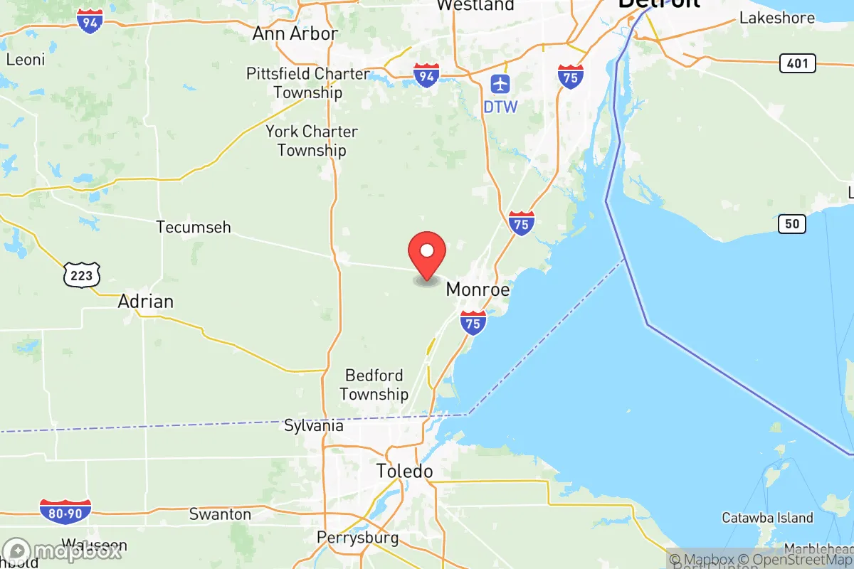
Monroe County, Michigan, occupies a strategic position along the western shore of Lake Erie, roughly midway between Detroit and Toledo, Ohio. For a relocator prioritizing resilience and self-sufficiency, the county offers a mix of genuine geographic advantages and notable exposure to man-made and natural risks. Its location provides access to freshwater, fertile farmland, and a relatively low population density outside the city of Monroe itself, but its proximity to major industrial corridors, international borders, and a major nuclear power plant requires careful consideration. This assessment weighs those factors for a conservative-leaning audience thinking seriously about disaster readiness and long-term stability.
Geographic position and natural advantages for long-term stability
Monroe County’s primary resilience asset is its position on Lake Erie, part of the Great Lakes system that holds roughly 20% of the world’s surface freshwater. The county’s 30-mile Lake Erie shoreline, from the city of Monroe north to the Pointe Mouillee State Game Area, provides a reliable, non-drought-prone water source. The River Raisin, which flows through the county seat of Monroe and empties into the lake, adds a secondary freshwater artery. The terrain is predominantly flat, fertile agricultural land—part of the Maumee River Valley—which supports local food production. The county’s population of roughly 150,000 is concentrated in the city of Monroe (about 20,000 residents) and a handful of smaller towns like Dundee, Petersburg, and Temperance, leaving large swaths of rural farmland that offer space for dispersed living. The climate is temperate, with four distinct seasons, and while winters can be harsh, the region avoids the extreme drought, wildfire, and hurricane risks common in other parts of the country. For a relocator seeking a stable, water-rich base with agricultural potential, the natural geography is a clear positive.
Risks, exposures, and proximity to fallout-relevant landmarks
The same location that provides water access also places Monroe County within a zone of significant man-made risk. The most prominent concern is the Fermi 2 Nuclear Power Plant, located in Frenchtown Charter Township, just north of the city of Monroe. This single-unit boiling water reactor, operated by DTE Energy, sits directly on the Lake Erie shore. While the plant has a strong safety record, its presence means that a major incident—whether from accident, sabotage, or natural disaster—could render large portions of the county uninhabitable or require rapid evacuation. The 10-mile emergency planning zone covers much of northern Monroe County, including the city of Monroe itself. Beyond nuclear risk, the county lies within the industrial corridor of the lower Detroit River and western Lake Erie. The Monroe Power Plant, a coal-fired facility also on the lake, and the Detroit Refinery complex (Marathon Petroleum) in nearby River Rouge, Michigan, represent potential chemical release or explosion hazards. The county’s position along Interstate 75, a major north-south freight corridor connecting Detroit to Toledo and beyond, means it is a likely route for hazardous material transport. For a relocator concerned with fallout from terrorism, industrial accidents, or grid failure, the concentration of critical infrastructure within a 20-mile radius of the county seat is a material risk that cannot be ignored.
Practical resilience for a relocator: food, water, energy, and defensibility
For a family or individual serious about self-sufficiency, Monroe County offers a mixed picture. Water security is strong: Lake Erie provides an essentially unlimited supply, though treatment and pumping would require off-grid capability in a prolonged emergency. The county’s groundwater is generally good, with many rural properties relying on private wells. Food production is a genuine advantage: the county is part of Michigan’s agricultural heartland, with significant acreage devoted to corn, soybeans, wheat, and hay. Smaller farms and orchards are common, particularly around Dundee and Petersburg. Local farmers’ markets and u-pick operations are abundant in normal times, and the agricultural base means that a relocator with land could reasonably pursue small-scale farming or livestock. Energy resilience is weaker: the county is heavily dependent on the regional grid, which is fed by the Monroe Power Plant and Fermi 2. In a grid-down scenario, natural gas and propane are the most common backup fuels, but solar potential is moderate due to cloud cover and winter snow. Wood heating is feasible in rural areas with forested lots. Defensibility is mixed: the flat, open terrain offers little natural cover or chokepoints, and the county’s network of state highways and I-75 makes it accessible from multiple directions. However, the rural townships—like Berlin, Exeter, and Whiteford—offer low population density and a strong hunting culture, which translates to a high rate of firearm ownership and practical outdoor skills among the local population. The county’s law enforcement presence is modest, with the Monroe County Sheriff’s Office covering most rural areas, meaning that community self-reliance is a practical necessity rather than an abstract ideal.
Overall, Monroe County presents a strategic trade-off for the resilience-minded relocator. Its natural advantages—abundant freshwater, fertile soil, a moderate climate, and low population density outside the city—are genuine and durable. The agricultural base and hunting culture support a lifestyle of self-sufficiency that aligns with conservative values of independence and preparedness. However, the concentration of industrial and nuclear infrastructure within a narrow corridor along the Lake Erie shore introduces a level of man-made risk that is higher than in more remote parts of the Midwest. For a relocator willing to accept that risk in exchange for proximity to the Great Lakes and a strong local food system, the county’s rural townships—particularly those south of the River Raisin and away from the Fermi 2 plume zone—offer a viable base. The key is to choose a specific location carefully, avoiding the immediate shadow of the power plant and the I-75 corridor, and to invest in off-grid water and energy systems that leverage the county’s natural strengths. Monroe County is not a bunker, but it is a defensible, resource-rich position for those who understand its exposures and plan accordingly.

* Values derived from national, state, county, city and local statistics and may differ in a specific area. Last updated: 2026-10-09T23:27:43.000Z
Narrative content on this page is AI-generated and may contain mistakes. Verify any details that matter before acting on them.
ReloMaps may earn a commission from affiliate links at no extra cost to you.

