
Photo: Wikipedia
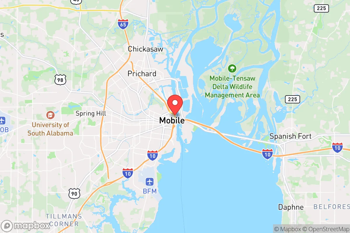
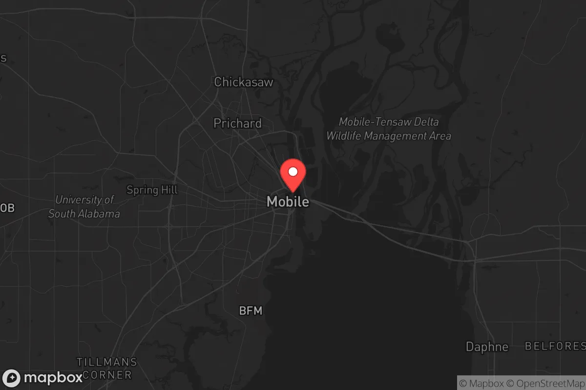
Strategic Assessment of Mobile, AL
Meaningful friction. Expect exposure to either population pressure, blast zones, or natural disaster risk. Consider buying a retreat property.
What does the Strategic Assessment tell us?
Our Strategic Assessment grades tactical survivability of an area. Major population centers, military targets, fallout zones, natural disasters, and border exposure all drive risk — lower exposure means a more defensible position in a crisis.
This is heavily inspired by Joel Skousen's Strategic Relocation book. Highly recommended you checkout the book ($)What does this tell us?
Our Strategic Assessment grades tactical survivability of an area. Major population centers, military targets, fallout zones, natural disasters, and border exposure all drive risk — lower exposure means a more defensible position in a crisis.
This is heavily inspired by Joel Skousen's Strategic Relocation book. Highly recommended you checkout the book ($)Strategic Pillars

Key Distances
Regional Safe Places
Below is our recommended "safe zones" in Alabama and the surrounding area based on our strategic heuristics. For most people, it's unrealistic to live in a “safe zone” full-time due to work, family or other personal reasons. They tend to be more rural. However, many of these areas are perfect for second homes and retreat properties that double as a vacation home or even a short-term rental.
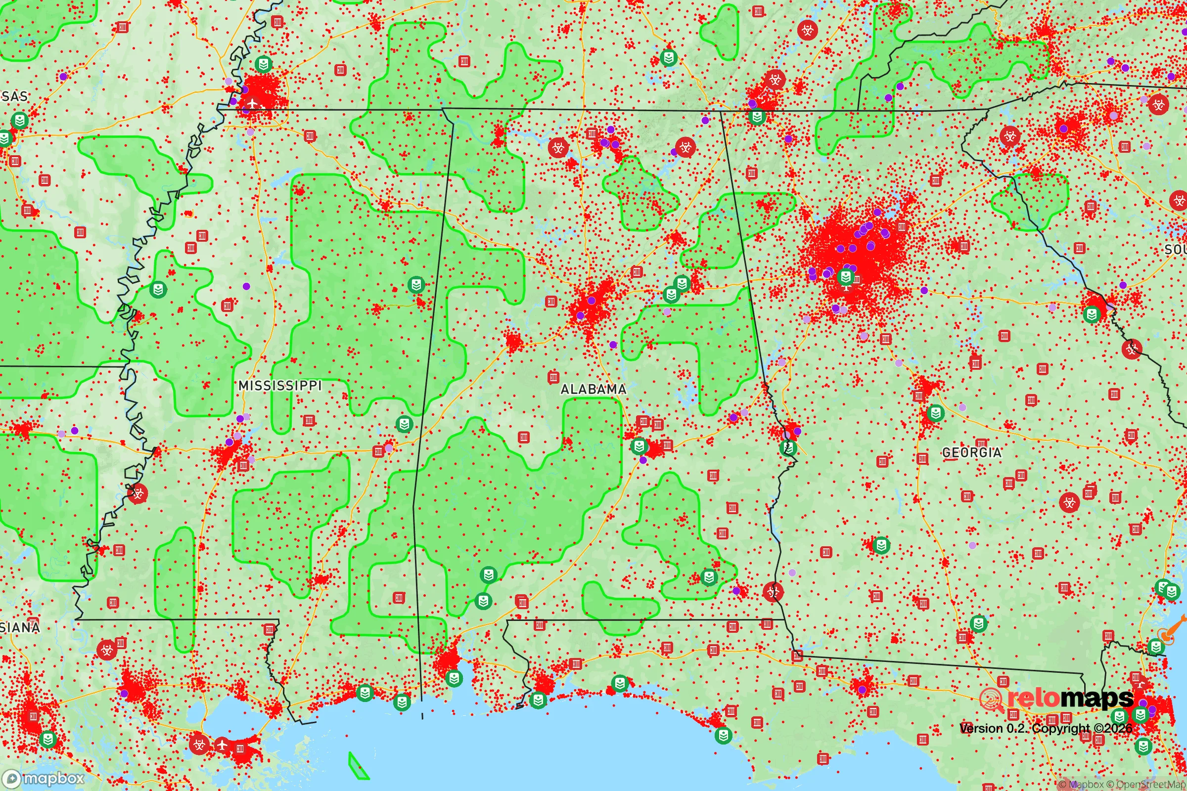
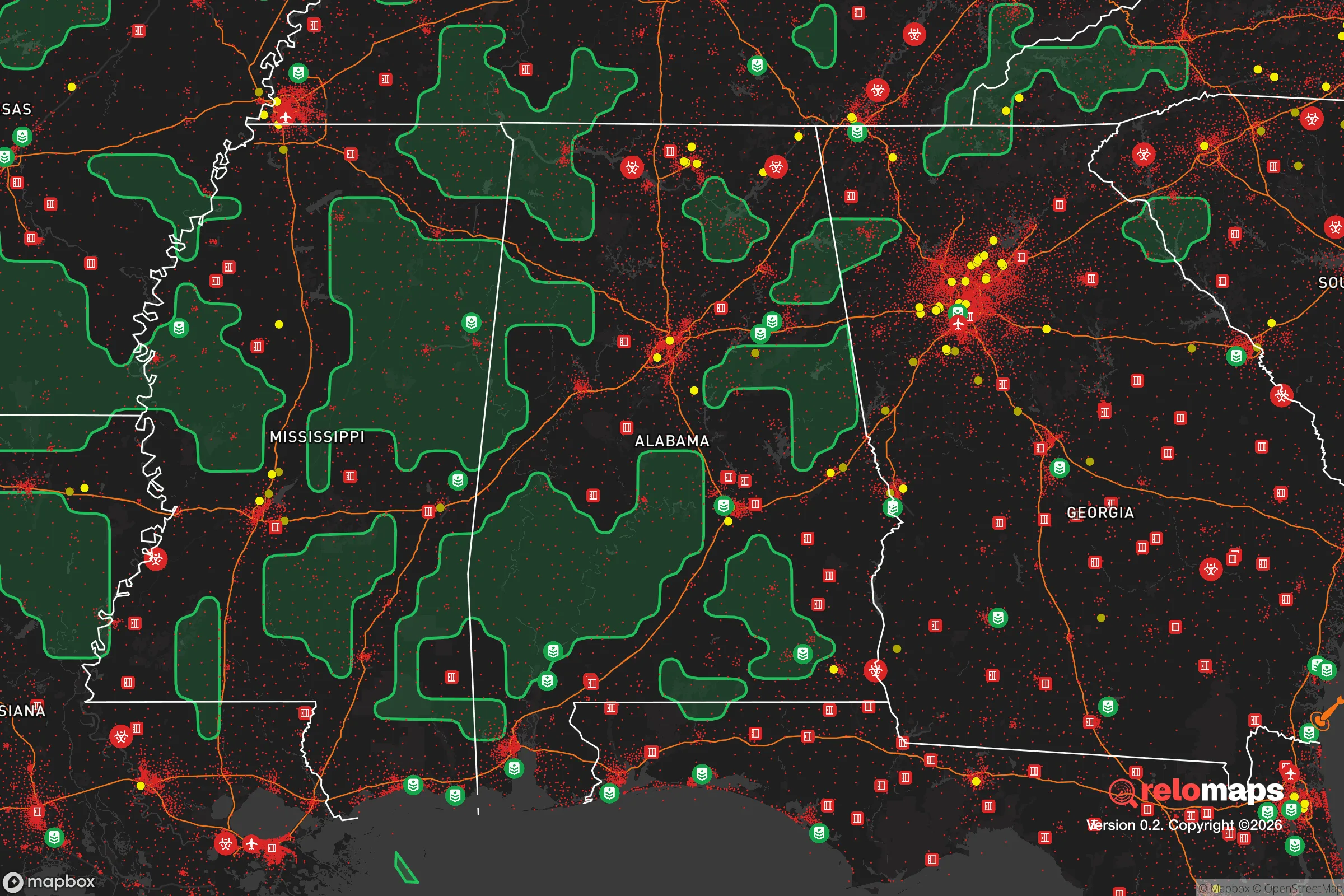
Important Note: For informational purposes only. This does not mean nothing bad ever happens in the green zones. Please use common sense. This is based on public data and modeled with AI. We tried to take a conservative approach but mistakes happen. We update this regularly as new information becomes available.
Solar Generator Recommendations
Backup power matters more here than in safer locations. We've picked three solar generators across budgets and capacity tiers — start with the budget unit if you only need a few essentials, or step up if you want to run a fridge and HVAC for days at a time.

Jackery Portable Power Station Explorer 300
Budget OptionPower on the Go: Weighing only 11 lbs, it's convenient to set up and store with book-sized foldable solar panels

BLUETTI Portable Power Station AC180
Designed for both indoor and outdoor scenarios, AC180 is highly capable as it has a robost capacity and continuous output power.

EF ECOFLOW DELTA Pro Ultra Power Station
Upgraded PickEcoFlow DELTA Pro Ultra is a whole-home energy system designed to grow with your family. Integrated with the Smart Home Panel 2, it scales to meet your evolving energy needs — keeping your home powered, intelligent, and secure through every stage of life.
We earn a commission, at no additional cost to you.
Strategic Assessment Analysis
Mobile, Alabama, occupies a unique strategic position in the lower Gulf Coast, offering a blend of deep-water port access, historical resilience, and a climate that demands respect. For the conservative-minded relocator looking at long-term sustainability and security, Mobile presents a mixed picture: it is a city with genuine natural advantages and a working-class backbone, but it sits directly in the path of some of the most powerful natural forces on the continent and within striking distance of major vulnerabilities. The key question is whether its location as a logistical hub and its distance from the worst of the coastal storm surge outweigh its exposure to hurricanes, industrial hazards, and the demographic pressures of a growing Sun Belt corridor.
Geographic position and natural advantages for long-term security
Mobile’s primary strategic asset is its geography. Situated at the head of Mobile Bay, it is the only deep-water port in Alabama and one of the busiest in the United States. This gives the area a built-in economic anchor that is less dependent on tourism or federal spending than other Gulf Coast cities. The Port of Mobile handles massive volumes of coal, forest products, and containerized cargo, meaning the local economy has a tangible, physical foundation—steel, ships, and timber—rather than just service-sector churn. For a prepper mindset, this is a significant plus: a city that makes and moves real things is more likely to maintain basic economic function during a crisis than one built on entertainment or real estate speculation. The surrounding region is also rich in fresh water, with the Mobile River system and the vast aquifer beneath the coastal plain providing a reliable supply that many Western and Southwestern cities would envy. The terrain is flat but heavily wooded, offering ample cover and natural resources for those willing to work the land. The climate is subtropical, with a long growing season that supports year-round food production, though the humidity and heat present their own challenges for long-term storage and physical labor.
Risks, exposures, and proximity to fallout-relevant landmarks
The most obvious and persistent threat to Mobile is hurricanes. The city has been hit directly by major storms—most notably Hurricane Katrina in 2005, which pushed a catastrophic storm surge up Mobile Bay, and Hurricane Frederic in 1979, which leveled large sections of the city. The geography that makes the port valuable also makes it a funnel for surge: a strong Category 3 or higher storm can push water 20 to 30 miles inland, flooding low-lying neighborhoods and industrial areas. The city’s levee system has been improved since Katrina, but it is not a guarantee. For a relocator, this means any property must be evaluated on elevation and flood risk with extreme care. Beyond weather, Mobile’s industrial corridor along the bay includes chemical plants, refineries, and a liquefied natural gas (LNG) export terminal. A major storm or a deliberate attack on these facilities could create a secondary disaster—toxic releases, fires, or explosions—that would make large parts of the city uninhabitable for weeks. On the security front, Mobile is roughly 150 miles from the massive population centers of New Orleans and the Florida Panhandle, and about 200 miles from the Pensacola Naval Air Station and Eglin Air Force Base. While not directly in a primary target zone, the city is within the fallout and disruption radius of any major event affecting those military installations or the Port of New Orleans. The city itself is not a high-value nuclear target, but its proximity to critical infrastructure and a major shipping chokepoint means it would feel the ripple effects of any national-level crisis.
Practical resilience for a relocator: food, water, energy, and defensibility
For a single individual or family looking to establish a resilient homestead, Mobile offers a mixed bag. The local food system is strong: the Gulf provides seafood, the surrounding farmland produces vegetables, poultry, and timber, and the port ensures that bulk goods can arrive even if rail or truck lines are disrupted. However, the city itself is heavily dependent on the interstate highway system (I-10 and I-65) for resupply, and a major hurricane or bridge failure could cut off the city for days. Water is abundant, but the municipal supply is vulnerable to power outages and storm damage; a well with a hand pump or a rainwater catchment system is a wise investment. Energy is a concern: the local grid is prone to outages during storms, and the summer heat makes air conditioning a survival necessity for the elderly and very young. Solar panels with battery storage are a practical hedge, but the frequent cloud cover from storms reduces their reliability. Defensibility is the weakest point. Mobile is a flat, sprawling city with no natural chokepoints or high ground. The suburbs and exurbs to the west and north offer more rural options, but the core of the city is difficult to secure in a civil unrest scenario. The local law enforcement presence is adequate for routine matters, but the city has a higher-than-average crime rate, and during a prolonged crisis, the police would be stretched thin. The best strategy for a prepper is to locate outside the city limits—north of I-10, preferably in the rural areas of Mobile or Washington County—where you can have acreage, a well, and a defensible perimeter while still being within a 30-minute drive of the port and medical facilities.
The overall strategic picture for Mobile is one of calculated trade-offs. It is not a bug-out location for those seeking total isolation, nor is it a high-risk urban core that will be a primary target. It is a working port city with real economic heft, abundant natural resources, and a population that is generally self-reliant and conservative in outlook. The threats are real—hurricanes, industrial accidents, and the logistical vulnerabilities of a coastal location—but they are manageable with proper planning, elevation, and a willingness to live a little outside the city limits. For the relocator who wants access to a functioning port, a long growing season, and a community that still values hard work and neighborly help, Mobile is a solid, if imperfect, option. The key is to treat it as a base of operations, not a fortress, and to have a plan for the inevitable storms—both meteorological and societal.
* Values derived from national, state, county, city and local statistics and may differ in a specific area. Last updated: 2026-04-19T18:58:18.000Z
Narrative content on this page is AI-generated and may contain mistakes. Verify any details that matter before acting on them.
ReloMaps may earn a commission from affiliate links at no extra cost to you.