Photo: Wikipedia
Strategic Assessment of Mount Airy, MD
Meaningful friction. Expect exposure to either population pressure, blast zones, or natural disaster risk. Consider buying a retreat property.
What does the Strategic Assessment tell us?
Our Strategic Assessment grades tactical survivability of an area. Major population centers, military targets, fallout zones, natural disasters, and border exposure all drive risk — lower exposure means a more defensible position in a crisis.
This is heavily inspired by Joel Skousen's Strategic Relocation book. Highly recommended you checkout the book ($)What does this tell us?
Our Strategic Assessment grades tactical survivability of an area. Major population centers, military targets, fallout zones, natural disasters, and border exposure all drive risk — lower exposure means a more defensible position in a crisis.
This is heavily inspired by Joel Skousen's Strategic Relocation book. Highly recommended you checkout the book ($)Strategic Pillars

Key Distances
Regional Safe Places
Below is our recommended "safe zones" in Maryland and the surrounding area based on our strategic heuristics. For most people, it's unrealistic to live in a “safe zone” full-time due to work, family or other personal reasons. They tend to be more rural. However, many of these areas are perfect for second homes and retreat properties that double as a vacation home or even a short-term rental.


Important Note: For informational purposes only. This does not mean nothing bad ever happens in the green zones. Please use common sense. This is based on public data and modeled with AI. We tried to take a conservative approach but mistakes happen. We update this regularly as new information becomes available.
Solar Generator Recommendations
Backup power matters more here than in safer locations. We've picked three solar generators across budgets and capacity tiers — start with the budget unit if you only need a few essentials, or step up if you want to run a fridge and HVAC for days at a time.

Jackery Portable Power Station Explorer 300
Budget OptionPower on the Go: Weighing only 11 lbs, it's convenient to set up and store with book-sized foldable solar panels

BLUETTI Portable Power Station AC180
Designed for both indoor and outdoor scenarios, AC180 is highly capable as it has a robost capacity and continuous output power.

EF ECOFLOW DELTA Pro Ultra Power Station
Upgraded PickEcoFlow DELTA Pro Ultra is a whole-home energy system designed to grow with your family. Integrated with the Smart Home Panel 2, it scales to meet your evolving energy needs — keeping your home powered, intelligent, and secure through every stage of life.
We earn a commission, at no additional cost to you.
Strategic Assessment Analysis
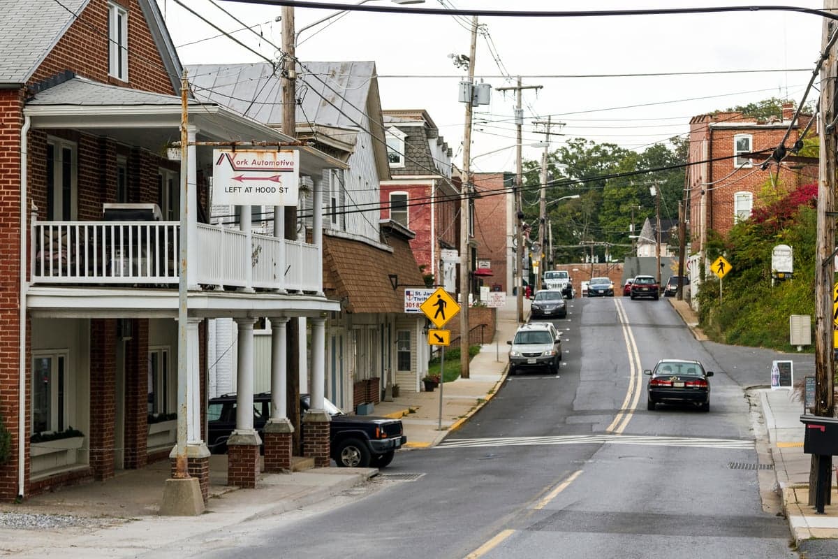
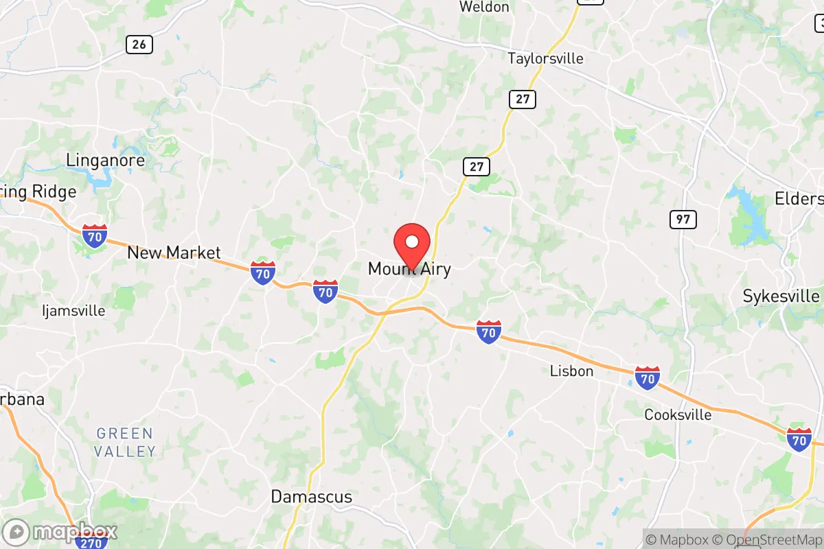
Mount Airy, Maryland, sits in a unique strategic pocket that offers a blend of rural seclusion and practical access, making it a serious contender for those prioritizing resilience over convenience. Located at the crossroads of Carroll, Frederick, and Howard counties, this town of roughly 9,000 people benefits from being just far enough from the Baltimore-Washington corridor to avoid the immediate blast and fallout zones of a major event, yet close enough to monitor regional instability. Its position along the Parr’s Ridge, the highest point in the region, provides natural elevation advantages for communication and observation, while the surrounding agricultural land offers a buffer against the sprawl that chokes most of the I-95 corridor. For a relocator with a prepper mindset, Mount Airy represents a calculated compromise: not a remote bunker, but a defensible, self-sufficient community within a day’s walk of critical resources.
Geographic position and natural advantages for long-term survival
The town’s elevation—roughly 800 feet above sea level—is its first and most underrated asset. In a grid-down scenario, high ground translates to better line-of-sight for radio communications, reduced flood risk, and cooler temperatures during heat events. Mount Airy sits on the Parr’s Ridge, a geological spine that runs through central Maryland, giving it a natural vantage point over the surrounding valleys. The area is laced with small streams and tributaries of the Patuxent and Monocacy rivers, providing decentralized water sources that are less likely to be contaminated by upstream industrial runoff compared to larger river systems. The soil in Carroll and Frederick counties is among the most productive in the state, with a long history of dairy farming and grain cultivation. This means that even a modest homestead can support vegetable gardens and small livestock, reducing reliance on supply chains that could snap during a crisis. The town’s position at the intersection of major roads like MD-27 and I-70 also offers multiple egress routes—critical if one direction becomes compromised by civil unrest or natural disaster.
Risks, exposures, and proximity to fallout-relevant landmarks
No location is without vulnerabilities, and Mount Airy’s primary risk stems from its proximity to the Baltimore-Washington metropolitan area, home to over 8 million people. In the event of a major geopolitical conflict or terrorist attack, the region’s concentration of federal agencies, military installations (Fort Meade, Andrews Air Force Base), and critical infrastructure (the Port of Baltimore, BWI Airport) makes it a high-value target. Fallout patterns from a nuclear detonation in D.C. or Baltimore would likely track northeast or southeast depending on prevailing winds, but Mount Airy’s position roughly 45 miles northwest of D.C. puts it outside the most severe immediate fallout zones—though not entirely safe from secondary contamination. The town itself has no major industrial facilities, chemical plants, or rail lines carrying hazardous materials, which is a significant plus. However, the nearby I-70 corridor is a major east-west artery that could become a chokepoint during an evacuation, drawing desperate populations from the cities westward. The risk of civil unrest is moderate: Mount Airy’s demographics skew older, more conservative, and more property-owning than the state average, which historically correlates with lower crime rates but also means the town could become a target for looters from less stable areas during a prolonged grid-down event.
Practical resilience for a relocator: food, water, energy, and defensibility
For someone serious about self-sufficiency, Mount Airy offers a workable baseline. The town’s water supply comes from a combination of municipal wells and private groundwater sources; many homes in the surrounding rural areas have their own wells, which is a major advantage over city dwellers dependent on centralized treatment plants. A hand pump or solar-powered well pump can keep water flowing even without grid power. The agricultural land means that local farmers’ markets and CSAs are abundant in normal times, and in a crisis, barter networks for fresh produce, eggs, and meat would likely emerge quickly. The area’s Amish and Mennonite communities, concentrated in nearby Union Bridge and New Windsor, are a practical resource—they already operate off-grid and possess skills in blacksmithing, animal husbandry, and food preservation that could be invaluable. Energy resilience is moderate: the region gets plenty of sun for solar panels, and wood-burning stoves are common in older homes, providing heat and cooking capability during winter outages. Defensibility is where Mount Airy shines. The town’s layout—a compact historic core surrounded by sprawling farms and wooded lots—means that a small group can secure a perimeter with relative ease. The local police force is small but responsive, and the Carroll County Sheriff’s Office has a reputation for proactive community engagement. That said, the town lacks a dedicated emergency operations center or hardened shelter, so individual preparedness is non-negotiable. Stockpiling at least three months of food, water, and medical supplies is advisable, as is establishing a communication plan with neighbors who share your mindset.
The overall strategic picture for Mount Airy is one of cautious optimism for the prepared relocator. It is not a fortress, nor is it a remote wilderness retreat—it is a working-class town with a conservative ethos, decent natural resources, and a location that balances accessibility with security. The biggest threat is not the land itself but the human tide that could wash over it during a regional collapse. For a single individual or family willing to invest in off-grid infrastructure, build local relationships, and maintain a low profile, Mount Airy offers a viable base of operations. The key is to treat it as a launch point, not a final destination: use its advantages to build redundancy, monitor the broader situation, and be ready to move deeper into the Appalachian foothills if the corridor becomes untenable. In a world where the margin for error is shrinking, this town buys you time—and time is the one resource you cannot stockpile.
* Values derived from national, state, county, city and local statistics and may differ in a specific area. Last updated: 2026-04-22T03:04:36.000Z
Narrative content on this page is AI-generated and may contain mistakes. Verify any details that matter before acting on them.
ReloMaps may earn a commission from affiliate links at no extra cost to you.