Photo: Wikipedia
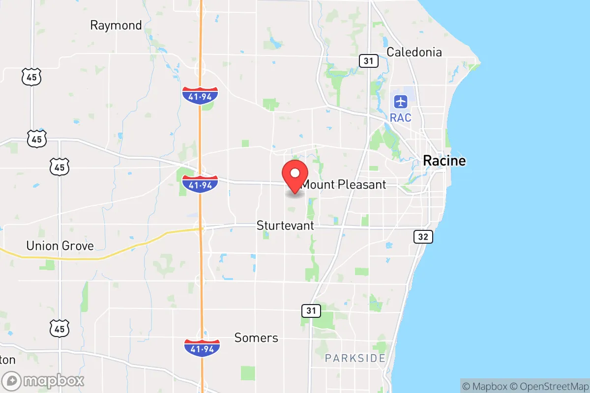
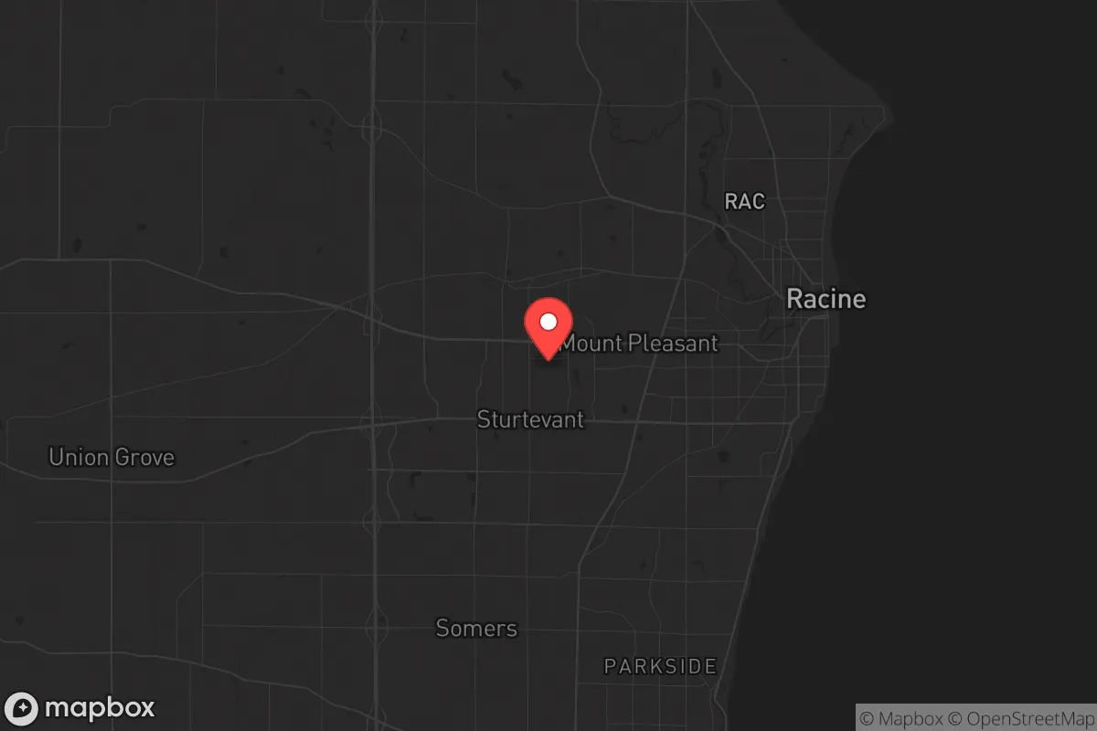
Strategic Assessment of Mount Pleasant, WI
Meaningful friction. Expect exposure to either population pressure, blast zones, or natural disaster risk. Consider buying a retreat property.
What does the Strategic Assessment tell us?
Our Strategic Assessment grades tactical survivability of an area. Major population centers, military targets, fallout zones, natural disasters, and border exposure all drive risk — lower exposure means a more defensible position in a crisis.
This is heavily inspired by Joel Skousen's Strategic Relocation book. Highly recommended you checkout the book ($)What does this tell us?
Our Strategic Assessment grades tactical survivability of an area. Major population centers, military targets, fallout zones, natural disasters, and border exposure all drive risk — lower exposure means a more defensible position in a crisis.
This is heavily inspired by Joel Skousen's Strategic Relocation book. Highly recommended you checkout the book ($)Strategic Pillars

Key Distances
Regional Safe Places
Below is our recommended "safe zones" in Wisconsin and the surrounding area based on our strategic heuristics. For most people, it's unrealistic to live in a “safe zone” full-time due to work, family or other personal reasons. They tend to be more rural. However, many of these areas are perfect for second homes and retreat properties that double as a vacation home or even a short-term rental.
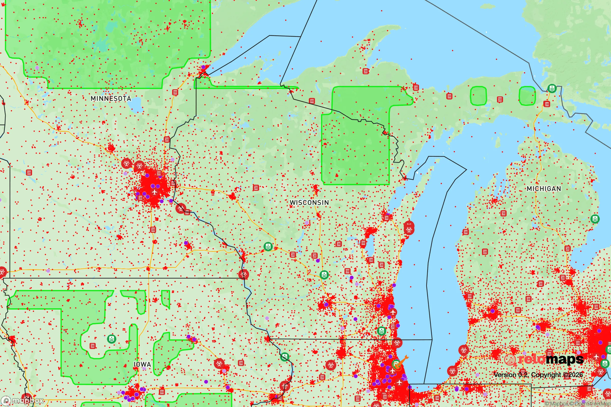
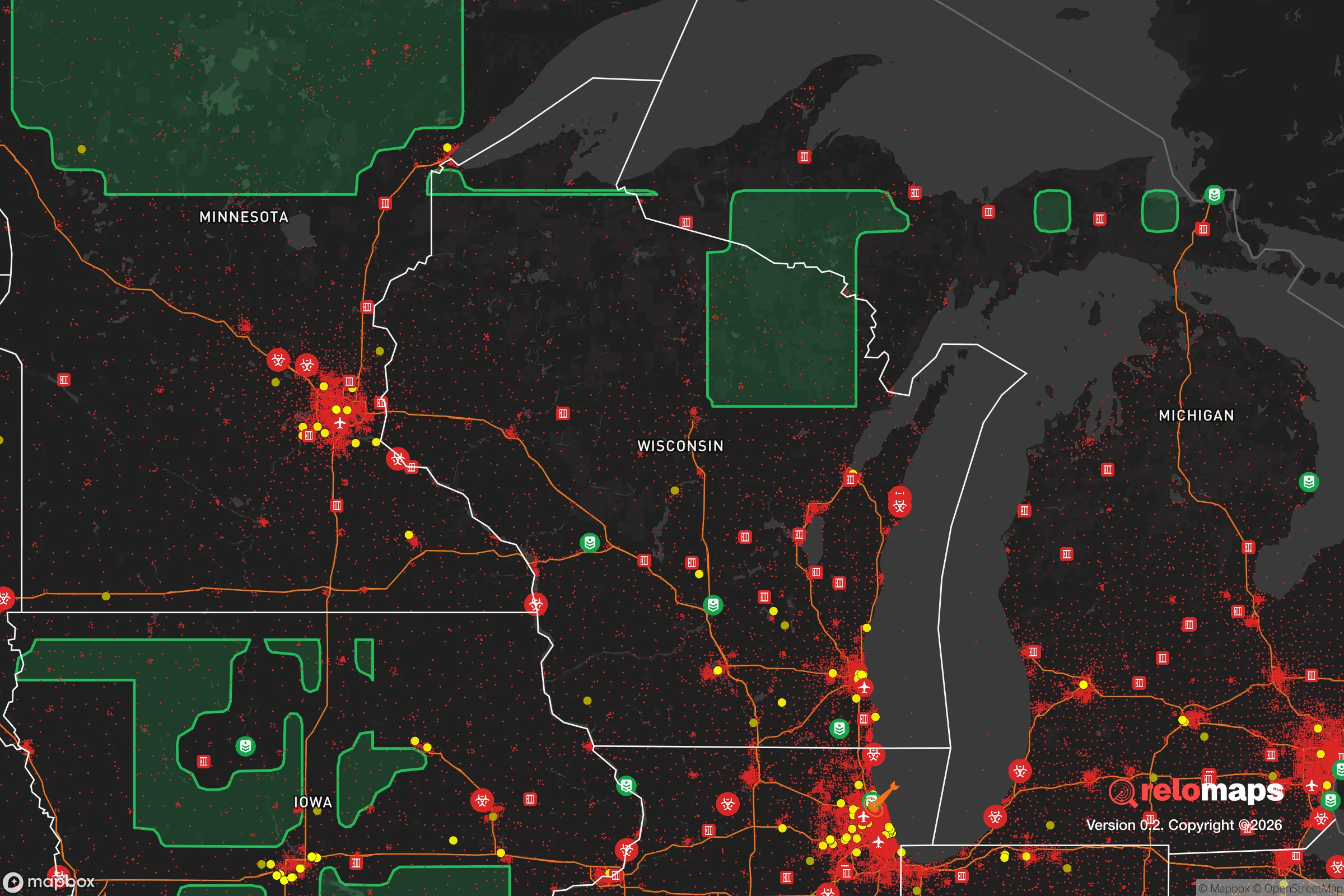
Important Note: For informational purposes only. This does not mean nothing bad ever happens in the green zones. Please use common sense. This is based on public data and modeled with AI. We tried to take a conservative approach but mistakes happen. We update this regularly as new information becomes available.
Solar Generator Recommendations
Backup power matters more here than in safer locations. We've picked three solar generators across budgets and capacity tiers — start with the budget unit if you only need a few essentials, or step up if you want to run a fridge and HVAC for days at a time.

Jackery Portable Power Station Explorer 300
Budget OptionPower on the Go: Weighing only 11 lbs, it's convenient to set up and store with book-sized foldable solar panels

BLUETTI Portable Power Station AC180
Designed for both indoor and outdoor scenarios, AC180 is highly capable as it has a robost capacity and continuous output power.

EF ECOFLOW DELTA Pro Ultra Power Station
Upgraded PickEcoFlow DELTA Pro Ultra is a whole-home energy system designed to grow with your family. Integrated with the Smart Home Panel 2, it scales to meet your evolving energy needs — keeping your home powered, intelligent, and secure through every stage of life.
We earn a commission, at no additional cost to you.
Strategic Assessment Analysis
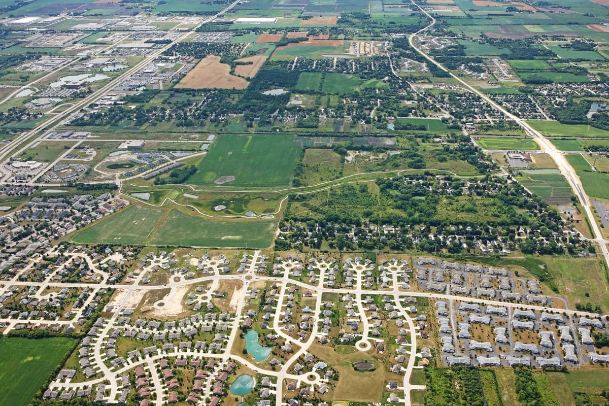
Mount Pleasant, Wisconsin, presents a mixed strategic picture for the conservative prepper or survivalist. Its primary resilience advantage is its location in the relatively stable Upper Midwest, far from the seismic and hurricane-prone coasts, yet its proximity to the Chicago-Milwaukee corridor introduces significant vulnerabilities. The town’s recent industrial boom, anchored by a massive Foxconn project (now scaled back) and a strong manufacturing base, offers economic insulation but also makes it a potential target for civil unrest or supply chain disruptions. For a relocator prioritizing long-term security, Mount Pleasant is a calculated compromise: it offers a buffer from the worst coastal chaos while remaining close enough to major population centers to be affected by their collapse.
Geographic position and natural advantages for long-term security
Mount Pleasant sits in Racine County, roughly 30 miles south of Milwaukee and 60 miles north of Chicago, placing it within the "Great Lakes redoubt" that many survivalists consider a viable fallback zone. The area benefits from abundant freshwater access via Lake Michigan, which is less prone to drought than the western states and provides a massive, non-saline water source. The local climate is temperate, with four distinct seasons that support subsistence agriculture, though the growing season is shorter than in the South—roughly 150 days. The terrain is flat to gently rolling, which is poor for defensive ambush but excellent for farming and solar panel placement. Critically, the region is outside the primary fallout zones of major nuclear targets like Chicago, New York, or Washington D.C., though it is within the secondary fallout plume zone for a strike on the Chicago metro area. The area’s natural advantages are real but not overwhelming; it is a solid B+ in a world of C-minuses.
Risks, exposures, and proximity to fallout-relevant landmarks
The most glaring risk for Mount Pleasant is its proximity to the Chicago-Milwaukee urban corridor, a high-probability target for any mass casualty event, whether from civil unrest, EMP attack, or nuclear exchange. Mount Pleasant is roughly 60 miles from Chicago’s city center, placing it within the moderate fallout zone for a ground-burst nuclear weapon on that city. Prevailing westerly winds would carry fallout eastward, meaning a strike on Chicago would deposit radioactive debris across Lake Michigan and into Michigan, not directly onto Mount Pleasant—but a strike on Milwaukee (30 miles north) would be a direct threat. The area also sits near the I-94 corridor, a major evacuation route that would become a death trap in a crisis. Racine County’s population density is about 400 people per square mile, which is moderate but still high enough to create competition for resources during a collapse. The nearby Foxconn site, while now a fraction of its original promise, remains a large industrial complex that could be a target for sabotage or looting. On the positive side, the area has no major military bases, nuclear power plants, or chemical weapons depots within 50 miles, reducing the risk of targeted strikes. The biggest exposure is human: the mass of desperate people fleeing Chicago and Milwaukee would overwhelm local infrastructure within hours of a major event.
Practical resilience for a relocator: food, water, energy, and defensibility
For a relocator with a prepper mindset, Mount Pleasant offers a workable but not ideal baseline for self-sufficiency. Lake Michigan provides an essentially unlimited water source, but it requires treatment—boiling, filtration, or chemical purification—before consumption. The lake is also a two-edged sword: it attracts refugees and is vulnerable to contamination from upstream industrial sites. Groundwater is available via wells, but the water table is shallow in many parts of Racine County, and well drilling is regulated. For food, the surrounding farmland is productive, with dairy, corn, and soybeans dominating. Racine County has over 400 farms, meaning local food production is viable, but most of it is commodity-scale and not oriented toward small-plot survival gardening. A relocator would need to secure land with good soil and water rights, which is possible but increasingly expensive as Chicago expats drive up prices. Energy resilience is moderate: the grid is reliable but aging, and the area gets enough sun for solar panels (about 4.5 peak sun hours per day), though winter cloud cover reduces output. Natural gas is widely available, but a prepper should plan for grid-down scenarios with propane or wood heat. Defensibility is the weak point. The flat terrain offers no natural chokepoints, and the area is crisscrossed by highways and rail lines that make it easy for outsiders to enter. A rural property with a long driveway, perimeter fencing, and a good line of sight is essential—a suburban subdivision in Mount Pleasant itself would be a liability. The local law enforcement presence is adequate for normal times, but in a crisis, the Racine County Sheriff’s Office (about 150 sworn deputies) would be overwhelmed by the scale of potential unrest.
The overall strategic picture for Mount Pleasant is one of cautious viability for the conservative relocator who values stability over isolation. It is not a bug-out paradise like the Idaho panhandle or the Ozarks, but it offers a realistic middle ground: close enough to urban job markets to build wealth and community, yet far enough to avoid the worst of coastal chaos. The key is to buy land with water access, establish a resilient homestead, and maintain a low profile. The area’s greatest strength is its economic base—manufacturing, logistics, and agriculture provide a buffer against the kind of hyperinflation and supply chain collapse that would devastate purely rural areas. Its greatest weakness is its population density and proximity to Chicago, which means a relocator must plan for a "gray man" strategy: blend in, stock up, and be ready to hunker down for weeks if the cities empty out. For the prepper who wants to be prepared without living off-grid in a cabin, Mount Pleasant is a solid, if unglamorous, choice. Just don’t expect to be the last man standing—expect to be one of the smart ones who survives the first wave.
* Values derived from national, state, county, city and local statistics and may differ in a specific area. Last updated: 2026-04-21T10:37:43.000Z
Narrative content on this page is AI-generated and may contain mistakes. Verify any details that matter before acting on them.
ReloMaps may earn a commission from affiliate links at no extra cost to you.