Photo: Wikipedia
Strategic Assessment of Mount Vernon, IA
Meaningful friction. Expect exposure to either population pressure, blast zones, or natural disaster risk. Consider buying a retreat property.
What does the Strategic Assessment tell us?
Our Strategic Assessment grades tactical survivability of an area. Major population centers, military targets, fallout zones, natural disasters, and border exposure all drive risk — lower exposure means a more defensible position in a crisis.
This is heavily inspired by Joel Skousen's Strategic Relocation book. Highly recommended you checkout the book ($)What does this tell us?
Our Strategic Assessment grades tactical survivability of an area. Major population centers, military targets, fallout zones, natural disasters, and border exposure all drive risk — lower exposure means a more defensible position in a crisis.
This is heavily inspired by Joel Skousen's Strategic Relocation book. Highly recommended you checkout the book ($)Strategic Pillars

Key Distances
Regional Safe Places
Below is our recommended "safe zones" in Iowa and the surrounding area based on our strategic heuristics. For most people, it's unrealistic to live in a “safe zone” full-time due to work, family or other personal reasons. They tend to be more rural. However, many of these areas are perfect for second homes and retreat properties that double as a vacation home or even a short-term rental.
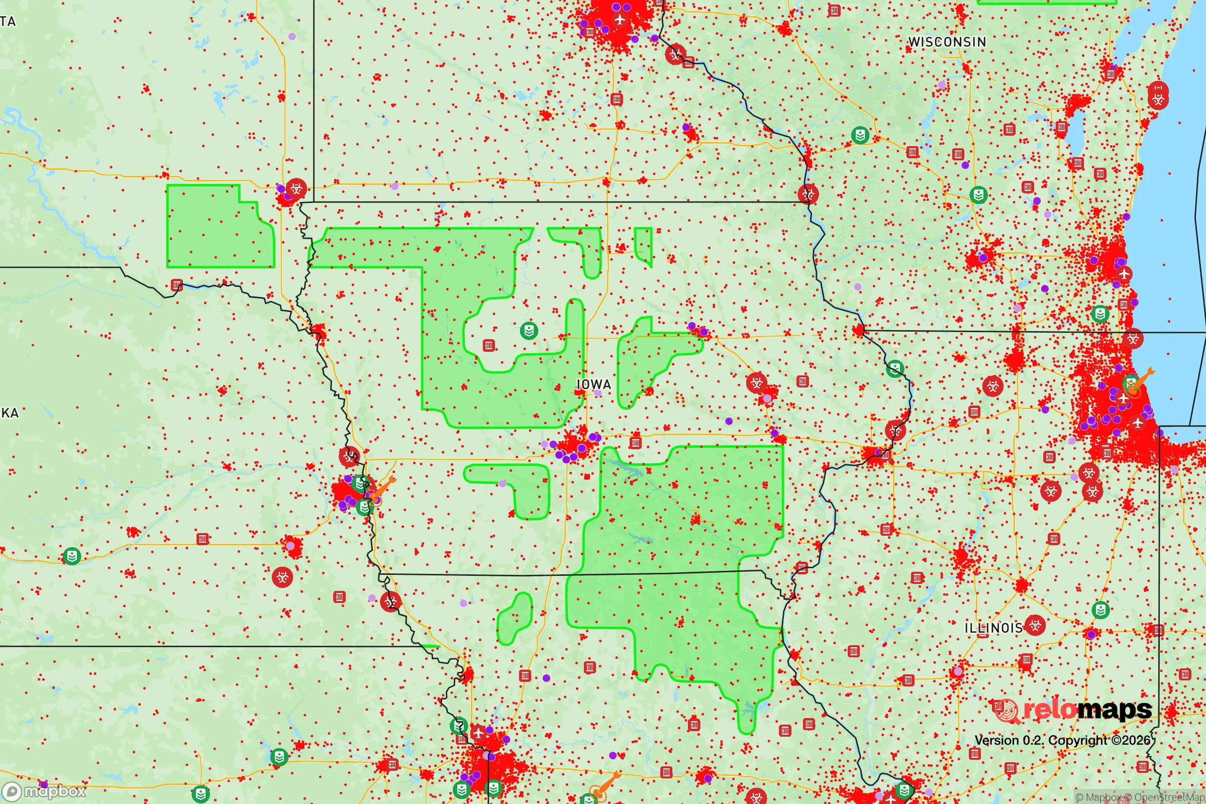
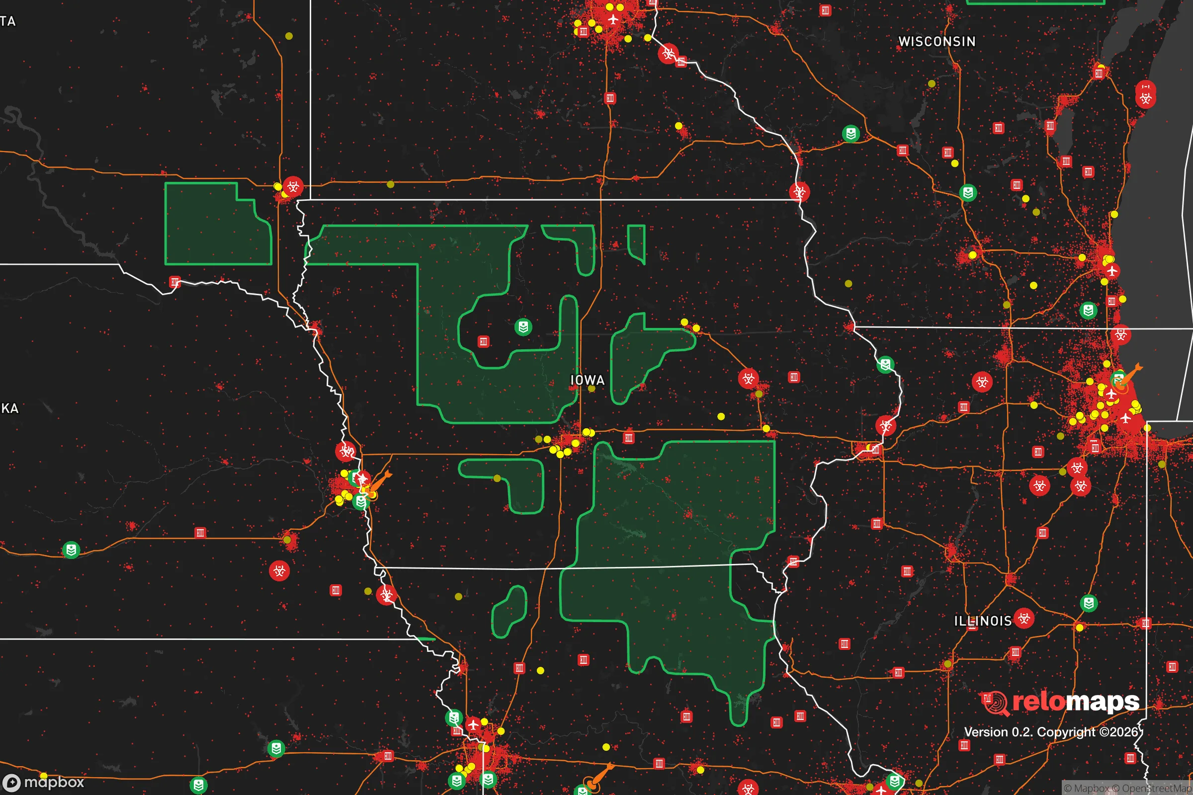


Important Note: For informational purposes only. This does not mean nothing bad ever happens in the green zones. Please use common sense. This is based on public data and modeled with AI. We tried to take a conservative approach but mistakes happen. We update this regularly as new information becomes available.
Solar Generator Recommendations
Backup power matters more here than in safer locations. We've picked three solar generators across budgets and capacity tiers — start with the budget unit if you only need a few essentials, or step up if you want to run a fridge and HVAC for days at a time.

Jackery Portable Power Station Explorer 300
Budget OptionPower on the Go: Weighing only 11 lbs, it's convenient to set up and store with book-sized foldable solar panels

BLUETTI Portable Power Station AC180
Designed for both indoor and outdoor scenarios, AC180 is highly capable as it has a robost capacity and continuous output power.

EF ECOFLOW DELTA Pro Ultra Power Station
Upgraded PickEcoFlow DELTA Pro Ultra is a whole-home energy system designed to grow with your family. Integrated with the Smart Home Panel 2, it scales to meet your evolving energy needs — keeping your home powered, intelligent, and secure through every stage of life.
We earn a commission, at no additional cost to you.
Strategic Assessment Analysis
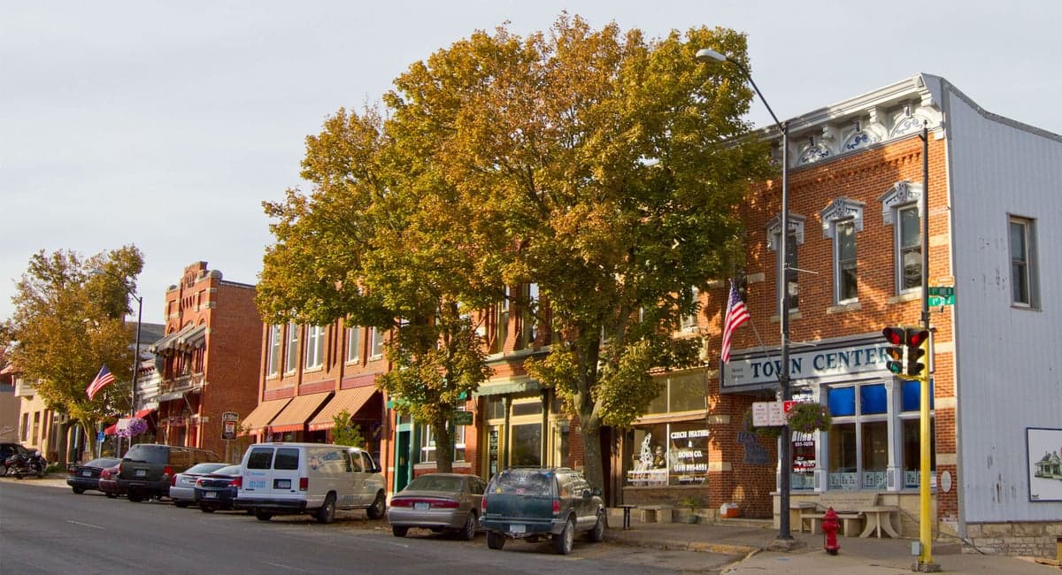
Mount Vernon, Iowa, presents a compelling case for a relocator prioritizing resilience and self-sufficiency, largely due to its position in the I-380 corridor between Cedar Rapids and Iowa City. This placement offers a strategic blend of small-town stability and access to regional resources, but it also introduces specific vulnerabilities that a serious preparedness-minded individual must weigh. The town’s character is defined by Cornell College and a historic downtown, but its strategic value lies in its agricultural surroundings, moderate climate, and distance from the most acute risks of major metropolitan centers, while still being close enough to benefit from their logistics and medical infrastructure.
Geographic position and natural advantages for long-term stability
Mount Vernon sits in Linn County, on the edge of the Iowan Surface, a region of gently rolling hills and fertile soil that is among the most productive agricultural zones in the United States. This is not a floodplain or a coastal zone; the area’s primary natural hazard is severe weather, including tornadoes and derechos, rather than hurricanes, earthquakes, or wildfires. The 2020 derecho that devastated Cedar Rapids missed Mount Vernon with less severe impact, but it serves as a reminder that the region is not immune to powerful storms. The town’s elevation and drainage are generally favorable, with the Cedar River running a few miles to the west, but most residential areas sit on higher ground, reducing flood risk compared to downstream communities. For a relocator, the key natural advantage is access to arable land and reliable rainfall—the area averages around 35 inches of precipitation annually, which supports robust local agriculture without the irrigation dependency of drier western states. This makes the region inherently more food-secure than many parts of the country.
Risks, exposures, and proximity to fallout-relevant landmarks
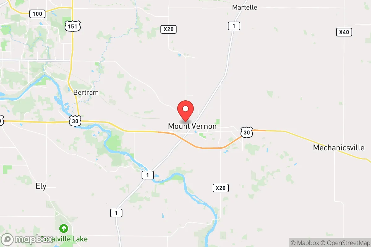
The most significant strategic risk for Mount Vernon is its location within the I-380 corridor, a high-value transportation and logistics artery connecting Cedar Rapids (population ~135,000) and Iowa City (population ~75,000). In a national emergency or conflict scenario, this corridor could become a target or a chokepoint. Cedar Rapids is home to Collins Aerospace, a major defense contractor, and the Eastern Iowa Airport, which serves both commercial and military cargo. Iowa City hosts the University of Iowa, a large research institution with its own critical infrastructure. While Mount Vernon itself is not a primary target, its proximity—roughly 15 miles from Cedar Rapids and 20 miles from Iowa City—places it within the zone that could experience secondary effects from a targeted strike on those cities, including fallout drift depending on wind patterns. Additionally, the Duane Arnold Energy Center, a decommissioned nuclear power plant near Palo, Iowa, is about 20 miles northwest. While the plant is permanently shut down, spent fuel remains on site in dry cask storage, which presents a low-probability but non-zero radiological risk. For a relocator, the calculus is clear: Mount Vernon is close enough to major targets to be affected by their disruption, but far enough to avoid the immediate blast zone of a precision strike. The town’s defensibility is moderate—it is surrounded by open farmland, which provides good visibility but limited natural cover, and its road network is limited to a few primary routes (U.S. Highway 30 and Iowa Highway 1), which could become congested during an evacuation.
Practical resilience for a relocator: food, water, energy, and defensibility
For someone serious about self-sufficiency, Mount Vernon offers a strong baseline. The surrounding agricultural land means that local food production is viable and established. The town itself has a small but functional farmers’ market, and the broader Linn County area has a network of farms, orchards, and livestock operations. A relocator with land could reasonably pursue small-scale farming or gardening, and the soil quality is excellent. Water availability is a major plus: the region sits atop the Jordan Aquifer, one of the largest and most reliable groundwater sources in the Midwest, and municipal water comes from the Cedar River and groundwater wells. For a private well owner, water security is high, though well depth and yield vary by specific location. Energy resilience is more mixed. The local grid is served by Alliant Energy, which has a mix of coal, natural gas, and wind generation. Power outages from storms are not uncommon, but they are typically short (hours to a day) rather than extended. Solar potential is moderate—Iowa gets about 4.5 peak sun hours per day on average, which is workable but not ideal for year-round off-grid solar without battery storage. Wood heating is a practical backup, as the area has ample timber in nearby state parks and private woodlots. Defensibility is the weakest link. Mount Vernon is a small town with a low crime rate, but its open layout and multiple access points make it difficult to secure in a prolonged crisis. The community is tight-knit, which can be a social asset for mutual aid, but the town lacks natural barriers like rivers or mountains that would slow an approach. For a relocator, the best strategy is to secure a property on the outskirts with good sightlines and a private water source, rather than relying on the town’s built-in defenses.
The overall strategic picture for Mount Vernon is one of moderate-to-high baseline resilience with specific, manageable vulnerabilities. Its greatest strengths are its agricultural setting, reliable water, and distance from the most acute risks of coastal or metropolitan life. Its greatest weaknesses are its proximity to the I-380 corridor and the defense industry in Cedar Rapids, which could become liabilities in a conflict scenario, and its lack of natural defensibility. For a relocator who values community, access to fertile land, and a lower cost of living than the coasts, Mount Vernon is a solid choice—provided they take the steps to secure their own water, energy, and food supply rather than relying entirely on municipal systems. It is not a bug-out location for a lone survivalist, but it is a viable long-term home for a family or individual willing to invest in preparedness while still enjoying the benefits of a functioning small town.

* Values derived from national, state, county, city and local statistics and may differ in a specific area. Last updated: 2026-10-20T17:16:53.000Z
Narrative content on this page is AI-generated and may contain mistakes. Verify any details that matter before acting on them.
ReloMaps may earn a commission from affiliate links at no extra cost to you.

