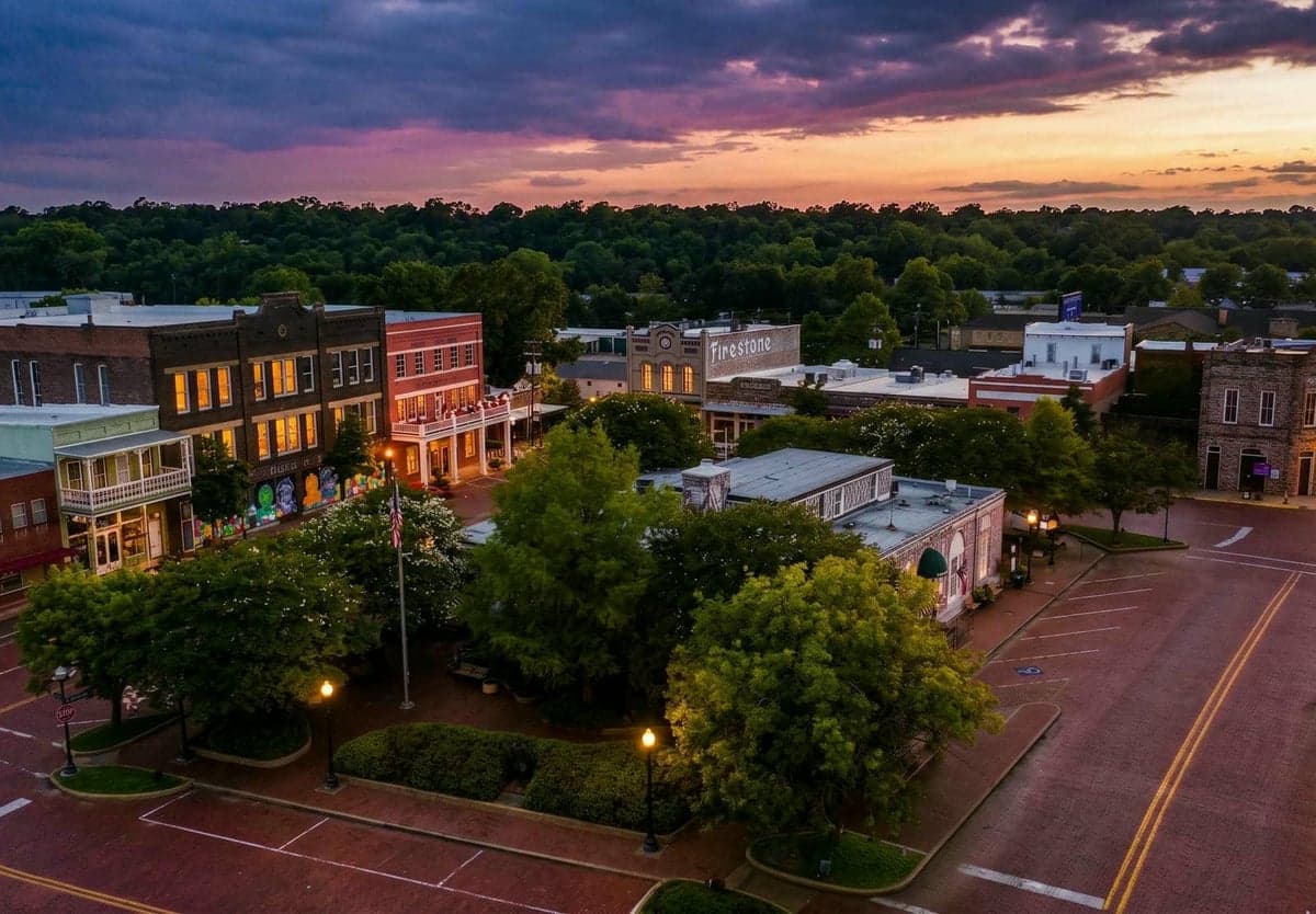
Strategic Assessment of Nacogdoches, TX
Meaningful friction. Expect exposure to either population pressure, blast zones, or natural disaster risk. Consider buying a retreat property.
What does the Strategic Assessment tell us?
Our Strategic Assessment grades tactical survivability of an area. Major population centers, military targets, fallout zones, natural disasters, and border exposure all drive risk — lower exposure means a more defensible position in a crisis.
This is heavily inspired by Joel Skousen's Strategic Relocation book. Highly recommended you checkout the book ($)What does this tell us?
Our Strategic Assessment grades tactical survivability of an area. Major population centers, military targets, fallout zones, natural disasters, and border exposure all drive risk — lower exposure means a more defensible position in a crisis.
This is heavily inspired by Joel Skousen's Strategic Relocation book. Highly recommended you checkout the book ($)Strategic Pillars

Key Distances
Regional Safe Places
Below is our recommended "safe zones" in Texas and the surrounding area based on our strategic heuristics. For most people, it's unrealistic to live in a “safe zone” full-time due to work, family or other personal reasons. They tend to be more rural. However, many of these areas are perfect for second homes and retreat properties that double as a vacation home or even a short-term rental.


Important Note: For informational purposes only. This does not mean nothing bad ever happens in the green zones. Please use common sense. This is based on public data and modeled with AI. We tried to take a conservative approach but mistakes happen. We update this regularly as new information becomes available.
Solar Generator Recommendations
Backup power matters more here than in safer locations. We've picked three solar generators across budgets and capacity tiers — start with the budget unit if you only need a few essentials, or step up if you want to run a fridge and HVAC for days at a time.

Jackery Portable Power Station Explorer 300
Budget OptionPower on the Go: Weighing only 11 lbs, it's convenient to set up and store with book-sized foldable solar panels

BLUETTI Portable Power Station AC180
Designed for both indoor and outdoor scenarios, AC180 is highly capable as it has a robost capacity and continuous output power.

EF ECOFLOW DELTA Pro Ultra Power Station
Upgraded PickEcoFlow DELTA Pro Ultra is a whole-home energy system designed to grow with your family. Integrated with the Smart Home Panel 2, it scales to meet your evolving energy needs — keeping your home powered, intelligent, and secure through every stage of life.
We earn a commission, at no additional cost to you.
Strategic Assessment Analysis
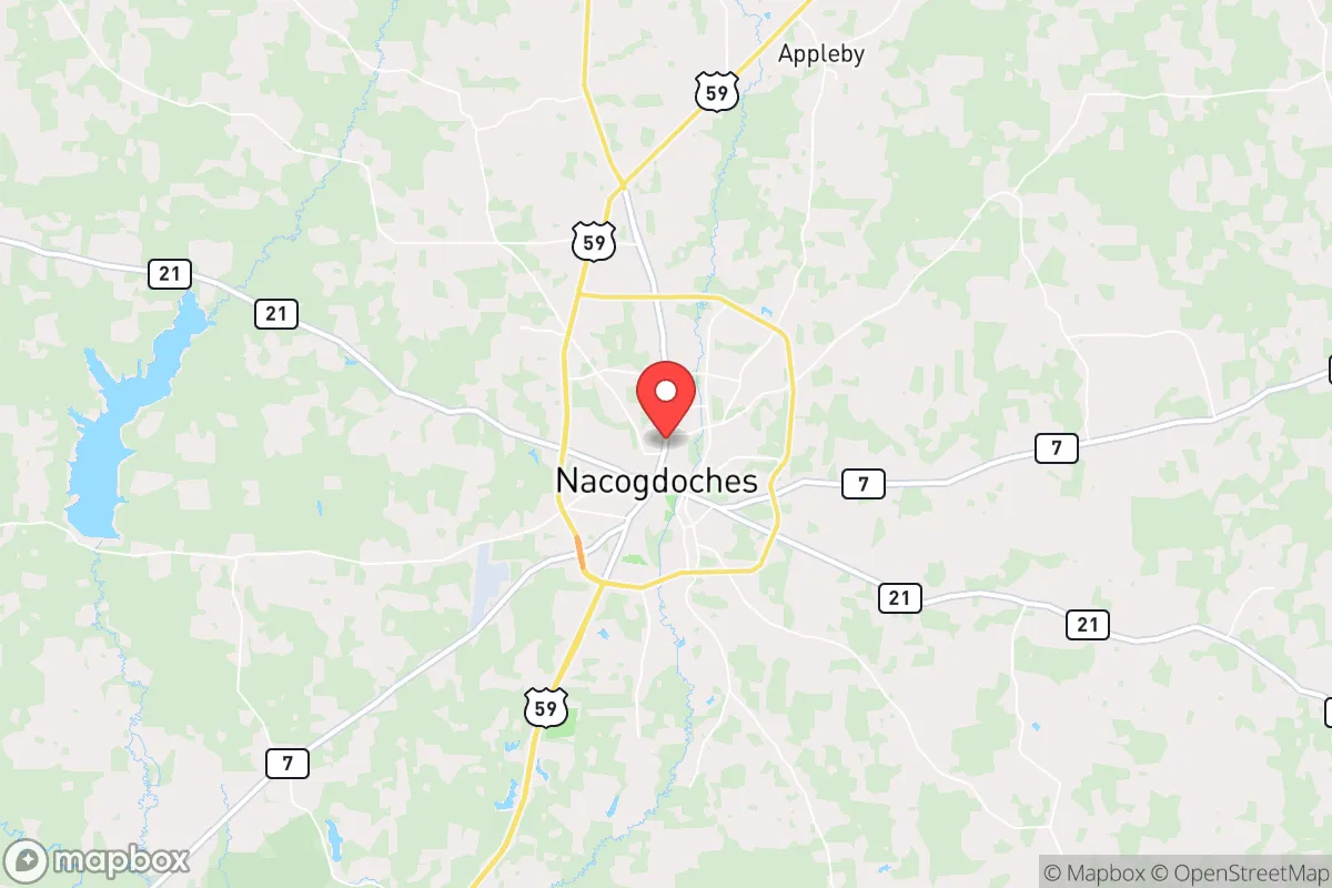
Nacogdoches, Texas, offers a compelling strategic position for those prioritizing resilience and self-sufficiency, sitting roughly 140 miles north of Houston and 160 miles east of Dallas—close enough to access major supply chains but far enough to avoid the immediate fallout of urban collapse. Its location in the Piney Woods region provides natural barriers, abundant water, and a lower population density that makes it a viable hub for a long-term preparedness posture. For a conservative-leaning relocator concerned with societal instability, this town’s blend of historical isolation and modern infrastructure presents a rare balance of retreat and practicality.
Geographic position and natural advantages for long-term security
Nacogdoches sits in the heart of the Deep East Texas timberlands, a region characterized by dense pine forests, rolling hills, and a network of rivers and creeks that offer both natural cover and reliable water sources. The area’s elevation—around 300 feet above sea level—keeps it above most flood zones, while the proximity to the Angelina National Forest and Sam Rayburn Reservoir provides a buffer against urban sprawl. The climate is humid subtropical, with hot summers and mild winters, which supports year-round gardening and livestock grazing, a key advantage for food independence. The town itself is anchored by Stephen F. Austin State University, which brings a modest but stable economic base, but the surrounding county (Nacogdoches County) has a population density of just 55 people per square mile—low enough to reduce competition for resources during a crisis. The major highways, US-59 and TX-7, offer evacuation routes north toward Arkansas or west toward I-45, but they also serve as potential chokepoints for movement; a savvy relocator would identify secondary dirt roads and forest service trails for discreet travel.
Risks, exposures, and proximity to fallout-relevant landmarks
The primary strategic downside is Nacogdoches’ relative proximity to several high-risk targets. It lies about 90 miles from the Sabine River border with Louisiana, which hosts the Sabine Pass LNG terminal and the Port Arthur petrochemical complex—both potential targets for sabotage or industrial accidents. The city is also within 120 miles of the Dallas-Fort Worth metroplex and 140 miles of Houston, meaning that a major urban collapse or nuclear event in either city could send refugees streaming east along US-59. The nearby Lufkin (20 miles west) and Nacogdoches’ own small airport (a general aviation field) are minor concerns, but the real threat is the region’s reliance on the electrical grid: the Piney Woods are part of the ERCOT system, which has proven vulnerable to winter storms (as in 2021) and cyberattacks. Natural disaster risks include tornadoes (the area is in Tornado Alley’s eastern fringe) and occasional ice storms, but these are manageable with proper preparation. The area’s lack of major military bases or nuclear facilities within 50 miles is a net positive, though the nearby Sam Rayburn Dam (a hydroelectric facility) could be a target for sabotage or a secondary hazard if breached.
Practical resilience for a relocator: food, water, energy, and defensibility
For a prepper or survivalist, Nacogdoches excels in the basics. Water is abundant: the Attoyac River, Banita Creek, and numerous springs provide surface water, and the average annual rainfall of 50 inches means rainwater catchment is highly viable. The local water table is shallow (20-40 feet in most areas), making well drilling affordable and effective. Food production is supported by a long growing season (March to November) and fertile sandy loam soils; the area is known for its peach orchards and pecan groves, and small-scale livestock (chickens, goats, cattle) is common among rural landowners. The local economy includes a handful of feed stores, hardware suppliers, and a Tractor Supply Co., which are critical for pre-collapse stockpiling. Energy resilience is a mixed bag: the grid is unreliable, but solar potential is decent (4.5-5 peak sun hours per day), and wood heating is practical given the abundant timber. Defensibility is strong for a rural property—dense forests provide natural concealment, and the low population density means fewer neighbors to worry about. The town itself has a small police force and a county sheriff’s office, but in a prolonged crisis, law enforcement would be stretched thin; a relocator should plan for self-defense and community mutual aid. The local gun culture is robust, with several gun shops and ranges, and Texas’s constitutional carry laws are favorable. The biggest vulnerability is the town’s reliance on a single major highway (US-59) for resupply; a bridge failure or roadblock could isolate the area, so stockpiling six months of essentials is prudent.
Overall, Nacogdoches presents a solid strategic option for a conservative relocator seeking a balance between isolation and access. It’s not a hardened bunker location—it’s too close to urban corridors and grid-dependent for that—but it offers a realistic, livable base for weathering moderate-to-severe disruptions. The key is to secure a property with its own water source, solar backup, and defensible perimeter, and to build relationships with like-minded locals before the crisis hits. For those willing to trade the absolute remoteness of West Texas for better water and cover, Nacogdoches is a smart, under-the-radar choice in a volatile world.
* Values derived from national, state, county, city and local statistics and may differ in a specific area. Last updated: 2026-05-12T15:29:53.000Z
Narrative content on this page is AI-generated and may contain mistakes. Verify any details that matter before acting on them.
ReloMaps may earn a commission from affiliate links at no extra cost to you.