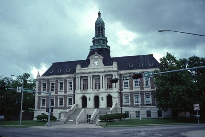
Photo: Wikipedia
Strategic Assessment of Hall County
Workable tactical position. Some exposure to population density or targets, but generally defensible in a crisis.
What does the Strategic Assessment tell us?
Our Strategic Assessment grades tactical survivability of an area. Major population centers, military targets, fallout zones, natural disasters, and border exposure all drive risk — lower exposure means a more defensible position in a crisis.
This is heavily inspired by Joel Skousen's Strategic Relocation book. Highly recommended you checkout the book ($)What does this tell us?
Our Strategic Assessment grades tactical survivability of an area. Major population centers, military targets, fallout zones, natural disasters, and border exposure all drive risk — lower exposure means a more defensible position in a crisis.
This is heavily inspired by Joel Skousen's Strategic Relocation book. Highly recommended you checkout the book ($)Strategic Pillars

Key Distances
Strategic Assessment Analysis
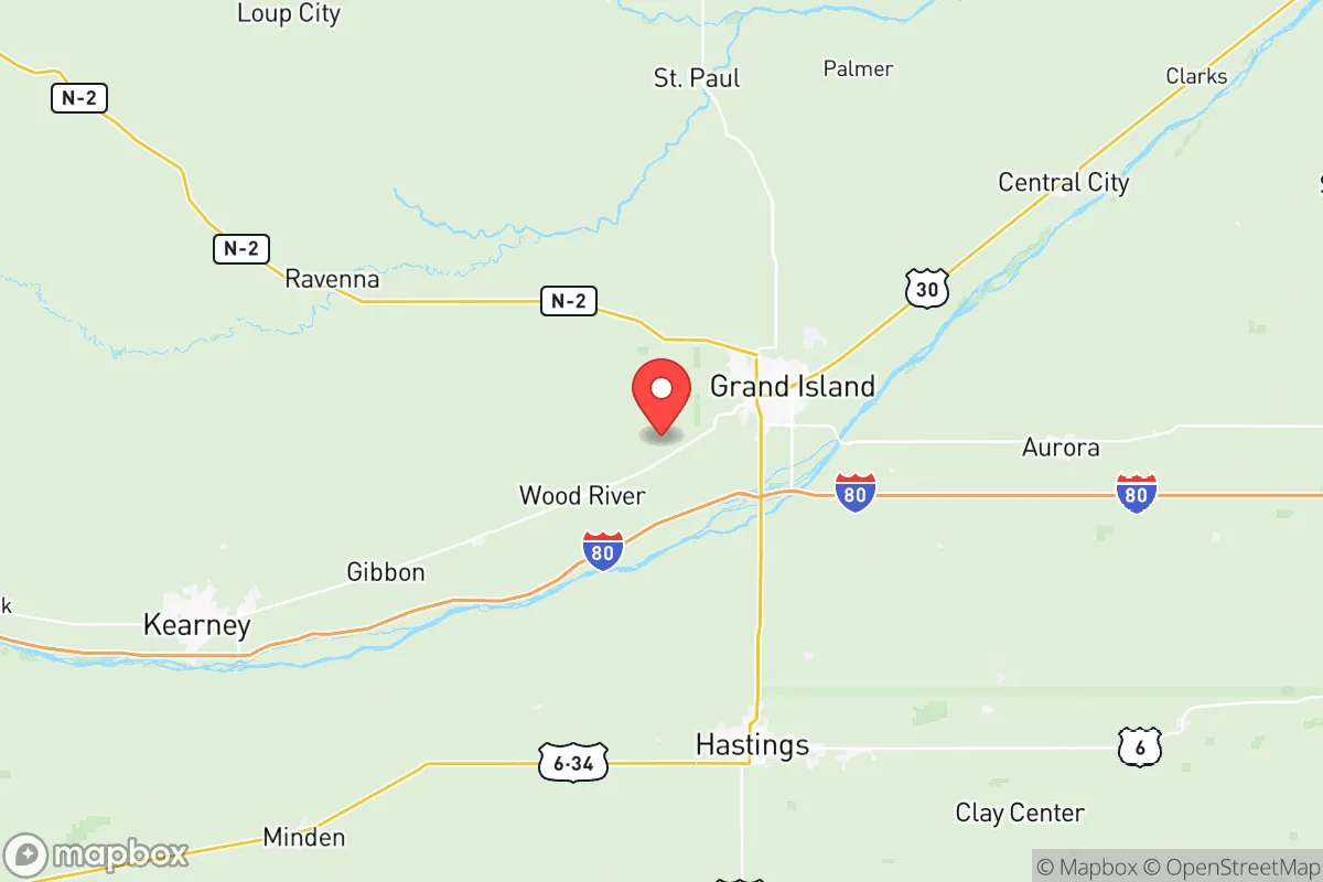
Hall County, Nebraska, offers a strategic relocation option for those prioritizing resilience and distance from major population centers, anchored by the city of Grand Island. Its position along the Platte River and Interstate 80 provides a solid logistical backbone without the vulnerabilities of a major metro hub. For a conservative-leaning individual or family focused on preparedness, this area represents a balance of accessibility and buffer—close enough to supply chains but far enough from the chaos of coastal or urban collapse zones.
Geographic position and natural advantages for long-term stability
Hall County sits in the heart of Nebraska's Platte River Valley, a region historically known for its agricultural productivity and stable climate patterns. The county's geography is defined by flat to gently rolling plains, with the Platte River running through its southern half, providing a reliable freshwater source. Grand Island, the county seat and largest city (population roughly 50,000), is the economic and logistical hub, but the surrounding rural areas offer ample space for self-sufficient living. The county's location along Interstate 80 places it roughly 90 miles west of Lincoln and 150 miles west of Omaha, meaning you're within a few hours' drive of those cities' resources—hospitals, supply depots, and rail hubs—without being in their immediate fallout or unrest zones. The Union Pacific rail line also runs through Grand Island, a key freight corridor that could become critical for moving goods during disruptions. The Platte River itself is a shallow, braided river that historically supported irrigation and wildlife, making it a viable water source for off-grid setups, though it requires treatment for drinking. The area's low population density—about 150 people per square mile in the county, with much of that concentrated in Grand Island—means you're not competing for resources with millions of neighbors.
Risks, exposures, and proximity to fallout-relevant landmarks
Hall County's primary risk exposure comes from its position along the I-80 corridor, which could become a chokepoint or target during large-scale civil unrest or a major disaster. The interstate is a primary east-west artery, and any disruption—whether from a natural disaster, a fuel shortage, or a coordinated attack—could funnel displaced populations or military movements through the area. Grand Island itself has a few industrial sites worth noting: the Grand Island Regional Airport is a general aviation facility that could be used for emergency logistics but also represents a potential target for aerial threats. The county is home to several large grain elevators and ethanol plants (e.g., the Green Plains ethanol facility near Wood River), which are industrial landmarks that could attract attention in a resource-scarce scenario. More critically, Hall County is about 100 miles from the Nebraska Army National Guard's Camp Ashland training site and roughly 150 miles from Offutt Air Force Base near Omaha—a major command and control center. While these are not direct fallout zones, they could become secondary targets or staging areas during a conflict, potentially drawing military activity into the region. The county's flat terrain offers little natural cover, which is a disadvantage for concealment but a boon for long-range visibility. Tornadoes are the most common natural hazard, with the area sitting in Tornado Alley; the 1980 Grand Island tornado outbreak is a historical reminder that severe weather can level neighborhoods. Flooding along the Platte River is a periodic risk, particularly in spring, but the river's shallow nature limits catastrophic flooding compared to larger rivers.
Practical resilience for a relocator: food, water, energy, and defensibility
For a relocator serious about self-sufficiency, Hall County's agricultural base is a major asset. The county is part of Nebraska's Corn Belt, with vast fields of corn, soybeans, and alfalfa, plus a strong cattle ranching presence. This means local food production is robust, and you can source grains, meat, and dairy directly from farms or co-ops. The Platte River provides a surface water source, but groundwater is abundant via the Ogallala Aquifer, which underlies much of the region—well drilling is feasible and relatively affordable for those with land. Energy infrastructure is decent: Grand Island has its own municipal power utility (Grand Island Utilities) that runs on a mix of natural gas and renewables, but off-grid solar is viable given the area's 200+ sunny days per year. The flat terrain makes wind power a strong option too, though you'll need to check local zoning. Defensibility is mixed: the open plains offer clear sightlines, which is good for perimeter awareness, but they also mean you're exposed. A rural property with a good well, solar panels, and a root cellar could be very sustainable, but you'd need to plan for long-range security—think fences, dogs, and a community network. The county's population is predominantly conservative and rural, with a strong sense of neighborly self-reliance; church groups, farm cooperatives, and local gun clubs are common, which can form the basis of a mutual aid network. Grand Island has a few hospitals (CHI Health St. Francis) and a regional airport, but in a prolonged crisis, you'd want to stockpile medical supplies and learn basic field medicine. The biggest practical challenge is the harsh winter: temperatures regularly drop below freezing from November to March, with occasional blizzards that can cut roads for days. A wood stove, propane backup, and a four-wheel-drive vehicle are essentials.
The overall strategic picture for Hall County is one of calculated trade-offs. You get a low-population, agriculturally rich area with decent water and energy resources, far from the coastal megacities and their associated risks of civil unrest, nuclear fallout, or supply chain collapse. The proximity to I-80 and rail lines is a double-edged sword—it gives you access to trade and evacuation routes but also makes you a potential waypoint for chaos. The flat terrain and tornado risk are genuine downsides, but they're manageable with proper planning. For a conservative prepper who values community, land, and distance from the fray, Hall County offers a solid foundation—just don't expect to go completely unnoticed. The key is to secure a rural property outside Grand Island, build relationships with local farmers and ranchers, and treat the county as a base camp rather than a fortress. It's not a bunker, but it's a place where you can live, grow food, and ride out the storm with a fighting chance.
* Values derived from national, state, county, city and local statistics and may differ in a specific area. Last updated: 2026-05-23T21:58:33.000Z
Narrative content on this page is AI-generated and may contain mistakes. Verify any details that matter before acting on them.
ReloMaps may earn a commission from affiliate links at no extra cost to you.