
Photo: Wikipedia
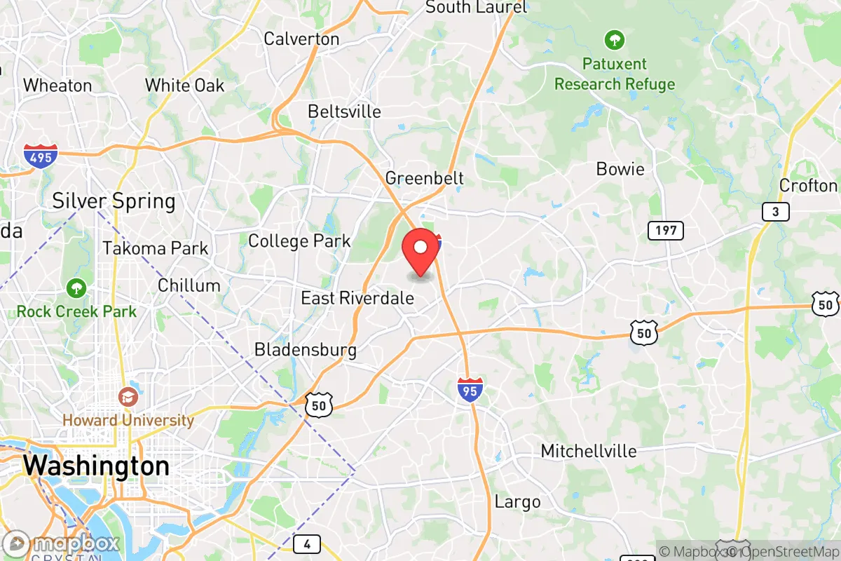
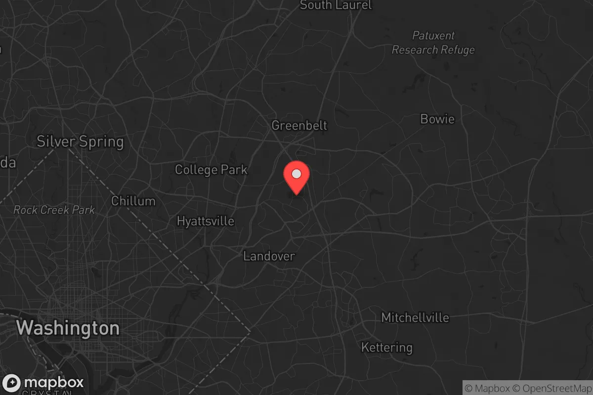
Strategic Assessment of New Carrollton, MD
Multiple tactical vulnerabilities. Population density, target proximity, or disaster risk are likely compounding. A retreat property and exit planning is required.
What does the Strategic Assessment tell us?
Our Strategic Assessment grades tactical survivability of an area. Major population centers, military targets, fallout zones, natural disasters, and border exposure all drive risk — lower exposure means a more defensible position in a crisis.
This is heavily inspired by Joel Skousen's Strategic Relocation book. Highly recommended you checkout the book ($)What does this tell us?
Our Strategic Assessment grades tactical survivability of an area. Major population centers, military targets, fallout zones, natural disasters, and border exposure all drive risk — lower exposure means a more defensible position in a crisis.
This is heavily inspired by Joel Skousen's Strategic Relocation book. Highly recommended you checkout the book ($)Strategic Pillars

Key Distances
Regional Safe Places
Below is our recommended "safe zones" in Maryland and the surrounding area based on our strategic heuristics. For most people, it's unrealistic to live in a “safe zone” full-time due to work, family or other personal reasons. They tend to be more rural. However, many of these areas are perfect for second homes and retreat properties that double as a vacation home or even a short-term rental.


Important Note: For informational purposes only. This does not mean nothing bad ever happens in the green zones. Please use common sense. This is based on public data and modeled with AI. We tried to take a conservative approach but mistakes happen. We update this regularly as new information becomes available.
Solar Generator Recommendations
Backup power matters more here than in safer locations. We've picked three solar generators across budgets and capacity tiers — start with the budget unit if you only need a few essentials, or step up if you want to run a fridge and HVAC for days at a time.

Jackery Portable Power Station Explorer 300
Budget OptionPower on the Go: Weighing only 11 lbs, it's convenient to set up and store with book-sized foldable solar panels

BLUETTI Portable Power Station AC180
Designed for both indoor and outdoor scenarios, AC180 is highly capable as it has a robost capacity and continuous output power.

EF ECOFLOW DELTA Pro Ultra Power Station
Upgraded PickEcoFlow DELTA Pro Ultra is a whole-home energy system designed to grow with your family. Integrated with the Smart Home Panel 2, it scales to meet your evolving energy needs — keeping your home powered, intelligent, and secure through every stage of life.
We earn a commission, at no additional cost to you.
Strategic Assessment Analysis
New Carrollton, Maryland, sits in a precarious strategic position that demands a clear-eyed assessment for anyone serious about long-term preparedness. While its location along the Washington D.C. beltway offers immediate access to federal employment and infrastructure, that same proximity makes it a high-risk zone for any scenario involving civic unrest, mass casualty events, or large-scale disaster. For the conservative prepper or survivalist, this is not a relocation destination for bugging in—it is a transit hub to be understood, avoided for permanent settlement, and used only as a temporary staging point before moving to more defensible ground.
Geographic position and natural advantages for a prepper
New Carrollton’s geography is defined by its role as a transportation nexus. It sits at the intersection of the Capital Beltway (I-495), the Baltimore-Washington Parkway, and the MARC and Amtrak rail lines, including the Northeast Corridor. This makes it a natural chokepoint for movement in and out of the D.C. metro area. For a relocator, the only strategic advantage here is the ability to monitor and potentially intercept movement along these corridors during an evacuation. The area is flat and heavily developed, with little in the way of natural cover or defensible terrain. The nearby Patuxent River and Anacostia River watersheds offer some water access, but these are urban waterways subject to contamination and heavy traffic. There are no significant elevation changes, no dense forests, and no natural barriers that would slow down a determined mob or military unit. The soil is primarily clay-based, making gardening difficult without significant amendment, and the water table is high, which complicates any deep well drilling. In short, the natural advantages are minimal—this is a suburb, not a homestead.
Risks, exposures, and proximity to fallout-relevant landmarks
The single greatest risk for a prepper in New Carrollton is its proximity to high-value federal targets. You are roughly 8 miles from the U.S. Capitol, 10 miles from the Pentagon, and within the blast radius of any nuclear or conventional strike on the D.C. metro area. The area is also adjacent to Joint Base Andrews (home of Air Force One) and the Goddard Space Flight Center, both of which are likely targets in a conflict. During a mass casualty event or civil unrest, New Carrollton would be in the direct path of anyone fleeing D.C. or Baltimore—the beltway and rail lines become escape corridors, but also vectors for violence and looting. The population density is high (over 4,000 people per square mile), and the housing stock is dominated by townhouses and apartment complexes with little defensible space. The local police force is the Prince George’s County Police, which is understaffed and has faced criticism for response times. In a grid-down scenario, expect law enforcement to be overwhelmed within hours. The area also sits on the fall line, meaning it is prone to flash flooding during heavy rain events, which can cut off road access and contaminate water supplies.
Practical resilience for a relocator: food, water, energy, and defensibility
For a single individual or family considering a move here, the practical resilience picture is poor. Food security is almost entirely dependent on grocery stores and supply chains—there is no significant local agriculture, and the few community gardens are small and vulnerable. Water is supplied by the Washington Suburban Sanitary Commission (WSSC), which draws from the Potomac and Patuxent rivers. In a prolonged outage, the system would fail, and the area has no backup wells or natural springs of any volume. Energy comes from the PJM Interconnection grid, which is reliable in normal times but vulnerable to cyberattack or physical sabotage—the nearby power substations are unguarded and easily targeted. Defensibility is the weakest point. The typical home here is a townhouse with shared walls, limited sightlines, and no perimeter. A single-family home with a yard is rare and expensive. There are no natural chokepoints to defend, and the street grid is designed for car traffic, not security. For a prepper, the best use of New Carrollton is as a temporary base to stock supplies and then move west or north to the Appalachian foothills. If you are forced to stay, your best bet is to identify a multi-unit building with a secure interior courtyard and a rooftop access point for observation, and to build relationships with neighbors who share your mindset—but this is a long shot in a transient, rental-heavy area.
The overall strategic picture for New Carrollton is clear: it is a high-risk, low-resilience location that offers no natural advantages for a survivalist or conservative prepper. Its only value is as a transit node for monitoring movement or as a temporary staging area before a planned relocation to a more defensible region. The proximity to D.C. and Baltimore, the lack of defensible terrain, the dependence on fragile infrastructure, and the high population density all point to a location that should be avoided for any long-term preparedness plan. If you are serious about resilience, look to the Shenandoah Valley, the Allegheny Mountains, or the Eastern Shore—anywhere with space, water, and distance from the blast zones. New Carrollton is a place to pass through, not to dig in.
* Values derived from national, state, county, city and local statistics and may differ in a specific area. Last updated: 2026-04-22T02:39:31.000Z
Narrative content on this page is AI-generated and may contain mistakes. Verify any details that matter before acting on them.
ReloMaps may earn a commission from affiliate links at no extra cost to you.