Strategic Assessment of Mckinley County
Strong survivability profile. Good buffer from population centers, with manageable environmental and tactical risks.
What does the Strategic Assessment tell us?
Our Strategic Assessment grades tactical survivability of an area. Major population centers, military targets, fallout zones, natural disasters, and border exposure all drive risk — lower exposure means a more defensible position in a crisis.
This is heavily inspired by Joel Skousen's Strategic Relocation book. Highly recommended you checkout the book ($)What does this tell us?
Our Strategic Assessment grades tactical survivability of an area. Major population centers, military targets, fallout zones, natural disasters, and border exposure all drive risk — lower exposure means a more defensible position in a crisis.
This is heavily inspired by Joel Skousen's Strategic Relocation book. Highly recommended you checkout the book ($)Strategic Pillars

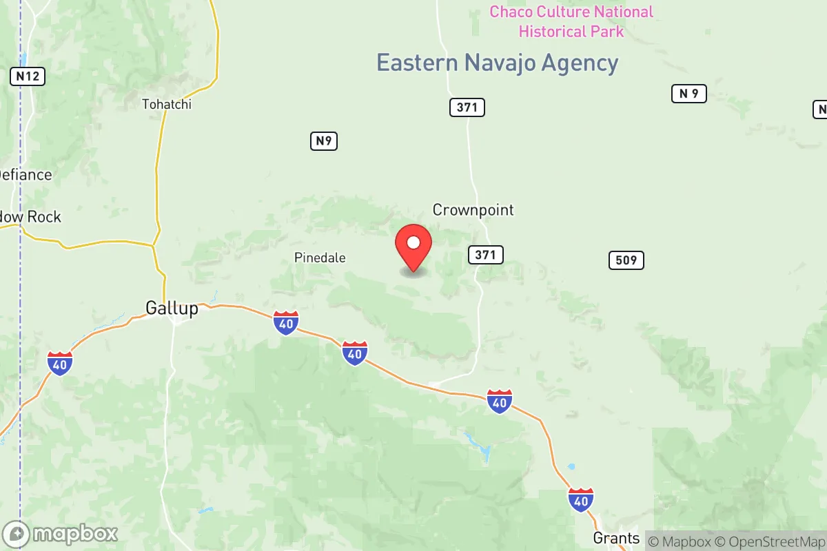
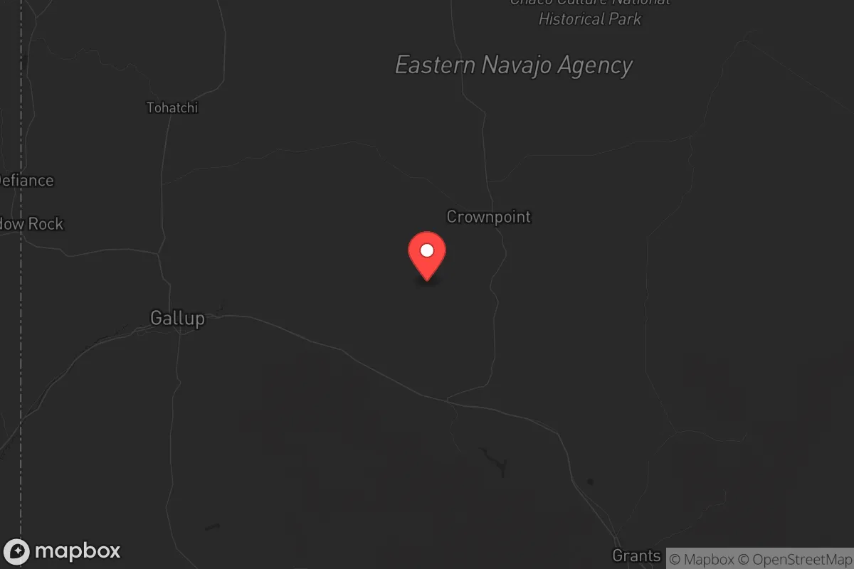
Key Distances
Strategic Assessment Analysis
McKinley County, New Mexico, offers a strategic relocation option for those prioritizing distance from major population centers and critical infrastructure vulnerabilities, though it comes with its own set of trade-offs. Located in the northwestern part of the state, the county's seat is Gallup, a town of roughly 21,000 people that serves as a regional hub. The area's primary advantage is its remoteness—far from the Interstate 25 corridor and the Rio Grande Valley's concentrated population, including Albuquerque and Santa Fe. This isolation provides a buffer against the cascading effects of urban unrest, grid collapse, or a mass casualty event targeting high-value targets like the Los Alamos National Laboratory or the Permian Basin's energy infrastructure. However, the county's proximity to the Navajo Nation and the Four Corners region introduces unique cultural and logistical considerations that a relocator must weigh carefully.
Geographic position and natural advantages for long-term security
McKinley County sits at the intersection of several geographic features that enhance its resilience. The county is part of the Colorado Plateau, characterized by high desert terrain with elevations ranging from 6,000 to 8,000 feet. This elevation provides a cooler climate than lower desert areas, reducing heat-related risks and supporting limited agriculture with careful water management. The region's primary water source is the Rio Puerco and the San Juan River basin, though surface water is scarce and groundwater access varies significantly—well drilling can be deep and expensive, often exceeding 500 feet. The area's natural defenses include rugged canyons and mesa tops that offer defensible positions, but the open terrain also means long lines of sight for potential threats. The county's sparse population density—roughly 6 people per square mile—means fewer neighbors and less competition for resources, but also fewer immediate support networks. For a relocator, the key advantage is the distance from major military targets: Gallup is over 150 miles from the nearest major military installation, Kirtland Air Force Base in Albuquerque, and more than 200 miles from the strategic nuclear assets at Los Alamos. This buffer zone significantly reduces the risk of direct fallout from a targeted strike on those facilities.
Risks, exposures, and proximity to fallout-relevant landmarks
While McKinley County avoids the immediate blast zones of major cities, it is not without its own exposure risks. The county is bisected by Interstate 40, a major east-west transportation corridor that could become a target for disruption or a chokepoint during a crisis. The nearby Four Corners area hosts the Four Corners Generating Station and the San Juan Generating Station, both coal-fired power plants that, while decommissioned or scaled back, still represent industrial landmarks that could be targeted for sabotage or collateral damage. More critically, the county lies within 100 miles of the Navajo Nation's uranium mining legacy, including abandoned mines and mill tailings near Church Rock and Crownpoint. A mass casualty event or natural disaster could disturb these sites, releasing radioactive dust into the air and water—a slow-burn hazard rather than an immediate blast. Additionally, the county's proximity to the Jicarilla Apache Nation and the Zuni Pueblo means that any large-scale unrest could involve complex jurisdictional issues between federal, state, and tribal authorities, complicating law enforcement and emergency response. The risk of civil unrest in Gallup itself is moderate; the town has a history of economic hardship and substance abuse issues, but the local population is generally insular and community-oriented, which could either foster cooperation or create friction with newcomers.
Practical resilience for a relocator: food, water, energy, and defensibility
For a relocator focused on self-sufficiency, McKinley County presents a mixed picture. Water is the most critical limiting factor. The county averages only 10-12 inches of precipitation annually, and most residential wells produce low yields—often less than 5 gallons per minute. Rainwater harvesting is feasible but requires substantial storage capacity, and the arid climate means evaporation is a constant concern. Gallup's municipal water supply comes from the San Juan River via the Navajo-Gallup Water Supply Project, a pipeline that could be vulnerable to disruption during a regional crisis. For off-grid living, a property with a reliable well and a backup solar-powered pump is essential. Food production is challenging due to the short growing season (May to September) and poor soil quality. Raised beds with imported soil and drip irrigation are the most practical approach, but large-scale gardening is not realistic without significant investment. The county's energy profile is more favorable: abundant sunshine makes solar power a viable primary source, and wind speeds are moderate enough for small-scale turbines. Wood for heating is available from piñon-juniper forests, but these are slow-growing and require careful management. Defensibility varies by property: canyon-edge homes offer natural barriers, while valley-floor properties are more exposed. The county's law enforcement presence is thin—the McKinley County Sheriff's Office has about 40 deputies for a 5,400-square-mile area—meaning that personal security and community watch systems are critical. The nearest Level 1 trauma center is in Albuquerque, over 140 miles away, so medical emergencies require either self-treatment or a long evacuation.
The overall strategic picture for McKinley County is one of calculated isolation with significant trade-offs. For a conservative-leaning relocator seeking to escape the vulnerabilities of urban centers and critical infrastructure targets, the county offers a genuine buffer zone—far from the refinery corridors of Houston, the military concentrations of Fort Hood and White Sands, and the political flashpoints of Santa Fe and Albuquerque. The remoteness is both a shield and a burden: you gain distance from fallout and unrest, but you lose access to medical care, supply chains, and community support. The county's demographic reality—over 70% Native American, with a median household income around $35,000—means that cultural integration is not optional; it is a prerequisite for long-term stability. A relocator who arrives with a cooperative mindset, practical skills, and a willingness to invest in water infrastructure can carve out a defensible niche. But this is not a place for the unprepared or the ideologically rigid. McKinley County rewards patience and self-reliance, but it punishes complacency and isolationism. If your goal is to be out of the blast radius and off the grid, this area deserves a hard look—just be ready to dig a deep well and make some neighbors.
* Values derived from national, state, county, city and local statistics and may differ in a specific area. Last updated: 2026-06-01T12:55:37.000Z
Narrative content on this page is AI-generated and may contain mistakes. Verify any details that matter before acting on them.
ReloMaps may earn a commission from affiliate links at no extra cost to you.