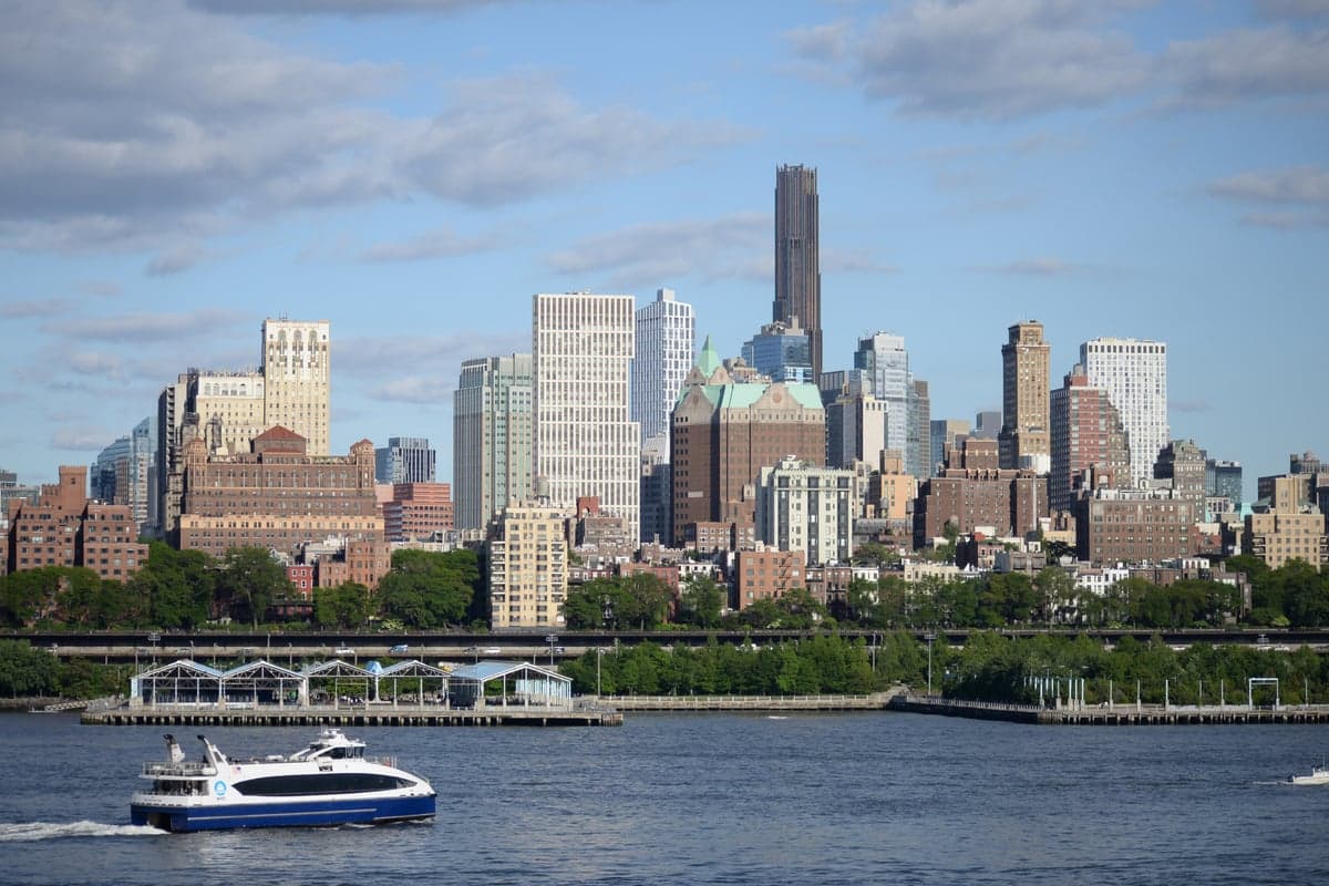
Photo: Wikipedia
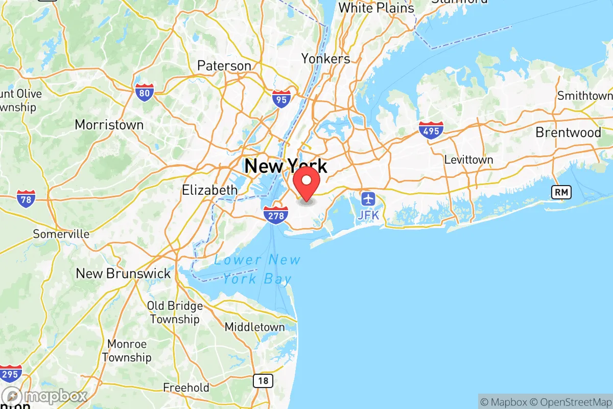
Strategic Assessment of Kings County
High tactical risk. This location is likely close to major population centers, strategic targets, or sits in a high-disaster corridor. A retreat property and careful exit planning is required.
What does the Strategic Assessment tell us?
Our Strategic Assessment grades tactical survivability of an area. Major population centers, military targets, fallout zones, natural disasters, and border exposure all drive risk — lower exposure means a more defensible position in a crisis.
This is heavily inspired by Joel Skousen's Strategic Relocation book. Highly recommended you checkout the book ($)What does this tell us?
Our Strategic Assessment grades tactical survivability of an area. Major population centers, military targets, fallout zones, natural disasters, and border exposure all drive risk — lower exposure means a more defensible position in a crisis.
This is heavily inspired by Joel Skousen's Strategic Relocation book. Highly recommended you checkout the book ($)Strategic Pillars

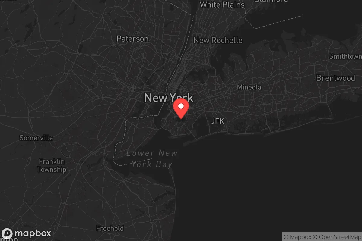
Key Distances
Strategic Assessment Analysis
Kings County, New York—better known as Brooklyn—presents a complex strategic picture for the conservative-leaning relocator focused on resilience, self-sufficiency, and long-term preparedness. While its dense urban fabric and coastal exposure are immediate red flags, the borough’s position within the New York City metropolitan area offers certain logistical advantages that a savvy prepper can leverage, provided they understand the risks. This analysis evaluates Kings County through a survivalist lens, weighing its geographic assets against its vulnerabilities to civic unrest, infrastructure failure, and fallout-related events.
Geographic position and natural advantages for a prepared relocator
Brooklyn sits on the western tip of Long Island, bordered by the Upper New York Bay to the west and the Atlantic Ocean to the south. Its location provides direct access to major waterways, including the East River and the Gowanus Canal, which could serve as alternative transportation routes if road networks become compromised. The borough’s proximity to John F. Kennedy International Airport and Port of New York and New Jersey—both within a 10-mile radius—means that in a crisis, supply chains might be re-routed through these hubs, though they would also be prime targets for disruption. For the relocator, the Jamaica Bay Wildlife Refuge and Prospect Park offer limited green space for small-scale foraging or water collection, but these are not substitutes for rural acreage. The area’s natural advantages are largely maritime: the coastline provides fishing opportunities, but the water quality in the bay is compromised by industrial runoff, making it a risky long-term food source without filtration. The borough’s flat topography offers no natural defensive high ground, a significant drawback for anyone planning to hold a position during unrest.
Risks, exposures, and proximity to fallout-relevant landmarks
Kings County is surrounded by high-value targets that make it a potential epicenter for fallout-related events. Brooklyn Navy Yard, a historic shipbuilding complex now repurposed for manufacturing and tech, remains a critical industrial asset that could attract sabotage or collateral damage. The Gowanus Canal Superfund site is a toxic liability—if a disaster ruptures containment, the area could become uninhabitable for years. The borough’s density—over 2.6 million residents in 71 square miles—means that any mass casualty event, whether from a chemical spill, terrorist attack, or grid failure, would overwhelm local hospitals like Brooklyn Methodist Hospital and Kings County Hospital Center. The Verrazzano-Narrows Bridge, connecting Brooklyn to Staten Island, is a single-point-of-failure chokepoint; its destruction would trap residents on Long Island. Additionally, the Red Hook Container Terminal handles hazardous materials, and a breach there could contaminate the southern neighborhoods. For the prepper, the sheer concentration of people and infrastructure means that civil unrest—triggered by food shortages, power outages, or political instability—would escalate rapidly, with few escape routes. The borough’s subway tunnels, while useful for concealment, are also flood-prone and could become death traps during a storm or attack.
Practical resilience for a relocator: food, water, energy, and defensibility
Securing basic necessities in Kings County is a formidable challenge. The borough relies entirely on external water sources—primarily the Delaware Aqueduct and Catskill/Delaware watersheds—meaning a disruption to that system would leave residents without potable water within days. Rainwater collection is possible but limited by rooftop space and pollution from urban runoff. Food storage is constrained by small apartment layouts; most residents lack the square footage for a 90-day supply. Community gardens exist in neighborhoods like Bedford-Stuyvesant and Park Slope, but they are not scalable for a population this dense. Energy dependence is another Achilles’ heel: the grid is old and vulnerable to cyberattacks, and natural gas lines—common in prewar buildings—pose explosion risks. Solar panels are impractical for most renters, and generators are noisy, attract attention, and require fuel that may be unavailable. Defensibility is poor: Brooklyn’s row houses and brownstones offer some cover, but the street grid is easily patrolled by hostile groups. The East River provides a natural barrier to Manhattan, but that also means escape routes are limited to bridges and tunnels, which would be contested. For the conservative relocator, the only viable resilience strategy here is to maintain a low profile, build a network of trusted neighbors, and have a pre-planned bug-out route to less populated areas upstate—such as the Catskill region or Orange County—within the first 24 hours of a major event.
The overall strategic picture for Kings County is one of high risk with limited reward for the survivalist-minded individual. Its economic and logistical importance makes it a likely target for both natural and man-made disasters, while its density and infrastructure fragility amplify every threat. For a single person or family willing to invest heavily in urban preparedness—think fortified apartments, water filtration systems, and off-grid communication gear—Brooklyn could serve as a temporary base for monitoring events before executing a rapid evacuation. But for anyone seeking a sustainable, defensible long-term location, the borough’s vulnerabilities far outweigh its advantages. The prudent conservative relocator would view Kings County as a place to pass through, not to plant roots, unless they are prepared to operate as a lone wolf in a high-stakes urban environment where the margin for error is razor-thin.
* Values derived from national, state, county, city and local statistics and may differ in a specific area. Last updated: 2026-06-05T13:16:54.000Z
Narrative content on this page is AI-generated and may contain mistakes. Verify any details that matter before acting on them.
ReloMaps may earn a commission from affiliate links at no extra cost to you.