Photo: Wikipedia
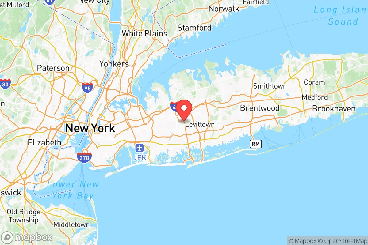
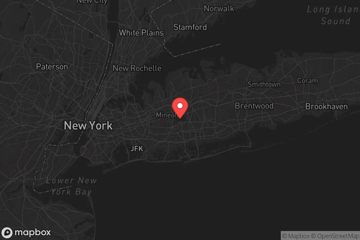
Strategic Assessment of Nassau County
High tactical risk. This location is likely close to major population centers, strategic targets, or sits in a high-disaster corridor. A retreat property and careful exit planning is required.
What does the Strategic Assessment tell us?
Our Strategic Assessment grades tactical survivability of an area. Major population centers, military targets, fallout zones, natural disasters, and border exposure all drive risk — lower exposure means a more defensible position in a crisis.
This is heavily inspired by Joel Skousen's Strategic Relocation book. Highly recommended you checkout the book ($)What does this tell us?
Our Strategic Assessment grades tactical survivability of an area. Major population centers, military targets, fallout zones, natural disasters, and border exposure all drive risk — lower exposure means a more defensible position in a crisis.
This is heavily inspired by Joel Skousen's Strategic Relocation book. Highly recommended you checkout the book ($)Strategic Pillars

Key Distances
Strategic Assessment Analysis
Nassau County, New York, presents a complex strategic picture for the conservative relocator seeking resilience. While its proximity to New York City offers economic advantages, that same closeness is a double-edged sword in a survivalist context, exposing the area to the full spectrum of urban collapse risks—from grid failure to civil unrest. The county’s true value lies in its coastal geography and dense suburban infrastructure, but these assets come with significant vulnerabilities that demand careful, prepper-minded assessment.
Geographic position and natural advantages for long-term survival
Nassau County occupies the western two-thirds of Long Island, bordered by the Atlantic Ocean to the south and Long Island Sound to the north. This peninsula geography provides a natural defensive buffer: any large-scale movement of people or resources must funnel through a narrow chokepoint at the Queens-Nassau border, near the Cross Island Parkway and the Throgs Neck Bridge corridor. For a relocator, this means the county is inherently defensible against mass migration from New York City, but only if that chokepoint is controlled. The county’s 115 miles of coastline, including towns like Long Beach, Jones Beach, and Oyster Bay, offer access to marine resources—fishing, shellfish, and desalination potential—that could sustain a household during supply chain disruptions. The North Shore’s glacial moraine topography, with its hills and wooded areas in places like Muttontown and Upper Brookville, provides limited but real terrain for concealment and small-scale agriculture. The area’s temperate climate, with four distinct seasons, allows for year-round gardening and livestock raising, though the growing season is shorter than the South’s. Groundwater from the Magothy aquifer, which underlies much of the county, is a critical asset—Nassau’s water supply is locally sourced, not piped from upstate, reducing dependency on long-haul infrastructure. However, the aquifer is shallow and vulnerable to saltwater intrusion and contamination, so a prepper should plan for well testing and filtration.
Risks, exposures, and proximity to fallout-relevant landmarks
The county’s strategic liabilities are substantial. Nassau sits within 20 miles of John F. Kennedy International Airport and LaGuardia Airport, both high-value targets for any mass-casualty event or electromagnetic pulse (EMP) attack. The Long Island Rail Road (LIRR) main line runs through the county’s spine, with major hubs at Jamaica and Hicksville—these are natural chokepoints for evacuation but also potential vectors for disease or civil unrest spillover from the city. The county hosts Mitchel Field, a former Air Force base now used for civilian aviation and New York Air National Guard operations, which could become a military staging area during a crisis, drawing unwanted attention. The Glen Cove and Port Washington areas have petroleum storage terminals along the Sound, making them secondary targets. More critically, Nassau’s dense suburban layout—with over 1.3 million residents in just 287 square miles—means that a single point of failure (a bridge collapse, a power substation outage) can cascade into gridlock and resource scarcity. The county’s reliance on the Robert Moses Causeway and Wantagh Parkway for coastal evacuation is a vulnerability; these roads are prone to flooding during nor’easters and storm surges. For the prepper, the proximity to New York City’s 8.5 million people is the overriding risk: any major event—pandemic, economic collapse, civil unrest—will push waves of desperate people eastward. The county’s police force, the Nassau County Police Department, is well-funded and professional, but it would be overwhelmed in a large-scale emergency, as seen during Superstorm Sandy in 2012 when looting and fuel shortages occurred.
Practical resilience for a relocator: food, water, energy, and defensibility
For a single individual or family looking to hunker down, Nassau offers a mixed bag. Food security is a challenge: the county has limited agricultural land, with most produce coming from the East End of Long Island (Suffolk County) or via the Hunts Point Market in the Bronx. A relocator should plan for at least a six-month supply of non-perishables, plus seeds for cold-hardy crops like kale, carrots, and potatoes. Community gardens exist in towns like Garden City and Hempstead, but they are small and often have waiting lists. Water security is more promising: the county’s public water system draws from the Magothy aquifer, and many homes have private wells, especially in the North Shore’s older estates. However, well owners must test for saltwater intrusion and nitrates, and a hand pump or solar-powered pump is essential for grid-down scenarios. Energy resilience is a weak point. Nassau’s grid is operated by PSEG Long Island, which has a history of outages during storms. Solar panels are viable—the county gets about 200 sunny days per year—but net metering policies are state-controlled and subject to change. Backup generators are common, but natural gas lines are vulnerable to earthquakes (rare but possible) and sabotage. For defensibility, the ideal property is a single-family home on a large lot (half-acre or more) in a low-density area like Old Westbury or Brookville, with a long driveway and sightlines to the road. The county’s many golf courses and parks, like Eisenhower Park, could become communal gathering points or refugee camps, so proximity to them is a double-edged sword. The Nassau County Police Department has a strong presence, but in a collapse scenario, law enforcement will prioritize the wealthy enclaves, leaving middle-class neighborhoods exposed. A relocator should invest in a good fence, a safe room, and a community network of like-minded neighbors—the county’s many homeowners’ associations can be leveraged for mutual aid, but they can also be a source of friction if they enforce restrictive covenants.
The overall strategic picture for Nassau County is one of calculated risk. It is not a bug-out location for the lone wolf—the density and proximity to New York City are too high. But for the relocator who values economic opportunity, existing infrastructure, and a strong local government, it can work as a semi-prepared base, provided you have the resources to ride out the first 30 days of a crisis. The key is to treat Nassau as a staging ground, not a final redoubt. Have a secondary location—perhaps a cabin in the Adirondacks or a property in Pennsylvania—and a plan to bug out if the city’s collapse becomes irreversible. For the conservative prepper who wants to stay close to family or work while maintaining a survivalist edge, Nassau County offers a viable, if imperfect, option. Just don’t expect it to be a fortress—it’s a suburb with a plan, not a bunker.
* Values derived from national, state, county, city and local statistics and may differ in a specific area. Last updated: 2026-05-12T07:33:07.000Z
Narrative content on this page is AI-generated and may contain mistakes. Verify any details that matter before acting on them.
ReloMaps may earn a commission from affiliate links at no extra cost to you.