Photo: Wikipedia
Strategic Assessment of Newport, KY
Multiple tactical vulnerabilities. Population density, target proximity, or disaster risk are likely compounding. A retreat property and exit planning is required.
What does the Strategic Assessment tell us?
Our Strategic Assessment grades tactical survivability of an area. Major population centers, military targets, fallout zones, natural disasters, and border exposure all drive risk — lower exposure means a more defensible position in a crisis.
This is heavily inspired by Joel Skousen's Strategic Relocation book. Highly recommended you checkout the book ($)What does this tell us?
Our Strategic Assessment grades tactical survivability of an area. Major population centers, military targets, fallout zones, natural disasters, and border exposure all drive risk — lower exposure means a more defensible position in a crisis.
This is heavily inspired by Joel Skousen's Strategic Relocation book. Highly recommended you checkout the book ($)Strategic Pillars

Key Distances
Regional Safe Places
Below is our recommended "safe zones" in Kentucky and the surrounding area based on our strategic heuristics. For most people, it's unrealistic to live in a “safe zone” full-time due to work, family or other personal reasons. They tend to be more rural. However, many of these areas are perfect for second homes and retreat properties that double as a vacation home or even a short-term rental.


Important Note: For informational purposes only. This does not mean nothing bad ever happens in the green zones. Please use common sense. This is based on public data and modeled with AI. We tried to take a conservative approach but mistakes happen. We update this regularly as new information becomes available.
Solar Generator Recommendations
Backup power matters more here than in safer locations. We've picked three solar generators across budgets and capacity tiers — start with the budget unit if you only need a few essentials, or step up if you want to run a fridge and HVAC for days at a time.

Jackery Portable Power Station Explorer 300
Budget OptionPower on the Go: Weighing only 11 lbs, it's convenient to set up and store with book-sized foldable solar panels

BLUETTI Portable Power Station AC180
Designed for both indoor and outdoor scenarios, AC180 is highly capable as it has a robost capacity and continuous output power.

EF ECOFLOW DELTA Pro Ultra Power Station
Upgraded PickEcoFlow DELTA Pro Ultra is a whole-home energy system designed to grow with your family. Integrated with the Smart Home Panel 2, it scales to meet your evolving energy needs — keeping your home powered, intelligent, and secure through every stage of life.
We earn a commission, at no additional cost to you.
Strategic Assessment Analysis
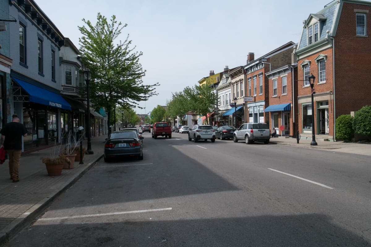
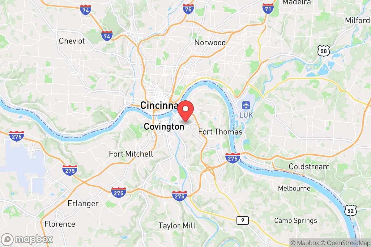
Newport, Kentucky, sits in a precarious strategic position that demands a hard-eyed assessment. While its location on the Ohio River offers genuine logistical advantages for a prepared relocator, its proximity to Cincinnati and the dense I-75 corridor introduces significant vulnerabilities that cannot be ignored. For a conservative-minded individual or family planning for civic unrest, mass casualty events, or systemic collapse, Newport presents a mixed picture: it offers some natural resilience features, but the surrounding urban density and critical infrastructure targets make it a location that requires constant vigilance and a well-developed exit plan.
Geographic position and natural advantages for long-term stability
Newport’s primary strategic asset is its position at the confluence of the Ohio and Licking Rivers. This provides a reliable, if not pristine, water source for filtration and basic needs, a factor that becomes critical during prolonged grid-down scenarios. The Ohio River valley also offers a degree of natural terrain shielding from the worst of a nuclear fallout plume originating from a distant strike on the East Coast, though this is a relative advantage, not a guarantee. The city itself sits on relatively flat ground, but the Kentucky hills rise quickly to the south and east, offering defensible terrain and potential retreat zones within a 30- to 60-minute drive. The local soil in surrounding Campbell County is workable for small-scale agriculture, and the growing season is long enough for a determined family to produce a meaningful portion of their own calories. However, the immediate urban footprint of Newport—dense housing, limited private green space, and a reliance on municipal water—means that true self-sufficiency within the city limits is nearly impossible. The real strategic value lies in using Newport as a forward operating base near urban resources, with a hardened retreat property in the hills of Pendleton or Bracken County as the primary fallback.
Risks, exposures, and proximity to fallout-relevant landmarks
The most glaring vulnerability is Newport’s location directly across the river from Cincinnati, a major metropolitan area of over 2 million people. In a scenario involving civil unrest, mass casualty events, or a coordinated attack, Cincinnati’s population density and critical infrastructure make it a high-probability target. The Brent Spence Bridge (I-71/I-75) is a notorious chokepoint that, if compromised, would trap tens of thousands of vehicles and effectively sever the primary north-south evacuation route. Newport itself hosts the Newport Naval Station (a decommissioned but still federally significant site) and is within 10 miles of the Cincinnati/Northern Kentucky International Airport (CVG), a major cargo hub that would be a prime target for disruption. The Ohio River’s many locks and dams, including the Markland Locks downstream, are vulnerable to sabotage or attack, which could disrupt barge traffic and potentially cause localized flooding. For the prepper, the key takeaway is that Newport sits in a "blast shadow" of a high-value urban target. Any event that destabilizes Cincinnati will immediately spill over into Newport, bringing refugees, resource scarcity, and potential violence. The city’s police force is small (roughly 50 sworn officers), and mutual aid from surrounding jurisdictions would be overwhelmed in a major crisis.
Practical resilience for a relocator: food, water, energy, and defensibility
For a single individual or family serious about preparedness, Newport demands a multi-layered approach. Water is the most immediate concern: the municipal supply comes from the Ohio River, treated at the Cincinnati Water Works. A prolonged power outage or contamination event would cut this supply within hours. A serious prepper should have a minimum of two weeks of stored water per person, plus a high-quality Berkey or similar gravity filter rated for river water. The Licking River is closer and less industrial than the Ohio, but still requires robust filtration. Food security is weak within the city. There are no major agricultural supply stores in Newport proper; the nearest reliable sources for bulk grains, seeds, and tools are in Alexandria (10 miles south) or the rural farm co-ops in Williamstown (40 miles south). Energy resilience is a mixed bag: Duke Energy provides grid power that is moderately reliable, but a determined household should invest in a solar generator (e.g., Goal Zero or Bluetti) with at least 2,000Wh capacity to run a fridge, lights, and communications for 48-72 hours. Natural gas is available in most of the city, which is a plus for cooking and heating if the grid fails but the gas lines remain intact. Defensibility is the weakest link. Newport’s street grid is open, with many attached homes and apartments. A single-family home with a fenced yard on a quiet side street (e.g., near the Mansion Hill area) offers the best chance of creating a defensible perimeter, but any prolonged siege scenario would likely force a retreat to a rural property. The city’s proximity to I-471 and I-275 provides rapid egress, but those same roads would become clogged with evacuees within hours of a major event. A prepper’s vehicle should be a reliable, fuel-efficient SUV or truck with a full tank and a pre-planned route to a secondary location in the hills.
The overall strategic picture for Newport is one of calculated risk. It offers genuine advantages—water access, proximity to the Ohio River valley’s agricultural potential, and a moderate climate—that make it a viable base for a prepared individual or family. But those advantages come with a heavy price: the constant threat of spillover from a major urban center, critical infrastructure vulnerabilities, and a built environment that is not designed for self-defense or self-sufficiency. For the conservative relocator who values community and wants to remain within striking distance of urban job markets while maintaining a serious preparedness posture, Newport can work—but only as a forward position, not a final redoubt. The smart play is to treat Newport as a "Phase 1" location: live here, build skills and networks, and invest in a hardened retreat property within a 45-minute drive to the south or east. Without that fallback, Newport’s strategic liabilities outweigh its assets. With it, you have a solid base for weathering the storms ahead.
* Values derived from national, state, county, city and local statistics and may differ in a specific area. Last updated: 2026-04-21T09:25:21.000Z
Narrative content on this page is AI-generated and may contain mistakes. Verify any details that matter before acting on them.
ReloMaps may earn a commission from affiliate links at no extra cost to you.