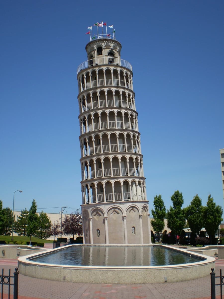
Photo: Wikipedia
Strategic Assessment of Niles, IL
Multiple tactical vulnerabilities. Population density, target proximity, or disaster risk are likely compounding. A retreat property and exit planning is required.
What does the Strategic Assessment tell us?
Our Strategic Assessment grades tactical survivability of an area. Major population centers, military targets, fallout zones, natural disasters, and border exposure all drive risk — lower exposure means a more defensible position in a crisis.
This is heavily inspired by Joel Skousen's Strategic Relocation book. Highly recommended you checkout the book ($)What does this tell us?
Our Strategic Assessment grades tactical survivability of an area. Major population centers, military targets, fallout zones, natural disasters, and border exposure all drive risk — lower exposure means a more defensible position in a crisis.
This is heavily inspired by Joel Skousen's Strategic Relocation book. Highly recommended you checkout the book ($)Strategic Pillars

Key Distances
Regional Safe Places
Below is our recommended "safe zones" in Illinois and the surrounding area based on our strategic heuristics. For most people, it's unrealistic to live in a “safe zone” full-time due to work, family or other personal reasons. They tend to be more rural. However, many of these areas are perfect for second homes and retreat properties that double as a vacation home or even a short-term rental.
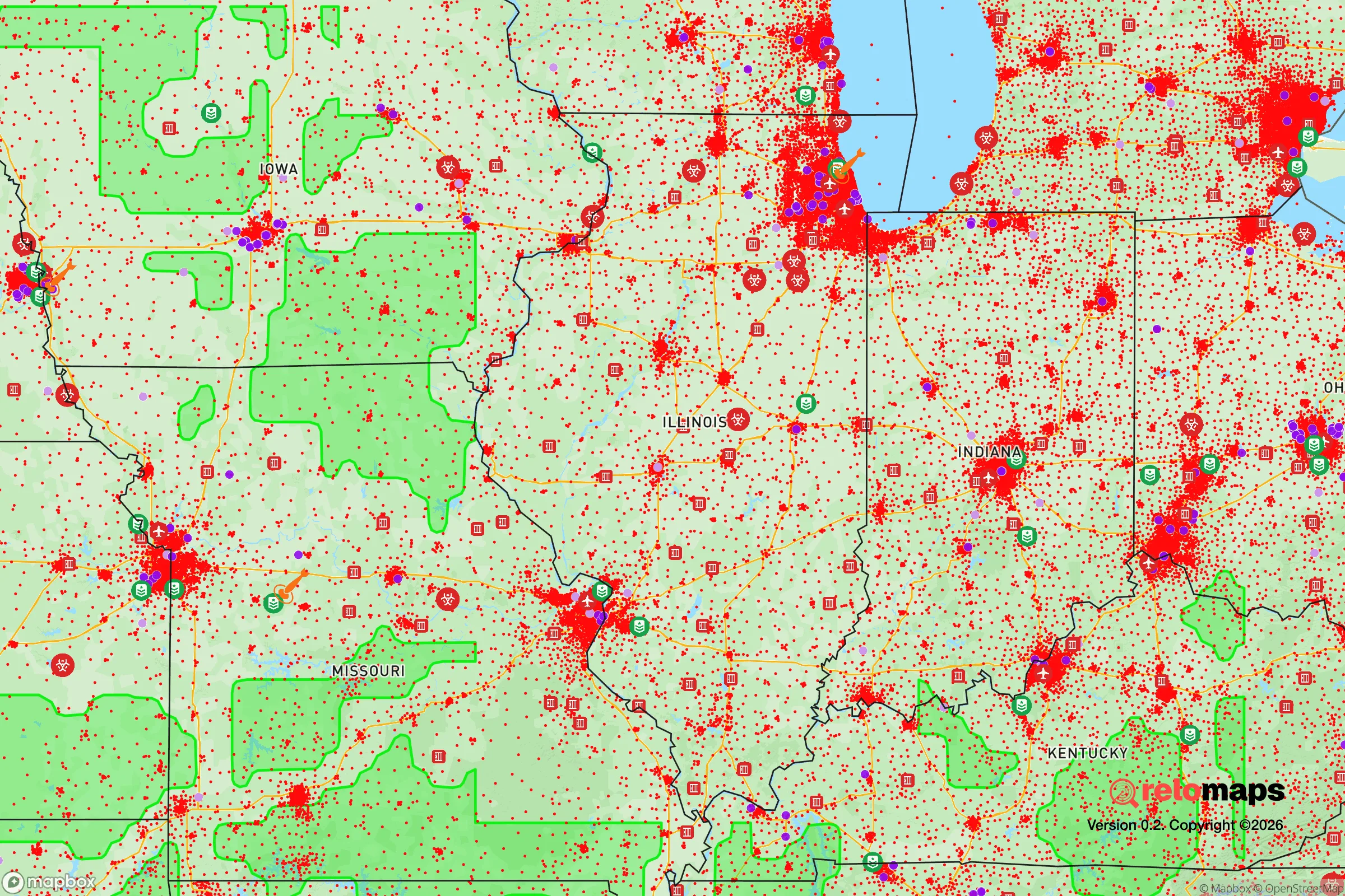
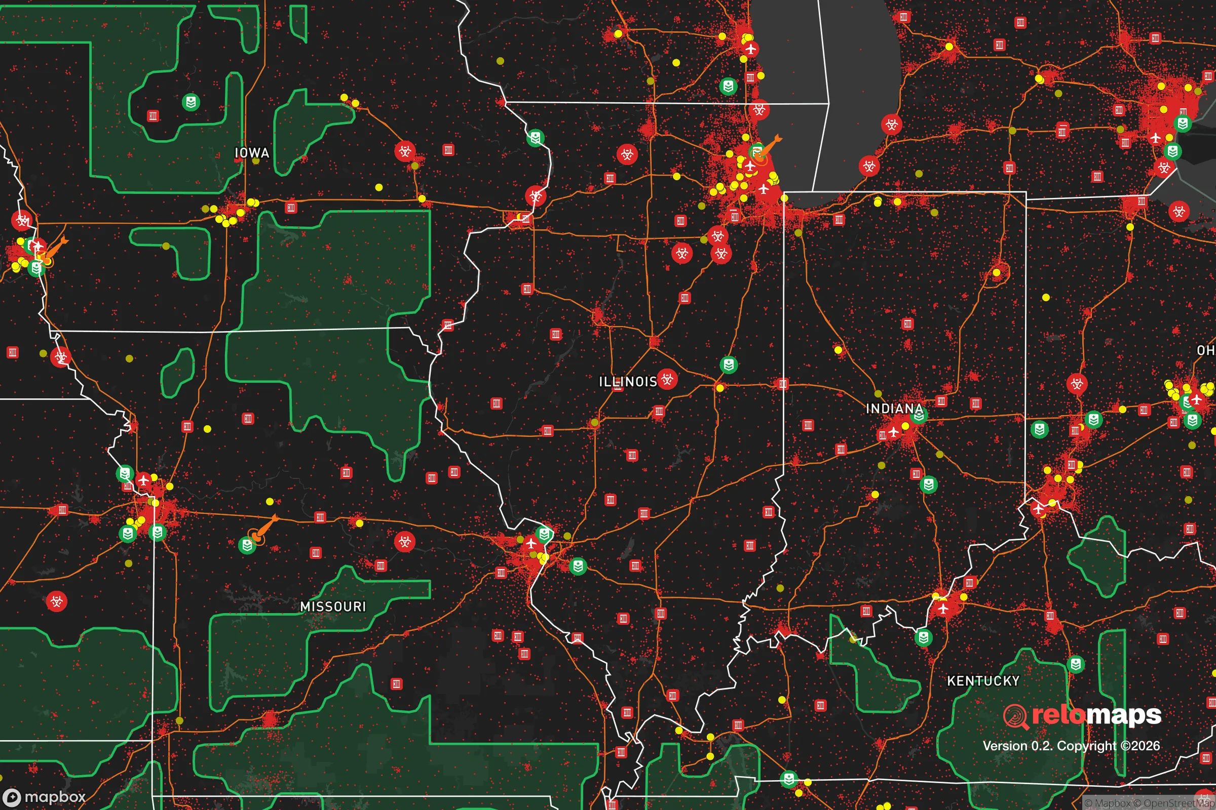


Important Note: For informational purposes only. This does not mean nothing bad ever happens in the green zones. Please use common sense. This is based on public data and modeled with AI. We tried to take a conservative approach but mistakes happen. We update this regularly as new information becomes available.
Solar Generator Recommendations
Backup power matters more here than in safer locations. We've picked three solar generators across budgets and capacity tiers — start with the budget unit if you only need a few essentials, or step up if you want to run a fridge and HVAC for days at a time.

Jackery Portable Power Station Explorer 300
Budget OptionPower on the Go: Weighing only 11 lbs, it's convenient to set up and store with book-sized foldable solar panels

BLUETTI Portable Power Station AC180
Designed for both indoor and outdoor scenarios, AC180 is highly capable as it has a robost capacity and continuous output power.

EF ECOFLOW DELTA Pro Ultra Power Station
Upgraded PickEcoFlow DELTA Pro Ultra is a whole-home energy system designed to grow with your family. Integrated with the Smart Home Panel 2, it scales to meet your evolving energy needs — keeping your home powered, intelligent, and secure through every stage of life.
We earn a commission, at no additional cost to you.
Strategic Assessment Analysis
Niles, Illinois, presents a mixed strategic picture for the relocation-minded reader focused on resilience and self-sufficiency. While its location within the Chicago metropolitan area offers certain logistical advantages, it also places the village squarely within a high-risk zone for both natural and man-made disruptions. For the conservative-leaning individual or family weighing disaster readiness, Niles offers a solid suburban infrastructure but demands a clear-eyed understanding of its vulnerabilities, particularly its proximity to major population centers and critical infrastructure targets.
Geographic position and natural advantages for a suburban homestead
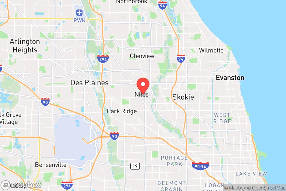
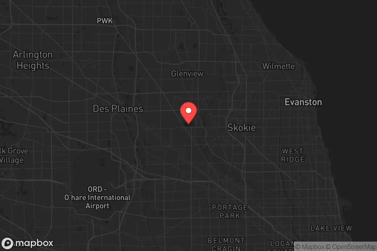
Niles sits roughly 15 miles northwest of downtown Chicago, a position that provides access to the region's extensive transportation network while maintaining a distinct suburban character. The village is bordered by the Chicago River's North Branch to the east, a waterway that historically supported industry but today offers limited practical utility for a relocator seeking a reliable water source. The terrain is flat, typical of the greater Chicago area, which simplifies construction and gardening but offers no natural defensive elevation. The area's soil is fertile, a remnant of glacial activity, which is a genuine plus for anyone planning a serious vegetable garden or small-scale food production. The village itself is compact—roughly 5.8 square miles—meaning that most points within it are within a 15-minute drive of major highways like I-94 and I-294. This connectivity is a double-edged sword: it facilitates supply runs and evacuation but also makes Niles a natural chokepoint for any regional disruption. The climate is continental, with cold winters and hot, humid summers, which imposes a real need for robust heating and cooling systems—and the fuel or electricity to run them. For a relocator, the key natural advantage here is the flat, arable land and the proximity to Lake Michigan (about 10 miles east), which serves as a massive, if distant, freshwater reservoir. However, the lake's water is not directly accessible from Niles without crossing through other municipalities, a vulnerability in a crisis.
Risks, exposures, and proximity to fallout-relevant landmarks
The most significant risk for Niles is its location within the Chicago metropolitan area, a region that contains numerous high-value targets for both natural disasters and man-made events. The village is within a 20-mile radius of O'Hare International Airport, one of the busiest in the world, and within 15 miles of several major rail yards and industrial complexes along the I-294 corridor. In a scenario involving a major power grid failure, a coordinated cyberattack, or a conventional military strike, these landmarks would be primary targets. The fallout zone from a detonation at O'Hare, for example, would likely extend over Niles depending on wind direction, making the village a potentially hazardous place to be in the immediate aftermath. Additionally, the area is crisscrossed by high-voltage power lines and natural gas pipelines, which are vulnerable to both accidental rupture and deliberate sabotage. Flooding is the primary natural risk: the Chicago River's North Branch has a history of overflow during heavy rain events, and parts of Niles, particularly near the river and along Golf Road, are in FEMA-designated flood zones. Tornadoes are a secondary concern; while the village has not experienced a direct hit in recent decades, the broader region is in Tornado Alley's northern fringe, and a direct strike would be devastating given the area's dense housing stock. For the relocator, the key takeaway is that Niles offers no meaningful buffer from the risks inherent to living near a major city. The village's density—over 30,000 people in a small area—means that any regional disruption would quickly become a local crisis, with competition for resources like fuel, food, and medical care.
Practical resilience for a relocator: food, water, energy, and defensibility
For a relocator serious about self-sufficiency, Niles presents a challenging environment. The village is almost entirely built out, with very little undeveloped land. This means that any serious food production would have to occur on a residential lot, most of which are a quarter-acre or smaller. The soil is generally good, but lead contamination from decades of leaded gasoline use along major roads is a real concern; a soil test is mandatory before planting edibles. Community gardens exist but are limited in number and size. Water is the most critical vulnerability. Niles draws its municipal water from Lake Michigan via the Chicago water system, a complex network of tunnels and treatment plants that is a single point of failure. A prolonged power outage or a contamination event at the intake cribs would leave the village without potable water. A private well is not an option in this densely built suburb, so any relocator must plan for at least two weeks of stored water per person, plus a reliable filtration system for emergency collection. Energy is similarly dependent on the regional grid. Natural gas is the primary heating fuel, and electricity comes from ComEd, which serves northern Illinois. A grid-down scenario in winter would be life-threatening within hours. Solar panels are permitted but must comply with village codes, and battery storage is advisable. Defensibility is poor. Niles is a grid of streets with multiple entry points, no natural barriers, and a police force of about 50 officers. In a widespread breakdown of civil order, the village would be difficult to secure. The best strategy for a relocator is to treat Niles as a base for a more remote property, not as a long-term survival location. Its strengths lie in its access to medical facilities (several hospitals within 10 miles), hardware stores, and a diverse food supply chain that would function longer than in more isolated areas. The local government has a basic emergency management plan, but it is designed for short-term events like blizzards or floods, not for prolonged crises.
The overall strategic picture for Niles is one of calculated trade-offs. It is not a place for a standalone, off-grid homestead. Its density, reliance on regional infrastructure, and proximity to high-value targets make it a high-risk location for anyone prioritizing long-term disaster readiness. However, for the relocator who wants to maintain a suburban lifestyle while building a moderate level of preparedness—stored supplies, a solid emergency plan, and a network of like-minded neighbors—Niles offers a functional, if not ideal, base. The village's real value is as a staging area: close enough to Chicago's resources to be useful in a slow-moving crisis, but far enough to avoid the worst of the immediate chaos. For the conservative-leaning reader, the honest assessment is that Niles is a place to live well in good times, but not a place to ride out a catastrophe. Plan accordingly, and consider a secondary property farther out as a true retreat.

* Values derived from national, state, county, city and local statistics and may differ in a specific area. Last updated: 2026-10-21T01:28:21.000Z
Narrative content on this page is AI-generated and may contain mistakes. Verify any details that matter before acting on them.
ReloMaps may earn a commission from affiliate links at no extra cost to you.

