Photo: Wikipedia
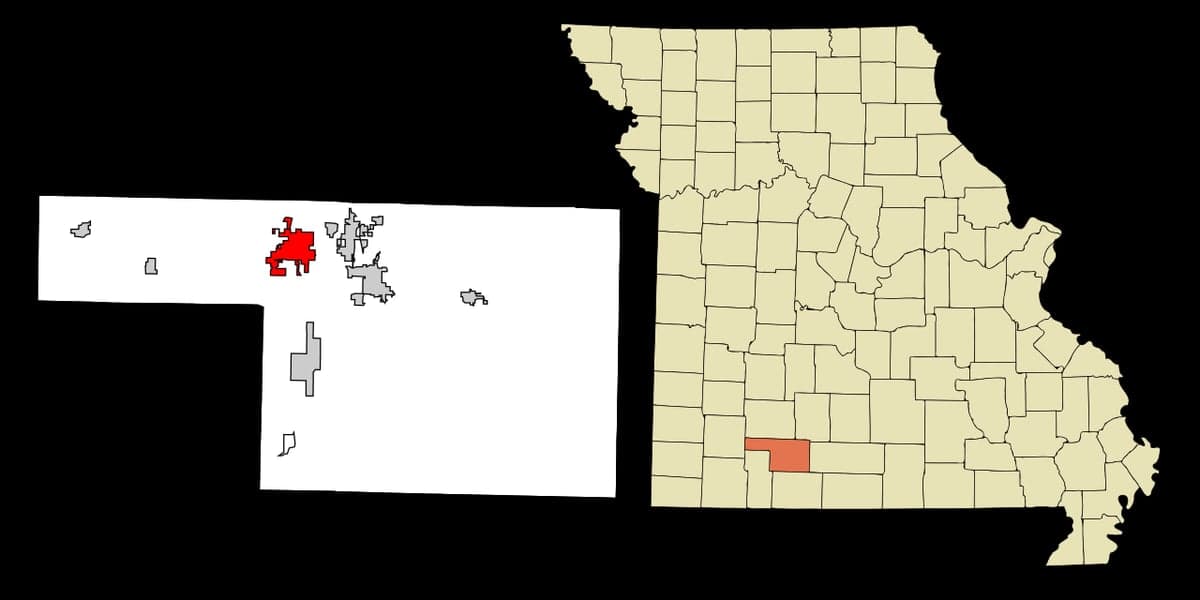
Strategic Assessment of Nixa, MO
Workable tactical position. Some exposure to population density or targets, but generally defensible in a crisis.
What does the Strategic Assessment tell us?
Our Strategic Assessment grades tactical survivability of an area. Major population centers, military targets, fallout zones, natural disasters, and border exposure all drive risk — lower exposure means a more defensible position in a crisis.
This is heavily inspired by Joel Skousen's Strategic Relocation book. Highly recommended you checkout the book ($)What does this tell us?
Our Strategic Assessment grades tactical survivability of an area. Major population centers, military targets, fallout zones, natural disasters, and border exposure all drive risk — lower exposure means a more defensible position in a crisis.
This is heavily inspired by Joel Skousen's Strategic Relocation book. Highly recommended you checkout the book ($)Strategic Pillars

Key Distances
Regional Safe Places
Below is our recommended "safe zones" in Missouri and the surrounding area based on our strategic heuristics. For most people, it's unrealistic to live in a “safe zone” full-time due to work, family or other personal reasons. They tend to be more rural. However, many of these areas are perfect for second homes and retreat properties that double as a vacation home or even a short-term rental.


Important Note: For informational purposes only. This does not mean nothing bad ever happens in the green zones. Please use common sense. This is based on public data and modeled with AI. We tried to take a conservative approach but mistakes happen. We update this regularly as new information becomes available.
Solar Generator Recommendations
Backup power matters more here than in safer locations. We've picked three solar generators across budgets and capacity tiers — start with the budget unit if you only need a few essentials, or step up if you want to run a fridge and HVAC for days at a time.

Jackery Portable Power Station Explorer 300
Budget OptionPower on the Go: Weighing only 11 lbs, it's convenient to set up and store with book-sized foldable solar panels

BLUETTI Portable Power Station AC180
Designed for both indoor and outdoor scenarios, AC180 is highly capable as it has a robost capacity and continuous output power.

EF ECOFLOW DELTA Pro Ultra Power Station
Upgraded PickEcoFlow DELTA Pro Ultra is a whole-home energy system designed to grow with your family. Integrated with the Smart Home Panel 2, it scales to meet your evolving energy needs — keeping your home powered, intelligent, and secure through every stage of life.
We earn a commission, at no additional cost to you.
Strategic Assessment Analysis
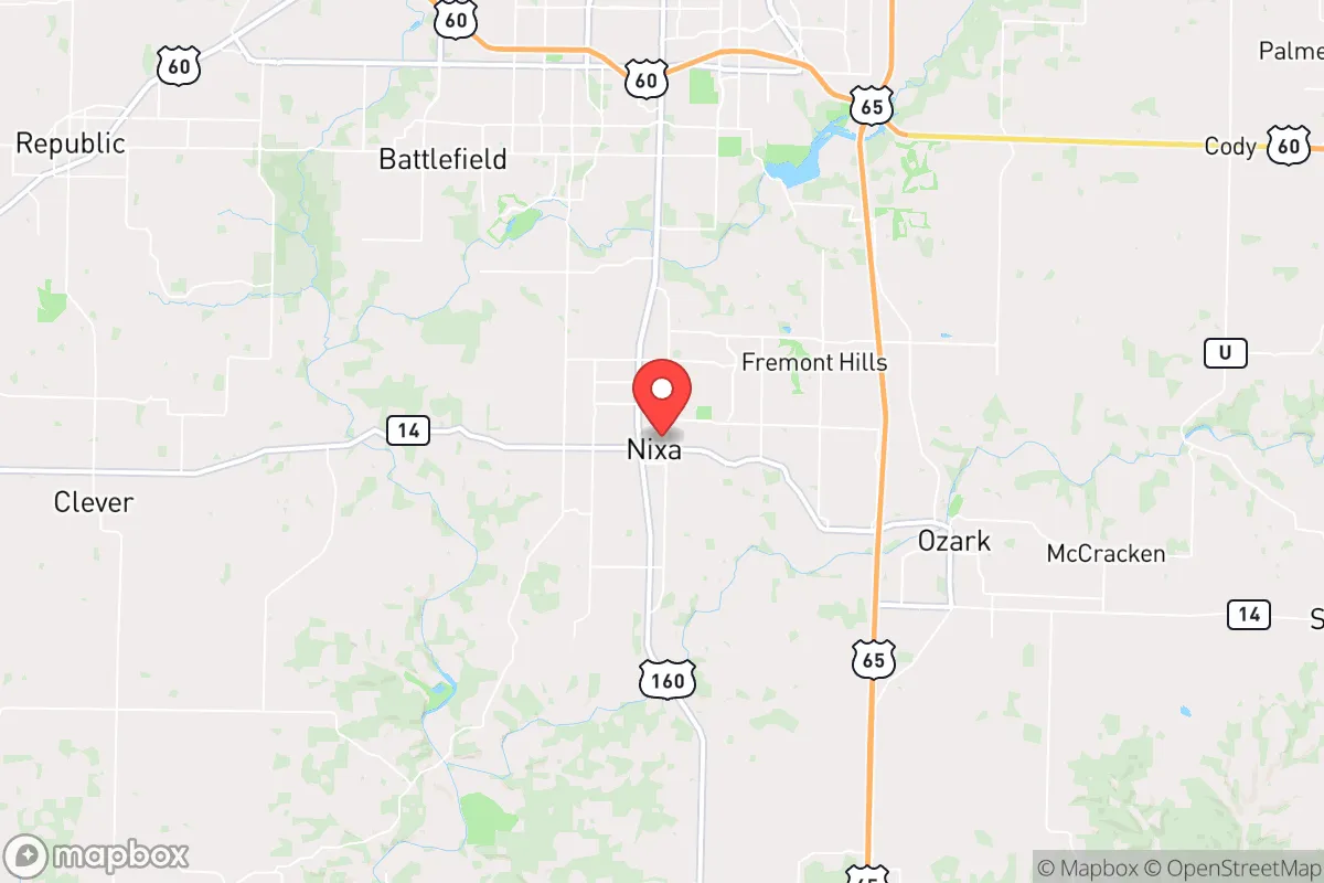
Nixa, Missouri, sits in a sweet spot that few relocation analysts fully appreciate: close enough to a major metro to access its logistics and medical infrastructure, yet far enough to avoid the blast radius, the grid collapse cascade, and the civil unrest that will likely follow a major national crisis. This is a town built on limestone bluffs above the James River, with a population hovering around 25,000 and a growth curve that suggests people are already voting with their feet. For the conservative-leaning prepper or survivalist family, Nixa offers a rare combination of geographic defensibility, resource access, and community cohesion that makes it a serious candidate for a strategic relocation base.
Geographic position and natural advantages for long-term security
Nixa’s primary strategic asset is its position within the Ozark Plateau, a region of karst topography, rolling hills, and dense hardwood forest that naturally limits approach vectors and provides ample cover. The town sits at roughly 1,200 feet elevation, which puts it above the flood-prone bottomlands of the Missouri and Mississippi river systems. The James River and its tributaries cut through the area, offering reliable surface water sources that are less likely to be contaminated by upstream industrial runoff than the big rivers. The underlying geology is limestone and dolomite, which means groundwater is plentiful and, with proper well placement, relatively easy to access. The region’s average annual rainfall is about 45 inches, making it one of the wetter parts of the Midwest—a critical advantage for off-grid water security. The growing season runs roughly April through October, long enough for serious food production, and the soil, while rocky in places, is workable for raised beds and terraced gardens. For a relocator thinking in decades, not election cycles, this is a climate that supports subsistence agriculture without the brutal winters of the northern plains or the desert aridity of the Southwest.
Risks, exposures, and proximity to fallout-relevant landmarks
No location is without vulnerabilities, and Nixa has a few that demand honest assessment. The most obvious risk is its proximity to Springfield, Missouri, about 10 miles to the north. Springfield is a regional hub with a population of 170,000, a major medical center (Mercy Hospital Springfield), and a significant transportation node at the intersection of I-44 and US-65. In a national emergency—whether economic collapse, grid failure, or civil unrest—Springfield will become a chokepoint. Expect roadblocks, refugee flows, and potential resource competition along the Highway 160 and US-65 corridors. Nixa itself is a bedroom community for Springfield, meaning a large portion of its workforce commutes north daily. If the grid goes down or fuel becomes scarce, that commuting population will be stranded or forced to return on foot, creating a temporary but serious population surge. The town also sits within 100 miles of the Arkansas Nuclear One power plant near Russellville, Arkansas, and within 200 miles of the Fort Leonard Wood military installation. While neither is a direct fallout target in a conventional war scenario, any nuclear incident—accidental or otherwise—could place Nixa within a downwind contamination zone depending on prevailing weather patterns. The prevailing winds in this region are from the southwest, which slightly mitigates risk from the Arkansas plant but does not eliminate it. On the plus side, Nixa is far from any major military command centers, ICBM fields, or strategic ports, which means it is unlikely to be a primary target in a kinetic conflict. The nearest major interstate is I-44, which runs east-west and connects to St. Louis and Tulsa; in a crisis, that highway will be a liability, not an asset, and Nixa’s position just south of it means the town is close enough to monitor traffic but far enough to avoid the worst of the chaos.
Practical resilience for a relocator: food, water, energy, and defensibility
For the individual or family looking to establish a resilient homestead, Nixa offers a workable baseline. Water is the first concern, and the Ozark aquifer system is one of the most productive in the country. Many existing homes in the area already have private wells, and drilling a new well typically runs $5,000 to $12,000 depending on depth, which averages 200 to 400 feet. The water quality is generally good, with moderate hardness but low levels of industrial contaminants. For surface water, the James River and its tributaries are fishable and swimmable, but any surface water use requires robust filtration and boiling protocols due to agricultural runoff and septic system leakage. Food production is viable: the growing season supports corn, beans, squash, tomatoes, peppers, and most common garden vegetables. Deer are abundant for hunting, and the Missouri Department of Conservation actively manages the population. Small-scale livestock—chickens, goats, rabbits—are legal within city limits with proper permits, and the rural areas outside Nixa have no meaningful restrictions. The local food culture is strong; the Nixa Farmers Market operates seasonally, and there are multiple local butchers and processors within a 20-minute drive. For energy, the grid is served by City Utilities of Springfield, which has a mixed generation portfolio including coal, natural gas, and hydro. In a prolonged outage, solar is viable—the region averages 200 sunny days per year, which is respectable but not ideal. Battery storage and a backup generator (propane or diesel) are strongly recommended. Defensibility is where Nixa shines. The town is laid out on a series of ridges and hollows, with limited entry points from the north and east. The residential areas south of the James River are particularly well-positioned, with natural chokepoints at the bridges on Highway 160 and CC Road. A determined group could effectively control access to the southern half of the town with relatively few personnel. The local law enforcement presence is modest—the Nixa Police Department has about 30 sworn officers—but the community is heavily armed and culturally predisposed to self-defense. The Christian County Sheriff’s Office is professional and conservative-leaning, and the local gun culture is strong, with multiple gun shops and ranges within a 15-minute drive. For a relocator, this means you are not alone; you are joining a community that already understands the value of preparedness.
The overall strategic picture for Nixa is one of moderate risk and high reward for the disciplined prepper. It is not a remote mountain redoubt—you will have neighbors, and you will have to navigate the complexities of a growing suburban environment. But it is also not a high-risk target zone. The town’s location, water resources, agricultural potential, and community character make it a viable base for a long-term resilience strategy. The key is to arrive before the crisis, establish your infrastructure, and build relationships with like-minded locals. If you are looking for a place that balances access to modern amenities with genuine survivability, Nixa deserves a hard look. It is not perfect, but in a world of diminishing options, it is one of the better bets in the central United States.
* Values derived from national, state, county, city and local statistics and may differ in a specific area. Last updated: 2026-04-23T04:20:07.000Z
Narrative content on this page is AI-generated and may contain mistakes. Verify any details that matter before acting on them.
ReloMaps may earn a commission from affiliate links at no extra cost to you.