
Photo: Wikipedia
Strategic Assessment of Clark County
Meaningful friction. Expect exposure to either population pressure, blast zones, or natural disaster risk. Consider buying a retreat property.
What does the Strategic Assessment tell us?
Our Strategic Assessment grades tactical survivability of an area. Major population centers, military targets, fallout zones, natural disasters, and border exposure all drive risk — lower exposure means a more defensible position in a crisis.
This is heavily inspired by Joel Skousen's Strategic Relocation book. Highly recommended you checkout the book ($)What does this tell us?
Our Strategic Assessment grades tactical survivability of an area. Major population centers, military targets, fallout zones, natural disasters, and border exposure all drive risk — lower exposure means a more defensible position in a crisis.
This is heavily inspired by Joel Skousen's Strategic Relocation book. Highly recommended you checkout the book ($)Strategic Pillars

Key Distances
Strategic Assessment Analysis
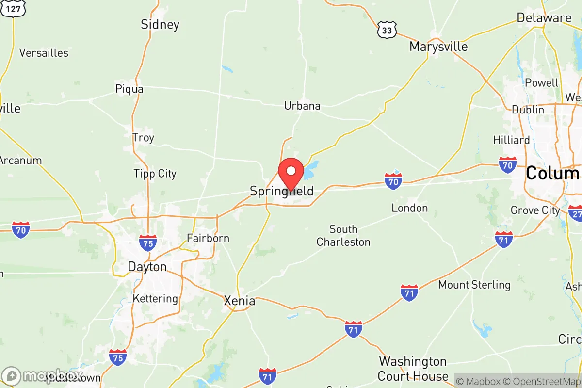
Clark County, Ohio, presents a nuanced strategic picture for those serious about long-term preparedness and resilience. Anchored by the city of Springfield, the county sits roughly 25 miles northeast of Dayton and 45 miles west of Columbus—close enough to tap into regional resources but far enough to avoid the immediate blast radius of major urban targets. Its agricultural foundation, ample water from the Mad River and Buck Creek watersheds, and a conservative-leaning rural population make it a location worth a hard look for relocators prioritizing self-sufficiency and security.
Geographic position and natural advantages for long-term security
Clark County's location in west-central Ohio offers a strategic sweet spot. It sits outside the suburban sprawl of Dayton and Columbus, yet remains connected via I-70 and I-75 for necessary travel or resupply. The terrain is mostly level to gently rolling, dominated by prime farmland—soils that support serious food production without heavy inputs. The Mad River and Buck Creek provide reliable surface water, and the underlying Great Miami Aquifer is a proven source for well drilling. Springfield Lake, a 600-acre reservoir, adds a significant buffer for water storage and emergency supply. For a relocator, the ability to grow food and access water without relying on municipal systems is a major advantage. The county's rural townships—German, Bethel, and Moorefield, among others—offer low-density living that makes defensibility easier. Ne
* Values derived from national, state, county, city and local statistics and may differ in a specific area. Last updated: 2026-05-14T13:29:27.000Z
Narrative content on this page is AI-generated and may contain mistakes. Verify any details that matter before acting on them.
ReloMaps may earn a commission from affiliate links at no extra cost to you.