
Photo: Wikipedia
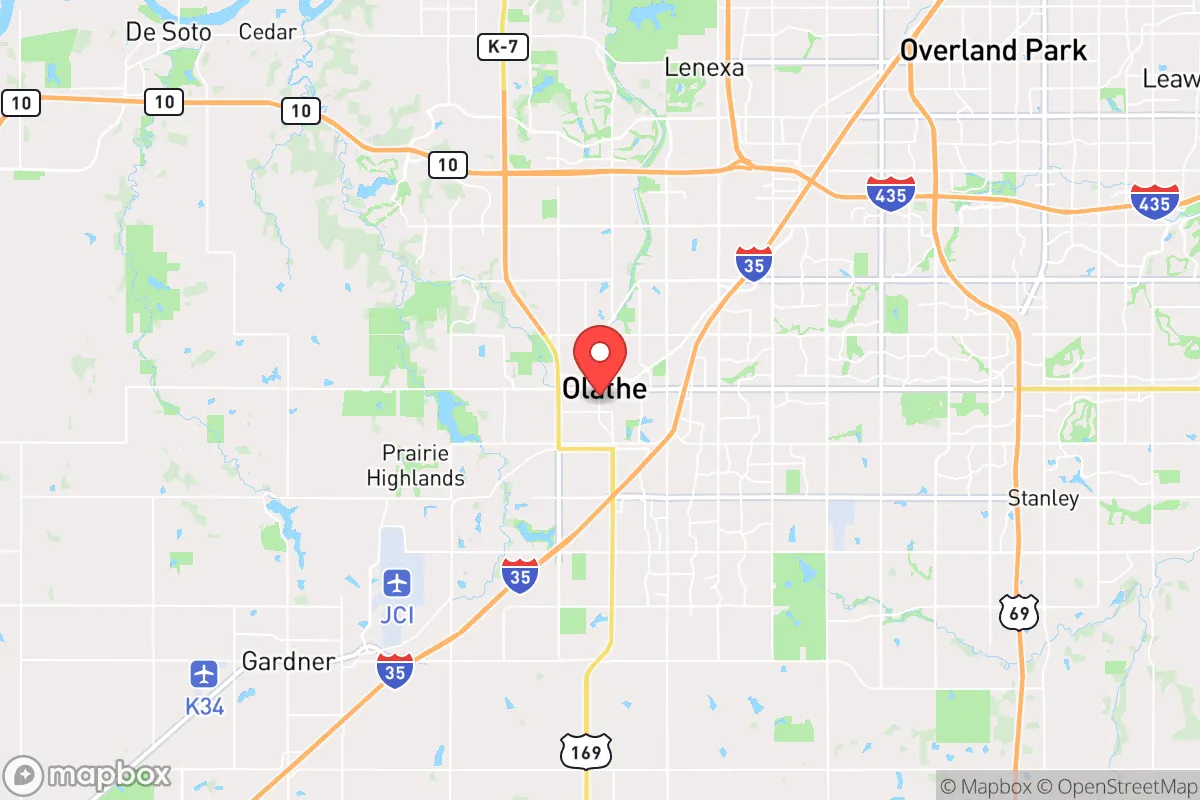
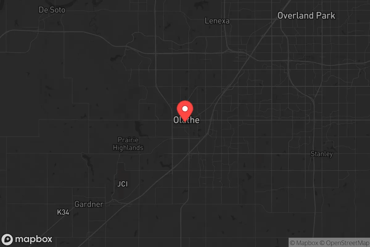
Strategic Assessment of Olathe, KS
Multiple tactical vulnerabilities. Population density, target proximity, or disaster risk are likely compounding. A retreat property and exit planning is required.
What does the Strategic Assessment tell us?
Our Strategic Assessment grades tactical survivability of an area. Major population centers, military targets, fallout zones, natural disasters, and border exposure all drive risk — lower exposure means a more defensible position in a crisis.
This is heavily inspired by Joel Skousen's Strategic Relocation book. Highly recommended you checkout the book ($)What does this tell us?
Our Strategic Assessment grades tactical survivability of an area. Major population centers, military targets, fallout zones, natural disasters, and border exposure all drive risk — lower exposure means a more defensible position in a crisis.
This is heavily inspired by Joel Skousen's Strategic Relocation book. Highly recommended you checkout the book ($)Strategic Pillars

Key Distances
Regional Safe Places
Below is our recommended "safe zones" in Kansas and the surrounding area based on our strategic heuristics. For most people, it's unrealistic to live in a “safe zone” full-time due to work, family or other personal reasons. They tend to be more rural. However, many of these areas are perfect for second homes and retreat properties that double as a vacation home or even a short-term rental.
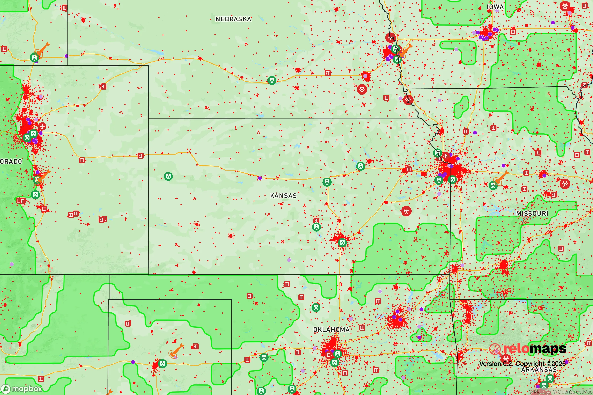
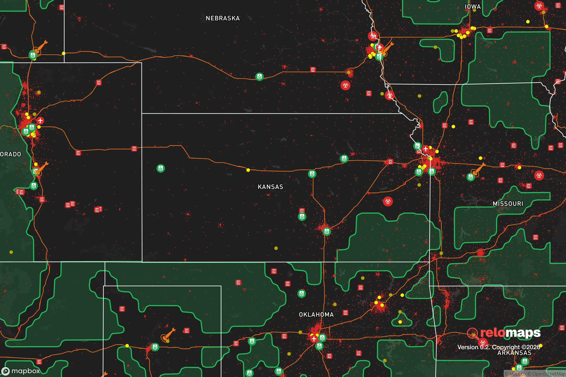
Important Note: For informational purposes only. This does not mean nothing bad ever happens in the green zones. Please use common sense. This is based on public data and modeled with AI. We tried to take a conservative approach but mistakes happen. We update this regularly as new information becomes available.
Solar Generator Recommendations
Backup power matters more here than in safer locations. We've picked three solar generators across budgets and capacity tiers — start with the budget unit if you only need a few essentials, or step up if you want to run a fridge and HVAC for days at a time.

Jackery Portable Power Station Explorer 300
Budget OptionPower on the Go: Weighing only 11 lbs, it's convenient to set up and store with book-sized foldable solar panels

BLUETTI Portable Power Station AC180
Designed for both indoor and outdoor scenarios, AC180 is highly capable as it has a robost capacity and continuous output power.

EF ECOFLOW DELTA Pro Ultra Power Station
Upgraded PickEcoFlow DELTA Pro Ultra is a whole-home energy system designed to grow with your family. Integrated with the Smart Home Panel 2, it scales to meet your evolving energy needs — keeping your home powered, intelligent, and secure through every stage of life.
We earn a commission, at no additional cost to you.
Strategic Assessment Analysis
Olathe, Kansas, offers a surprisingly solid strategic position for those prioritizing resilience, sitting far enough from major metropolitan cores to avoid the worst of initial chaos while remaining close enough to leverage their resources in a stable period. The city’s location in Johnson County, roughly 20 miles southwest of downtown Kansas City, places it in a sweet spot: close enough to access medical centers, supply chains, and transportation hubs, but far enough that a major event in the urban core—whether civil unrest, a mass casualty incident, or a grid-down scenario—won’t immediately overwhelm the area. For a conservative-leaning relocator thinking in terms of long-term preparedness, Olathe’s combination of suburban infrastructure, agricultural adjacency, and relative political alignment makes it a viable base of operations, not a retreat, but a defensible forward position.
Geographic position and natural advantages for long-term stability
Olathe sits on the eastern edge of the Kansas Flint Hills, a region of rolling prairie that transitions into more wooded terrain along the Kansas River basin. This geography provides several practical advantages. The area is not prone to earthquakes, hurricanes, or wildfires—the primary natural threats are tornadoes (which are predictable and survivable with proper shelter) and occasional ice storms. The local water supply is robust: the Kansas River and its tributaries, including the Marais des Cygnes and the Missouri River system, provide ample surface water, and the underlying Ogallala Aquifer extends into western Kansas, though Olathe itself draws from the Kansas River via WaterOne, a regional utility. For a prepper, this means water is not a scarcity concern in the short term, though filtration and storage are still wise. The soil in Johnson County is fertile, with a growing season of roughly 180 days, making small-scale food production viable for those with land. The city’s elevation—around 1,000 feet—offers no defensive high ground, but the flat-to-rolling terrain is easy to patrol and offers good line-of-sight for observation. The lack of major natural barriers (mountains, large rivers) means movement is easy, but so is movement for potential threats; defensibility here relies on community cohesion and prepared infrastructure, not geography.
Risks, exposures, and proximity to fallout-relevant landmarks
The most significant risk for Olathe is its proximity to the Kansas City metropolitan area, which includes a major transportation hub (Kansas City International Airport), a large rail yard, and several industrial facilities that could become secondary targets or sources of contamination in a major conflict or terrorist event. The city is roughly 30 miles from the BNSF Railway’s Argentine Yard in Kansas City, Kansas, one of the largest rail classification yards in the country, which handles hazardous materials including chemicals and fuels. A derailment or attack there could produce a toxic plume that, depending on wind, could reach Olathe within hours. Additionally, the nearby Sunflower Army Ammunition Plant in De Soto (about 10 miles west) is a former munitions facility now being redeveloped, but its history means residual contamination is possible. For fallout concerns, Olathe is not near any active nuclear power plant—the closest is Wolf Creek in Burlington, Kansas, about 100 miles southwest—but the area is within the fallout zone of a theoretical strike on Whiteman Air Force Base (home to B-2 bombers) in Knob Noster, Missouri, roughly 80 miles east. In a full-scale conflict, Olathe would likely see no direct blast effects, but fallout from a strike on Whiteman or on Kansas City’s infrastructure could be a real concern. The city’s position in the prevailing westerly wind belt means fallout from western targets (like nuclear missile silos in western Kansas or Nebraska) is less likely, but eastern or southern targets could be problematic. The risk of civil unrest is moderate: Johnson County is affluent and politically conservative, which reduces the likelihood of localized rioting, but a mass casualty event in Kansas City could send refugees south and west along I-35, which runs directly through Olathe. The city’s police department is well-funded and professional, but in a widespread breakdown, the sheer number of people fleeing the urban core could overwhelm local resources.
Practical resilience for a relocator: food, water, energy, and defensibility
For a relocator focused on practical self-sufficiency, Olathe offers a mixed bag. Food security is achievable but not automatic. The city is surrounded by agricultural land—corn, soybeans, and wheat are the primary crops—and there are several local farms and farmers’ markets (like the Olathe Farmers Market) that can provide fresh produce in normal times. For long-term storage, the area has numerous big-box stores (Costco, Sam’s Club, Walmart) that can be used for bulk purchasing, but these will be stripped quickly in a crisis. The better play is to establish relationships with local farmers or to buy land in the unincorporated areas south of Olathe, near Edgerton or Gardner, where acreage is more affordable and zoning is less restrictive. Water is the stronger suit. The city’s water supply comes from the Kansas River, treated by WaterOne, which serves over 400,000 customers. In a grid-down scenario, the treatment plant would stop functioning, but the river itself is a reliable surface water source. A well on private property is the gold standard here, and the water table in Johnson County is generally accessible at depths of 50 to 150 feet. Energy resilience is middling. The local grid is managed by Evergy, which has a mixed reliability record—outages from ice storms or high winds can last days. Solar is viable, with the area averaging about 200 sunny days per year, but net metering policies in Kansas are less favorable than in some states, so battery storage is essential. Natural gas is widely available for heating and cooking, which is a plus for those who can store propane or have a backup generator. Defensibility is neighborhood-dependent. Older parts of Olathe (near the historic downtown) have tighter street grids and more cover, while newer subdivisions (like those around 119th Street) are more open and harder to secure. The ideal property for a prepper would be on the outskirts, with a minimum of 5 acres, a well, and a septic system, and with a clear line of sight to approach roads. The city’s gun laws are favorable—Kansas is a shall-issue state for concealed carry, with no permit required for open carry—and Johnson County has a strong culture of firearm ownership, which means a higher baseline of armed residents. That said, the county’s affluence also means that in a collapse scenario, it could become a target for looting from less-prepared areas. The best defense is to be part of a local network; there are several prepper and homesteading groups in the region, and the nearby town of Louisburg (about 15 miles south) has a more rural, self-reliant character.
The overall strategic picture for Olathe is that it is a viable, if not ideal, location for a conservative relocator with a prepper mindset. It offers the infrastructure and resources of a major metro area without being directly in the kill zone, and its political and cultural alignment reduces the friction of daily life for those who value self-reliance and traditional community structures. The primary vulnerabilities are its position along a major evacuation corridor (I-35) and its proximity to potential secondary targets in Kansas City. For a single individual or a family willing to invest in a well, solar, and a defensible property on the city’s southern fringe, Olathe provides a solid base for riding out the next decade of instability. It is not a remote bug-out location—it is a suburban strongpoint that requires active preparation and community engagement. If you are looking for a place where you can work a remote job, raise kids in a relatively safe environment, and still be ready for the worst, Olathe deserves a serious look. Just don’t expect to disappear; expect to stand your ground.
* Values derived from national, state, county, city and local statistics and may differ in a specific area. Last updated: 2026-04-30T07:07:22.000Z
Narrative content on this page is AI-generated and may contain mistakes. Verify any details that matter before acting on them.
ReloMaps may earn a commission from affiliate links at no extra cost to you.