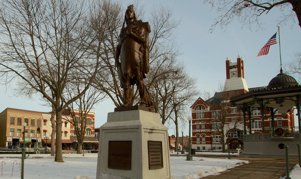
Photo: Wikipedia
Strategic Assessment of Oskaloosa, IA
Workable tactical position. Some exposure to population density or targets, but generally defensible in a crisis.
What does the Strategic Assessment tell us?
Our Strategic Assessment grades tactical survivability of an area. Major population centers, military targets, fallout zones, natural disasters, and border exposure all drive risk — lower exposure means a more defensible position in a crisis.
This is heavily inspired by Joel Skousen's Strategic Relocation book. Highly recommended you checkout the book ($)What does this tell us?
Our Strategic Assessment grades tactical survivability of an area. Major population centers, military targets, fallout zones, natural disasters, and border exposure all drive risk — lower exposure means a more defensible position in a crisis.
This is heavily inspired by Joel Skousen's Strategic Relocation book. Highly recommended you checkout the book ($)Strategic Pillars

Key Distances
Regional Safe Places
Below is our recommended "safe zones" in Iowa and the surrounding area based on our strategic heuristics. For most people, it's unrealistic to live in a “safe zone” full-time due to work, family or other personal reasons. They tend to be more rural. However, many of these areas are perfect for second homes and retreat properties that double as a vacation home or even a short-term rental.


Important Note: For informational purposes only. This does not mean nothing bad ever happens in the green zones. Please use common sense. This is based on public data and modeled with AI. We tried to take a conservative approach but mistakes happen. We update this regularly as new information becomes available.
Solar Generator Recommendations
Backup power matters more here than in safer locations. We've picked three solar generators across budgets and capacity tiers — start with the budget unit if you only need a few essentials, or step up if you want to run a fridge and HVAC for days at a time.

Jackery Portable Power Station Explorer 300
Budget OptionPower on the Go: Weighing only 11 lbs, it's convenient to set up and store with book-sized foldable solar panels

BLUETTI Portable Power Station AC180
Designed for both indoor and outdoor scenarios, AC180 is highly capable as it has a robost capacity and continuous output power.

EF ECOFLOW DELTA Pro Ultra Power Station
Upgraded PickEcoFlow DELTA Pro Ultra is a whole-home energy system designed to grow with your family. Integrated with the Smart Home Panel 2, it scales to meet your evolving energy needs — keeping your home powered, intelligent, and secure through every stage of life.
We earn a commission, at no additional cost to you.
Strategic Assessment Analysis
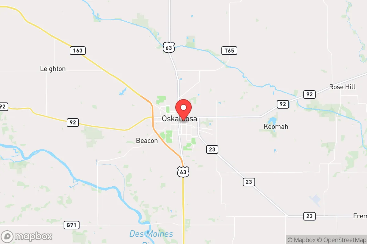
Oskaloosa, Iowa, sits in a sweet spot that few relocation-focused preppers fully appreciate: it offers genuine geographic resilience without the crushing isolation of the far northern plains. Located in Mahaska County, roughly 60 miles southeast of Des Moines and 50 miles northeast of Ottumwa, this town of about 11,000 people benefits from being far enough from any major metropolitan center to avoid the worst of civil unrest or fallout drift, yet close enough to access regional medical care, supply chains, and transportation corridors if needed. The area’s agricultural backbone, relatively stable population, and distance from high-value military or industrial targets make it a quietly serious option for those thinking through long-term strategic relocation.
Geographic position and natural advantages for long-term security
Oskaloosa’s position in the Southern Iowa Drift Plain gives it rolling hills, decent surface water, and soils that support both row crops and pasture—critical for any scenario where supply chains falter. The town sits near the confluence of several minor creeks that feed into the Des Moines River about 15 miles west, meaning groundwater recharge is reasonable and well-drilling potential is above average for the region. Unlike flatter parts of northern Iowa, the topography here offers modest defensible terrain: ridges, wooded draws, and scattered timber breaks that provide cover and limit line-of-sight from main roads. The area is also far from any active seismic zones, major fault lines, or known fracking-related injection wells that could trigger induced seismicity. Winters are cold but manageable, with average January lows around 14°F and annual snowfall under 30 inches—nothing that would strand a prepared household for more than a few days. The growing season runs roughly 155 days, long enough for a serious garden and short-season grain crops, which is a meaningful advantage if you’re planning for food autonomy.
Risks, exposures, and proximity to fallout-relevant landmarks
The primary risk for Oskaloosa is not direct blast or fallout from a nuclear exchange, but rather secondary effects from regional instability. The closest obvious target is Des Moines, home to the Iowa National Guard headquarters, the state capitol, and major data centers—but at 60 miles distance, prevailing winds from the west-northwest would carry fallout primarily east-northeast, putting Oskaloosa in a lower-risk zone for direct deposition. The town is also roughly 90 miles from the Omaha metro area, which includes Offutt Air Force Base (home to U.S. Strategic Command) and the Northern Command’s alternate facility—a high-value target in any major conflict. That said, the prevailing wind patterns from Omaha blow east toward Des Moines and beyond, not directly toward Oskaloosa. The real concern is less a single strike and more the cascading effects: refugees from Des Moines or Omaha heading southeast along Highway 163, which runs right through town. Oskaloosa sits on a major east-west state highway (IA-92) and is within 20 miles of Interstate 35, a primary north-south evacuation route. In a crisis, that connectivity becomes a double-edged sword—good for resupply, bad for controlling population flow. There are no nuclear power plants within 100 miles (the closest is Duane Arnold, near Cedar Rapids, which is permanently shut down), and no major chemical or biological research facilities nearby. The biggest industrial risk is the Cargill meat processing plant in Ottumwa, about 30 miles southwest, which could become a secondary target or a source of civil unrest if food distribution breaks down.
Practical resilience for a relocator: food, water, energy, and defensibility
For someone serious about self-sufficiency, Oskaloosa offers a workable baseline. The surrounding county is heavily agricultural—corn, soybeans, and livestock operations dominate—so local food production knowledge is abundant, and land prices remain reasonable compared to the Front Range or the Pacific Northwest. A 5- to 20-acre parcel with a well and septic can still be found for under $200,000, and many properties come with existing outbuildings suitable for root cellars, tool storage, or livestock shelter. Water is the critical variable: Mahaska County sits atop the Jordan Aquifer, a deep sandstone formation that provides reliable groundwater, but well depths typically run 150–300 feet, and drilling costs are around $25–$40 per foot. Surface water from the Des Moines River is accessible but requires treatment and is shared with upstream agricultural runoff. For energy, the area is served by Mahaska Rural Electric Cooperative, which has a decent reliability record, but grid-down scenarios would require solar or generator backup—solar insolation here is average for the Midwest (about 4.5 peak sun hours per day), so a modest 5 kW array with battery storage could cover basic refrigeration, lighting, and communications. Defensibility is moderate: the rolling terrain and scattered woodlots provide natural cover, but the town itself is laid out in a traditional grid, with multiple entry points from Highway 163 and several county roads. A rural property set back from main roads, with a long driveway and good sightlines, would be far more defensible than an in-town lot. The local sheriff’s office is small (about 20 sworn deputies for the entire county), so law enforcement response times in a crisis would be measured in hours, not minutes—meaning personal security capability is non-negotiable.
The overall strategic picture for Oskaloosa is one of moderate resilience with clear trade-offs. It’s not a hardened redoubt like the Idaho panhandle or the Ozarks, but it doesn’t carry the same logistical burdens or extreme weather risks either. For a relocator who wants to stay within a day’s drive of a major medical center (Des Moines has Level 1 trauma capability at Iowa Methodist Medical Center) while maintaining genuine food and water autonomy, this area checks most boxes. The biggest vulnerabilities are its position along evacuation routes from larger cities and the lack of a strong local prepper community—you’ll be building your network from scratch. But if your priority is a place where you can buy affordable land, drill a well, grow food, and stay off the radar of anyone looking for high-profile targets, Oskaloosa deserves a serious look. It’s not flashy, and it won’t make the cover of any survival magazine, but that’s exactly the point.
* Values derived from national, state, county, city and local statistics and may differ in a specific area. Last updated: 2026-04-30T04:33:33.000Z
Narrative content on this page is AI-generated and may contain mistakes. Verify any details that matter before acting on them.
ReloMaps may earn a commission from affiliate links at no extra cost to you.