Photo: Wikipedia
Strategic Assessment of Ottumwa, IA
Workable tactical position. Some exposure to population density or targets, but generally defensible in a crisis.
What does the Strategic Assessment tell us?
Our Strategic Assessment grades tactical survivability of an area. Major population centers, military targets, fallout zones, natural disasters, and border exposure all drive risk — lower exposure means a more defensible position in a crisis.
This is heavily inspired by Joel Skousen's Strategic Relocation book. Highly recommended you checkout the book ($)What does this tell us?
Our Strategic Assessment grades tactical survivability of an area. Major population centers, military targets, fallout zones, natural disasters, and border exposure all drive risk — lower exposure means a more defensible position in a crisis.
This is heavily inspired by Joel Skousen's Strategic Relocation book. Highly recommended you checkout the book ($)Strategic Pillars

Key Distances
Regional Safe Places
Below is our recommended "safe zones" in Iowa and the surrounding area based on our strategic heuristics. For most people, it's unrealistic to live in a “safe zone” full-time due to work, family or other personal reasons. They tend to be more rural. However, many of these areas are perfect for second homes and retreat properties that double as a vacation home or even a short-term rental.


Important Note: For informational purposes only. This does not mean nothing bad ever happens in the green zones. Please use common sense. This is based on public data and modeled with AI. We tried to take a conservative approach but mistakes happen. We update this regularly as new information becomes available.
Solar Generator Recommendations
Backup power matters more here than in safer locations. We've picked three solar generators across budgets and capacity tiers — start with the budget unit if you only need a few essentials, or step up if you want to run a fridge and HVAC for days at a time.

Jackery Portable Power Station Explorer 300
Budget OptionPower on the Go: Weighing only 11 lbs, it's convenient to set up and store with book-sized foldable solar panels

BLUETTI Portable Power Station AC180
Designed for both indoor and outdoor scenarios, AC180 is highly capable as it has a robost capacity and continuous output power.

EF ECOFLOW DELTA Pro Ultra Power Station
Upgraded PickEcoFlow DELTA Pro Ultra is a whole-home energy system designed to grow with your family. Integrated with the Smart Home Panel 2, it scales to meet your evolving energy needs — keeping your home powered, intelligent, and secure through every stage of life.
We earn a commission, at no additional cost to you.
Strategic Assessment Analysis
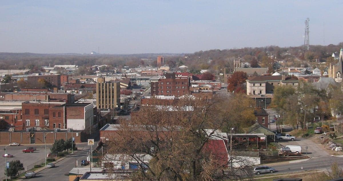
Ottumwa, Iowa, sits in a position that many preppers overlook, but its resilience profile is stronger than its modest reputation suggests. Located in Wapello County along the Des Moines River, this city of roughly 25,000 offers a blend of industrial history, agricultural self-sufficiency, and relative isolation from the major fault lines of American unrest. For a conservative-leaning relocator concerned with civic breakdown, mass casualty events, or natural disasters, Ottumwa presents a strategic option that balances affordability with genuine survivability — provided you understand both its strengths and its blind spots.
Geographic position and natural advantages for long-term survival
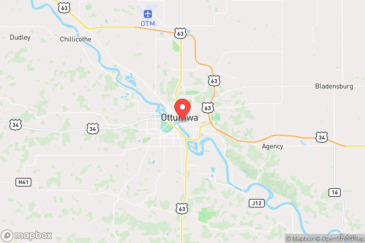
Ottumwa’s primary strategic asset is its location in southeastern Iowa, roughly 80 miles southeast of Des Moines and 50 miles northwest of the Missouri border. This places it well outside the blast radius of any major metropolitan target — no nuclear power plants within 50 miles, no major military installations, and no high-value infrastructure that would draw a first-strike scenario. The Des Moines River cuts through the city, providing a reliable freshwater source that is less contested than rivers near larger population centers. The surrounding terrain is rolling farmland, offering natural defensibility through open sightlines and limited cover for any approaching threat. The area’s agricultural base means that even in a supply chain collapse, local food production remains viable — Wapello County is part of the Corn Belt, with thousands of acres of row crops and livestock operations within a 20-mile radius. For a relocator, this translates into a lower dependency on fragile just-in-time grocery logistics. The climate is continental, with cold winters that naturally reduce population mobility and hot summers that support gardening, but the region is not prone to hurricanes, earthquakes, or wildfires — the primary natural risks are tornadoes (which are survivable with a basement) and occasional flooding along the river bottomlands.
Risks, exposures, and proximity to fallout-relevant landmarks
No location is without vulnerabilities, and Ottumwa has several that a serious prepper must weigh. The most immediate concern is the city’s proximity to the Burlington Northern Santa Fe (BNSF) rail line and the nearby U.S. Highway 63 and Highway 34 corridors. These transportation arteries could become chokepoints or targets during civil unrest, and they also carry hazardous materials — a derailment or chemical spill near the river would threaten the water supply. The Des Moines River itself is a double-edged sword: while it provides water, it also creates a flood risk for low-lying neighborhoods, particularly south of the downtown area. The 2018 floods caused significant damage, and climate models suggest increased precipitation variability in the Midwest. More critically, Ottumwa is within 100 miles of the Iowa Army Ammunition Plant in Burlington and the Duane Arnold Energy Center (a decommissioned nuclear plant near Cedar Rapids), though neither poses an immediate fallout risk under normal conditions. The nearest major population center is Des Moines, which at 80 miles is far enough to avoid direct fallout from a hypothetical strike but close enough that refugee flow could become a problem during a collapse scenario. The city’s own population density is low enough to avoid cascading failure in a pandemic or grid-down event, but the hospital system — Ottumwa Regional Health Center — is a single facility with limited surge capacity. For a relocator, the key takeaway is that Ottumwa’s risks are manageable with proper planning: a basement for tornadoes, elevation above the floodplain for river events, and a well-stocked pantry for supply chain disruptions.
Practical resilience for a relocator: food, water, energy, and defensibility
For the individual or family looking to establish a resilient homestead, Ottumwa offers a practical foundation. The local water supply comes from the Des Moines River, treated by the Ottumwa Water Works, but a prepper should plan for a backup — shallow wells in the area typically hit water at 30-50 feet, and rainwater catchment is feasible given the 35 inches of annual precipitation. The electrical grid is served by MidAmerican Energy, which relies on a mix of coal, natural gas, and wind; grid failure during winter storms is a known risk, but the city has not experienced prolonged outages in recent years. Solar panels are a viable supplement, with the region averaging 4.5 peak sun hours per day. For food, the local farmers’ market operates seasonally, and the surrounding county has multiple u-pick operations and CSAs. Hunting and fishing are legal with licenses — deer, turkey, and waterfowl are abundant, and the river holds catfish and bass. Defensibility is moderate: Ottumwa’s layout is a mix of older residential neighborhoods with narrow streets and newer subdivisions with cul-de-sacs, but the rural outskirts offer acreage with clear fields of fire. The local law enforcement presence is the Wapello County Sheriff’s Office and Ottumwa Police Department, both understaffed relative to national averages — meaning that in a crisis, self-reliance is the default. The gun culture in Iowa is strong, with constitutional carry in effect since 2021, and there are multiple local gun shops and ranges for training. For a relocator, the practical steps are clear: secure a property outside the floodplain, install a backup water system, stockpile at least three months of food, and establish a community network with like-minded neighbors. The Amish and Mennonite communities in nearby Davis and Van Buren counties are a resource for off-grid skills and barter relationships, though cultural differences require respectful engagement.
Overall, Ottumwa’s strategic picture is one of quiet viability rather than flashy preparedness. It lacks the dramatic mountain redoubts of the West or the coastal isolation of the Upper Peninsula, but it compensates with agricultural abundance, manageable risks, and a population that is neither hostile nor overly dependent on government systems. The city’s industrial past — once a major meatpacking and manufacturing hub — has left behind a workforce accustomed to hard labor and a housing stock that is cheap by national standards, with median home prices around $120,000 as of 2025. For a conservative relocator who values community, self-sufficiency, and distance from the chaos of coastal cities, Ottumwa is a solid B+ option — not a bug-out paradise, but a place where a prepared family can ride out the coming storms with a reasonable chance of success. The key is to move before the next crisis, secure your position, and build relationships with the locals who have been farming this land for generations. They know the ground better than any map can show.
* Values derived from national, state, county, city and local statistics and may differ in a specific area. Last updated: 2026-04-19T22:34:29.000Z
Narrative content on this page is AI-generated and may contain mistakes. Verify any details that matter before acting on them.
ReloMaps may earn a commission from affiliate links at no extra cost to you.