
Photo: Wikipedia
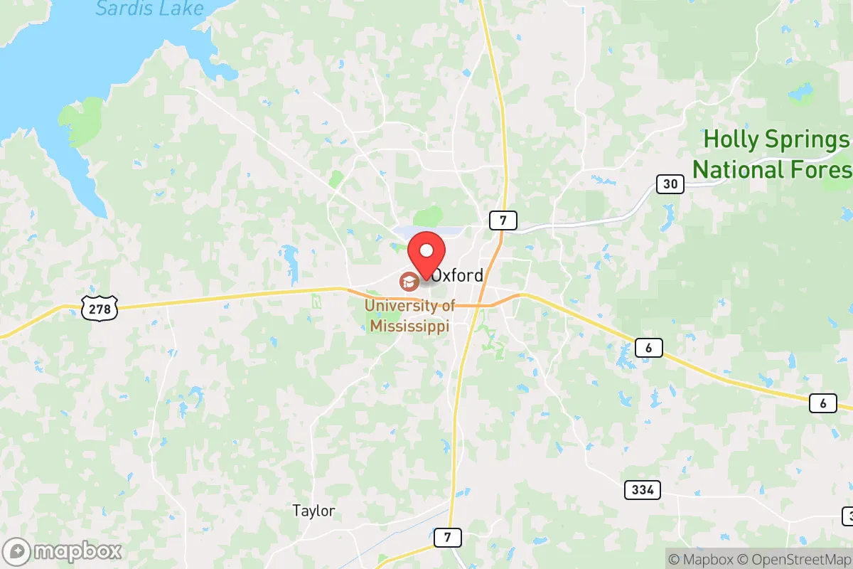
Strategic Assessment of Oxford, MS
Workable tactical position. Some exposure to population density or targets, but generally defensible in a crisis.
What does the Strategic Assessment tell us?
Our Strategic Assessment grades tactical survivability of an area. Major population centers, military targets, fallout zones, natural disasters, and border exposure all drive risk — lower exposure means a more defensible position in a crisis.
This is heavily inspired by Joel Skousen's Strategic Relocation book. Highly recommended you checkout the book ($)What does this tell us?
Our Strategic Assessment grades tactical survivability of an area. Major population centers, military targets, fallout zones, natural disasters, and border exposure all drive risk — lower exposure means a more defensible position in a crisis.
This is heavily inspired by Joel Skousen's Strategic Relocation book. Highly recommended you checkout the book ($)Strategic Pillars

Key Distances
Regional Safe Places
Below is our recommended "safe zones" in Mississippi and the surrounding area based on our strategic heuristics. For most people, it's unrealistic to live in a “safe zone” full-time due to work, family or other personal reasons. They tend to be more rural. However, many of these areas are perfect for second homes and retreat properties that double as a vacation home or even a short-term rental.
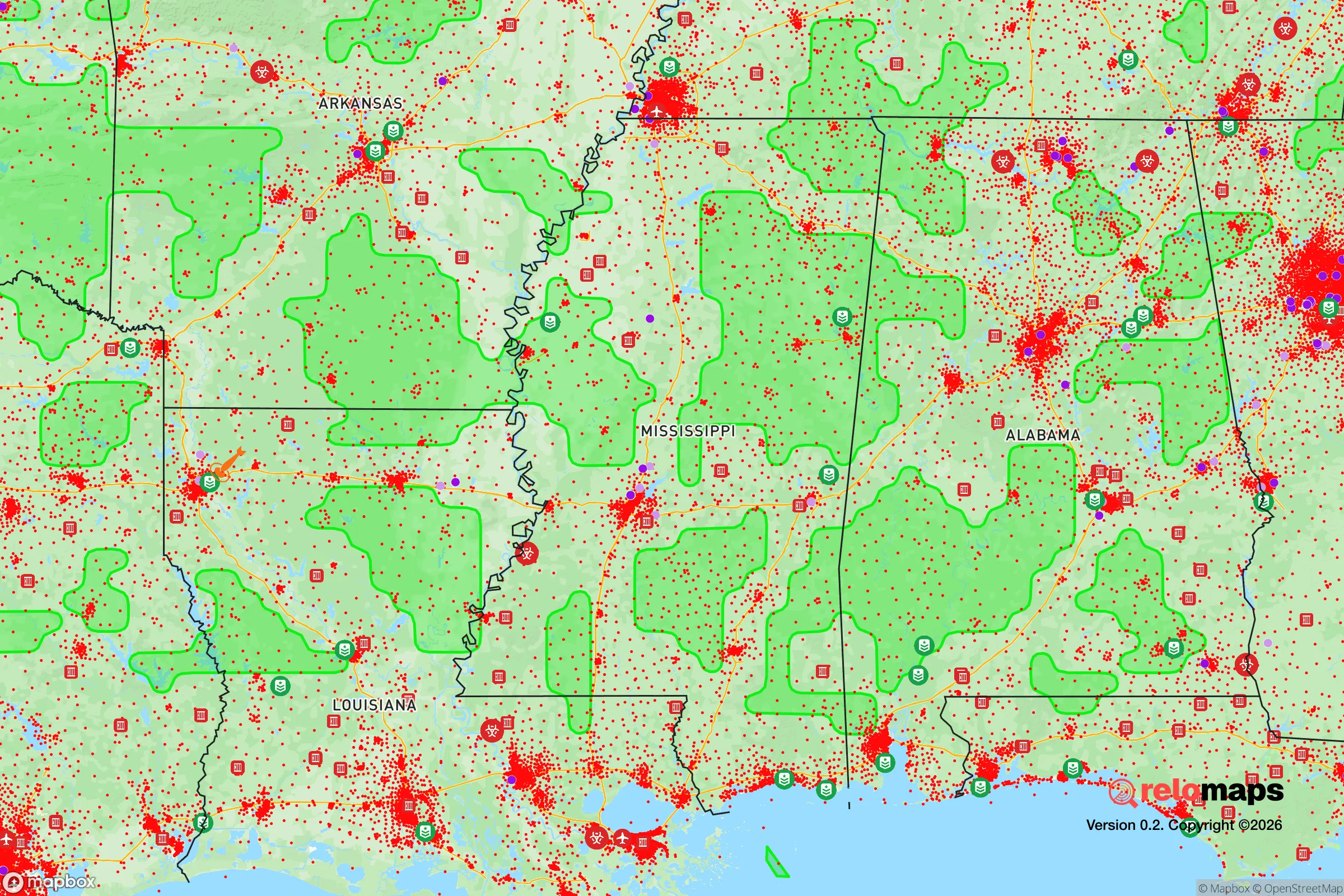
Important Note: For informational purposes only. This does not mean nothing bad ever happens in the green zones. Please use common sense. This is based on public data and modeled with AI. We tried to take a conservative approach but mistakes happen. We update this regularly as new information becomes available.
Solar Generator Recommendations
Backup power matters more here than in safer locations. We've picked three solar generators across budgets and capacity tiers — start with the budget unit if you only need a few essentials, or step up if you want to run a fridge and HVAC for days at a time.

Jackery Portable Power Station Explorer 300
Budget OptionPower on the Go: Weighing only 11 lbs, it's convenient to set up and store with book-sized foldable solar panels

BLUETTI Portable Power Station AC180
Designed for both indoor and outdoor scenarios, AC180 is highly capable as it has a robost capacity and continuous output power.

EF ECOFLOW DELTA Pro Ultra Power Station
Upgraded PickEcoFlow DELTA Pro Ultra is a whole-home energy system designed to grow with your family. Integrated with the Smart Home Panel 2, it scales to meet your evolving energy needs — keeping your home powered, intelligent, and secure through every stage of life.
We earn a commission, at no additional cost to you.
Strategic Assessment Analysis
Oxford, Mississippi, offers a surprisingly resilient strategic position for those prioritizing long-term stability and self-sufficiency, though it is not without its trade-offs. The town’s core advantage lies in its relative isolation from the most volatile corridors of the Deep South, sitting roughly 75 miles southeast of Memphis and 90 miles northwest of Tupelo. This distance from major metropolitan centers—while still being within a day’s drive of critical resources—provides a buffer against the cascading effects of urban unrest, supply chain disruptions, or mass casualty events that tend to concentrate in larger population hubs. For the conservative-minded relocator, Oxford represents a middle ground: close enough to access medical and logistical support, yet far enough to avoid being swept up in the chaos of a failing city.
Geographic position and natural advantages for long-term stability
Oxford sits in the North Central Hills region of Mississippi, a landscape of rolling hardwood forests, clay-loam soils, and abundant water sources. The area’s elevation—averaging around 500 feet—is modest but sufficient to avoid the catastrophic flooding that plagues the Mississippi Delta or coastal zones. The nearby Sardis Lake, a U.S. Army Corps of Engineers reservoir, holds roughly 1.5 million acre-feet of water and provides a reliable freshwater reserve that could sustain a community through extended drought or infrastructure failure. The surrounding Lafayette County is sparsely populated, with a density of about 55 people per square mile, meaning that a relocator can secure acreage with natural cover and defensible perimeters without drawing attention. The region’s temperate climate allows for year-round food production, with a growing season of roughly 220 days—enough for two full crop cycles of staples like corn, beans, and squash. For those serious about food sovereignty, the local extension service at the University of Mississippi offers soil testing and heirloom seed resources that are often overlooked by the broader prepper community.
Risks, exposures, and proximity to fallout-relevant landmarks
No strategic assessment is complete without acknowledging the liabilities. Oxford’s most significant exposure is its proximity to Memphis, a city that has experienced chronic civil unrest, high violent crime rates, and periodic infrastructure failures. In a scenario of widespread civic breakdown, Memphis could become a source of displaced populations or organized looting moving south along Highway 78 or Interstate 55. The Tennessee Valley Authority’s nuclear plants—specifically the Browns Ferry facility in Alabama (about 120 miles east) and the Sequoyah plant near Chattanooga (roughly 200 miles northeast)—are distant enough to avoid direct fallout in most plausible accident or attack scenarios, but prevailing winds from the west-northwest during spring storms could carry particulate matter into the region. More immediately, the University of Mississippi Medical Center in Jackson (about 160 miles south) is a Level I trauma center that would be overwhelmed in a mass casualty event, meaning that serious medical emergencies in Oxford would rely on the local Baptist Memorial Hospital—a 217-bed facility with limited surgical capacity. The town’s location along the New Madrid Seismic Zone, while not directly on a fault line, means that a major earthquake (magnitude 7.0 or greater) could disrupt rail lines and fuel pipelines that run through the region, particularly the Colonial Pipeline corridor that passes within 50 miles. For the prepper, these risks are manageable but require a plan: stockpiling medical supplies, maintaining alternative fuel sources, and establishing a communication network that doesn’t depend on cellular towers.
Practical resilience for a relocator: food, water, energy, and defensibility
For the individual or family looking to establish a resilient homestead, Oxford’s practical assets are solid but require upfront investment. The local water table is high—typically 10 to 30 feet deep—making hand-dug wells or shallow boreholes feasible for those with the equipment. Rainwater catchment is also viable, with annual precipitation averaging 55 inches, distributed fairly evenly across the year. The dominant soil type, the Ruston series, is sandy loam that drains well but requires amendment with organic matter for sustained vegetable production; local farmers’ co-ops in nearby Batesville and Water Valley sell bulk compost and cover-crop seed at reasonable prices. Energy independence is achievable through solar, with the region averaging 4.5 peak sun hours per day—adequate for a modest off-grid system, though winter cloud cover can reduce output by 30% for weeks at a time. A backup generator running on propane or diesel is a wise hedge, and local suppliers like Oxford Oil Company offer bulk delivery. Defensibility is a mixed bag: the rolling terrain and dense tree lines provide natural concealment and chokepoints, but the town’s layout—centered around the historic Square—is not designed for perimeter security. A relocator should prioritize acreage at least 10 miles outside the city limits, preferably along county roads that dead-end or have limited access. The local sheriff’s office, while professional, is small (roughly 40 deputies for the entire county), so in a prolonged crisis, self-reliance is the only reliable option. Firearms are a cultural norm here, and the local gun shops and ranges (such as the Oxford Gun Club) offer training and community networking that can be invaluable for mutual aid.
The overall strategic picture for Oxford is one of cautious optimism for the prepared relocator. It is not a hardened bunker location—it lacks the extreme isolation of the Rocky Mountain redoubts or the arid self-sufficiency of the High Plains. But for someone who values community, access to higher education (the University of Mississippi provides a stable institutional anchor), and a climate that supports year-round subsistence, it offers a viable middle path. The key is to treat Oxford as a base of operations, not a fortress: build relationships with local farmers, stockpile at least six months of supplies, and maintain a low profile. In a world where the next crisis—whether economic collapse, civil unrest, or a public health emergency—is always just around the corner, this town provides the breathing room to adapt without being consumed by the chaos of the cities. The conservative prepper will find that Oxford rewards preparation and punishes complacency, which is exactly the kind of honest assessment this analysis aims to deliver.
* Values derived from national, state, county, city and local statistics and may differ in a specific area. Last updated: 2026-04-30T03:28:03.000Z
Narrative content on this page is AI-generated and may contain mistakes. Verify any details that matter before acting on them.
ReloMaps may earn a commission from affiliate links at no extra cost to you.