Photo: Wikipedia
Strategic Assessment of Palmdale, CA
Multiple tactical vulnerabilities. Population density, target proximity, or disaster risk are likely compounding. A retreat property and exit planning is required.
What does the Strategic Assessment tell us?
Our Strategic Assessment grades tactical survivability of an area. Major population centers, military targets, fallout zones, natural disasters, and border exposure all drive risk — lower exposure means a more defensible position in a crisis.
This is heavily inspired by Joel Skousen's Strategic Relocation book. Highly recommended you checkout the book ($)What does this tell us?
Our Strategic Assessment grades tactical survivability of an area. Major population centers, military targets, fallout zones, natural disasters, and border exposure all drive risk — lower exposure means a more defensible position in a crisis.
This is heavily inspired by Joel Skousen's Strategic Relocation book. Highly recommended you checkout the book ($)Strategic Pillars

Key Distances
Regional Safe Places
Below is our recommended "safe zones" in California and the surrounding area based on our strategic heuristics. For most people, it's unrealistic to live in a “safe zone” full-time due to work, family or other personal reasons. They tend to be more rural. However, many of these areas are perfect for second homes and retreat properties that double as a vacation home or even a short-term rental.


Important Note: For informational purposes only. This does not mean nothing bad ever happens in the green zones. Please use common sense. This is based on public data and modeled with AI. We tried to take a conservative approach but mistakes happen. We update this regularly as new information becomes available.
Solar Generator Recommendations
Backup power matters more here than in safer locations. We've picked three solar generators across budgets and capacity tiers — start with the budget unit if you only need a few essentials, or step up if you want to run a fridge and HVAC for days at a time.

Jackery Portable Power Station Explorer 300
Budget OptionPower on the Go: Weighing only 11 lbs, it's convenient to set up and store with book-sized foldable solar panels

BLUETTI Portable Power Station AC180
Designed for both indoor and outdoor scenarios, AC180 is highly capable as it has a robost capacity and continuous output power.

EF ECOFLOW DELTA Pro Ultra Power Station
Upgraded PickEcoFlow DELTA Pro Ultra is a whole-home energy system designed to grow with your family. Integrated with the Smart Home Panel 2, it scales to meet your evolving energy needs — keeping your home powered, intelligent, and secure through every stage of life.
We earn a commission, at no additional cost to you.
Strategic Assessment Analysis
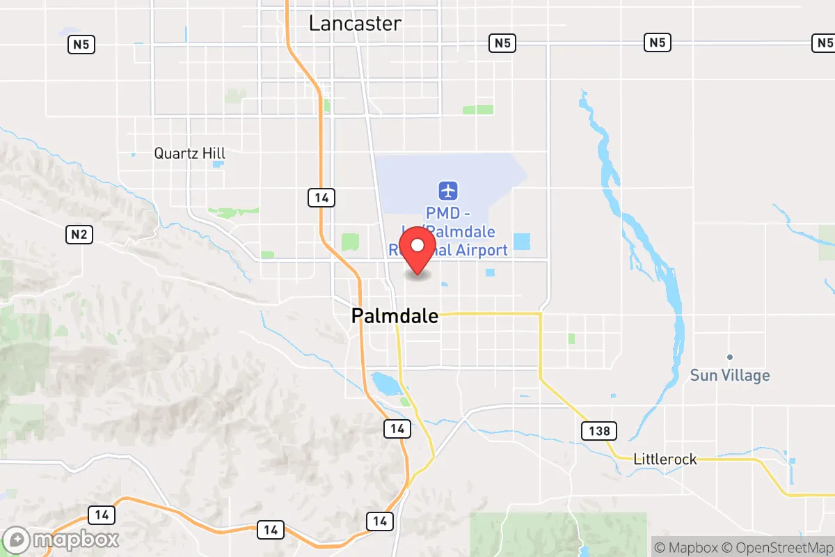
Palmdale, California, offers a mixed strategic picture for the prepper or survivalist-minded relocator. Its primary advantage is geographic positioning: situated in the Antelope Valley at the western edge of the Mojave Desert, it sits roughly 60 miles north of downtown Los Angeles, placing it far enough from the immediate blast zones and urban chaos of a major metropolitan collapse, yet close enough to leverage the region's economic and logistical infrastructure before things go sideways. The city's elevation—around 2,600 feet—provides a modest climate buffer against coastal heatwaves and some airborne contaminants, while the surrounding high desert offers natural chokepoints and limited approach routes for any large-scale movement. However, the area is not without serious vulnerabilities, and a clear-eyed assessment requires weighing its resilience against its exposure to the same systemic risks that plague the rest of Southern California.
Geographic position and natural advantages for long-term survival
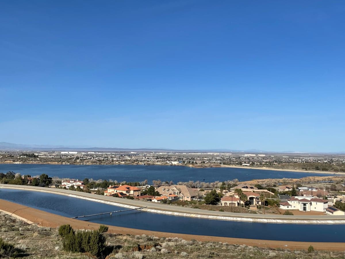
Palmdale's location in the high desert gives it several hard-to-replicate advantages for a strategic relocation. The city sits on the western edge of the Mojave Desert, with the San Gabriel Mountains forming a natural barrier to the south—a 4,000- to 8,000-foot wall that would slow or stop any uncontrolled movement from the Los Angeles basin. To the north and east, open desert stretches for hundreds of miles, offering escape routes into less populated areas like the Owens Valley or even Nevada if things get truly bad. The climate is arid, with annual rainfall under 10 inches, which means less mold, rot, and pest pressure on stored supplies compared to coastal or forested regions. The area also benefits from strong prevailing winds that would disperse airborne fallout from any nuclear event in the LA basin, though this is a double-edged sword—those same winds could carry contamination from a strike on Edwards Air Force Base or Naval Air Weapons Station China Lake, both within 100 miles. Water is the obvious Achilles' heel: the region relies heavily on the State Water Project and the California Aqueduct, both of which are vulnerable to earthquake damage, sabotage, or simply being shut off during a crisis. A serious prepper would need to secure a private well or have a plan for rainwater catchment, as municipal supply would be unreliable in any prolonged emergency.
Risks, exposures, and proximity to fallout-relevant landmarks
Palmdale's proximity to high-value military and infrastructure targets is its most significant liability. Edwards Air Force Base, home to the Air Force Test Center and a primary landing site for the Space Shuttle, lies just 20 miles east. Naval Air Weapons Station China Lake, a major research and testing facility for advanced munitions, is about 80 miles north. Both are Tier-1 targets in any peer-level conflict, and a ground burst at either would produce fallout that could reach Palmdale within hours depending on wind direction. Additionally, the city is within 50 miles of the San Onofre Nuclear Generating Station (now decommissioned but still storing spent fuel) and within 100 miles of Diablo Canyon, still operational. A major earthquake on the San Andreas Fault—which runs through the nearby San Gabriel Mountains—could disrupt the aqueducts, power lines, and natural gas pipelines that supply the Antelope Valley, leaving Palmdale isolated without water or electricity for weeks. The city's population of roughly 170,000 is a double-edged sword: large enough to provide some economic activity and services in normal times, but small enough that a sudden influx of refugees from LA (just a 60-minute drive on a good day) could overwhelm local resources. The main evacuation routes—the Antelope Valley Freeway (CA-14) and Pearblossom Highway (CA-138)—are two-lane roads in many sections, easily clogged or blocked. In a mass evacuation scenario, Palmdale could become a bottleneck rather than a sanctuary.
Practical resilience for a relocator: food, water, energy, and defensibility
For the individual or family looking to establish a resilient homestead, Palmdale offers a mixed bag. Water is the critical constraint: the average household uses 300-400 gallons per day, and municipal supply is dependent on the California Aqueduct, which is vulnerable to earthquake disruption. Drilling a private well is possible but expensive—typically $15,000 to $30,000 for a 300- to 500-foot well in the high desert—and yields are unpredictable. Rainwater catchment is feasible given the arid climate, but you'd need large storage tanks (5,000+ gallons) to get through a dry summer. Food production is limited by the short growing season (last frost in April, first in October) and poor soil, but raised beds with imported soil and drip irrigation can produce decent yields of hardy crops like beans, squash, and tomatoes. The area has strong solar potential—over 280 sunny days per year—so a solar array with battery storage is a must for energy independence. Natural gas is available in most neighborhoods, but a propane backup generator or wood-burning stove would be wise for grid-down scenarios. Defensibility is decent: the city's layout is mostly suburban sprawl with wide streets and limited natural cover, but the surrounding desert offers good fields of fire and limited approach routes. A property on the outskirts with a clear view of the main access roads would be ideal. The local population is a mix of aerospace workers, military retirees, and working-class families—generally conservative-leaning and self-reliant, which is a positive for community resilience. However, there is also a significant transient population and some gang activity in certain neighborhoods, so choosing a location carefully is essential. The Antelope Valley Fairgrounds and local churches could serve as community coordination points in a crisis, but don't count on FEMA or state assistance arriving quickly—California's bureaucracy is slow even in normal times.
The overall strategic picture for Palmdale is one of calculated risk. It offers genuine advantages—distance from the LA blast zone, natural barriers, strong solar potential, and a relatively self-reliant population—but these are offset by serious vulnerabilities: water dependence on fragile infrastructure, proximity to high-value military targets, and the ever-present threat of a mass evacuation from the south. For a single individual or a small family with the resources to drill a well, install solar, and stockpile supplies, Palmdale could serve as a viable base of operations—a place to ride out the initial chaos and then decide whether to stay or push further into the desert. But it is not a bug-out location in the classic sense; it is a suburban city with all the dependencies that implies. If you're looking for true isolation and self-sufficiency, you'd need to go another 100 miles north to places like Ridgecrest or even into Nevada. Palmdale is a compromise—better than LA, worse than the middle of nowhere—and that compromise might be exactly what you need, or exactly what gets you killed, depending on how the dominoes fall. Know your risks, plan accordingly, and don't assume the desert will save you just because it's empty. It's empty for a reason.
* Values derived from national, state, county, city and local statistics and may differ in a specific area. Last updated: 2026-04-24T12:48:20.000Z
Narrative content on this page is AI-generated and may contain mistakes. Verify any details that matter before acting on them.
ReloMaps may earn a commission from affiliate links at no extra cost to you.