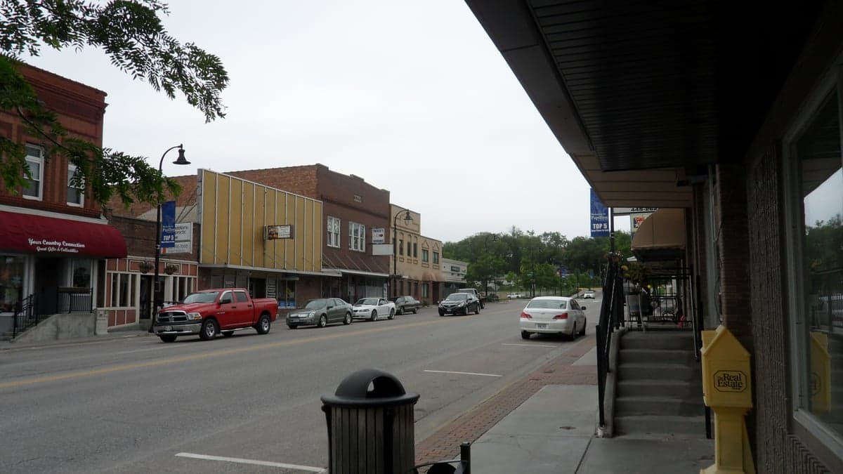
Photo: Wikipedia
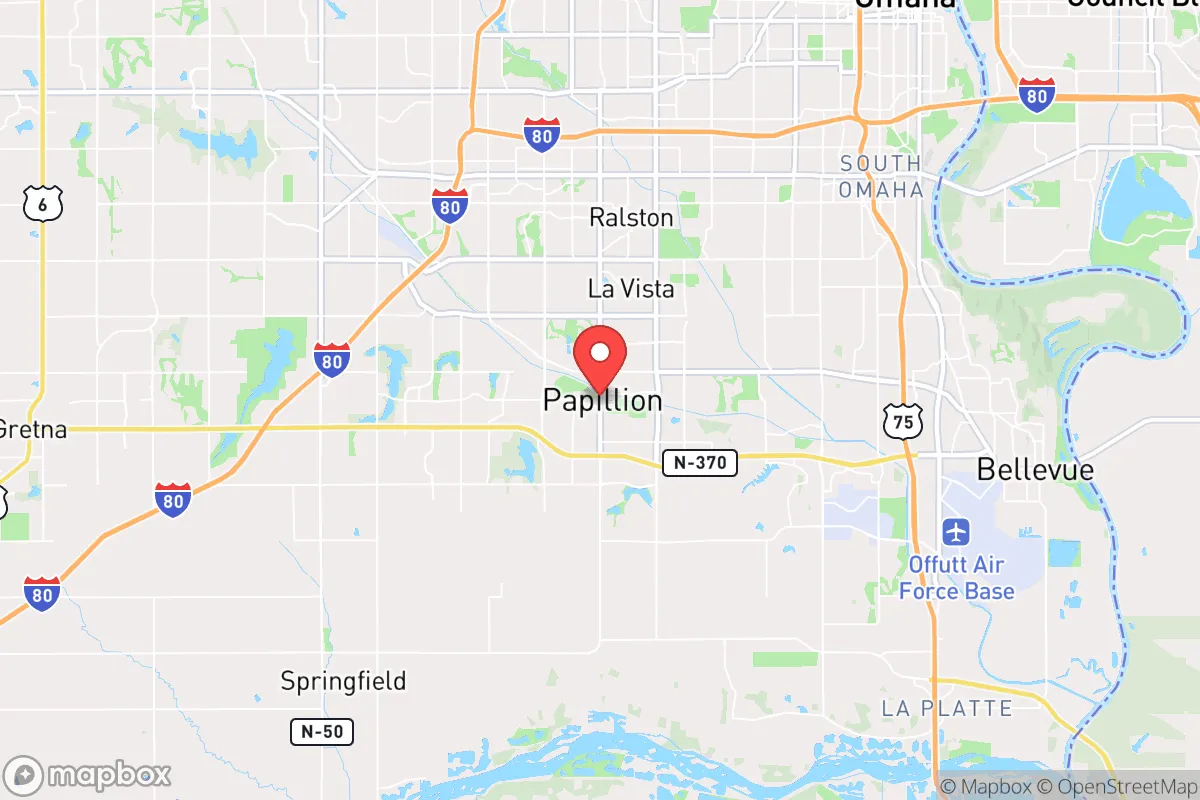
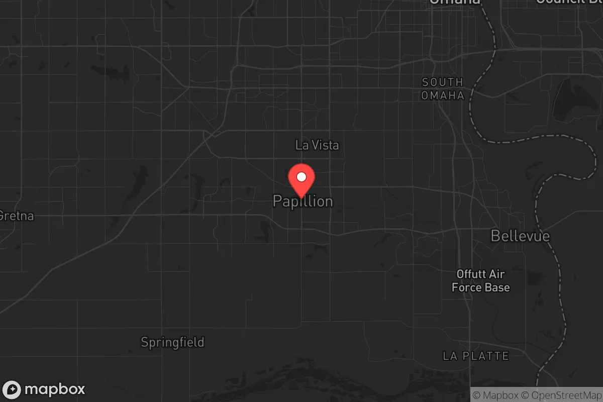
Strategic Assessment of Papillion, NE
Meaningful friction. Expect exposure to either population pressure, blast zones, or natural disaster risk. Consider buying a retreat property.
What does the Strategic Assessment tell us?
Our Strategic Assessment grades tactical survivability of an area. Major population centers, military targets, fallout zones, natural disasters, and border exposure all drive risk — lower exposure means a more defensible position in a crisis.
This is heavily inspired by Joel Skousen's Strategic Relocation book. Highly recommended you checkout the book ($)What does this tell us?
Our Strategic Assessment grades tactical survivability of an area. Major population centers, military targets, fallout zones, natural disasters, and border exposure all drive risk — lower exposure means a more defensible position in a crisis.
This is heavily inspired by Joel Skousen's Strategic Relocation book. Highly recommended you checkout the book ($)Strategic Pillars

Key Distances
Regional Safe Places
Below is our recommended "safe zones" in Nebraska and the surrounding area based on our strategic heuristics. For most people, it's unrealistic to live in a “safe zone” full-time due to work, family or other personal reasons. They tend to be more rural. However, many of these areas are perfect for second homes and retreat properties that double as a vacation home or even a short-term rental.
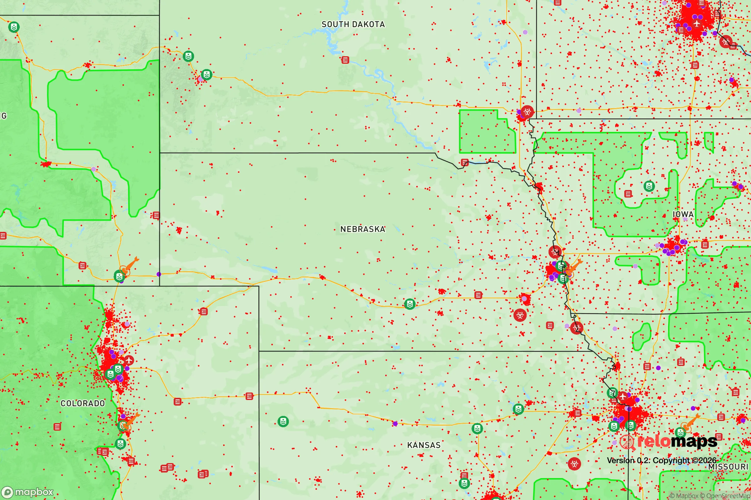
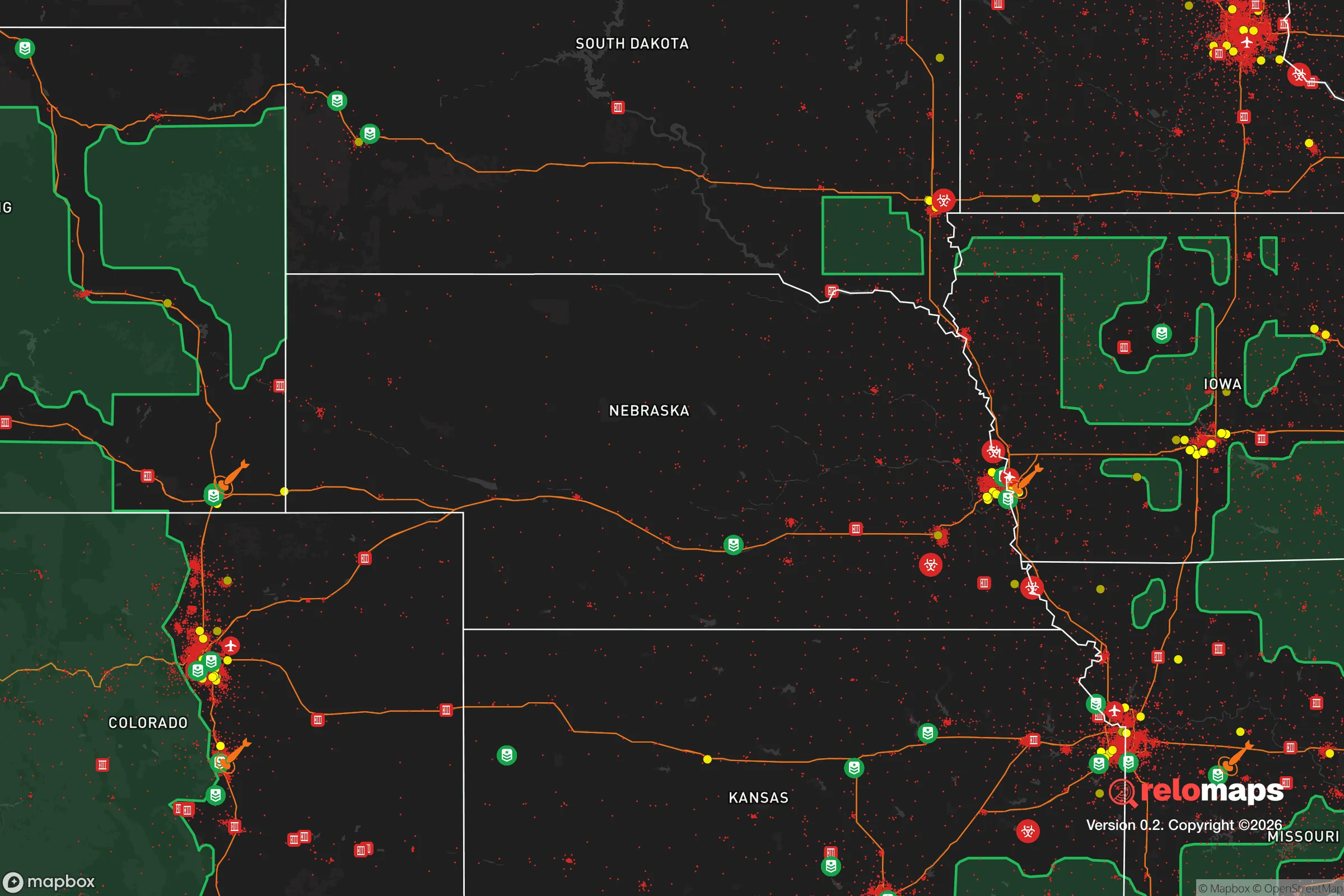
Important Note: For informational purposes only. This does not mean nothing bad ever happens in the green zones. Please use common sense. This is based on public data and modeled with AI. We tried to take a conservative approach but mistakes happen. We update this regularly as new information becomes available.
Solar Generator Recommendations
Backup power matters more here than in safer locations. We've picked three solar generators across budgets and capacity tiers — start with the budget unit if you only need a few essentials, or step up if you want to run a fridge and HVAC for days at a time.

Jackery Portable Power Station Explorer 300
Budget OptionPower on the Go: Weighing only 11 lbs, it's convenient to set up and store with book-sized foldable solar panels

BLUETTI Portable Power Station AC180
Designed for both indoor and outdoor scenarios, AC180 is highly capable as it has a robost capacity and continuous output power.

EF ECOFLOW DELTA Pro Ultra Power Station
Upgraded PickEcoFlow DELTA Pro Ultra is a whole-home energy system designed to grow with your family. Integrated with the Smart Home Panel 2, it scales to meet your evolving energy needs — keeping your home powered, intelligent, and secure through every stage of life.
We earn a commission, at no additional cost to you.
Strategic Assessment Analysis
Papillion, Nebraska, offers a surprisingly strong strategic position for those prioritizing resilience, sitting just south of Omaha but far enough from the urban core to avoid the worst of a collapse scenario. Its location on the eastern edge of the Great Plains provides a buffer against coastal disruptions, while the area’s robust infrastructure and agricultural hinterland make it a viable long-term holdout. For a relocator with a prepper mindset, Papillion balances proximity to resources with a degree of separation from the chaos that could engulf larger cities.
Geographic position and natural advantages for long-term survival
Papillion’s geography is its primary strategic asset. The city lies in the Platte River Valley, a region historically rich in groundwater and fertile soil, which means local food production is feasible even if supply chains falter. The surrounding Sarpy County is part of the Missouri River watershed, providing ample surface water for filtration and irrigation. Elevation is modest but sufficient to avoid major flood risks from the Platte or Missouri, with most residential areas sitting on well-drained loess soils. The area’s continental climate—hot summers and cold winters—is manageable with proper preparation, and the lack of significant seismic or hurricane activity reduces natural disaster threats. For a relocator, the flat terrain also simplifies defensive positioning and off-grid travel, though it offers few natural choke points against a determined threat.
Risks, exposures, and proximity to fallout-relevant landmarks
The most significant risk for Papillion is its proximity to Omaha, roughly 15 miles north, and Offutt Air Force Base, home to U.S. Strategic Command (STRATCOM). Offutt is a prime target in any major conflict, and a nuclear strike on the base would likely devastate the entire Omaha metro area, including Papillion, within the blast and fallout zones. Even a conventional attack or EMP event targeting STRATCOM could cripple regional power grids and communications. Additionally, the city sits near Interstate 80 and the Union Pacific rail corridor, both critical logistics arteries that could become chokepoints or targets during civil unrest. The presence of large data centers and defense contractors in the area also raises the risk of secondary attacks or sabotage. For a relocator, this means Papillion is not a remote sanctuary—it’s a suburban buffer zone that could become a refugee funnel if Omaha collapses.
Practical resilience for a relocator: food, water, energy, and defensibility
On the practical side, Papillion offers several advantages for a prepared individual or family. The city’s water supply comes from the Platte River and local aquifers, and many homes have private wells or access to rural water districts—critical if municipal treatment fails. The surrounding farmland produces corn, soybeans, and livestock, and local farmers’ markets and co-ops provide direct-to-consumer food sources that could be bartered or secured. Energy infrastructure is tied to the regional grid, but natural gas and propane are widely available for backup heating and cooking. Solar potential is moderate, with about 200 sunny days per year, enough for supplemental panels but not full off-grid reliance. Defensibility is mixed: Papillion’s suburban layout with cul-de-sacs and tree-lined streets offers some natural screening, but the lack of natural barriers and the density of single-family homes means a determined group could easily move through the area. The city’s police and fire services are well-funded, but in a prolonged crisis, they would likely be overwhelmed. For a relocator, the key is to secure a property with a well, a garden, and a defensible perimeter—preferably on the southern or western edges of town, away from the Omaha-bound highways.
Overall strategic picture for a conservative relocator
Papillion is a calculated compromise for the survivalist-minded relocator. It offers the infrastructure and community of a small city—good schools, a low crime rate, and a politically conservative population that leans toward self-reliance—while still being close enough to Omaha to access medical centers, hardware stores, and trade networks. The risks from STRATCOM and the interstate corridor are real, but they are not immediate unless a major conflict erupts. For those willing to invest in a well, solar panels, and a food stockpile, Papillion provides a solid base for weathering economic collapse or localized unrest. The real test would come during a national emergency: the city’s 25,000 residents would likely band together, but the influx of refugees from Omaha could strain resources. In short, Papillion is a good place to ride out a storm, not a fortress to survive a war. It’s a strategic choice for those who want to be prepared without living off-grid, but it demands constant vigilance and a plan for evacuation if the worst happens.
* Values derived from national, state, county, city and local statistics and may differ in a specific area. Last updated: 2026-05-03T20:29:05.000Z
Narrative content on this page is AI-generated and may contain mistakes. Verify any details that matter before acting on them.
ReloMaps may earn a commission from affiliate links at no extra cost to you.