Photo: Wikipedia
Strategic Assessment of Parkersburg, WV
Meaningful friction. Expect exposure to either population pressure, blast zones, or natural disaster risk. Consider buying a retreat property.
What does the Strategic Assessment tell us?
Our Strategic Assessment grades tactical survivability of an area. Major population centers, military targets, fallout zones, natural disasters, and border exposure all drive risk — lower exposure means a more defensible position in a crisis.
This is heavily inspired by Joel Skousen's Strategic Relocation book. Highly recommended you checkout the book ($)What does this tell us?
Our Strategic Assessment grades tactical survivability of an area. Major population centers, military targets, fallout zones, natural disasters, and border exposure all drive risk — lower exposure means a more defensible position in a crisis.
This is heavily inspired by Joel Skousen's Strategic Relocation book. Highly recommended you checkout the book ($)Strategic Pillars

Key Distances
Regional Safe Places
Below is our recommended "safe zones" in West Virginia and the surrounding area based on our strategic heuristics. For most people, it's unrealistic to live in a “safe zone” full-time due to work, family or other personal reasons. They tend to be more rural. However, many of these areas are perfect for second homes and retreat properties that double as a vacation home or even a short-term rental.


Important Note: For informational purposes only. This does not mean nothing bad ever happens in the green zones. Please use common sense. This is based on public data and modeled with AI. We tried to take a conservative approach but mistakes happen. We update this regularly as new information becomes available.
Solar Generator Recommendations
Backup power matters more here than in safer locations. We've picked three solar generators across budgets and capacity tiers — start with the budget unit if you only need a few essentials, or step up if you want to run a fridge and HVAC for days at a time.

Jackery Portable Power Station Explorer 300
Budget OptionPower on the Go: Weighing only 11 lbs, it's convenient to set up and store with book-sized foldable solar panels

BLUETTI Portable Power Station AC180
Designed for both indoor and outdoor scenarios, AC180 is highly capable as it has a robost capacity and continuous output power.

EF ECOFLOW DELTA Pro Ultra Power Station
Upgraded PickEcoFlow DELTA Pro Ultra is a whole-home energy system designed to grow with your family. Integrated with the Smart Home Panel 2, it scales to meet your evolving energy needs — keeping your home powered, intelligent, and secure through every stage of life.
We earn a commission, at no additional cost to you.
Strategic Assessment Analysis
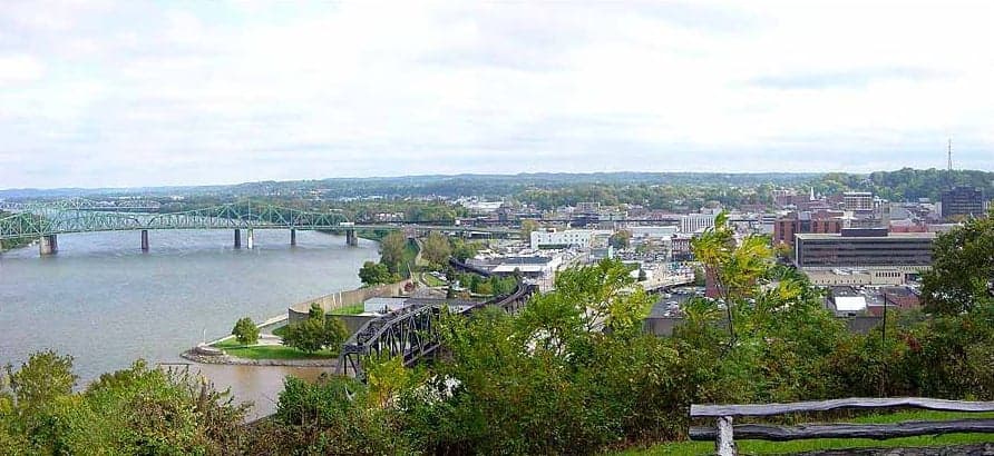
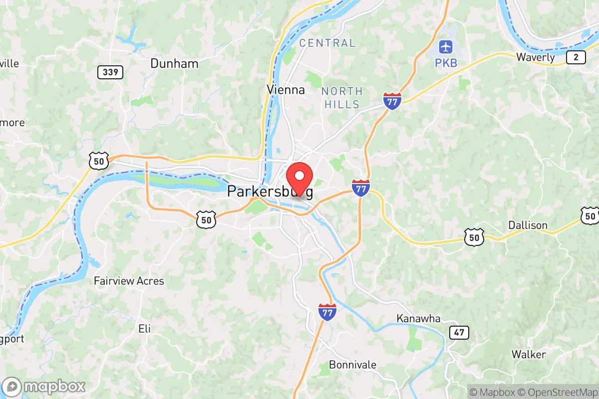
Parkersburg, West Virginia, offers a strategic relocation option for those prioritizing resilience and self-sufficiency, sitting at the confluence of the Ohio and Little Kanawha Rivers in the Mid-Ohio Valley. Its location roughly 90 miles south of Pittsburgh and 120 miles east of Columbus places it within a day’s drive of major urban centers while remaining insulated from their immediate fallout risks. The area’s historical industrial base, including a DuPont plant and a major chemical corridor, provides a mixed blessing: it signals economic activity but also introduces specific exposure concerns that a prepper must weigh carefully.
Geographic position and natural advantages for long-term survival
Parkersburg’s position in the Appalachian foothills gives it a defensible terrain advantage over flatter, more exposed regions. The surrounding hills and wooded valleys create natural chokepoints and line-of-sight barriers, making large-scale movement through the area difficult without local knowledge. The Ohio River provides a reliable water source for filtration and transport, while the Little Kanawha River offers a secondary route into less populated interior West Virginia. The region sits outside the primary blast and fallout zones of major targets like Washington D.C. (roughly 300 miles east) and the Pittsburgh industrial complex, though prevailing westerly winds could carry fallout from a strike on the Ohio River chemical plants near Marietta or the DuPont Washington Works facility just south of town. The area’s moderate climate supports year-round gardening and foraging, with average annual rainfall around 42 inches and a growing season of roughly 170 days. The nearby Wayne National Forest and Monongahela National Forest provide vast public land for hunting, timber, and isolation if needed.
Risks, exposures, and proximity to fallout-relevant landmarks
The primary strategic risk for Parkersburg is its location within the Ohio River Valley’s chemical and industrial corridor. The DuPont Washington Works facility, less than 10 miles south, produces specialty chemicals and has a history of accidental releases, including a 2010 phosgene leak that killed one worker. A major industrial accident or targeted attack could release toxic clouds that drift north over the city. The nearby Willow Island nuclear power plant (Pleasants Power Station) is decommissioned but still stores spent fuel on-site, presenting a radiological hazard if breached. The area is also within 200 miles of the Perry Nuclear Power Plant in Ohio and the Beaver Valley Nuclear Power Station in Pennsylvania, both potential targets. For a prepper, the concentration of chemical plants along the Ohio River from Parkersburg to Huntington creates a vulnerability corridor that requires careful wind-direction monitoring and a pre-planned evacuation route south or east into the hills. The region’s seismic risk is low, but the area is prone to flooding from the Ohio River, with major floods in 1937, 1964, and 2018 causing significant damage to low-lying neighborhoods.
Practical resilience for a relocator: food, water, energy, and defensibility
For a relocator focused on self-sufficiency, Parkersburg offers a mix of advantages and challenges. The Ohio River provides abundant water, but it requires robust filtration due to upstream agricultural runoff and industrial discharge—a high-quality Berkey or reverse osmosis system is non-negotiable. The surrounding farmland in Wood County and neighboring Washington County, Ohio, supports local food production, with farmers’ markets and CSAs available, though the growing season is shorter than the Deep South. The area’s coal history means cheap electricity and natural gas are still available, but the grid is aging and vulnerable to weather events—ice storms in 2022 left thousands without power for days. Solar potential is moderate, with roughly 4.5 peak sun hours per day, making a ground-mounted array feasible on rural acreage. Defensibility is strong: the hills and hollows offer natural cover, and the low population density (roughly 30,000 in the city, 85,000 in the county) means fewer people to compete with for resources in a collapse scenario. However, the city itself has a high crime rate relative to its size—property crime is above the national average—so a rural property outside the city limits is strongly advised. The local gun culture is robust, with multiple gun shops and ranges, and West Virginia’s constitutional carry law means no permit is needed for concealed carry. The state’s strong property rights and low taxes (no state income tax on Social Security, low property taxes) make it easier to secure land and build a homestead.
The overall strategic picture for Parkersburg is one of calculated trade-offs. It offers a solid base for a prepper who values geographic isolation from major targets, abundant water, and a supportive legal environment for self-defense and property ownership. The risks from the chemical corridor and floodplain are real but manageable with proper planning—choosing a home on high ground east of the city, maintaining a wind-direction weather station, and stockpiling filtration and medical supplies for chemical exposure. The area’s proximity to the Appalachian Trail and national forests provides a bug-out option into deeper wilderness, while the local economy (healthcare, manufacturing, and energy) offers a cover for normal life. For a conservative-leaning relocator concerned about urban unrest, supply chain disruptions, or a major geopolitical event, Parkersburg is a viable, if not perfect, choice—a place where you can live quietly, prepare seriously, and avoid the worst of what’s coming without going completely off-grid.
* Values derived from national, state, county, city and local statistics and may differ in a specific area. Last updated: 2026-05-02T07:01:07.000Z
Narrative content on this page is AI-generated and may contain mistakes. Verify any details that matter before acting on them.
ReloMaps may earn a commission from affiliate links at no extra cost to you.