Photo: Wikipedia
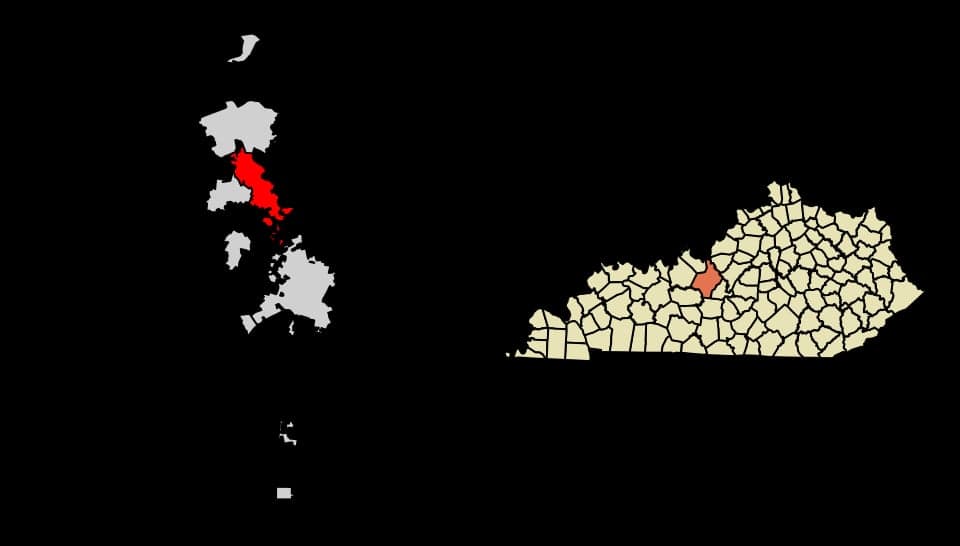
Strategic Assessment of Radcliff, KY
Meaningful friction. Expect exposure to either population pressure, blast zones, or natural disaster risk. Consider buying a retreat property.
What does the Strategic Assessment tell us?
Our Strategic Assessment grades tactical survivability of an area. Major population centers, military targets, fallout zones, natural disasters, and border exposure all drive risk — lower exposure means a more defensible position in a crisis.
This is heavily inspired by Joel Skousen's Strategic Relocation book. Highly recommended you checkout the book ($)What does this tell us?
Our Strategic Assessment grades tactical survivability of an area. Major population centers, military targets, fallout zones, natural disasters, and border exposure all drive risk — lower exposure means a more defensible position in a crisis.
This is heavily inspired by Joel Skousen's Strategic Relocation book. Highly recommended you checkout the book ($)Strategic Pillars

Key Distances
Regional Safe Places
Below is our recommended "safe zones" in Kentucky and the surrounding area based on our strategic heuristics. For most people, it's unrealistic to live in a “safe zone” full-time due to work, family or other personal reasons. They tend to be more rural. However, many of these areas are perfect for second homes and retreat properties that double as a vacation home or even a short-term rental.


Important Note: For informational purposes only. This does not mean nothing bad ever happens in the green zones. Please use common sense. This is based on public data and modeled with AI. We tried to take a conservative approach but mistakes happen. We update this regularly as new information becomes available.
Solar Generator Recommendations
Backup power matters more here than in safer locations. We've picked three solar generators across budgets and capacity tiers — start with the budget unit if you only need a few essentials, or step up if you want to run a fridge and HVAC for days at a time.

Jackery Portable Power Station Explorer 300
Budget OptionPower on the Go: Weighing only 11 lbs, it's convenient to set up and store with book-sized foldable solar panels

BLUETTI Portable Power Station AC180
Designed for both indoor and outdoor scenarios, AC180 is highly capable as it has a robost capacity and continuous output power.

EF ECOFLOW DELTA Pro Ultra Power Station
Upgraded PickEcoFlow DELTA Pro Ultra is a whole-home energy system designed to grow with your family. Integrated with the Smart Home Panel 2, it scales to meet your evolving energy needs — keeping your home powered, intelligent, and secure through every stage of life.
We earn a commission, at no additional cost to you.
Strategic Assessment Analysis
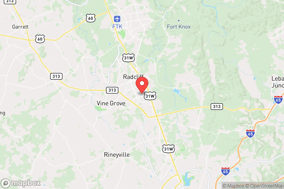
Radcliff, Kentucky, sits in a strategic sweet spot that preppers and survivalists should take seriously: close enough to the logistical spine of I-65 to move supplies or bug out, but far enough from Louisville (45 miles north) and Fort Knox’s immediate blast radius to avoid the worst of a cascading urban collapse. The city’s resilience stems from its dual identity as a military-adjacent community and a rural-urban hybrid, giving it infrastructure that most small towns lack—reliable water, grid access, and a population accustomed to discipline and emergency protocols. For a conservative relocator worried about civil unrest, supply chain failures, or mass casualty events, Radcliff offers a foothold that balances isolation with access, provided you understand its specific vulnerabilities.
Geographic position and natural advantages for long-term survival
Radcliff sits in Hardin County, roughly 35 miles south of Louisville and 15 miles north of Elizabethtown, placing it in a corridor that’s both a transportation hub and a natural buffer zone. The area is part of the Pennyroyal Plateau, characterized by rolling hills, limestone bedrock, and abundant groundwater—critical for well drilling if municipal systems fail. The Ohio River is 30 miles north, but Radcliff itself relies on the Nolin River and local aquifers, which are less vulnerable to contamination from upstream industrial sites. The climate is temperate, with four distinct seasons and an average annual rainfall of 48 inches, supporting subsistence gardening and livestock without the drought risks of the West. The surrounding Hardin County is heavily forested, offering cover and game (deer, turkey, small game) for those with hunting skills, though public land is limited—most is private farmland or military-controlled. The lack of major floodplains or fault lines means natural disasters are rare; the biggest weather threats are tornadoes (the area sits in Dixie Alley) and occasional ice storms, both manageable with proper shelter and stored fuel.
Risks, exposures, and proximity to fallout-relevant landmarks
The elephant in the room is Fort Knox, which lies directly adjacent to Radcliff’s eastern border. The base houses the U.S. Army’s Armor School, the Gold Depository, and significant ammunition and fuel storage. In a major conflict or domestic terror event, this makes Radcliff a potential secondary target—not for a direct strike, but for the chaos that follows an attack on the base. The 2024 security breach at Fort Knox (a drone incursion that exposed perimeter weaknesses) underscores that the base is not invulnerable. Additionally, I-65 is a double-edged sword: it’s your lifeline for resupply, but in a mass evacuation scenario, it becomes a choke point clogged with refugees from Louisville and Nashville (160 miles south). The Louisville International Airport and UPS Worldport are 40 minutes north—a prime target for a cargo disruption or terrorist strike that could ripple into Radcliff via supply chain collapse. On the plus side, Radcliff’s population of ~13,000 is small enough to avoid the density-driven disease spread and resource competition of a city, but large enough to have a Walmart, two grocery stores, and a hospital (the 25-bed Ireland Army Health Clinic on base, plus Baptist Health Hardin in Elizabethtown). The biggest risk is complacency: many residents assume the military presence guarantees protection, but in a grid-down scenario, the base will lock down and prioritize its own, leaving Radcliff civilians to fend for themselves.
Practical resilience for a relocator: food, water, energy, and defensibility
Water is Radcliff’s strongest asset. The city draws from the Nolin River and the Louisville Water Company’s regional system, but most homes in the outskirts have private wells—a must for any prepper buying property here. The water table is high (20-40 feet depth), and well drilling is affordable ($3,000-$5,000). For food, the local agricultural scene is robust: Hardin County has over 1,200 farms, with corn, soybeans, and cattle dominating. The Radcliff Farmers Market runs May-October, but for year-round security, you’ll want to establish relationships with local growers—Amish and Mennonite communities in neighboring Larue and Hart counties are a reliable source for seed, livestock, and barter goods. Energy is a weak point: the grid is served by LG&E and KU, both reliant on coal and natural gas plants that are vulnerable to cyberattack (the 2021 Colonial Pipeline hack showed how fast fuel supply can vanish). Solar is viable—the area gets 4.5 peak sun hours per day—but zoning in Radcliff’s older neighborhoods can be restrictive; check Hardin County’s codes before installing panels. Defensibility is mixed. The terrain is gently rolling, not mountainous, so you can’t rely on natural chokepoints. However, the suburban layout (cul-de-sacs, tree-lined streets) allows for neighborhood watch-style perimeter control. The biggest advantage is the local gun culture: Kentucky is a constitutional carry state, and Hardin County has a 40%+ household firearm ownership rate. The Radcliff Police Department is small (30 officers) and will be overwhelmed in a crisis, so your security is your own responsibility. Stockpile ammunition and consider a rural property with a long driveway and clear sightlines.
The overall strategic picture for Radcliff is one of calculated trade-offs. It’s not a remote bunker—you’re 45 minutes from a major city and adjacent to a military base that could become a liability. But for a conservative relocator who wants to stay connected to infrastructure while maintaining a low profile, it works. The community is politically red (Hardin County voted +35 R in 2024), with a strong veteran presence that brings practical skills and a no-nonsense attitude. The local economy is stable (unemployment around 4%, anchored by Fort Knox and distribution centers), so you can work remotely or in trades without drawing attention. The real test will be the first 72 hours after a major event: can you secure your home, filter your water, and avoid the I-65 exodus? If you’ve prepped for that, Radcliff gives you a fighting chance. If not, the same proximity that makes it convenient will become a trap. Treat it as a base camp, not a fortress, and you’ll be ahead of 90% of the population.
* Values derived from national, state, county, city and local statistics and may differ in a specific area. Last updated: 2026-04-21T09:43:20.000Z
Narrative content on this page is AI-generated and may contain mistakes. Verify any details that matter before acting on them.
ReloMaps may earn a commission from affiliate links at no extra cost to you.