
Photo: Wikipedia
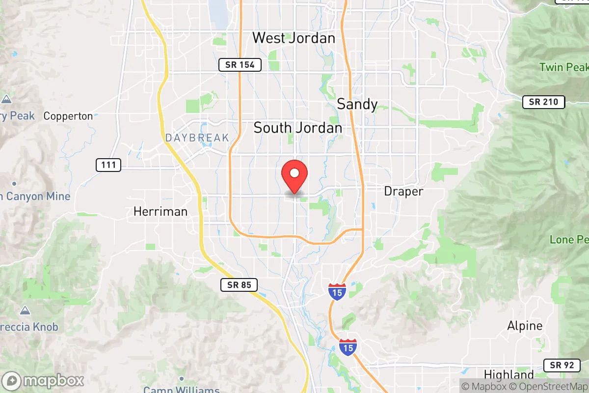
Strategic Assessment of Riverton, UT
Workable tactical position. Some exposure to population density or targets, but generally defensible in a crisis.
What does the Strategic Assessment tell us?
Our Strategic Assessment grades tactical survivability of an area. Major population centers, military targets, fallout zones, natural disasters, and border exposure all drive risk — lower exposure means a more defensible position in a crisis.
This is heavily inspired by Joel Skousen's Strategic Relocation book. Highly recommended you checkout the book ($)What does this tell us?
Our Strategic Assessment grades tactical survivability of an area. Major population centers, military targets, fallout zones, natural disasters, and border exposure all drive risk — lower exposure means a more defensible position in a crisis.
This is heavily inspired by Joel Skousen's Strategic Relocation book. Highly recommended you checkout the book ($)Strategic Pillars

Key Distances
Regional Safe Places
Below is our recommended "safe zones" in Utah and the surrounding area based on our strategic heuristics. For most people, it's unrealistic to live in a “safe zone” full-time due to work, family or other personal reasons. They tend to be more rural. However, many of these areas are perfect for second homes and retreat properties that double as a vacation home or even a short-term rental.


Important Note: For informational purposes only. This does not mean nothing bad ever happens in the green zones. Please use common sense. This is based on public data and modeled with AI. We tried to take a conservative approach but mistakes happen. We update this regularly as new information becomes available.
Solar Generator Recommendations
Backup power matters more here than in safer locations. We've picked three solar generators across budgets and capacity tiers — start with the budget unit if you only need a few essentials, or step up if you want to run a fridge and HVAC for days at a time.

Jackery Portable Power Station Explorer 300
Budget OptionPower on the Go: Weighing only 11 lbs, it's convenient to set up and store with book-sized foldable solar panels

BLUETTI Portable Power Station AC180
Designed for both indoor and outdoor scenarios, AC180 is highly capable as it has a robost capacity and continuous output power.

EF ECOFLOW DELTA Pro Ultra Power Station
Upgraded PickEcoFlow DELTA Pro Ultra is a whole-home energy system designed to grow with your family. Integrated with the Smart Home Panel 2, it scales to meet your evolving energy needs — keeping your home powered, intelligent, and secure through every stage of life.
We earn a commission, at no additional cost to you.
Strategic Assessment Analysis
Riverton, Utah, offers a compelling mix of strategic advantages and notable vulnerabilities for the conservative-minded relocator focused on long-term resilience. Situated at the southwestern edge of the Salt Lake Valley, this community of roughly 45,000 benefits from a strong local economy, a deeply rooted culture of self-reliance, and a geographic position that provides both access to critical resources and a buffer from the densest urban chaos. However, its proximity to a major metropolitan area and key infrastructure targets means that any serious disruption—whether from civil unrest, a major earthquake, or a geopolitical event—would test the preparedness of even the most seasoned prepper.
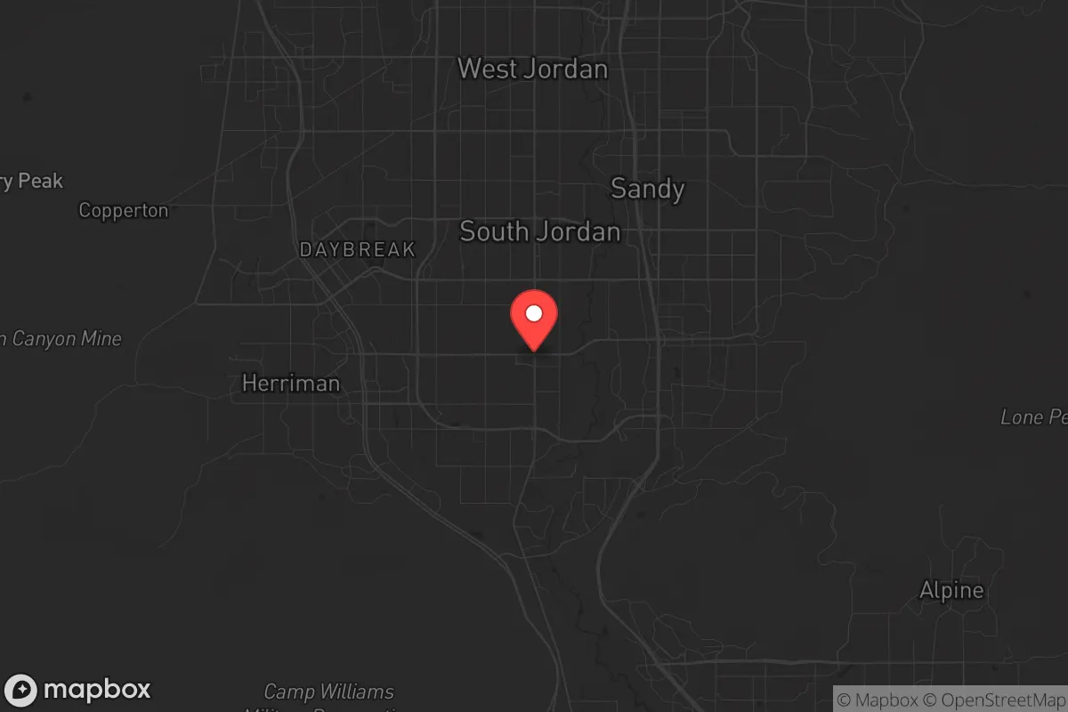
Geographic position and natural advantages for long-term security
Riverton sits at the base of the Oquirrh Mountains, with the Jordan River running along its eastern edge, placing it in a unique transitional zone between the urban Wasatch Front and the more remote, defensible terrain of Utah's west desert. The city's elevation—around 4,400 feet—provides a moderate climate with four distinct seasons, reducing the risk of extreme weather events that plague other regions. The nearby Bingham Canyon Mine, while an economic engine, also offers a stark reminder of the area's industrial backbone; the mine's massive pit and surrounding tailings create a natural barrier to the southwest, funneling any potential threat from that direction. More importantly, Riverton's position at the mouth of several canyons—including the Jordan River Parkway and the foothills of the Oquirrhs—gives residents multiple egress routes into the backcountry, a critical advantage if the valley floor becomes compromised. The city's water supply, drawn from the Jordan River and supplemented by deep aquifers, is relatively secure compared to desert communities, though it remains vulnerable to upstream contamination or seismic disruption.
Risks, exposures, and proximity to fallout-relevant landmarks
The most significant strategic weakness of Riverton is its location within the Salt Lake City metropolitan area, roughly 20 miles south of downtown. This places it within the blast and fallout radius of any major attack on Hill Air Force Base (40 miles north), the Tooele Army Depot (30 miles west), or the Salt Lake City International Airport (25 miles north). A single nuclear detonation at any of these targets would render much of the valley uninhabitable for weeks or months, and Riverton's position in the southern part of the valley offers only marginal protection from prevailing winds that would carry fallout southward. Additionally, the Wasatch Fault runs directly through the eastern edge of the city, with a major earthquake event—estimated at a 1-in-7 chance in the next 50 years—posing a catastrophic risk to infrastructure, including the Jordan River's levees and the region's natural gas pipelines. Civil unrest, while less likely in Riverton's relatively homogeneous and family-oriented neighborhoods, could still spill over from Salt Lake City if supply chains collapse or political tensions escalate. The city's proximity to the Utah State Prison (now relocated to Salt Lake City proper) and the Kennecott copper mine's hazardous materials storage are secondary but real concerns for those planning for worst-case scenarios.
Practical resilience for a relocator: food, water, energy, and defensibility
For the individual or family serious about self-sufficiency, Riverton offers a mixed bag. The city's zoning allows for backyard gardens and small livestock in many residential areas, and the local soil—while alkaline—can be amended for productive vegetable plots. Water rights are a critical consideration: the Jordan River's flow is heavily regulated, and during drought years, secondary water rights (for irrigation) are often curtailed. A well-drilled on private property is the gold standard, but depths of 200–400 feet are common, and drilling costs can run $15,000–$30,000. The city's municipal water system is treated and reliable, but a prolonged power outage would render pumps useless without a backup generator or hand-pump capability. Energy resilience is achievable: solar panels are increasingly common, and net metering with Rocky Mountain Power allows for grid-tied systems, but a battery backup (like a Tesla Powerwall or equivalent) is essential for off-grid capability during a grid-down scenario. Natural gas is the primary heating fuel, and while the local distribution network is robust, a major earthquake could rupture lines, making a wood-burning stove or propane backup a wise investment. Defensibility is a challenge in a suburban grid layout; Riverton's neighborhoods are interconnected by wide streets and cul-de-sacs, making them difficult to secure against a determined group. However, the city's low crime rate and strong community ties—bolstered by a high percentage of LDS families who practice food storage and emergency preparedness—create a social fabric that can be leveraged for mutual aid. The nearby Bingham Creek and the Jordan River provide natural barriers to the east and west, but the southern and northern approaches are open, requiring a neighborhood-level security plan rather than a purely individual one.
The overall strategic picture for Riverton is one of calculated risk. It is not a remote bug-out location; it is a suburban community with significant exposure to regional threats. For the conservative relocator who values a strong local economy, good schools, and a culture of preparedness, Riverton offers a solid foundation—but only if paired with a serious commitment to redundancy in water, energy, and food storage, and a realistic plan for evacuation or shelter-in-place during a major event. The city's greatest strength is its people: a population that, by and large, understands the value of hard work, community, and self-reliance. Its greatest weakness is its geography: too close to high-value targets and a major fault line to be considered a safe haven. For those willing to invest in preparation and accept the trade-offs, Riverton can be a viable base of operations. For those seeking true isolation and minimal risk, the deserts of western Utah or the mountains of central Idaho remain better options.
* Values derived from national, state, county, city and local statistics and may differ in a specific area. Last updated: 2026-05-03T20:34:04.000Z
Narrative content on this page is AI-generated and may contain mistakes. Verify any details that matter before acting on them.
ReloMaps may earn a commission from affiliate links at no extra cost to you.