Photo: Wikipedia
Strategic Assessment of Rock Springs, WY
Strong survivability profile. Good buffer from population centers, with manageable environmental and tactical risks.
What does the Strategic Assessment tell us?
Our Strategic Assessment grades tactical survivability of an area. Major population centers, military targets, fallout zones, natural disasters, and border exposure all drive risk — lower exposure means a more defensible position in a crisis.
This is heavily inspired by Joel Skousen's Strategic Relocation book. Highly recommended you checkout the book ($)What does this tell us?
Our Strategic Assessment grades tactical survivability of an area. Major population centers, military targets, fallout zones, natural disasters, and border exposure all drive risk — lower exposure means a more defensible position in a crisis.
This is heavily inspired by Joel Skousen's Strategic Relocation book. Highly recommended you checkout the book ($)Strategic Pillars

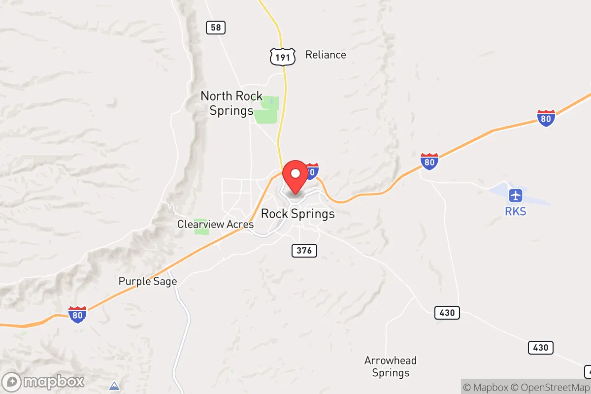
Key Distances
Regional Safe Places
Below is our recommended "safe zones" in Wyoming and the surrounding area based on our strategic heuristics. For most people, it's unrealistic to live in a “safe zone” full-time due to work, family or other personal reasons. They tend to be more rural. However, many of these areas are perfect for second homes and retreat properties that double as a vacation home or even a short-term rental.
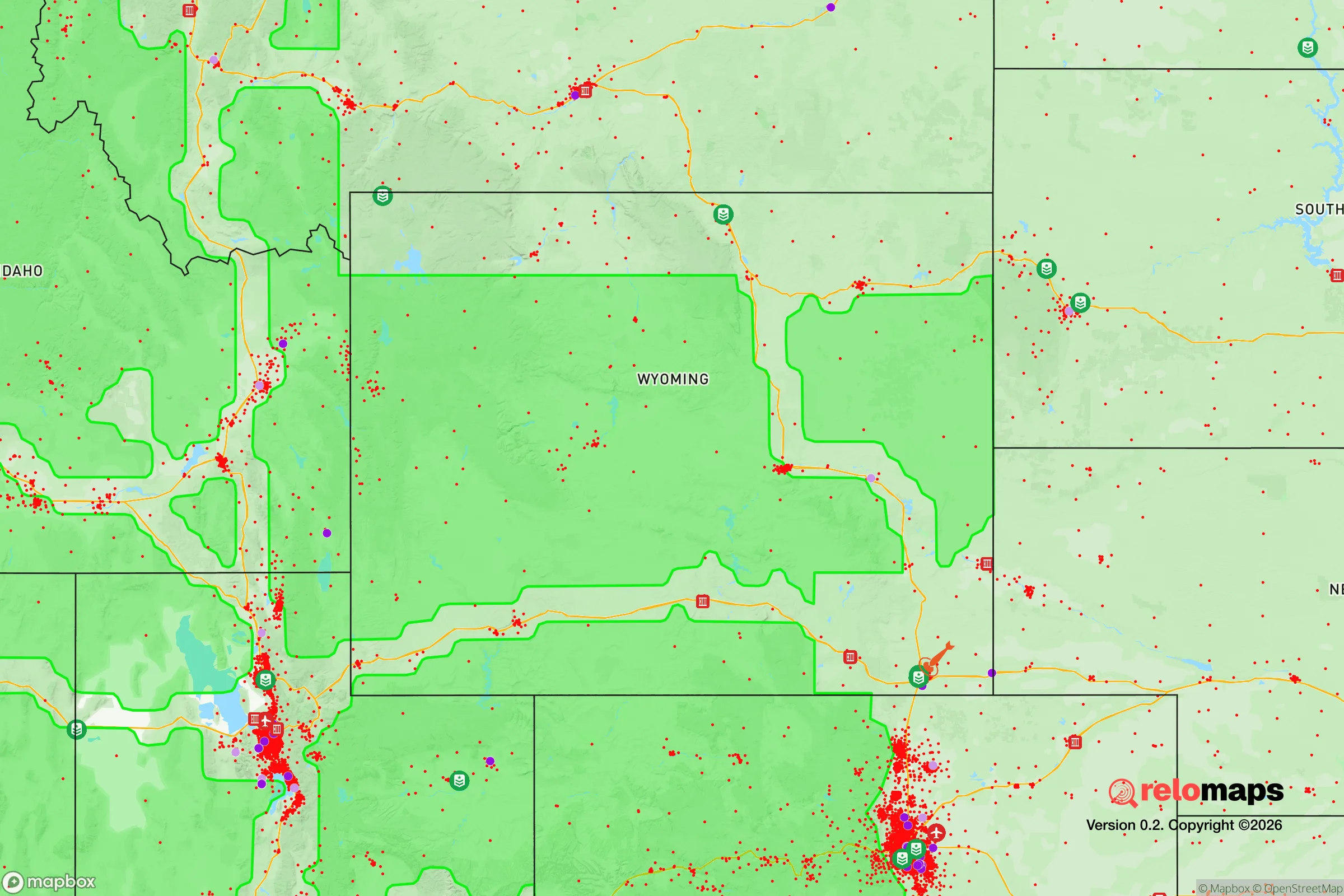
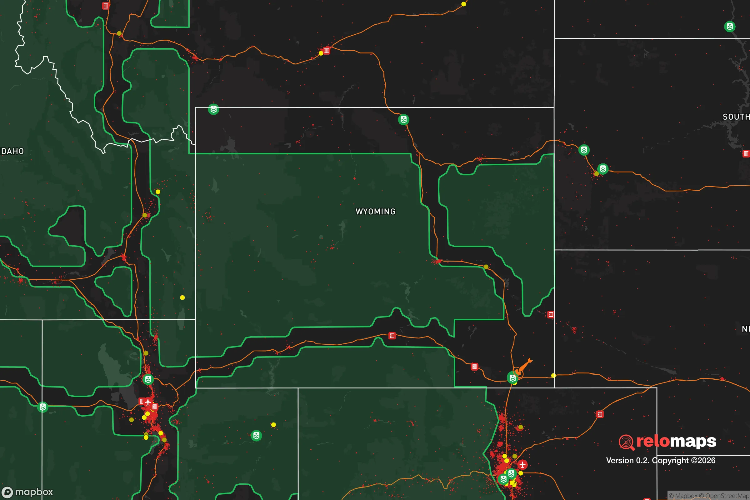
Important Note: For informational purposes only. This does not mean nothing bad ever happens in the green zones. Please use common sense. This is based on public data and modeled with AI. We tried to take a conservative approach but mistakes happen. We update this regularly as new information becomes available.
Solar Generator Recommendations
Backup power matters more here than in safer locations. We've picked three solar generators across budgets and capacity tiers — start with the budget unit if you only need a few essentials, or step up if you want to run a fridge and HVAC for days at a time.

Jackery Portable Power Station Explorer 300
Budget OptionPower on the Go: Weighing only 11 lbs, it's convenient to set up and store with book-sized foldable solar panels

BLUETTI Portable Power Station AC180
Designed for both indoor and outdoor scenarios, AC180 is highly capable as it has a robost capacity and continuous output power.

EF ECOFLOW DELTA Pro Ultra Power Station
Upgraded PickEcoFlow DELTA Pro Ultra is a whole-home energy system designed to grow with your family. Integrated with the Smart Home Panel 2, it scales to meet your evolving energy needs — keeping your home powered, intelligent, and secure through every stage of life.
We earn a commission, at no additional cost to you.
Strategic Assessment Analysis
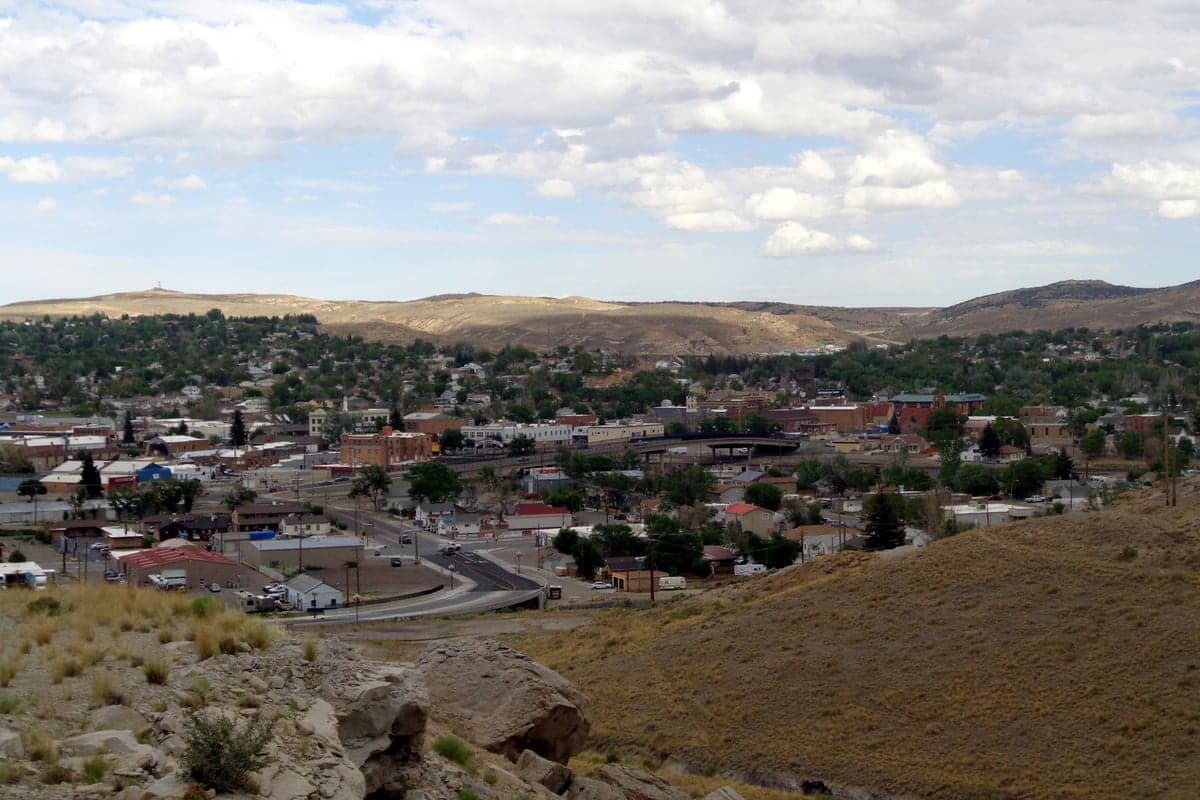
Rock Springs, Wyoming, offers a strategic relocation option for those prioritizing resilience and self-sufficiency, largely due to its remote location in the high desert of Sweetwater County and its historical role as a resource extraction hub. The city sits roughly 150 miles from Salt Lake City and 200 miles from Denver, placing it far enough from major metropolitan centers to avoid the immediate fallout of urban unrest or mass casualty events, yet close enough to supply chains for essential goods. Its position along Interstate 80 and the Union Pacific rail line provides a logistical backbone for movement and resupply, while the surrounding landscape—arid, sparsely populated, and ringed by the Green River and the Red Desert—offers natural buffers against large-scale population movement. For a conservative-leaning individual or family concerned with civic breakdown, this combination of isolation and infrastructure makes Rock Springs a viable fallback location, though not without its own vulnerabilities.
Geographic position and natural advantages for long-term survival
Rock Springs sits in the high desert at about 6,200 feet elevation, with the Green River running just west of town and the Flaming Gorge National Recreation Area to the south. The area’s primary natural advantage is its distance from major population centers—the nearest city of any size is Salt Lake City, over two hours away, and Cheyenne is nearly three hours east. This buffer reduces the risk of being caught in the initial wave of civil unrest or a mass casualty event originating from a dense urban area. The surrounding terrain is a mix of sagebrush steppe, badlands, and buttes, which limits vehicular access and makes the region naturally defensible against large groups. The Green River provides a reliable freshwater source, and the area sits atop the Green River Basin, one of the largest natural gas and coal reserves in the country, ensuring energy independence in a grid-down scenario. The local climate is harsh—cold winters with heavy snow and hot, dry summers—but this also discourages casual migration and forces residents to develop real survival skills, like winterizing homes and storing food for months of isolation.
Risks, exposures, and proximity to fallout-relevant landmarks
While Rock Springs is remote, it is not immune to risks that could affect a survivalist strategy. The city is within 100 miles of the Farson-Eden natural gas fields and the Jim Bridger coal-fired power plant, both of which are critical energy infrastructure that could become targets in a conflict or grid-down scenario. The Union Pacific rail line and I-80 corridor are major transportation arteries; in a crisis, these routes could see heavy military or refugee traffic, drawing unwanted attention to the area. The nearby Rock Springs Uplift, a geological formation used for carbon sequestration and oil extraction, could be a point of interest for federal or corporate activity. Additionally, the city’s proximity to the Wyoming High-Altitude Training Center and the Little America rest stop—a known staging area for emergency response—means that Rock Springs could become a logistical hub for government operations during a disaster, potentially increasing surveillance or martial law presence. The risk of natural disasters is low—no hurricanes, few earthquakes, and minimal flood risk—but the area is prone to wildfires and severe winter storms that can cut off roads for days.
Practical resilience for a relocator: food, water, energy, and defensibility
For a relocator focused on practical self-sufficiency, Rock Springs offers a mixed bag. Water is the strongest asset: the Green River flows year-round and is accessible for diversion with proper permits, and the city’s municipal water comes from deep aquifers, making it less vulnerable to surface contamination. However, the high desert climate means that food production is limited—the growing season is short (about 90 days) and soil quality is poor, requiring raised beds, greenhouses, or hydroponics for any serious gardening. Local hunting and fishing are viable: mule deer, pronghorn, and sage grouse are common, and the Green River holds trout, but over-reliance on game could deplete resources quickly in a prolonged crisis. Energy is abundant: the area is rich in natural gas and coal, and many homes already use propane or natural gas for heating. Solar potential is high due to over 200 sunny days per year, but winter snow and short daylight hours require battery storage or backup generators. Defensibility is moderate: the city itself is a grid of streets with some choke points (the I-80 exits and the railroad underpasses), but the surrounding open terrain makes it hard to secure a large perimeter. A better strategy is to locate outside city limits—properties along the Green River or in the rural subdivisions near White Mountain offer better isolation and line-of-sight advantages. The local population is small (about 23,000) and largely employed in mining, energy, and transportation, which means a higher-than-average percentage of people with mechanical and outdoor skills—a potential asset for forming a mutual-aid network.
The overall strategic picture for Rock Springs is one of calculated trade-offs. It offers genuine isolation from the worst of urban collapse, reliable water and energy, and a defensible position against mass migration. But it also carries risks tied to its role as a regional energy and transportation hub, and its harsh climate and poor agricultural potential mean that long-term survival requires serious preparation—not just a bug-out bag, but a plan for food storage, water purification, and community building. For a conservative relocator who values independence and is willing to invest in infrastructure, Rock Springs is a solid choice. For someone expecting a low-effort retreat, the reality of Wyoming winters and the area’s exposure to industrial targets will quickly disabuse them of that notion. It’s not a paradise, but it’s a place where a prepared individual or family can ride out a crisis with a fighting chance.
* Values derived from national, state, county, city and local statistics and may differ in a specific area. Last updated: 2026-04-21T10:51:06.000Z
Narrative content on this page is AI-generated and may contain mistakes. Verify any details that matter before acting on them.
ReloMaps may earn a commission from affiliate links at no extra cost to you.