
Photo: Wikipedia
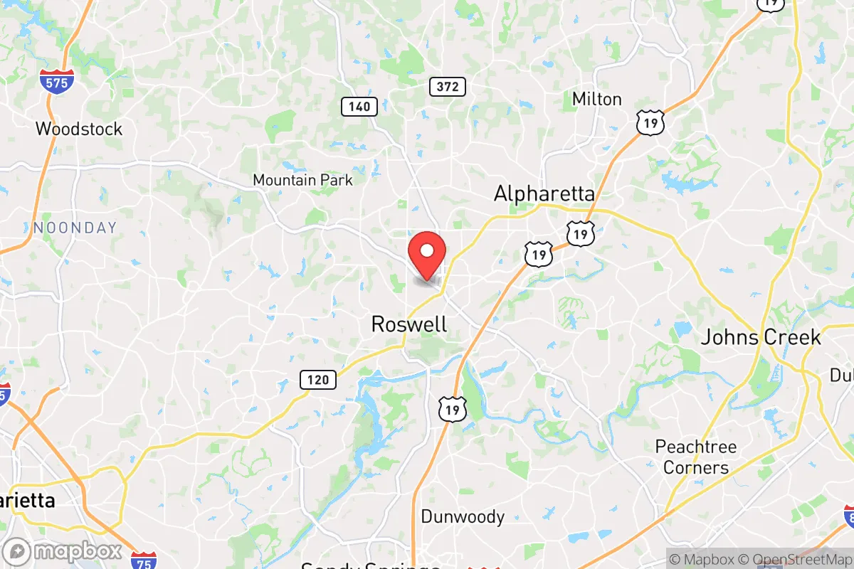
Strategic Assessment of Roswell, GA
Multiple tactical vulnerabilities. Population density, target proximity, or disaster risk are likely compounding. A retreat property and exit planning is required.
What does the Strategic Assessment tell us?
Our Strategic Assessment grades tactical survivability of an area. Major population centers, military targets, fallout zones, natural disasters, and border exposure all drive risk — lower exposure means a more defensible position in a crisis.
This is heavily inspired by Joel Skousen's Strategic Relocation book. Highly recommended you checkout the book ($)What does this tell us?
Our Strategic Assessment grades tactical survivability of an area. Major population centers, military targets, fallout zones, natural disasters, and border exposure all drive risk — lower exposure means a more defensible position in a crisis.
This is heavily inspired by Joel Skousen's Strategic Relocation book. Highly recommended you checkout the book ($)Strategic Pillars

Key Distances
Regional Safe Places
Below is our recommended "safe zones" in Georgia and the surrounding area based on our strategic heuristics. For most people, it's unrealistic to live in a “safe zone” full-time due to work, family or other personal reasons. They tend to be more rural. However, many of these areas are perfect for second homes and retreat properties that double as a vacation home or even a short-term rental.


Important Note: For informational purposes only. This does not mean nothing bad ever happens in the green zones. Please use common sense. This is based on public data and modeled with AI. We tried to take a conservative approach but mistakes happen. We update this regularly as new information becomes available.
Solar Generator Recommendations
Backup power matters more here than in safer locations. We've picked three solar generators across budgets and capacity tiers — start with the budget unit if you only need a few essentials, or step up if you want to run a fridge and HVAC for days at a time.

Jackery Portable Power Station Explorer 300
Budget OptionPower on the Go: Weighing only 11 lbs, it's convenient to set up and store with book-sized foldable solar panels

BLUETTI Portable Power Station AC180
Designed for both indoor and outdoor scenarios, AC180 is highly capable as it has a robost capacity and continuous output power.

EF ECOFLOW DELTA Pro Ultra Power Station
Upgraded PickEcoFlow DELTA Pro Ultra is a whole-home energy system designed to grow with your family. Integrated with the Smart Home Panel 2, it scales to meet your evolving energy needs — keeping your home powered, intelligent, and secure through every stage of life.
We earn a commission, at no additional cost to you.
Strategic Assessment Analysis
Roswell, Georgia, sits in a strategic sweet spot that balances proximity to critical infrastructure with enough buffer from the most volatile urban flashpoints. Its position roughly 20 miles north of Atlanta’s core puts it outside the immediate blast radius of a major terrorist or EMP event targeting downtown, yet close enough to access medical, logistical, and supply networks if they remain functional. The city’s location along the Chattahoochee River and its network of state highways (GA 400, GA 9, and I-285 within 15 minutes) provide multiple egress routes, a key advantage when one road becomes impassable due to unrest, accident, or deliberate blockage. For a relocator thinking in terms of years, not weeks, Roswell offers a rare combination: a suburban tax base that hasn’t collapsed, a water source that isn’t fully controlled by Atlanta, and a geography that forces any threat to approach through predictable chokepoints.
Geographic position and natural advantages for long-term security
Roswell’s topography is its first line of defense. The city sits on the eastern edge of the Piedmont region, with the Chattahoochee River forming its western and southern boundaries. This river isn’t just scenic—it’s a reliable water source that doesn’t depend on municipal treatment plants that could fail during a grid-down scenario. The land rises steadily from the river valley, with numerous hills and ridges that provide natural observation points and make the area harder to approach unseen. The surrounding forests—primarily mixed hardwood and pine—offer cover, firewood, and game, though deer populations are managed and not abundant enough for long-term subsistence without supplement. The climate is temperate, with four distinct seasons but no extreme cold that would kill off a garden or freeze pipes for weeks on end. Annual rainfall averages around 50 inches, meaning rain catchment systems are viable for most of the year. The soil in the river bottoms is loamy and workable; the upland clay is harder but can be amended. For a prepper, the key takeaway is that Roswell’s natural resources—water, timber, moderate climate—are sufficient to support a small, prepared group through a 6- to 12-month disruption without outside resupply.
Risks, exposures, and proximity to fallout-relevant landmarks
The biggest liability is Atlanta itself. Roswell is close enough that a major event in the city—a dirty bomb, a large-scale riot, a cyberattack on the power grid that cascades north—will send refugees, looters, and panicked civilians up GA 400 and into the suburbs within hours. The city’s population of roughly 95,000 swells to over 120,000 during the workday, meaning many of those people will try to get home through the same roads you’d use to leave. The Chattahoochee River, while a water asset, is also a contamination risk: any upstream industrial accident or intentional release at Buford Dam (about 20 miles north) could render the river unusable for weeks. The nearby Fulton County Airport (Charlie Brown Field) is a general aviation hub that could become a target or a staging ground for relief operations, drawing unwanted attention. More concerning is the proximity to Dobbins Air Reserve Base (15 miles southwest) and the Lockheed Martin plant in Marietta, which builds F-35s and other military aircraft. In a conflict scenario, that facility is a high-value target for sabotage or conventional strike. Roswell is also within 30 miles of two nuclear plants—Plant Hatch (southeast) and Plant Vogtle (south)—though prevailing winds would carry fallout away from the city in most weather patterns. The bottom line: Roswell is not a remote bug-out location. It’s a suburban buffer zone that will see heavy traffic and potential violence if Atlanta collapses. You need a plan to secure your home and a secondary route out if the main arteries clog.
Practical resilience for a relocator: food, water, energy, and defensibility
Water is the strongest pillar. The Chattahoochee is year-round and accessible from several public parks and boat ramps, but you’ll need a filtration system capable of handling silt, agricultural runoff, and potential biological contaminants. A Berkey or similar gravity filter with ceramic elements is the minimum; a UV or reverse-osmosis system is better if you have power. The city’s municipal water comes from the river, so if the treatment plant goes down, you’re on your own. Rainwater collection is legal in Georgia, and a 1,000-gallon cistern can supply a family of four for about two months with rationing. Food is more challenging. Roswell has no significant agricultural land within city limits; the nearest working farms are in Cherokee County to the north or Forsyth County to the east, both a 20- to 30-minute drive. Grocery stores are plentiful (Publix, Kroger, Walmart, Whole Foods) but will empty within 48 hours of a declared emergency. A serious prepper should have a minimum of three months of shelf-stable food stored, preferably in a basement or interior closet away from windows. Energy is a mixed bag. The grid is reliable in normal times, but Georgia Power has a history of rolling blackouts during extreme weather (ice storms, summer heat waves). Solar is viable—the area gets about 210 sunny days per year—but HOA restrictions in many Roswell neighborhoods can make panel installation difficult. A dual-fuel generator (gasoline/propane) with a 100-pound propane tank is a more practical backup for most homes. Defensibility is average for a suburb. Most houses are on quarter-acre lots with neighbors close enough to see and hear trouble, which is both a deterrent and a risk. The best defensive positions are on the north side of the river, where the terrain rises and roads narrow. A home on a cul-de-sac or dead-end street with a single point of entry is ideal. Avoid properties directly on GA 400 or major arterials—those will be the first to see looting and traffic jams.
The overall strategic picture for Roswell is one of calculated risk. It’s not a fortress, and it’s not a remote homestead. It’s a well-positioned suburb with solid natural resources, a defensible geography, and a population that is mostly law-abiding and middle-class—which means less immediate chaos than in denser urban areas, but also less communal survival knowledge than in rural counties. The biggest threat is the proximity to Atlanta and its military-industrial targets; the biggest asset is the river and the multiple escape routes north into the North Georgia mountains. For a single individual or a family willing to invest in storage, water filtration, and a generator, Roswell offers a realistic base of operations for the next decade. But you need to know your neighbors, have a plan for the first 72 hours of a crisis, and accept that if things go truly sideways, you’ll be moving north within a week. Roswell is a staging ground, not a final destination—and for a strategic relocator, that’s exactly the right role for it to play.
* Values derived from national, state, county, city and local statistics and may differ in a specific area. Last updated: 2026-04-23T05:11:54.000Z
Narrative content on this page is AI-generated and may contain mistakes. Verify any details that matter before acting on them.
ReloMaps may earn a commission from affiliate links at no extra cost to you.