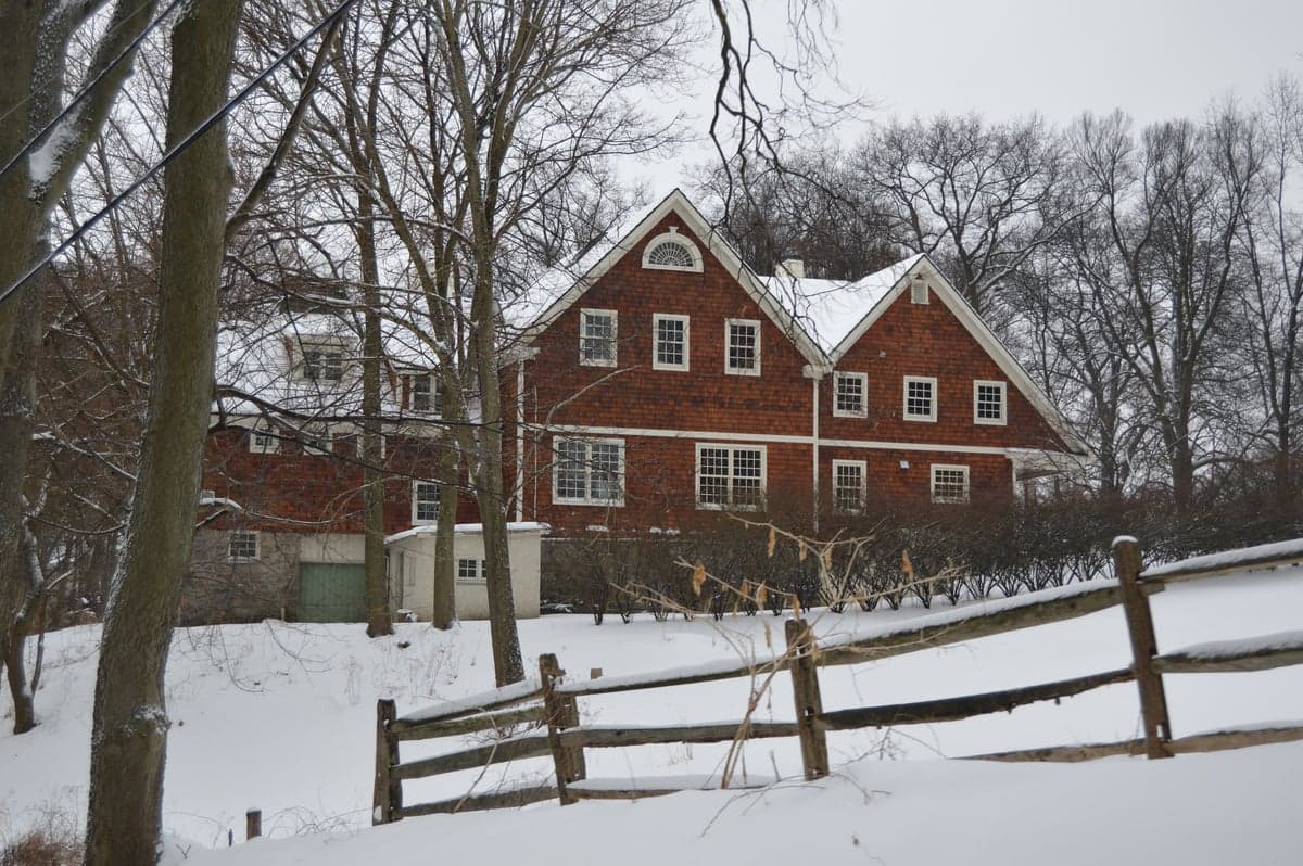
Photo: Wikipedia
Strategic Assessment of Sewickley Heights, PA
Meaningful friction. Expect exposure to either population pressure, blast zones, or natural disaster risk. Consider buying a retreat property.
What does the Strategic Assessment tell us?
Our Strategic Assessment grades tactical survivability of an area. Major population centers, military targets, fallout zones, natural disasters, and border exposure all drive risk — lower exposure means a more defensible position in a crisis.
This is heavily inspired by Joel Skousen's Strategic Relocation book. Highly recommended you checkout the book ($)What does this tell us?
Our Strategic Assessment grades tactical survivability of an area. Major population centers, military targets, fallout zones, natural disasters, and border exposure all drive risk — lower exposure means a more defensible position in a crisis.
This is heavily inspired by Joel Skousen's Strategic Relocation book. Highly recommended you checkout the book ($)Strategic Pillars

Key Distances
Regional Safe Places
Below is our recommended "safe zones" in Pennsylvania and the surrounding area based on our strategic heuristics. For most people, it's unrealistic to live in a “safe zone” full-time due to work, family or other personal reasons. They tend to be more rural. However, many of these areas are perfect for second homes and retreat properties that double as a vacation home or even a short-term rental.


Important Note: For informational purposes only. This does not mean nothing bad ever happens in the green zones. Please use common sense. This is based on public data and modeled with AI. We tried to take a conservative approach but mistakes happen. We update this regularly as new information becomes available.
Solar Generator Recommendations
Backup power matters more here than in safer locations. We've picked three solar generators across budgets and capacity tiers — start with the budget unit if you only need a few essentials, or step up if you want to run a fridge and HVAC for days at a time.

Jackery Portable Power Station Explorer 300
Budget OptionPower on the Go: Weighing only 11 lbs, it's convenient to set up and store with book-sized foldable solar panels

BLUETTI Portable Power Station AC180
Designed for both indoor and outdoor scenarios, AC180 is highly capable as it has a robost capacity and continuous output power.

EF ECOFLOW DELTA Pro Ultra Power Station
Upgraded PickEcoFlow DELTA Pro Ultra is a whole-home energy system designed to grow with your family. Integrated with the Smart Home Panel 2, it scales to meet your evolving energy needs — keeping your home powered, intelligent, and secure through every stage of life.
We earn a commission, at no additional cost to you.
Strategic Assessment Analysis
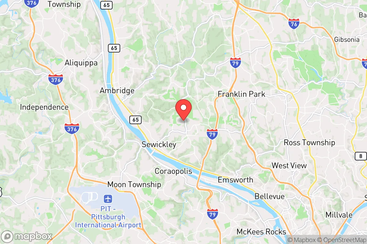
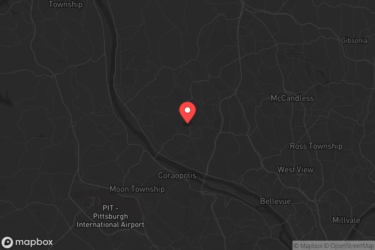
Sewickley Heights, Pennsylvania, presents a complex strategic picture for the conservative prepper or survivalist. Its primary advantage is its elevated, wooded terrain and low population density, offering a degree of natural isolation and defensibility that is rare within 20 miles of a major city. However, this proximity to Pittsburgh—a prime target for civil unrest, infrastructure collapse, or a mass casualty event—is the single greatest liability. The Heights sit on a hilltop plateau overlooking the Ohio River Valley, which provides excellent vantage points and natural chokepoints via the few winding roads that access the borough, but it also places residents squarely in the fallout shadow of a major metropolitan area and its associated critical infrastructure. For a relocator prioritizing long-term resilience, Sewickley Heights is a high-risk, high-reward location: a potential redoubt that could become a trap if the surrounding region destabilizes.
Geographic position and natural advantages for a retreat
Sewickley Heights occupies roughly 1.5 square miles of the highest ground in Allegheny County, with elevations reaching over 1,200 feet above sea level. This elevation provides a natural cooling effect in summer and, more critically, places the borough above the valley fog and floodplains that plague lower-lying communities along the Ohio River. The terrain is heavily forested with mature hardwoods, offering excellent natural cover and concealment from ground-level observation. The borough's zoning is almost exclusively large-lot residential—minimum lot sizes of two to three acres—which means neighbors are spaced far apart, reducing the risk of cascading problems from a close-knit suburban grid. The road network is deliberately sparse: only a handful of paved roads (like Little Sewickley Creek Road and Blackburn Road) provide access, and many are narrow, winding, and easily blocked by a single downed tree or disabled vehicle. This is a double-edged sword—it makes ingress and egress difficult for outsiders, but it also means residents have limited escape routes if the area becomes compromised. The nearby Ohio River and the CSX rail line running through the valley are both strategic liabilities, as they are likely chokepoints for any large-scale movement of people or goods during a crisis.
Risks, exposures, and proximity to fallout-relevant landmarks
The most serious risk for Sewickley Heights is its proximity to Pittsburgh, roughly 12 miles southeast as the crow flies. In a mass casualty event—whether from a terrorist attack, a nuclear incident at the Beaver Valley Power Station (about 25 miles northwest), or a large-scale civil unrest scenario—the borough sits within the likely evacuation shadow and potential fallout zone. The Beaver Valley plant is a pressurized water reactor that, while not as notorious as some, represents a real target for sabotage or accident. Additionally, the area is downwind of several major chemical plants along the Ohio River corridor, including the Shell cracker plant in Monaca (about 15 miles northwest). A catastrophic release from any of these facilities could render the air unbreathable for days. The borough itself has no significant industrial or government targets, which is a plus, but its residents would be competing with hundreds of thousands of panicked evacuees from Pittsburgh for the same limited road capacity. The Sewickley Bridge and the Ambridge-Aliquippa Bridge are the only crossings over the Ohio River for miles, and both would become impassable chokepoints in a crisis. For a prepper, the key takeaway is that Sewickley Heights is a good place to be after the initial chaos subsides, but a very dangerous place to be during the first 72 hours of a regional emergency.
Practical resilience for a relocator: food, water, energy, and defensibility
For a relocator serious about self-sufficiency, Sewickley Heights offers a mixed bag. The large lots mean ample space for a private well and septic system—many homes already have them—which is a critical advantage over municipal water systems that can be contaminated or shut down. However, the borough is not zoned for agriculture, and most lots are wooded, not open farmland. Growing a meaningful food supply would require significant clearing and soil amendment, and the deer population is dense enough to destroy any unprotected garden. Hunting is restricted within borough limits, though small game and deer are abundant in the surrounding state game lands (like the 6,000-acre Raccoon Creek State Park, about 10 miles west). For energy, the wooded terrain makes solar panels less effective unless you have a cleared southern exposure, but it also provides ample firewood for heating and cooking. Many homes in the Heights have propane tanks and backup generators, which is a strong plus. Defensibility is the borough's strongest suit: the limited road access, combined with the natural elevation and tree cover, means a small, organized group could effectively control the approaches. But this also means that if a larger, better-armed group decides to take the high ground, residents would have few options for retreat. The nearest hospital is Heritage Valley Sewickley, about 3 miles downhill—convenient for routine care but likely overwhelmed in a mass casualty event. For a single individual or family, the practical advice is to stockpile at least 90 days of food, water, and medical supplies, invest in a reliable off-grid power system, and establish a relationship with neighbors who share your preparedness mindset. The borough's small population (around 800) and high property values mean most residents are not preppers, but they are likely to be resourceful and community-oriented in a crisis.
Overall, Sewickley Heights is a strategic location for a prepper who values natural defensibility and proximity to Pittsburgh's job market during normal times, but who is willing to accept the very real risks of being near a major urban center and critical infrastructure corridor. It is not a bug-out location—it is a live-in-place retreat for those who can afford the high property taxes (around 2.5% of assessed value) and the cost of maintaining a large, wooded estate. The ideal resident is a single individual or family with the skills and resources to harden their property, store supplies, and form a mutual assistance network with a few like-minded neighbors. For anyone looking to ride out a regional crisis in relative comfort and security, Sewickley Heights offers a viable option—provided you have a plan for the first 72 hours, when the chaos from Pittsburgh will be at its peak. If you can survive that window, the Heights could become a very safe place to wait out the storm. If you cannot, the same geography that makes it defensible will make it a trap.
* Values derived from national, state, county, city and local statistics and may differ in a specific area. Last updated: 2026-04-27T14:33:08.000Z
Narrative content on this page is AI-generated and may contain mistakes. Verify any details that matter before acting on them.
ReloMaps may earn a commission from affiliate links at no extra cost to you.