Photo: Wikipedia
Strategic Assessment of Shelbyville, KY
Workable tactical position. Some exposure to population density or targets, but generally defensible in a crisis.
What does the Strategic Assessment tell us?
Our Strategic Assessment grades tactical survivability of an area. Major population centers, military targets, fallout zones, natural disasters, and border exposure all drive risk — lower exposure means a more defensible position in a crisis.
This is heavily inspired by Joel Skousen's Strategic Relocation book. Highly recommended you checkout the book ($)What does this tell us?
Our Strategic Assessment grades tactical survivability of an area. Major population centers, military targets, fallout zones, natural disasters, and border exposure all drive risk — lower exposure means a more defensible position in a crisis.
This is heavily inspired by Joel Skousen's Strategic Relocation book. Highly recommended you checkout the book ($)Strategic Pillars

Key Distances
Regional Safe Places
Below is our recommended "safe zones" in Kentucky and the surrounding area based on our strategic heuristics. For most people, it's unrealistic to live in a “safe zone” full-time due to work, family or other personal reasons. They tend to be more rural. However, many of these areas are perfect for second homes and retreat properties that double as a vacation home or even a short-term rental.


Important Note: For informational purposes only. This does not mean nothing bad ever happens in the green zones. Please use common sense. This is based on public data and modeled with AI. We tried to take a conservative approach but mistakes happen. We update this regularly as new information becomes available.
Solar Generator Recommendations
Backup power matters more here than in safer locations. We've picked three solar generators across budgets and capacity tiers — start with the budget unit if you only need a few essentials, or step up if you want to run a fridge and HVAC for days at a time.

Jackery Portable Power Station Explorer 300
Budget OptionPower on the Go: Weighing only 11 lbs, it's convenient to set up and store with book-sized foldable solar panels

BLUETTI Portable Power Station AC180
Designed for both indoor and outdoor scenarios, AC180 is highly capable as it has a robost capacity and continuous output power.

EF ECOFLOW DELTA Pro Ultra Power Station
Upgraded PickEcoFlow DELTA Pro Ultra is a whole-home energy system designed to grow with your family. Integrated with the Smart Home Panel 2, it scales to meet your evolving energy needs — keeping your home powered, intelligent, and secure through every stage of life.
We earn a commission, at no additional cost to you.
Strategic Assessment Analysis
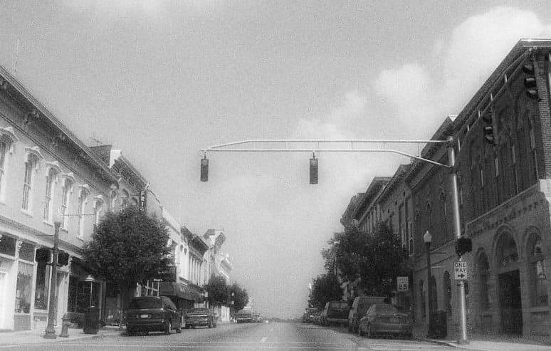
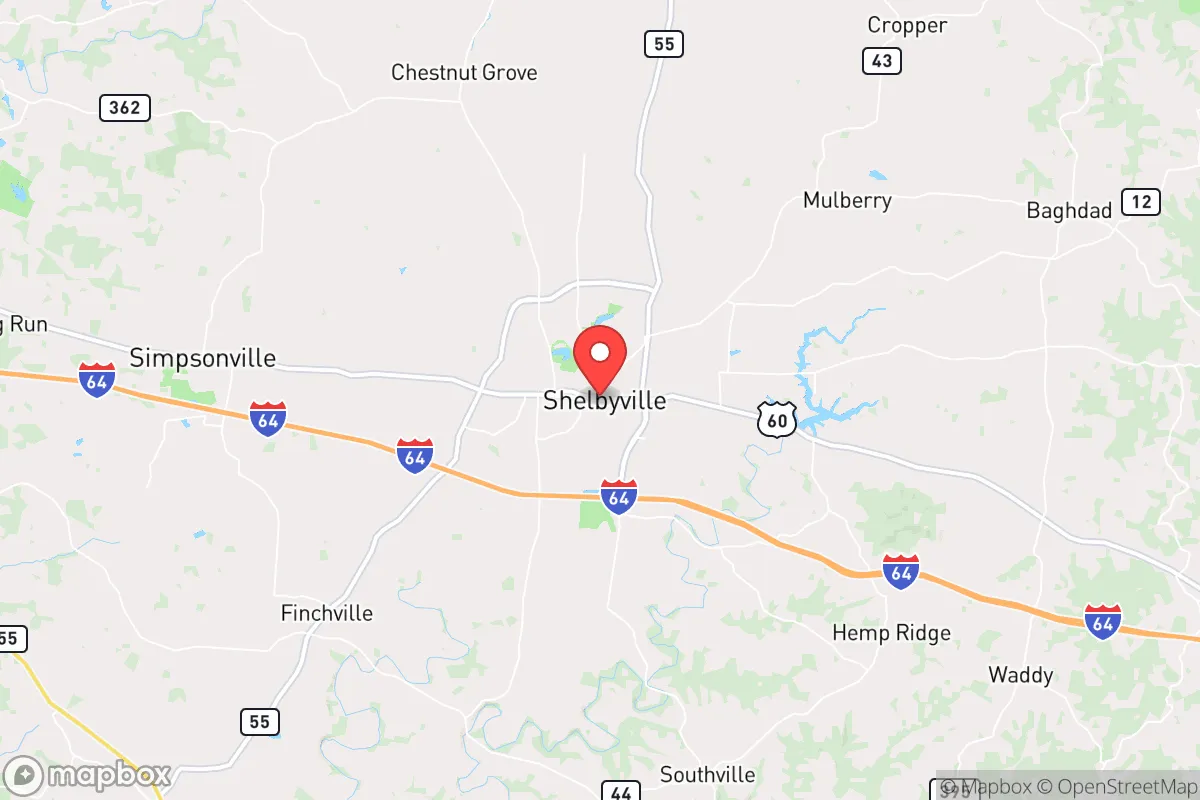
Shelbyville, Kentucky, sits in a sweet spot that few relocation analysts fully appreciate: close enough to Louisville and Lexington to access their resources, yet far enough to avoid the blast zones, fallout patterns, and civil unrest that would engulf those cities in a major crisis. The town's position along I-64 gives it a logistical spine, but its rural character and agricultural base mean it can function without constant resupply from outside. For a relocator thinking in terms of decades, not just the next election cycle, Shelbyville offers a rare combination of strategic depth and everyday livability.
Geographic position and natural advantages for long-term security
Shelbyville anchors Shelby County, a region defined by rolling hills, limestone bedrock, and the Salt River watershed. The area sits outside the 50-mile radius of any major metropolitan center, which is a critical buffer against both nuclear fallout patterns and the kind of cascading infrastructure failure that follows a major event. The Ohio River, a major strategic waterway, lies about 30 miles north, but Shelbyville itself is not a target for river-based commerce disruption. The local topography provides natural defensibility: the hills offer observation points, and the numerous creeks and streams create natural barriers to movement. The soil is among the most productive in the state, with deep, well-drained silt loam that supports row crops, pasture, and orchards. This isn't just farmland—it's a long-term food production asset that can sustain a community without industrial inputs. The climate is temperate, with reliable rainfall averaging 45 inches per year, reducing dependence on irrigation infrastructure that might fail in a crisis.
Risks, exposures, and proximity to fallout-relevant landmarks
No location is risk-free, and Shelbyville has exposures that a serious prepper must weigh. The most obvious is I-64, which runs directly through the county. In a mass evacuation scenario from Louisville or Lexington, this highway would become a chokepoint and a vector for desperate populations. The same road that brings supplies in peacetime could bring chaos in a crisis. The Blue Grass Army Depot in Richmond, about 60 miles southeast, stores chemical weapons and conventional munitions—a potential secondary target or accident site. Fort Knox, 30 miles southwest, is a major military installation that could become a focal point for federal activity or a target itself. The Louisville International Airport and UPS Worldport, 35 miles north, are high-value logistics hubs that would attract attention in any conflict. Fallout patterns from a Louisville strike would likely drift northeast, away from Shelbyville, but a strike on Fort Knox or the depot could put the area in a secondary risk zone. The local water supply comes from the Salt River and groundwater wells; contamination from upstream industrial sites or agricultural runoff is a peacetime concern, but in a crisis, the decentralized well network is actually an advantage over a single municipal intake.
Practical resilience for a relocator: food, water, energy, and defensibility
For a relocator serious about self-sufficiency, Shelbyville checks most boxes. The agricultural base means local food production is already established—you can buy beef, pork, poultry, eggs, and produce directly from farms within a 15-mile radius. The Shelby County Farmers Market operates year-round, and several CSAs serve the area. For water, the limestone aquifer provides reliable well water at depths of 100-300 feet, with good quality and yield. Municipal water comes from the Salt River, but a well with a hand pump or solar-powered pump gives you independence. Energy resilience is mixed: the local grid is served by Louisville Gas and Electric and Shelby Energy Cooperative, both of which have above-average reliability but are still vulnerable to cascading failures. Solar potential is decent—the area gets about 200 sunny days per year—and the rural zoning codes are lenient enough for off-grid setups. Wood heating is viable, with abundant hardwood forests in the surrounding counties. Defensibility is about community as much as terrain. Shelbyville has a strong local culture of hunting, shooting sports, and outdoor skills. The Shelby County Sheriff's Office is well-regarded and responsive, but in a prolonged crisis, the real security will come from neighborhood networks and the fact that the population density is low enough to make organized defense feasible. The town itself has a compact, walkable core, but most relocators will want acreage outside the city limits for operational security.
Overall strategic picture for the conservative relocator
Shelbyville is not a survivalist fantasy—it's a real, functioning community where you can build a life that is resilient by default, not by constant effort. The proximity to Louisville and Lexington is a double-edged sword: it gives you access to medical centers, specialty goods, and employment, but it also means you're within a day's drive of potential chaos. The key is to treat those cities as resources, not lifelines. Stockpile what you need, build local relationships, and develop skills that don't depend on Amazon delivery. The political culture of Shelby County leans conservative, with a strong independent streak—people here are used to solving their own problems. The school system is solid, the cost of living is below the national average, and the property taxes are low. For a relocator who wants to be prepared without living in a bunker, Shelbyville offers a balanced equation: enough distance from the blast zones, enough local resources to ride out a disruption, and enough community to make the effort worthwhile. It's not the most remote option, but it might be the most practical one for someone who still wants to live in the world while being ready for when the world changes.
* Values derived from national, state, county, city and local statistics and may differ in a specific area. Last updated: 2026-05-03T20:24:19.000Z
Narrative content on this page is AI-generated and may contain mistakes. Verify any details that matter before acting on them.
ReloMaps may earn a commission from affiliate links at no extra cost to you.