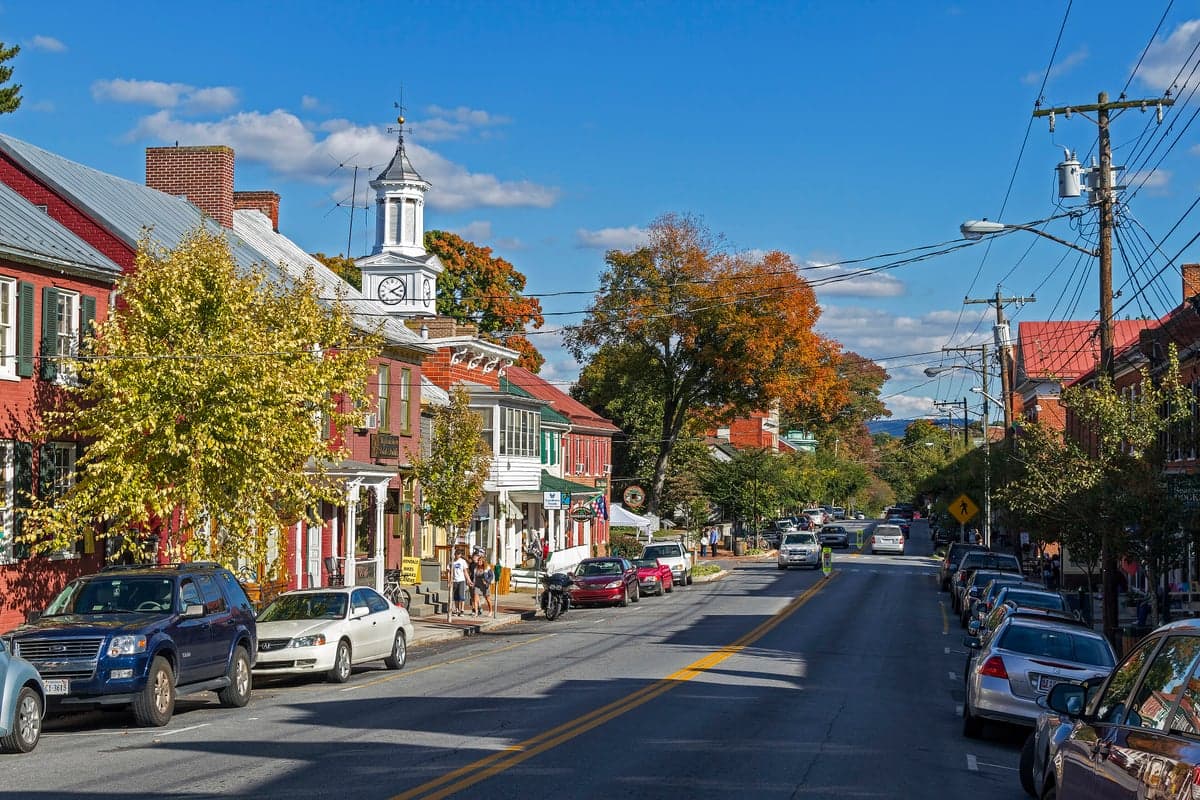
Photo: Wikipedia
Strategic Assessment of Shepherdstown, WV
Meaningful friction. Expect exposure to either population pressure, blast zones, or natural disaster risk. Consider buying a retreat property.
What does the Strategic Assessment tell us?
Our Strategic Assessment grades tactical survivability of an area. Major population centers, military targets, fallout zones, natural disasters, and border exposure all drive risk — lower exposure means a more defensible position in a crisis.
This is heavily inspired by Joel Skousen's Strategic Relocation book. Highly recommended you checkout the book ($)What does this tell us?
Our Strategic Assessment grades tactical survivability of an area. Major population centers, military targets, fallout zones, natural disasters, and border exposure all drive risk — lower exposure means a more defensible position in a crisis.
This is heavily inspired by Joel Skousen's Strategic Relocation book. Highly recommended you checkout the book ($)Strategic Pillars

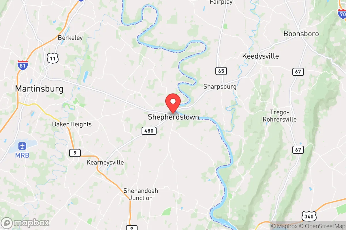
Key Distances
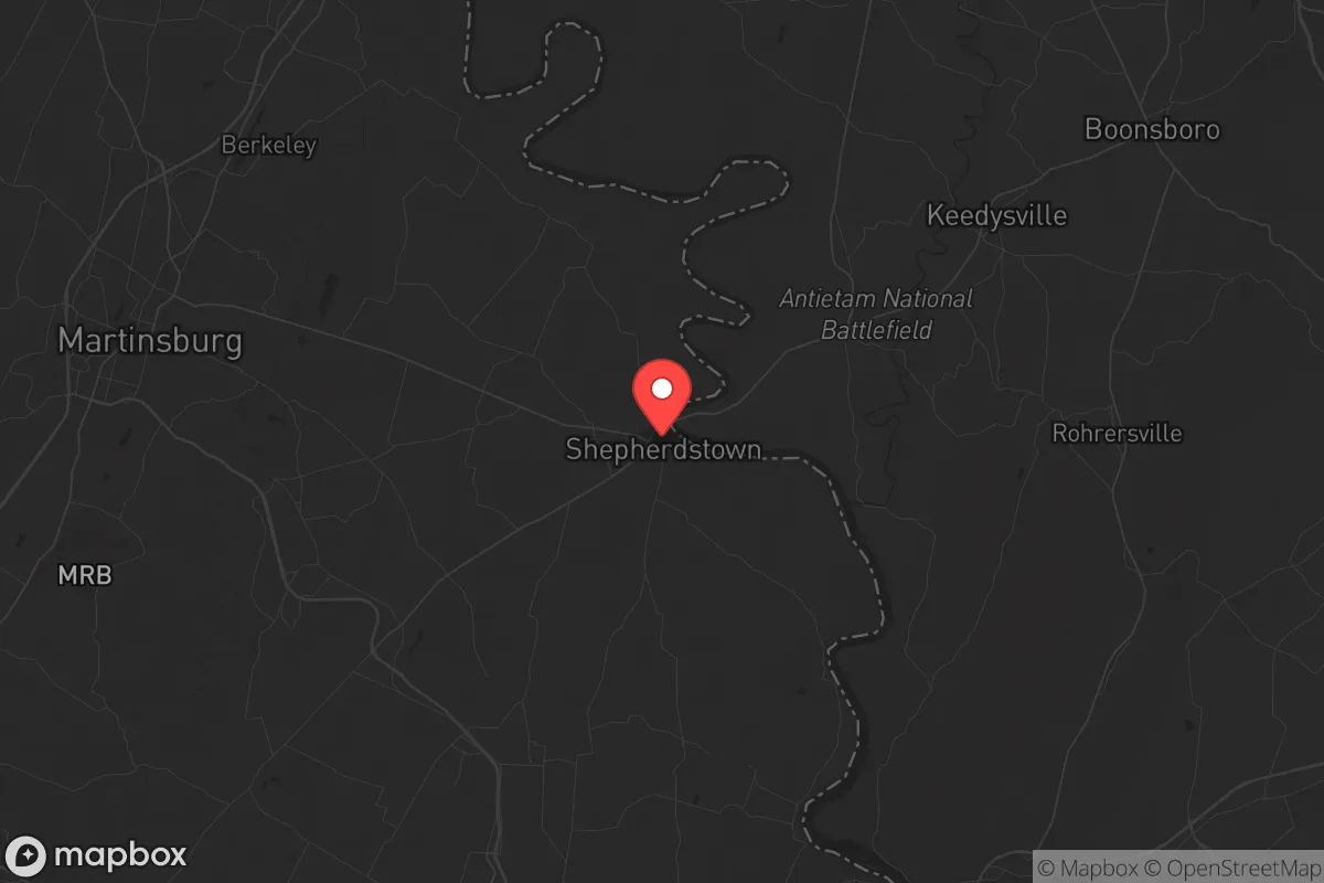
Regional Safe Places
Below is our recommended "safe zones" in West Virginia and the surrounding area based on our strategic heuristics. For most people, it's unrealistic to live in a “safe zone” full-time due to work, family or other personal reasons. They tend to be more rural. However, many of these areas are perfect for second homes and retreat properties that double as a vacation home or even a short-term rental.


Important Note: For informational purposes only. This does not mean nothing bad ever happens in the green zones. Please use common sense. This is based on public data and modeled with AI. We tried to take a conservative approach but mistakes happen. We update this regularly as new information becomes available.
Solar Generator Recommendations
Backup power matters more here than in safer locations. We've picked three solar generators across budgets and capacity tiers — start with the budget unit if you only need a few essentials, or step up if you want to run a fridge and HVAC for days at a time.

Jackery Portable Power Station Explorer 300
Budget OptionPower on the Go: Weighing only 11 lbs, it's convenient to set up and store with book-sized foldable solar panels

BLUETTI Portable Power Station AC180
Designed for both indoor and outdoor scenarios, AC180 is highly capable as it has a robost capacity and continuous output power.

EF ECOFLOW DELTA Pro Ultra Power Station
Upgraded PickEcoFlow DELTA Pro Ultra is a whole-home energy system designed to grow with your family. Integrated with the Smart Home Panel 2, it scales to meet your evolving energy needs — keeping your home powered, intelligent, and secure through every stage of life.
We earn a commission, at no additional cost to you.
Strategic Assessment Analysis
Shepherdstown, West Virginia, presents a mixed bag for the strategic relocator. Its primary resilience advantage is its position in the Eastern Panhandle, a narrow strip of land that is both a buffer and a liability. While the town itself is small and historic, its location roughly 70 miles from Washington, D.C., and within a 90-minute drive of Baltimore and Northern Virginia, means it sits in the shadow of major population centers and potential fallout zones. For a prepper or survivalist, the key question isn't whether Shepherdstown is a remote mountain redoubt—it isn't—but whether its specific geography, local resources, and community dynamics can be leveraged into a defensible, self-sufficient position when the grid goes down or civil unrest spills outward from the cities.
Geographic position and natural advantages for a long-term survival scenario
Shepherdstown's location along the Potomac River is its single greatest natural asset. The river provides a reliable, year-round water source, which is critical for drinking, sanitation, and small-scale agriculture. The town sits in the fertile Shenandoah Valley, with deep, well-drained soils that support gardening and livestock. The surrounding Jefferson County is a patchwork of farmland, orchards, and wooded hills, offering both concealment and potential for food production. The area's topography is rolling, not mountainous, which means it lacks the extreme defensibility of a high-elevation retreat, but it also avoids the isolation that can make resupply and community networking difficult. The C&O Canal towpath and the Appalachian Trail run nearby, providing off-road travel corridors that could be used for movement or resupply without relying on major highways. The local climate is temperate, with four distinct seasons, allowing for year-round food storage and moderate heating demands. For a relocator, the natural advantages here are real but require active development—the land is productive, but it is not a pre-built fortress.
Risks, exposures, and proximity to fallout-relevant landmarks
The most glaring risk for Shepherdstown is its proximity to the Washington, D.C., metropolitan area. In a major crisis—whether a nuclear event, a pandemic, or widespread civil unrest—the Eastern Panhandle would likely become a primary evacuation corridor. Interstate 81 and U.S. Route 340 are the main arteries, and both would be choked with refugees fleeing the cities. Shepherdstown itself is small (population roughly 2,000), but it sits directly in the path of any mass exodus from the D.C. suburbs. The town is also within 50 miles of the Fort Detrick military installation in Frederick, Maryland, a U.S. Army biodefense lab that has been a subject of controversy and could be a target in a conflict. Additionally, the nearby Three Mile Island nuclear plant (Pennsylvania) is roughly 80 miles away, and while not an immediate fallout risk, it represents a potential secondary hazard. The area is also in a moderate seismic zone, though earthquakes are rare. The real exposure is human: the town's economy is heavily tied to tourism and the nearby Shepherd University, meaning a collapse would strand a transient population with limited local food production. For the strategic relocator, the risk is not that Shepherdstown itself is a target, but that it is a funnel point for chaos from the east.
Practical resilience for a relocator: food, water, energy, and defensibility
On the practical side, Shepherdstown offers a mixed but workable foundation. Water is abundant from the Potomac, but it requires treatment—boiling, filtration, or chemical purification—as the river carries agricultural runoff and upstream sewage. A well on private property is a major advantage here, and many older homes in the area have hand-dug wells or springs. Food production is viable but not automatic. The surrounding farmland is mostly corn and soybeans, not diversified small-scale agriculture. A relocator would need to establish gardens, orchards, and possibly small livestock (chickens, goats, rabbits) within the first year. The local farmers' market and co-ops exist but are unreliable in a crisis. Energy independence is a challenge. The grid is aging and prone to outages from storms (ice, wind, and occasional hurricanes). Solar is feasible but requires significant upfront investment; the area gets about 200 sunny days per year, which is adequate but not ideal. Wood heating is common, with ample firewood in the surrounding forests, but a chainsaw and a good stove are essential. Defensibility is moderate. The town's layout—a compact historic core with narrow streets and stone buildings—offers some natural chokepoints, but the surrounding countryside is open farmland with limited cover. A rural property with a long driveway, a creek or pond, and a good line of sight is far more defensible than a house in town. The local sheriff's office is small and would be overwhelmed in a major event; community defense would fall to neighbors. The Amish and Mennonite communities in the area are a significant asset—they already live without modern infrastructure and have skills in blacksmithing, animal husbandry, and food preservation. Building relationships with them before a crisis is a high-value move.
The overall strategic picture for Shepherdstown is one of calculated risk. It is not a remote survivalist paradise, but it is not a death trap either. For a relocator with a conservative, self-reliant mindset, the town offers a foothold in a region that is close enough to urban resources (medical, hardware, trade) to be useful in normal times, yet far enough to provide a buffer when things go sideways. The key is to treat it as a base of operations, not a final retreat. A well-prepared individual or family could ride out a moderate crisis here—a pandemic, a short-term grid failure, or localized civil unrest—by relying on the river, local farmland, and a tight-knit community. But for a major, long-term collapse, the proximity to D.C. and the vulnerability of the evacuation corridors make it a location that requires constant vigilance, a solid bug-out plan, and a willingness to move deeper into the West Virginia mountains if the situation deteriorates. Shepherdstown is a good place to be prepared, but it is not a place to be complacent.
* Values derived from national, state, county, city and local statistics and may differ in a specific area. Last updated: 2026-04-23T05:53:00.000Z
Narrative content on this page is AI-generated and may contain mistakes. Verify any details that matter before acting on them.
ReloMaps may earn a commission from affiliate links at no extra cost to you.