

Photo: Wikipedia
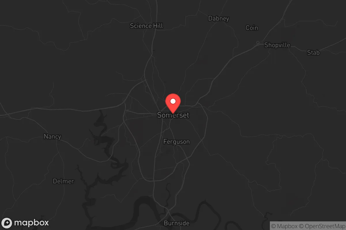
Strategic Assessment of Somerset, KY
Workable tactical position. Some exposure to population density or targets, but generally defensible in a crisis.
What does the Strategic Assessment tell us?
Our Strategic Assessment grades tactical survivability of an area. Major population centers, military targets, fallout zones, natural disasters, and border exposure all drive risk — lower exposure means a more defensible position in a crisis.
This is heavily inspired by Joel Skousen's Strategic Relocation book. Highly recommended you checkout the book ($)What does this tell us?
Our Strategic Assessment grades tactical survivability of an area. Major population centers, military targets, fallout zones, natural disasters, and border exposure all drive risk — lower exposure means a more defensible position in a crisis.
This is heavily inspired by Joel Skousen's Strategic Relocation book. Highly recommended you checkout the book ($)Strategic Pillars

Key Distances
Regional Safe Places
Below is our recommended "safe zones" in Kentucky and the surrounding area based on our strategic heuristics. For most people, it's unrealistic to live in a “safe zone” full-time due to work, family or other personal reasons. They tend to be more rural. However, many of these areas are perfect for second homes and retreat properties that double as a vacation home or even a short-term rental.


Important Note: For informational purposes only. This does not mean nothing bad ever happens in the green zones. Please use common sense. This is based on public data and modeled with AI. We tried to take a conservative approach but mistakes happen. We update this regularly as new information becomes available.
Solar Generator Recommendations
Backup power matters more here than in safer locations. We've picked three solar generators across budgets and capacity tiers — start with the budget unit if you only need a few essentials, or step up if you want to run a fridge and HVAC for days at a time.

Jackery Portable Power Station Explorer 300
Budget OptionPower on the Go: Weighing only 11 lbs, it's convenient to set up and store with book-sized foldable solar panels

BLUETTI Portable Power Station AC180
Designed for both indoor and outdoor scenarios, AC180 is highly capable as it has a robost capacity and continuous output power.

EF ECOFLOW DELTA Pro Ultra Power Station
Upgraded PickEcoFlow DELTA Pro Ultra is a whole-home energy system designed to grow with your family. Integrated with the Smart Home Panel 2, it scales to meet your evolving energy needs — keeping your home powered, intelligent, and secure through every stage of life.
We earn a commission, at no additional cost to you.
Strategic Assessment Analysis
Somerset, Kentucky, sits in a geographic sweet spot that makes it a serious contender for anyone thinking long-term about resilience and self-sufficiency. Tucked into the southern edge of the Lake Cumberland region, this town of roughly 12,000 offers a blend of natural barriers, manageable infrastructure, and a community culture that still values neighborly self-reliance. For a relocator with a prepper mindset—someone watching the fragility of supply chains, the drift of federal policy, and the potential for civil disorder—Somerset presents a strategic base that is far enough from major population centers to avoid the worst of a collapse, yet close enough to access critical resources when things are stable. The area’s economic anchor is a mix of manufacturing, healthcare, and tourism tied to the lake, but the real draw is what lies beneath the surface: a landscape that can support a low-profile, prepared lifestyle without the isolation that makes daily life impractical.
Geographic position and natural advantages for long-term security
Somerset’s location in south-central Kentucky, roughly 80 miles south of Lexington and 90 miles north of Knoxville, places it in a corridor that is both accessible and defensible. The city sits on the edge of the Cumberland Plateau, where the terrain transitions from rolling hills to more rugged, forested ridges. This topography provides natural choke points and limited line-of-sight for anyone approaching from the north or east, which is a tangible advantage if you’re thinking about perimeter awareness or bug-out routes. The area is not in a floodplain—the major water bodies like Lake Cumberland and the Cumberland River are controlled by the Wolf Creek Dam, which has been reinforced in recent years—so you’re not trading one risk for another. The local geology includes limestone bedrock, which supports reliable well water and makes basement construction straightforward for those who want underground storage or shelter. The growing season runs about 190 days, long enough for serious gardening, and the surrounding national forest land—over 600,000 acres of the Daniel Boone National Forest to the east—offers public access for foraging, hunting, and timber if needed. For a relocator, this means you can secure a property with a well, septic, and solar array without fighting zoning boards or HOAs that frown on self-sufficiency.
Risks, exposures, and proximity to fallout-relevant landmarks
No location is perfect, and Somerset has its share of vulnerabilities that a strategic assessment must flag. The most obvious risk is the Wolf Creek Dam, located about 30 miles southwest near Jamestown. While the dam has undergone a $600 million rehabilitation project completed in 2020, it remains a high-hazard structure—a catastrophic failure would send a wall of water down the Cumberland River valley, potentially affecting low-lying areas near the lake. Somerset itself sits on higher ground, but the downstream impact on infrastructure and evacuation routes is worth noting. More concerning for the prepper mindset is the proximity to the Blue Grass Army Depot in Richmond, about 70 miles north. That facility stores chemical weapons and conventional munitions, and while security is tight, it’s a target in any major conflict scenario. The same goes for the Oak Ridge National Laboratory in Tennessee, roughly 100 miles south—a prime target for any adversary looking to disrupt U.S. research and energy infrastructure. On the civil unrest front, Somerset is far enough from Louisville, Lexington, and Nashville that you’re unlikely to see spillover from urban riots, but the city is connected by US-27 and the Cumberland Parkway, which could become chokepoints if mass evacuations occur. The local population is overwhelmingly conservative and rural, which means law enforcement and community response are likely to be faster and more coordinated than in urban areas, but the county’s emergency services are thin—Pulaski County has one hospital (Lake Cumberland Regional) and a volunteer-heavy fire service. If you’re planning for a grid-down scenario, you need to assume you’re on your own for the first 72 hours.
Practical resilience for a relocator: food, water, energy, and defensibility
For someone serious about self-reliance, Somerset checks the boxes that matter. Water is abundant—the area averages 48 inches of rainfall per year, and the limestone aquifer means most properties can yield a reliable well at depths of 100-300 feet. Surface water from creeks and the lake is available but requires filtration due to agricultural runoff and recreational use. Food production is viable: the local soil is clay-heavy but workable with raised beds or no-till methods, and the farmers’ market in downtown Somerset operates from April through October, offering a chance to network with local growers who can share seed stock and knowledge. Hunting is a serious activity here—white-tailed deer, turkey, and small game are plentiful in the national forest, and the Kentucky Department of Fish and Wildlife Resources manages public access areas within a 30-minute drive. Energy independence is achievable: the region gets about 200 sunny days per year, enough for a modest solar array, and the prevailing winds are steady enough for small-scale wind turbines on ridgelines. Natural gas is available in town, but rural properties rely on propane or wood—and wood is abundant. Defensibility is where Somerset really shines. The terrain around the city is a mix of open farmland and wooded ridges, which means you can choose a property with a clear field of view and limited access points. The local culture is armed—Kentucky is a constitutional carry state, and Pulaski County has a strong tradition of hunting and sport shooting. The sheriff’s department is responsive, but the expectation is that citizens handle their own security. For a single individual or a family, this means you can live without the paranoia of urban life while still being prepared. The biggest practical downside is the lack of specialized medical care—if you need a trauma center or a specialist, you’re driving to Lexington or Nashville, which is a two-hour trip in good conditions. Stockpiling medications and learning basic emergency medicine is a must.
The overall strategic picture for Somerset is one of balanced risk and reward. It is not a hardened bunker location—it has vulnerabilities to dam failure, proximity to military targets, and thin local services. But for a relocator who wants to be within a day’s drive of major resources while living in a community that values independence and preparedness, it offers a rare combination of affordability, natural resources, and cultural alignment. The real estate market is still reasonable compared to the national average—you can find a 10-acre property with a house and a barn for under $300,000—and the tax burden is light, with no state tax on Social Security and a flat 4% income tax. If you’re looking for a place to build a life that can weather the next decade of uncertainty, Somerset deserves a serious look. Just don’t expect to find a prepper community waiting for you—the locals are already living the lifestyle, they just don’t call it that.
* Values derived from national, state, county, city and local statistics and may differ in a specific area. Last updated: 2026-04-19T08:30:06.000Z
Narrative content on this page is AI-generated and may contain mistakes. Verify any details that matter before acting on them.
ReloMaps may earn a commission from affiliate links at no extra cost to you.