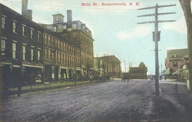
Photo: Wikipedia
Strategic Assessment of Somersworth, NH
Multiple tactical vulnerabilities. Population density, target proximity, or disaster risk are likely compounding. A retreat property and exit planning is required.
What does the Strategic Assessment tell us?
Our Strategic Assessment grades tactical survivability of an area. Major population centers, military targets, fallout zones, natural disasters, and border exposure all drive risk — lower exposure means a more defensible position in a crisis.
This is heavily inspired by Joel Skousen's Strategic Relocation book. Highly recommended you checkout the book ($)What does this tell us?
Our Strategic Assessment grades tactical survivability of an area. Major population centers, military targets, fallout zones, natural disasters, and border exposure all drive risk — lower exposure means a more defensible position in a crisis.
This is heavily inspired by Joel Skousen's Strategic Relocation book. Highly recommended you checkout the book ($)Strategic Pillars

Key Distances
Regional Safe Places
Below is our recommended "safe zones" in New Hampshire and the surrounding area based on our strategic heuristics. For most people, it's unrealistic to live in a “safe zone” full-time due to work, family or other personal reasons. They tend to be more rural. However, many of these areas are perfect for second homes and retreat properties that double as a vacation home or even a short-term rental.


Important Note: For informational purposes only. This does not mean nothing bad ever happens in the green zones. Please use common sense. This is based on public data and modeled with AI. We tried to take a conservative approach but mistakes happen. We update this regularly as new information becomes available.
Solar Generator Recommendations
Backup power matters more here than in safer locations. We've picked three solar generators across budgets and capacity tiers — start with the budget unit if you only need a few essentials, or step up if you want to run a fridge and HVAC for days at a time.

Jackery Portable Power Station Explorer 300
Budget OptionPower on the Go: Weighing only 11 lbs, it's convenient to set up and store with book-sized foldable solar panels

BLUETTI Portable Power Station AC180
Designed for both indoor and outdoor scenarios, AC180 is highly capable as it has a robost capacity and continuous output power.

EF ECOFLOW DELTA Pro Ultra Power Station
Upgraded PickEcoFlow DELTA Pro Ultra is a whole-home energy system designed to grow with your family. Integrated with the Smart Home Panel 2, it scales to meet your evolving energy needs — keeping your home powered, intelligent, and secure through every stage of life.
We earn a commission, at no additional cost to you.
Strategic Assessment Analysis
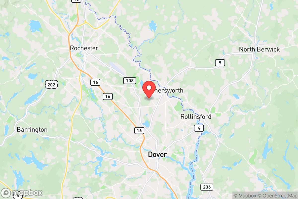
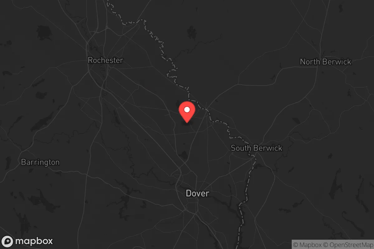
Somersworth, New Hampshire, occupies a strategic position that balances proximity to economic corridors with a degree of separation from the highest-risk urban centers, making it a location worth serious consideration for those prioritizing resilience and self-reliance. Nestled in Strafford County along the Salmon Falls River, this small city of roughly 12,000 residents sits just west of the Maine border and about 10 miles inland from the Atlantic coast. Its location offers a buffer from the immediate fallout zones of major metropolitan areas like Boston (roughly 70 miles south) and Portland, Maine (about 50 miles northeast), while still providing access to essential supply routes and regional infrastructure. For a relocator with a survivalist mindset, Somersworth presents a mixed picture: it avoids the worst of urban vulnerability, but its position near the Seacoast region and along major transit corridors introduces distinct risks that demand careful evaluation.
Geographic position and natural advantages for long-term security
Somersworth’s geography provides several natural advantages for those seeking a defensible and resource-rich base. The city lies within the Piscataqua River watershed, with the Salmon Falls River forming its eastern border—a reliable freshwater source that can support off-grid water collection and small-scale agriculture. The surrounding terrain is a mix of rolling hills, mixed hardwood forests, and wetlands, offering ample cover and natural barriers against unwanted movement. The area’s relatively low population density (roughly 1,100 people per square mile, compared to Boston’s 14,000) reduces competition for resources during a crisis. The climate, while harsh in winter with average January lows around 15°F, also acts as a natural deterrent to unprepared transient populations. The region’s agricultural potential is modest but real: the growing season runs about 150 days, suitable for cold-hardy crops like potatoes, squash, and root vegetables. The proximity to the White Mountain National Forest (about 60 miles northwest) provides a vast, sparsely populated retreat zone with abundant game, timber, and water. However, the city’s position along the Spaulding Turnpike (NH Route 16) and near Interstate 95 means it sits on a primary evacuation and supply corridor, which could become a liability during mass movement events—a double-edged sword that requires careful route planning.
Risks, exposures, and proximity to fallout-relevant landmarks
The most significant strategic vulnerability for Somersworth is its proximity to several high-value targets and choke points that could attract attention during a major conflict or cascading disaster. The city lies roughly 40 miles from the Portsmouth Naval Shipyard (on the Maine border), a critical nuclear submarine maintenance facility that would be a primary target in any peer-level conflict. The Seabrook Nuclear Power Plant, located about 25 miles south in New Hampshire, presents a dual risk: a potential target for sabotage or attack, and a source of radiological fallout in the event of a catastrophic failure. The plant’s containment structure is hardened, but prevailing winds from the southwest could carry a plume directly over Somersworth. Additionally, the city is within 70 miles of Boston’s Logan International Airport and the Port of Boston, both likely nodes for military logistics or refugee movement during a national emergency. The Spaulding Turnpike and I-95 corridors could become impassable during a crisis, as they serve as primary routes for both civilian evacuation and military resupply. The nearby Portsmouth International Airport at Pease (about 15 miles south) is a former Air Force base now used for cargo and general aviation, but it retains runways capable of handling military aircraft—a potential asset or liability depending on the scenario. For a relocator, these factors mean that Somersworth is not a remote safe haven but rather a location that requires active monitoring and a pre-planned secondary retreat option deeper into northern New England.
Practical resilience for a relocator: food, water, energy, and defensibility
For a single individual or family looking to establish a resilient homestead, Somersworth offers a workable but not ideal baseline. The city’s municipal water supply comes from the Salmon Falls River and groundwater wells, but reliance on a centralized system is a vulnerability—a prolonged power outage or contamination event would cut off access. A prudent relocator should invest in a private well (depths in the area typically range from 100 to 300 feet) and a hand-pump or solar-powered backup. The local soil is predominantly sandy loam, well-drained but requiring amendment for sustained crop yields; raised beds and greenhouses can extend the growing season. The region’s abundant rainfall (about 45 inches annually) supports rainwater catchment systems, and the numerous small streams and ponds provide secondary water sources. For energy, the area’s mix of grid electricity, natural gas, and heating oil leaves most homes dependent on external supply chains. Solar potential is moderate—the region averages about 200 sunny days per year, with winter cloud cover reducing output—but a properly sized off-grid system with battery storage can cover basic needs. Wood heating is a practical and resilient option, as the surrounding forests provide ample fuel; a wood stove or outdoor boiler should be considered essential. Defensibility is mixed: Somersworth’s compact, walkable downtown and older neighborhoods offer some natural chokepoints, but the city’s layout along major roads and its proximity to the larger cities of Dover (3 miles west) and Rochester (5 miles north) mean that a determined group could approach from multiple directions. A rural property on the outskirts, with a long driveway and clear sightlines, would be far more defensible than an in-town residence. The local police force is small (about 25 officers), and mutual aid agreements with surrounding towns would be strained during a widespread event, so self-reliance in security is non-negotiable.
The overall strategic picture for Somersworth is one of calculated compromise. It offers a meaningful buffer from the highest-risk urban zones while retaining access to essential infrastructure and natural resources, but it is not a remote redoubt. For a relocator with a conservative, prepper mindset, the city’s greatest strength is its position as a staging ground—close enough to the coast and economic hubs to maintain a normal life and income, yet far enough to avoid the worst of a cascading collapse. The key is to treat Somersworth as a base of operations rather than a final destination: invest in a well-supplied home with redundant systems, build relationships with like-minded neighbors in the surrounding rural areas, and have a pre-planned bug-out route to the north or west. The risks from the Portsmouth Naval Shipyard, Seabrook, and the major transit corridors are real but manageable with proper preparation—stockpiling potassium iodide, maintaining a go-bag, and practicing route alternatives. In a world where the next crisis could be economic, environmental, or geopolitical, Somersworth sits in a sweet spot: not too close to the fire, but not so far that you’re cut off from the resources you need to thrive. It’s a location that rewards the prepared and punishes the complacent—and that, in itself, is a recommendation worth heeding.
* Values derived from national, state, county, city and local statistics and may differ in a specific area. Last updated: 2026-05-01T08:42:49.000Z
Narrative content on this page is AI-generated and may contain mistakes. Verify any details that matter before acting on them.
ReloMaps may earn a commission from affiliate links at no extra cost to you.