
Photo: Wikipedia
Strategic Assessment of Butte County
Deep buffer from population centers and strategic targets. Low natural disaster risk and minimal exposure to border or coastal threats.
What does the Strategic Assessment tell us?
Our Strategic Assessment grades tactical survivability of an area. Major population centers, military targets, fallout zones, natural disasters, and border exposure all drive risk — lower exposure means a more defensible position in a crisis.
This is heavily inspired by Joel Skousen's Strategic Relocation book. Highly recommended you checkout the book ($)What does this tell us?
Our Strategic Assessment grades tactical survivability of an area. Major population centers, military targets, fallout zones, natural disasters, and border exposure all drive risk — lower exposure means a more defensible position in a crisis.
This is heavily inspired by Joel Skousen's Strategic Relocation book. Highly recommended you checkout the book ($)Strategic Pillars

Key Distances
Strategic Assessment Analysis
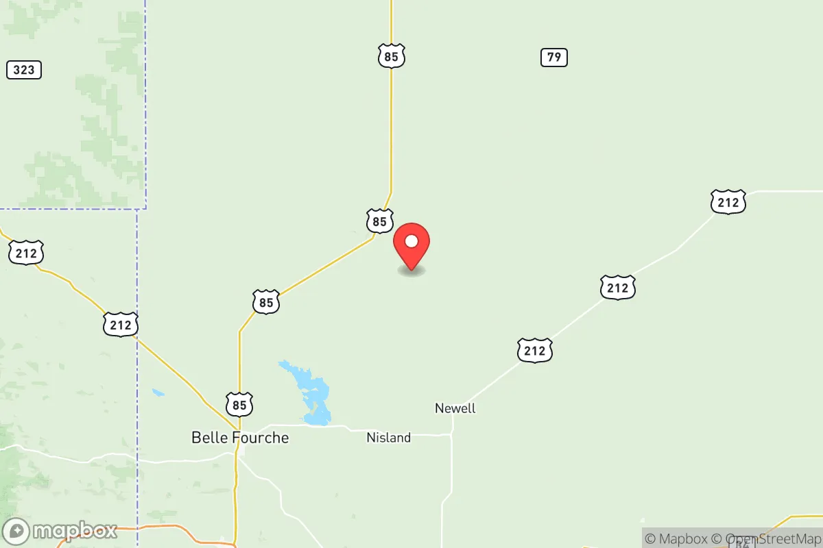
Butte County, South Dakota, offers a strategic relocation option for those prioritizing geographic isolation, resource security, and distance from major population centers and likely fallout targets. Anchored by the town of Belle Fourche and extending into the surrounding plains and buttes, the county sits far from any major metropolitan area, military base, or critical infrastructure complex that would attract a first-strike or secondary fallout hazard in a national crisis. For a relocator with a prepper mindset—concerned with civic unrest, grid collapse, or mass casualty events—this area presents a combination of low risk, high resource availability, and natural defensibility that is increasingly rare in the lower 48.
Geographic position, natural advantages, and what makes the area defensible
Butte County occupies the northwestern corner of South Dakota, bordered by Wyoming and Montana, placing it well outside the shadow of any primary target zone. The nearest city of any size is Rapid City, about 70 miles to the south, which itself is small enough to avoid being a likely first-wave target. Belle Fourche, the county seat, is a town of roughly 5,500 people—small enough to maintain social cohesion but large enough to provide basic services, a hospital, and a hardware supply chain. The terrain is a mix of open prairie, pine-dotted buttes, and river bottoms along the Belle Fourche River, offering multiple options for dispersed homesteading. This topography provides natural observation points and chokepoints, making it easier to monitor approach routes. The region sits on the northern edge of the Black Hills, which means access to national forest land, game, and timber. The local water table is robust, with the Belle Fourche Reservoir (also known as Orman Dam) providing a significant surface water reserve that is not dependent on an imported water system. For a relocator, the ability to secure a property with a well, solar exposure, and a defensible ridgeline is realistic here, unlike in much of the coastal or suburban United States.
Risks, exposures, and proximity to fallout-relevant landmarks you need to know
The primary strategic advantage of Butte County is distance from high-value targets. Ellsworth Air Force Base, located just east of Rapid City, is the closest military installation and is a potential target given its B-1 bomber mission. However, Belle Fourche sits 75 miles northwest of Ellsworth—far enough to be outside the primary blast and fire zones, and likely outside the heaviest fallout plume depending on wind direction. The prevailing winds in this region come from the west and southwest, which carries fallout from a strike on Ellsworth or the Minuteman missile fields further east away from Butte County in many scenarios. The county is also far from any major refinery, port, or population cluster. The closest significant infrastructure targets are the refineries in Wyoming’s Powder River Basin, about 100 miles west, and the Intercontinental Ballistic Missile (ICBM) fields east of I-29, which are over 200 miles away. This distance buys time for monitoring and decision-making. The real risks here are natural rather than man-made: severe winter storms, extended cold snaps, and the potential for wildfire in the buttes. There is no significant earthquake, hurricane, or flood threat. Socially, the county is conservative-leaning, with a culture of self-reliance, firearm ownership, and neighborly mutual aid that aligns with a preparedness mindset. The risks from civil unrest or supply chain collapse are minimal because the population is sparse and the local economy is tied to agriculture, not complex logistics.
Practical resilience for a relocator: food, water, energy, and community bandwidth
Butte County offers a realistic path toward resource independence that is difficult to achieve in more densely populated regions. Water is the foundation: the Belle Fourche River and the Orman Dam system provide reliable surface water, and private wells in the area typically produce at moderate depths (100-300 feet) with decent quality. The growing season is short—roughly 120 days—but suited to cold-hardy crops, with local soil that supports hay, oats, and garden vegetables when amended. For protein, the area has a strong ranching culture, making it possible to source beef, pork, and poultry locally without relying on grocery store supply chains. Hunting and fishing access is excellent: the Black Hills National Forest and state game production areas offer mule deer, whitetail, turkey, and small game, along with trout in the Belle Fourche River and nearby streams. Energy resilience is also achievable. The region averages over 200 sunny days per year, making solar a practical primary or backup system. Wind is also a consistent resource—this is the same corridor that hosts commercial wind farms. Wood heat is a viable option for those with land, given the proximity to national forest timber and private woodlots. For defensibility, the county’s low population density (roughly 10,000 people over 2,200 square miles) means that neighbors are close enough for mutual aid but not close enough to pose a threat in a collapse scenario. Belle Fourche has a local hospital, a sheriff’s office, and a small airport with a 5,000-foot runway, providing a potential evacuation or resupply route. The community culture is generally one of practical independence—people here already tend to keep food stores, fuel reserves, and tools on hand, reducing the social friction that can emerge in a crisis.
The overall strategic picture for Butte County is that of a low-signature, resource-rich, socially stable region that is well-suited for a relocator seeking to be prepared for national-level disruptions. It lacks the glamour of mountainous retreats or the security of coastal redoubts, but it offers something more valuable in a long-term crisis: the ability to live off the land, remain under the radar, and maintain community trust. The distance from Ellsworth Air Force Base and the ICBM fields is a real advantage, as is the absence of any major refinery, port, or population center within fallout range under most conditions. For the conservative-minded prepper—whether single or raising children—this county provides a viable workspace for building the kind of resilient, independent life that is becoming harder to sustain elsewhere in the country. The winters are harsh, the summers can be dry, and the isolation is real. That is precisely the point.
* Values derived from national, state, county, city and local statistics and may differ in a specific area. Last updated: 2026-06-03T06:25:01.000Z
Narrative content on this page is AI-generated and may contain mistakes. Verify any details that matter before acting on them.
ReloMaps may earn a commission from affiliate links at no extra cost to you.