
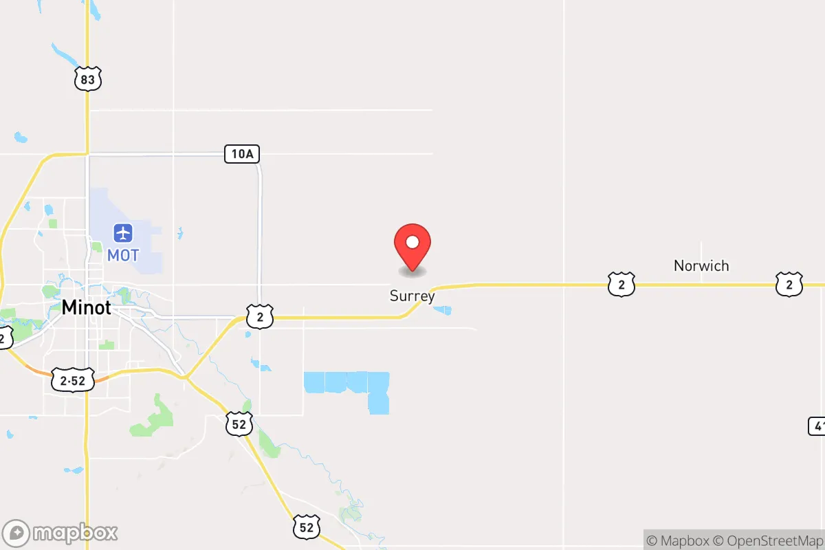
Strategic Assessment of Surrey, ND
Workable tactical position. Some exposure to population density or targets, but generally defensible in a crisis.
What does the Strategic Assessment tell us?
Our Strategic Assessment grades tactical survivability of an area. Major population centers, military targets, fallout zones, natural disasters, and border exposure all drive risk — lower exposure means a more defensible position in a crisis.
This is heavily inspired by Joel Skousen's Strategic Relocation book. Highly recommended you checkout the book ($)What does this tell us?
Our Strategic Assessment grades tactical survivability of an area. Major population centers, military targets, fallout zones, natural disasters, and border exposure all drive risk — lower exposure means a more defensible position in a crisis.
This is heavily inspired by Joel Skousen's Strategic Relocation book. Highly recommended you checkout the book ($)Strategic Pillars

Key Distances
Regional Safe Places
Below is our recommended "safe zones" in North Dakota and the surrounding area based on our strategic heuristics. For most people, it's unrealistic to live in a “safe zone” full-time due to work, family or other personal reasons. They tend to be more rural. However, many of these areas are perfect for second homes and retreat properties that double as a vacation home or even a short-term rental.
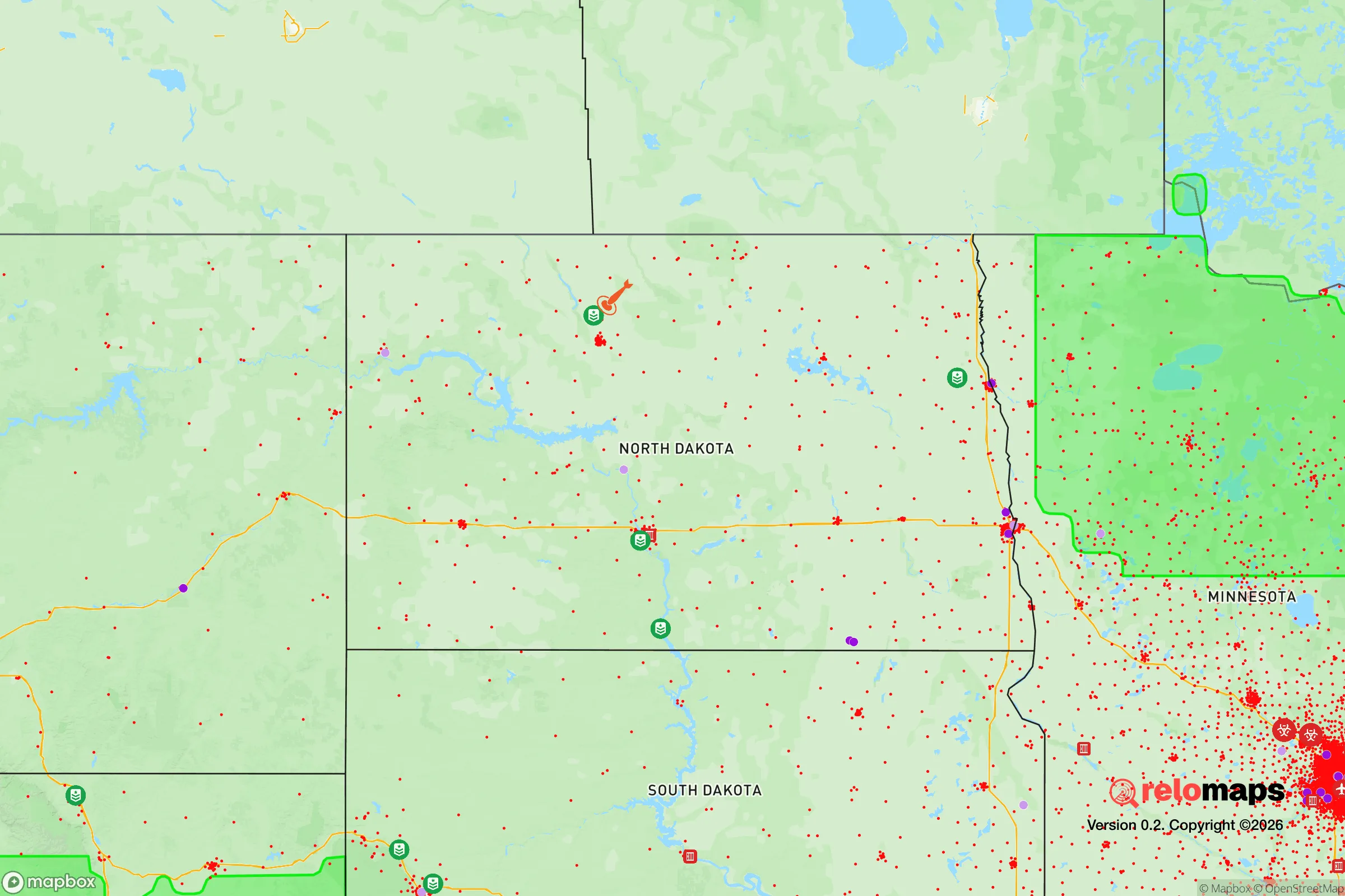
Important Note: For informational purposes only. This does not mean nothing bad ever happens in the green zones. Please use common sense. This is based on public data and modeled with AI. We tried to take a conservative approach but mistakes happen. We update this regularly as new information becomes available.
Solar Generator Recommendations
Backup power matters more here than in safer locations. We've picked three solar generators across budgets and capacity tiers — start with the budget unit if you only need a few essentials, or step up if you want to run a fridge and HVAC for days at a time.

Jackery Portable Power Station Explorer 300
Budget OptionPower on the Go: Weighing only 11 lbs, it's convenient to set up and store with book-sized foldable solar panels

BLUETTI Portable Power Station AC180
Designed for both indoor and outdoor scenarios, AC180 is highly capable as it has a robost capacity and continuous output power.

EF ECOFLOW DELTA Pro Ultra Power Station
Upgraded PickEcoFlow DELTA Pro Ultra is a whole-home energy system designed to grow with your family. Integrated with the Smart Home Panel 2, it scales to meet your evolving energy needs — keeping your home powered, intelligent, and secure through every stage of life.
We earn a commission, at no additional cost to you.
Strategic Assessment Analysis
Surrey, North Dakota, offers a strategic relocation option for those prioritizing resilience, self-sufficiency, and distance from major population centers. Located in Ward County, this small community sits roughly 75 miles from the Canadian border and about 30 miles from Minot, providing a buffer from urban chaos while retaining access to regional infrastructure. For a conservative-leaning individual or family preparing for civic unrest, mass casualty events, or systemic collapse, Surrey’s low population density, agricultural base, and relative isolation present a compelling, though not risk-free, foundation for long-term preparedness.
Geographic position and natural advantages for long-term survival
Surrey’s location in north-central North Dakota places it squarely within the Great Plains, a region known for harsh winters but also for abundant land and water resources. The community sits near the Souris River, which provides a reliable freshwater source—critical for any off-grid or semi-self-sufficient setup. The surrounding terrain is flat to gently rolling, with fertile soil that supports wheat, barley, and sunflower farming, meaning local food production is viable and neighbors are likely to have agricultural skills. The area’s low population density—Ward County has roughly 70 people per square mile—reduces the risk of disease spread, resource competition, and social friction during a crisis. Winters are severe, with average January lows around -5°F, but this climate acts as a natural barrier to unprepared migrants and limits the viability of large-scale refugee flows. For a prepper, the cold is a double-edged sword: it demands robust heating and shelter but also discourages transient populations from settling. The region’s distance from major interstates and rail hubs further insulates Surrey from the chaos that would likely engulf corridors like I-94 or the Red River Valley during a national emergency.
Risks, exposures, and proximity to fallout-relevant landmarks
No location is without vulnerabilities, and Surrey’s strategic picture includes several notable exposures. The most immediate concern is the proximity to Minot Air Force Base, home to the 5th Bomb Wing and the 91st Missile Wing, which operates nuclear-capable B-52s and Minuteman III intercontinental ballistic missiles. This makes Surrey a potential target in any large-scale conflict involving nuclear exchange. The base is roughly 20 miles southeast, placing the community within the blast and fallout zone for a direct strike on the base. Additionally, the nearby Minot city center (population ~48,000) could become a secondary target or a source of refugee outflow during a crisis. The Souris River also poses a flood risk; major floods in 2011 and 2019 damaged infrastructure and displaced residents, a vulnerability that could compound during a breakdown of emergency services. On the positive side, Surrey is far from coastal targets, major financial centers, and population-dense corridors like the Northeast or California. The nearest major city with over 100,000 people is Fargo, 200 miles east, and Minneapolis is 400 miles away—distances that provide significant buffer time during a cascading collapse. For a relocator, the key trade-off is clear: you gain isolation and agricultural viability but accept a non-zero risk from military-target proximity. A prudent prepper would factor in fallout shelter construction and a plan for temporary evacuation if tensions escalate.
Practical resilience for a relocator: food, water, energy, and defensibility
For a single individual or family moving to Surrey with a prepper mindset, the practical aspects of daily survival are manageable with proper planning. Water access is strong: the Souris River and local aquifers provide year-round supply, and well drilling is common in the area. Rainwater catchment is feasible during the growing season, though winter freezing requires insulated storage. Food production is a major advantage: the surrounding farmland supports grains, legumes, and livestock, and local farmers’ markets and co-ops in Minot offer bulk purchasing options. Hunting and fishing are viable—deer, waterfowl, and walleye are abundant in the region. For energy, North Dakota’s Bakken oil fields mean natural gas and propane are relatively cheap and available, though reliance on external supply chains is a vulnerability. Solar panels are effective in the region’s sunny summers but require battery storage for long, dark winters; a backup generator with stored fuel is a wise investment. Defensibility is moderate: the flat terrain offers limited natural cover, but a rural property with a long driveway, perimeter fencing, and a well-stocked root cellar can be secured. The community’s small size (population ~1,500) means neighbors are likely known and can form a mutual-aid network—a critical asset for any long-term survival scenario. However, the lack of natural barriers like mountains or forests means that a determined group could approach from any direction, so situational awareness and early-warning systems (e.g., radio, motion sensors) are essential. For a relocator, the biggest practical challenge is winter preparedness: ensuring a reliable heat source, insulating pipes, and stockpiling food for months of potential isolation. The trade-off is that the same harsh climate that tests your gear also deters unprepared outsiders.
The overall strategic picture for Surrey, ND, is one of calculated trade-offs. It offers genuine advantages for a conservative-leaning prepper: low population density, abundant water and arable land, distance from major urban centers, and a community that values self-reliance. The risks—primarily from Minot Air Force Base and the harsh climate—are real but manageable with proper planning and infrastructure. For a single individual or family willing to invest in winter-ready shelter, fallout protection, and a local network, Surrey provides a defensible, resource-rich base for weathering the storms of civic unrest, economic collapse, or natural disaster. It is not a perfect sanctuary, but in a world of increasing uncertainty, it represents a rational, grounded choice for those who prioritize preparedness over convenience.
* Values derived from national, state, county, city and local statistics and may differ in a specific area. Last updated: 2026-04-19T05:15:57.000Z
Narrative content on this page is AI-generated and may contain mistakes. Verify any details that matter before acting on them.
ReloMaps may earn a commission from affiliate links at no extra cost to you.