Strategic Assessment of Tega Cay, SC
Multiple tactical vulnerabilities. Population density, target proximity, or disaster risk are likely compounding. A retreat property and exit planning is required.
What does the Strategic Assessment tell us?
Our Strategic Assessment grades tactical survivability of an area. Major population centers, military targets, fallout zones, natural disasters, and border exposure all drive risk — lower exposure means a more defensible position in a crisis.
This is heavily inspired by Joel Skousen's Strategic Relocation book. Highly recommended you checkout the book ($)What does this tell us?
Our Strategic Assessment grades tactical survivability of an area. Major population centers, military targets, fallout zones, natural disasters, and border exposure all drive risk — lower exposure means a more defensible position in a crisis.
This is heavily inspired by Joel Skousen's Strategic Relocation book. Highly recommended you checkout the book ($)Strategic Pillars

Key Distances
Regional Safe Places
Below is our recommended "safe zones" in South Carolina and the surrounding area based on our strategic heuristics. For most people, it's unrealistic to live in a “safe zone” full-time due to work, family or other personal reasons. They tend to be more rural. However, many of these areas are perfect for second homes and retreat properties that double as a vacation home or even a short-term rental.


Important Note: For informational purposes only. This does not mean nothing bad ever happens in the green zones. Please use common sense. This is based on public data and modeled with AI. We tried to take a conservative approach but mistakes happen. We update this regularly as new information becomes available.
Solar Generator Recommendations
Backup power matters more here than in safer locations. We've picked three solar generators across budgets and capacity tiers — start with the budget unit if you only need a few essentials, or step up if you want to run a fridge and HVAC for days at a time.

Jackery Portable Power Station Explorer 300
Budget OptionPower on the Go: Weighing only 11 lbs, it's convenient to set up and store with book-sized foldable solar panels

BLUETTI Portable Power Station AC180
Designed for both indoor and outdoor scenarios, AC180 is highly capable as it has a robost capacity and continuous output power.

EF ECOFLOW DELTA Pro Ultra Power Station
Upgraded PickEcoFlow DELTA Pro Ultra is a whole-home energy system designed to grow with your family. Integrated with the Smart Home Panel 2, it scales to meet your evolving energy needs — keeping your home powered, intelligent, and secure through every stage of life.
We earn a commission, at no additional cost to you.
Strategic Assessment Analysis
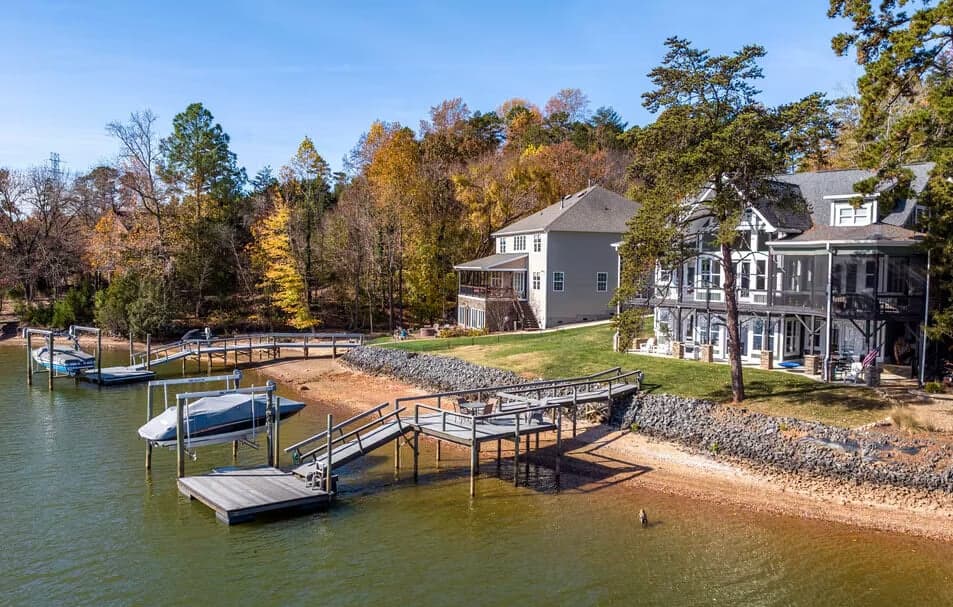
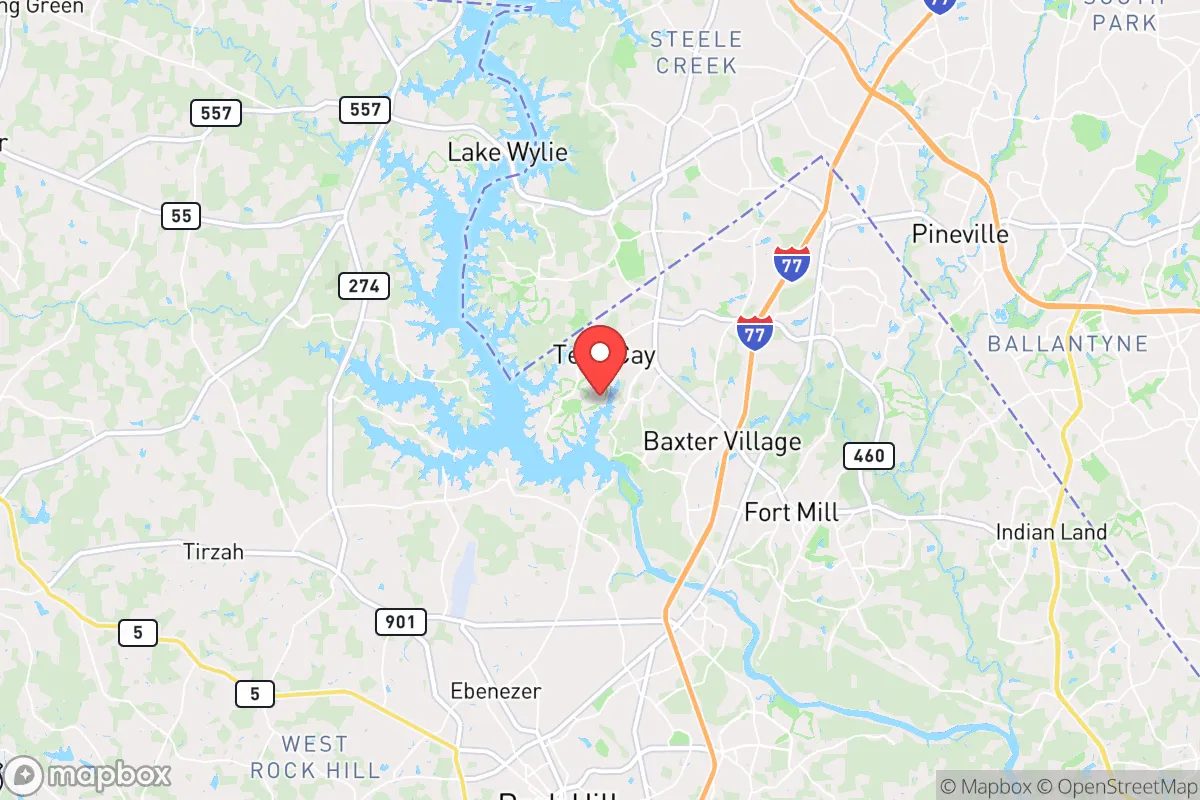
Tega Cay, South Carolina, sits in a strategic pocket that balances proximity to Charlotte’s economic engine with a degree of geographic insulation that matters for those thinking long-term about resilience. The city’s location on a peninsula jutting into Lake Wylie—a 13,400-acre reservoir on the Catawba River—provides a natural buffer against the sprawl that defines much of the Charlotte metro. For a relocator with a prepper mindset, the key advantage here is that Tega Cay is close enough to access jobs, healthcare, and supplies in a stable period, but far enough from the urban core to offer a defensible retreat when things go sideways. The city’s population hovers around 12,000, and its layout—winding roads, cul-de-sacs, and lakefront properties—creates a layout that is inherently harder to navigate for anyone unfamiliar with the area. This is not a place that will be on the front lines of a mass casualty event or a rapid evacuation scenario, but it is close enough to Charlotte’s 900,000 residents that you need to think carefully about what that proximity means when the grid goes down or civil unrest spills outward.
Geographic position and natural advantages for long-term security
Tega Cay’s position on Lake Wylie is its single most valuable asset from a survivalist perspective. The lake provides a reliable source of fresh water—something that becomes critical when municipal systems fail or are contaminated. The Catawba River feeds the lake, and the surrounding watershed is relatively undeveloped compared to the Charlotte side, meaning less industrial runoff and fewer points of contamination. The peninsula geography means there are only a few roads in and out of the city: Highway 160 (Gold Hill Road) to the north and a handful of secondary routes like Pleasant Road and Stoneypoint Drive. This chokepoint dynamic is a double-edged sword—it makes ingress and egress easy to control in a crisis, but it also means a single accident or roadblock could trap residents. The terrain is rolling hills with mixed hardwood forest, offering decent cover and natural barriers. The elevation is modest—around 600 feet above sea level—but the lake moderates temperatures, reducing the risk of extreme heat or cold that could stress off-grid systems. For a relocator, the natural advantages here are water access, limited entry points, and a topography that supports small-scale agriculture and rainwater catchment.
Risks, exposures, and proximity to fallout-relevant landmarks
The biggest risk for Tega Cay is its proximity to Charlotte, which is a Tier 1 target in any major conflict scenario. Charlotte is home to Bank of America’s headquarters, Duke Energy’s corporate offices, and a major international airport (CLT) that handles over 50 million passengers annually. In a mass casualty event or a geopolitical crisis, these are high-value targets for disruption. The city is also within 20 miles of the Catawba Nuclear Station, a two-unit nuclear power plant on Lake Wylie that provides power to the region. While the plant has a solid safety record, any incident—whether from natural disaster, sabotage, or grid failure—would put Tega Cay in the potential fallout zone. The prevailing winds in the region are from the southwest, which means a release from the plant would push contamination toward the lake and the peninsula. Additionally, the I-77 corridor runs just west of the city, connecting Charlotte to Columbia, SC. In a civil unrest scenario, this highway becomes a funnel for displaced populations moving south. Tega Cay’s limited road network means that a sudden influx of people from Charlotte could overwhelm local resources quickly. The city has no major hospitals—the nearest trauma center is Piedmont Medical Center in Rock Hill, about 15 minutes away—and that facility could be overrun in a crisis. Flooding is a moderate risk; the lake level is controlled by the Duke Energy dam, but heavy rain events have caused localized flooding in low-lying areas near the water.
Practical resilience for a relocator: food, water, energy, and defensibility
For someone serious about self-sufficiency, Tega Cay offers a mixed bag. The lake provides an immediate water source, but you’ll need a filtration system—something like a Berkey or a Sawyer filter—because the water is treated with chlorine and contains agricultural runoff from upstream farms. Rainwater collection is viable; the area averages 45 inches of rain per year, and a 1,000-square-foot roof can capture about 28,000 gallons annually. The soil is sandy loam, which drains well but requires amendment for serious gardening. Raised beds with compost are the standard approach here. For energy, the grid is reliable in normal times, but Duke Energy has a history of outages during storms—Hurricane Hugo in 1989 and the 2014 ice storm both knocked out power for days. Solar is feasible; the region gets about 215 sunny days per year, and there are no HOA restrictions in most of Tega Cay that would prevent rooftop panels. Battery storage (like a Tesla Powerwall or a DIY LiFePO4 setup) is a smart investment. Defensibility is where Tega Cay shines: the peninsula layout means you can monitor the few entry points, and the lake provides a natural barrier on three sides. The community is tight-knit, with a strong neighborhood watch culture and a police department that responds quickly—average response time is under 5 minutes. However, the city is not walled or gated in most areas, so you’ll need to harden your own property. Firearms are common here; South Carolina is a shall-issue state for concealed carry, and open carry is legal. For food storage, the nearest bulk suppliers are in Rock Hill (Costco, Sam’s Club) and Fort Mill (Walmart, Lowe’s Foods). You’ll want to stockpile at least a 90-day supply of non-perishables, because a major event on I-77 could cut off resupply for weeks. The local farmers’ market in nearby Fort Mill runs seasonally, but for year-round food security, you’ll need to grow your own or establish relationships with local hunters—deer and turkey are abundant in the surrounding woods.
The overall strategic picture for Tega Cay is one of calculated trade-offs. You get a defensible peninsula with reliable water, a moderate climate, and a community that leans conservative and self-reliant. But you are not remote—Charlotte is 20 minutes away, and that proximity brings risks that cannot be ignored. For a relocator who wants to be prepared for civic unrest, mass casualty events, or a grid-down scenario, Tega Cay works best as a base camp: a place to hunker down with supplies and a plan, not a place to ride out a long-term collapse without external support. The key is to treat it as a strategic asset—use the lake for water and transport, leverage the chokepoints for security, and maintain a low profile. If you are willing to invest in off-grid systems and build relationships with neighbors, Tega Cay offers a solid foundation. But if your plan relies on complete isolation, you will need to look further into the South Carolina backcountry. For most preppers, this is a realistic middle ground: close enough to the city to thrive in normal times, far enough to survive when normal ends.
* Values derived from national, state, county, city and local statistics and may differ in a specific area. Last updated: 2026-04-23T03:52:30.000Z
Narrative content on this page is AI-generated and may contain mistakes. Verify any details that matter before acting on them.
ReloMaps may earn a commission from affiliate links at no extra cost to you.